Sterling is a city in Rice County, Kansas, United States. As of the 2020 census, the population of the city was 2,248. Sterling is home to Sterling College.
| Name: | Sterling city |
|---|---|
| LSAD Code: | 25 |
| LSAD Description: | city (suffix) |
| State: | Kansas |
| County: | Rice County |
| Founded: | 1872 (Peace) |
| Incorporated: | 1876 |
| Elevation: | 1,641 ft (500 m) |
| Total Area: | 1.83 sq mi (4.75 km²) |
| Land Area: | 1.79 sq mi (4.64 km²) |
| Water Area: | 0.04 sq mi (0.11 km²) |
| Total Population: | 2,248 |
| Population Density: | 1,200/sq mi (470/km²) |
| ZIP code: | 67579 |
| Area code: | 620 |
| FIPS code: | 2068200 |
| Website: | sterling-kansas.com |
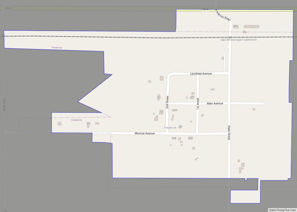
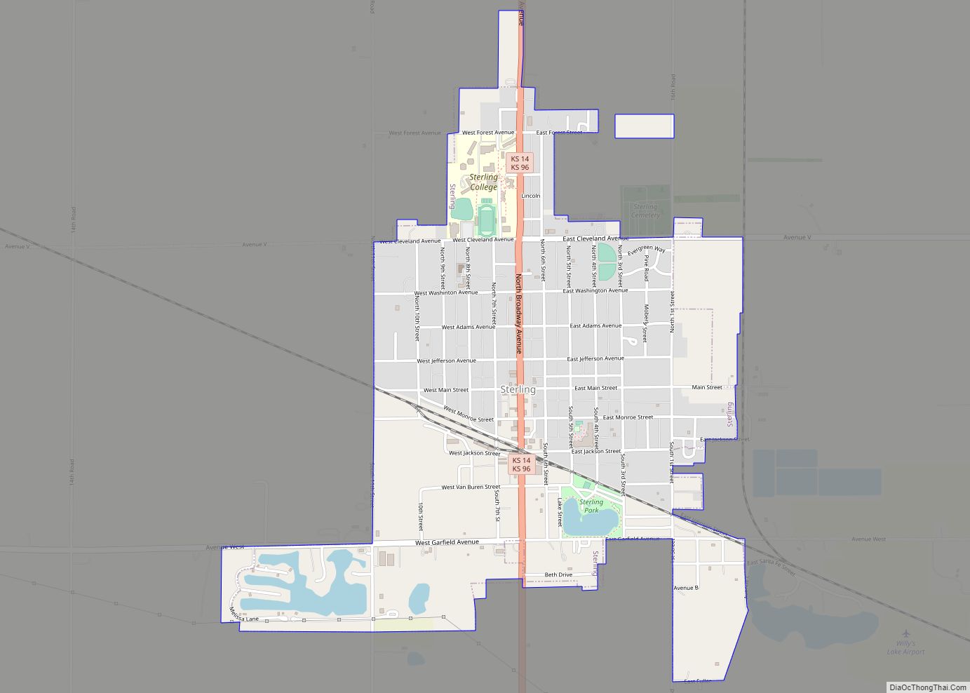
Online Interactive Map
Click on ![]() to view map in "full screen" mode.
to view map in "full screen" mode.
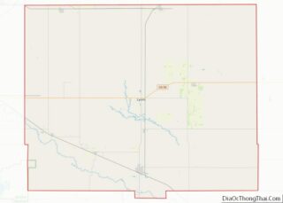
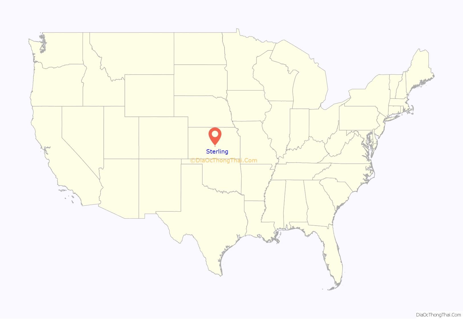
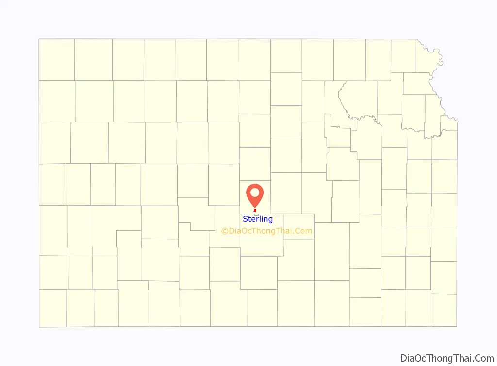
Sterling location map. Where is Sterling city?
History
For millennia, the land now known as Kansas was inhabited by Native Americans. In 1803, most of modern Kansas was secured by the United States as part of the Louisiana Purchase. In 1854, the Kansas Territory was organized, then in 1861 Kansas became the 34th U.S. state. In 1867, Rice County was founded.
Sterling was originally called Peace, and under the latter name was founded in 1872. In 1876, the name was changed to Sterling, by two brothers after their father Sterling Rosan.
In the 1890s, Jonathan S. Dillon sold groceries at his general store in Sterling. Later in 1913, he opened his first J.S. Dillon Cash Food Market in Hutchinson. Later he expanded into the Dillons grocery supermarket chain.
Historic places
- Charles K. Beckett House (NRHP), 210 West Main Street.
- Cooper Hall (NRHP), North Broadway Avenue.
- Shay Building (NRHP), 202 South Broadway Avenue.
- Sterling Carnegie Library (NRHP), 132 North Broadway Avenue.
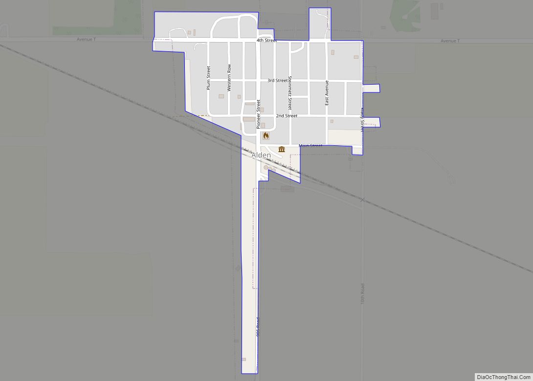
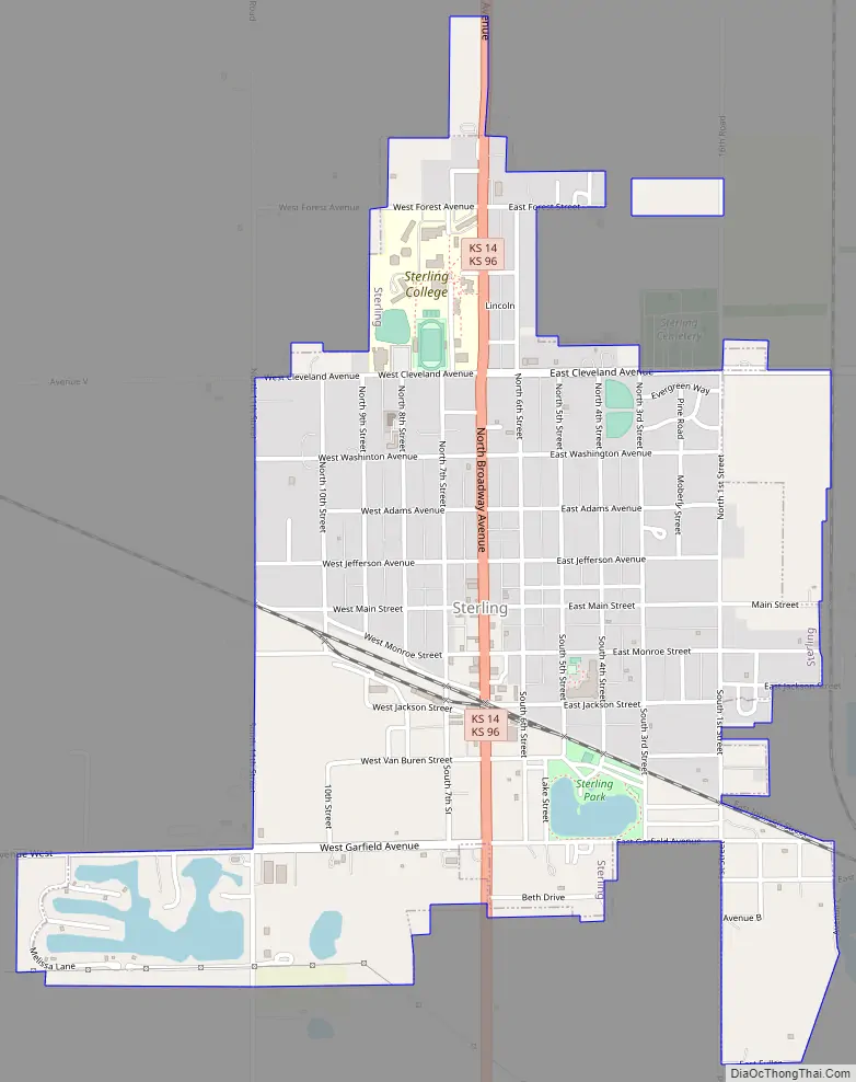
Sterling Road Map
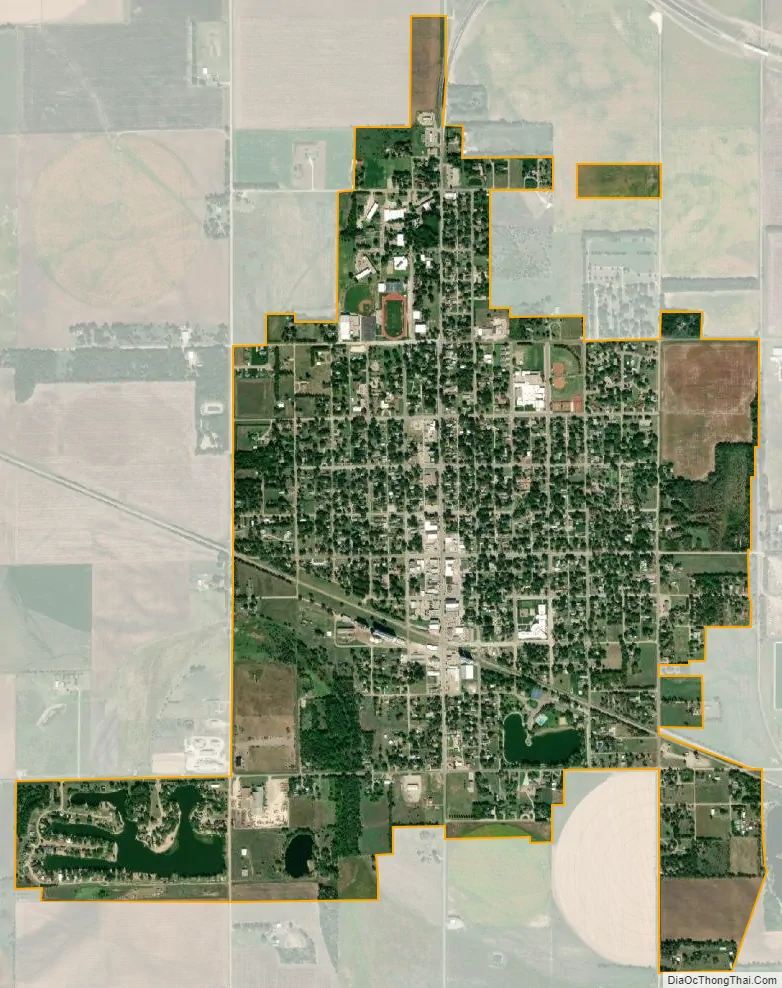
Sterling city Satellite Map
Geography
Sterling is located at 38°12′38″N 98°12′16″W / 38.21056°N 98.20444°W / 38.21056; -98.20444 (38.210658, -98.204549). According to the United States Census Bureau, the city has a total area of 1.71 square miles (4.43 km), of which, 1.67 square miles (4.33 km) is land and 0.04 square miles (0.10 km) is water.
Climate
See also
Map of Kansas State and its subdivision:- Allen
- Anderson
- Atchison
- Barber
- Barton
- Bourbon
- Brown
- Butler
- Chase
- Chautauqua
- Cherokee
- Cheyenne
- Clark
- Clay
- Cloud
- Coffey
- Comanche
- Cowley
- Crawford
- Decatur
- Dickinson
- Doniphan
- Douglas
- Edwards
- Elk
- Ellis
- Ellsworth
- Finney
- Ford
- Franklin
- Geary
- Gove
- Graham
- Grant
- Gray
- Greeley
- Greenwood
- Hamilton
- Harper
- Harvey
- Haskell
- Hodgeman
- Jackson
- Jefferson
- Jewell
- Johnson
- Kearny
- Kingman
- Kiowa
- Labette
- Lane
- Leavenworth
- Lincoln
- Linn
- Logan
- Lyon
- Marion
- Marshall
- McPherson
- Meade
- Miami
- Mitchell
- Montgomery
- Morris
- Morton
- Nemaha
- Neosho
- Ness
- Norton
- Osage
- Osborne
- Ottawa
- Pawnee
- Phillips
- Pottawatomie
- Pratt
- Rawlins
- Reno
- Republic
- Rice
- Riley
- Rooks
- Rush
- Russell
- Saline
- Scott
- Sedgwick
- Seward
- Shawnee
- Sheridan
- Sherman
- Smith
- Stafford
- Stanton
- Stevens
- Sumner
- Thomas
- Trego
- Wabaunsee
- Wallace
- Washington
- Wichita
- Wilson
- Woodson
- Wyandotte
- Alabama
- Alaska
- Arizona
- Arkansas
- California
- Colorado
- Connecticut
- Delaware
- District of Columbia
- Florida
- Georgia
- Hawaii
- Idaho
- Illinois
- Indiana
- Iowa
- Kansas
- Kentucky
- Louisiana
- Maine
- Maryland
- Massachusetts
- Michigan
- Minnesota
- Mississippi
- Missouri
- Montana
- Nebraska
- Nevada
- New Hampshire
- New Jersey
- New Mexico
- New York
- North Carolina
- North Dakota
- Ohio
- Oklahoma
- Oregon
- Pennsylvania
- Rhode Island
- South Carolina
- South Dakota
- Tennessee
- Texas
- Utah
- Vermont
- Virginia
- Washington
- West Virginia
- Wisconsin
- Wyoming