Udall is a city in Cowley County, Kansas, United States. As of the 2020 census, the population of the city was 661.
| Name: | Udall city |
|---|---|
| LSAD Code: | 25 |
| LSAD Description: | city (suffix) |
| State: | Kansas |
| County: | Cowley County |
| Founded: | 1870s |
| Incorporated: | 1881 |
| Elevation: | 1,273 ft (388 m) |
| Total Area: | 0.55 sq mi (1.41 km²) |
| Land Area: | 0.55 sq mi (1.41 km²) |
| Water Area: | 0.00 sq mi (0.00 km²) |
| Total Population: | 661 |
| Population Density: | 1,200/sq mi (470/km²) |
| ZIP code: | 67146 |
| Area code: | 620 |
| FIPS code: | 2071950 |
| Website: | cityofudall.com |
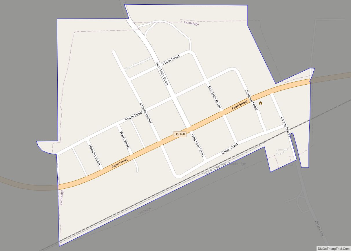
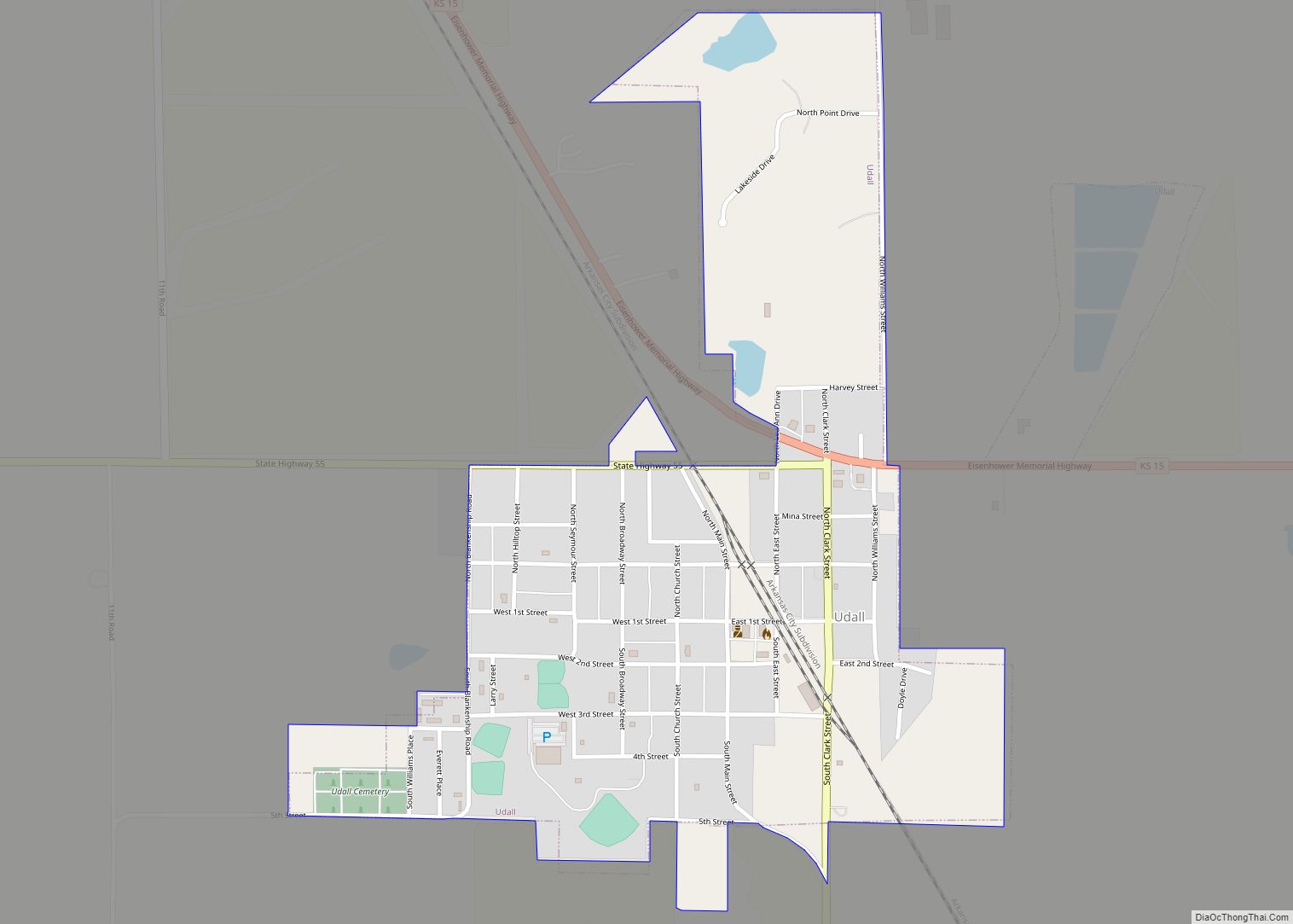
Online Interactive Map
Click on ![]() to view map in "full screen" mode.
to view map in "full screen" mode.
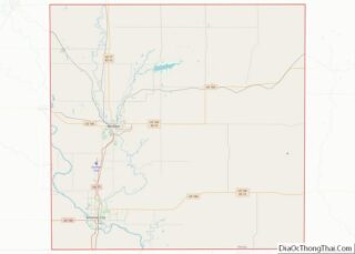
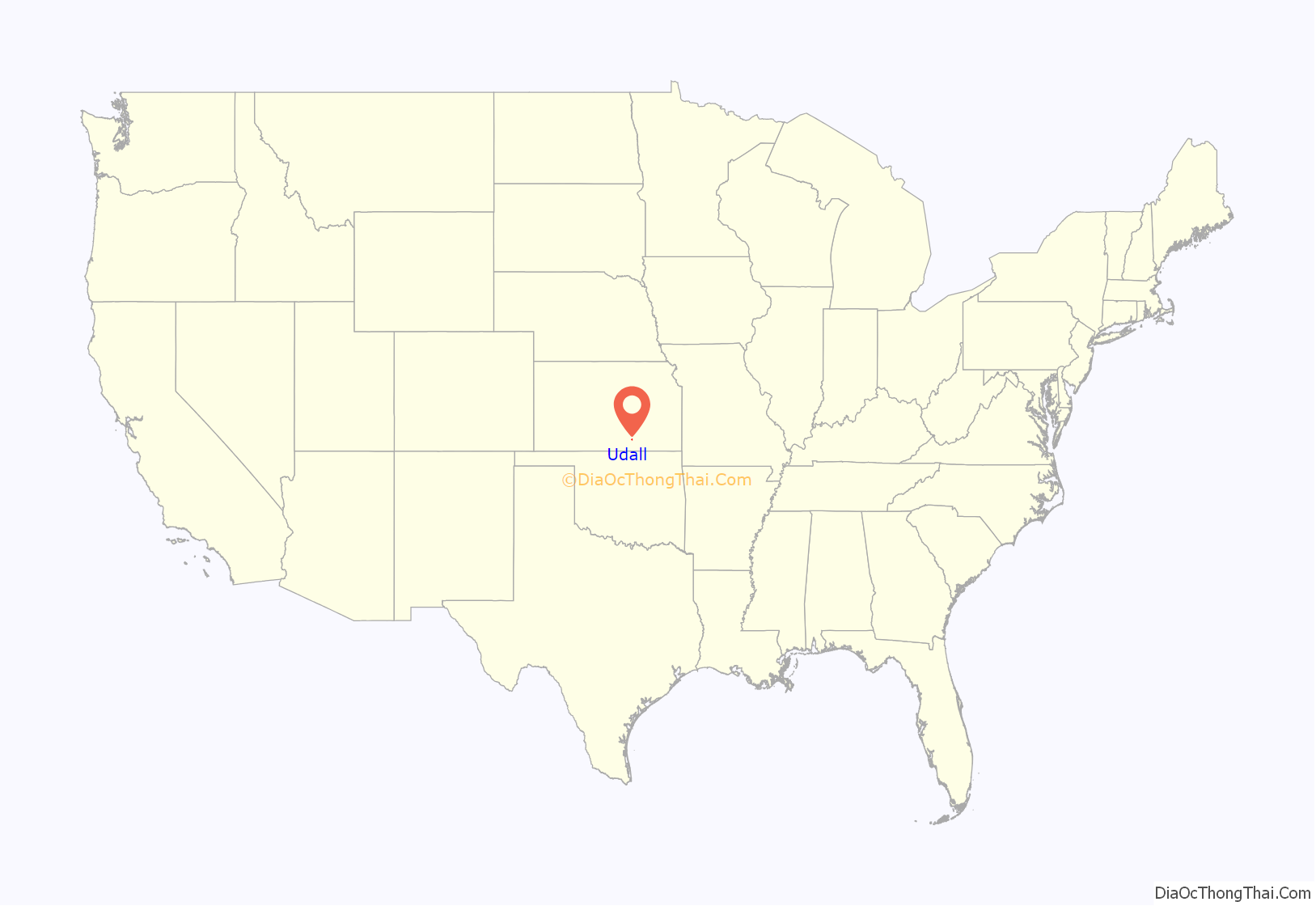
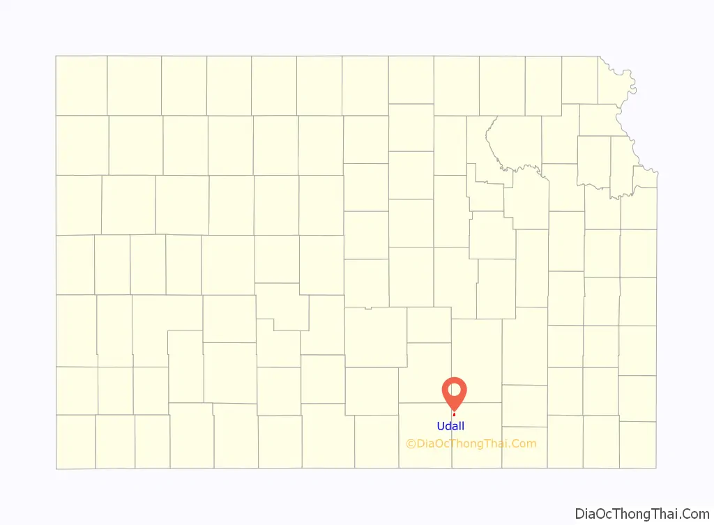
Udall location map. Where is Udall city?
History
The first post office at Udall was established in September 1879. J.M. Napier and P.W. Smith purchased a ten-acre tract from I.N Nelson in 1879. Udall was laid out in 1881 by Napier and Smith. It was named after English author Cornelius Udall. D.C. Green built the first house in Udall and opened a store.
1955 tornado
On May 25, 1955, the deadliest tornado to ever hit the state of Kansas struck Udall at 10:35 p.m. The town was demolished by a 1,300 yd (0.74 mi) wide F5 tornado; no building within the city limits was untouched, including the grain elevator, water tower, old grade school, new high school, city hall, three churches. The water tower had been knocked over and the streets were flooded. Vehicles were thrown hundreds of yards and mangled beyond recognition, including a pickup truck that was wrapped around a tree and stripped of everything but its frame and tires. The tornado killed 77 and injured 270, and 192 buildings were destroyed, including 170 homes. Around 50% of families lost one or more members.
Before striking Udall, there were no warnings issued by the Weather Bureau. Unknown to them, the same tornado-producing thunderstorm had just laid waste to the city of Blackwell, Oklahoma, where 20 died and 250 were injured.
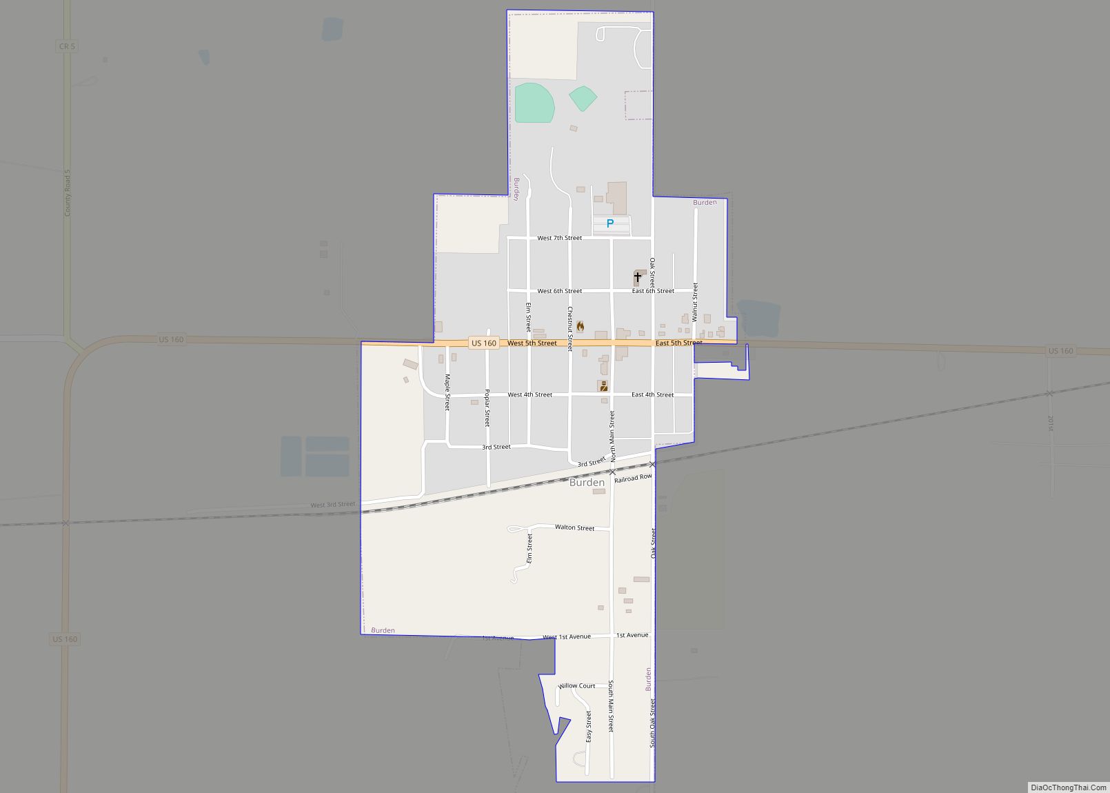
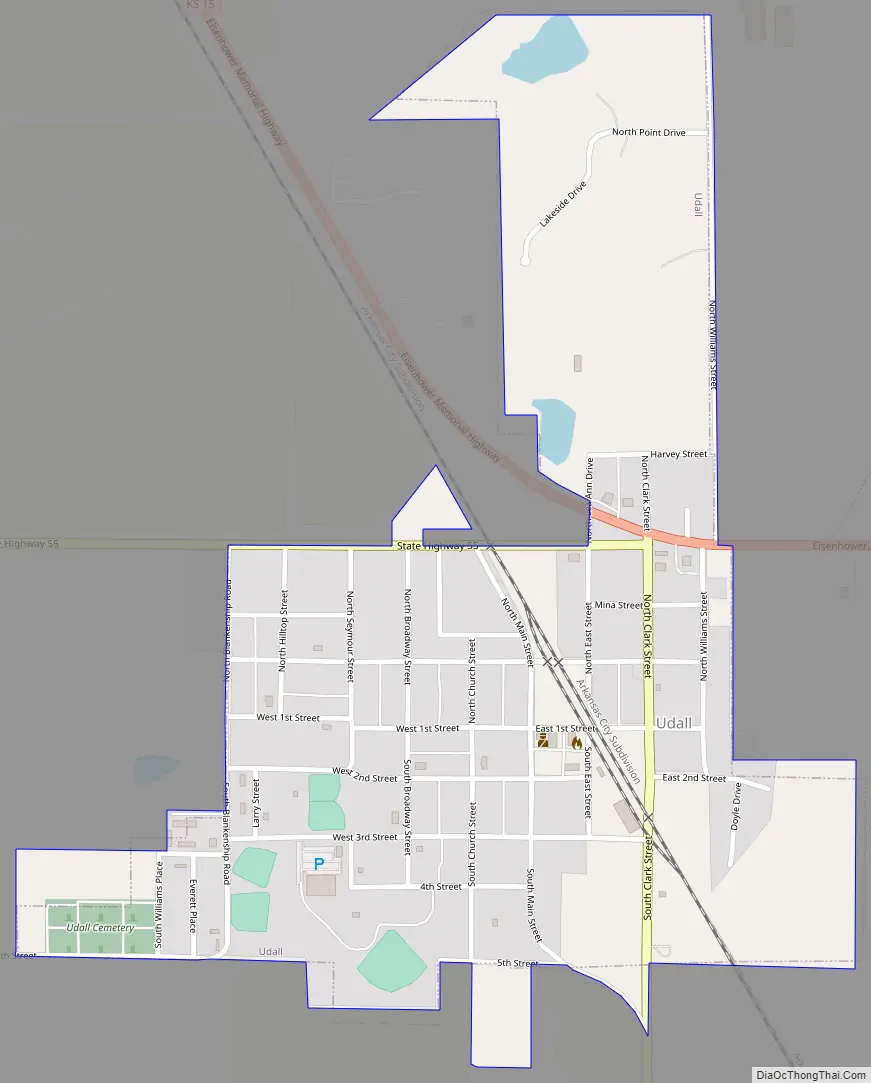
Udall Road Map
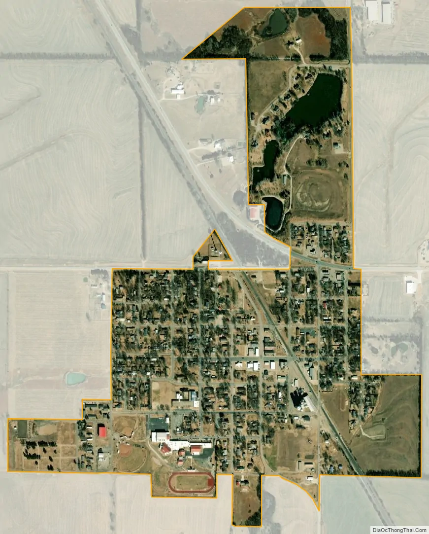
Udall city Satellite Map
Geography
According to the United States Census Bureau, the city has a total area of 0.57 square miles (1.48 km), all of which is land.
See also
Map of Kansas State and its subdivision:- Allen
- Anderson
- Atchison
- Barber
- Barton
- Bourbon
- Brown
- Butler
- Chase
- Chautauqua
- Cherokee
- Cheyenne
- Clark
- Clay
- Cloud
- Coffey
- Comanche
- Cowley
- Crawford
- Decatur
- Dickinson
- Doniphan
- Douglas
- Edwards
- Elk
- Ellis
- Ellsworth
- Finney
- Ford
- Franklin
- Geary
- Gove
- Graham
- Grant
- Gray
- Greeley
- Greenwood
- Hamilton
- Harper
- Harvey
- Haskell
- Hodgeman
- Jackson
- Jefferson
- Jewell
- Johnson
- Kearny
- Kingman
- Kiowa
- Labette
- Lane
- Leavenworth
- Lincoln
- Linn
- Logan
- Lyon
- Marion
- Marshall
- McPherson
- Meade
- Miami
- Mitchell
- Montgomery
- Morris
- Morton
- Nemaha
- Neosho
- Ness
- Norton
- Osage
- Osborne
- Ottawa
- Pawnee
- Phillips
- Pottawatomie
- Pratt
- Rawlins
- Reno
- Republic
- Rice
- Riley
- Rooks
- Rush
- Russell
- Saline
- Scott
- Sedgwick
- Seward
- Shawnee
- Sheridan
- Sherman
- Smith
- Stafford
- Stanton
- Stevens
- Sumner
- Thomas
- Trego
- Wabaunsee
- Wallace
- Washington
- Wichita
- Wilson
- Woodson
- Wyandotte
- Alabama
- Alaska
- Arizona
- Arkansas
- California
- Colorado
- Connecticut
- Delaware
- District of Columbia
- Florida
- Georgia
- Hawaii
- Idaho
- Illinois
- Indiana
- Iowa
- Kansas
- Kentucky
- Louisiana
- Maine
- Maryland
- Massachusetts
- Michigan
- Minnesota
- Mississippi
- Missouri
- Montana
- Nebraska
- Nevada
- New Hampshire
- New Jersey
- New Mexico
- New York
- North Carolina
- North Dakota
- Ohio
- Oklahoma
- Oregon
- Pennsylvania
- Rhode Island
- South Carolina
- South Dakota
- Tennessee
- Texas
- Utah
- Vermont
- Virginia
- Washington
- West Virginia
- Wisconsin
- Wyoming