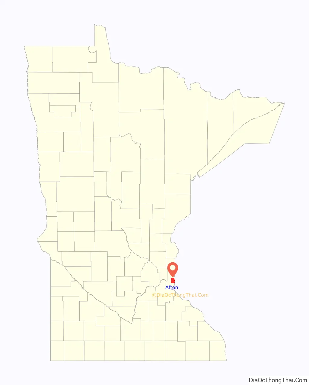
Afton is a city in Washington County, Minnesota, United States. The population was 2,886 at the 2010 United States Census. It lies on a small bay where Valley Creek empties into the St. Croix River, several miles north of its confluence with the Mississippi River.
Afton is well known for Afton Alps, the largest ski and snowboard area in the Twin Cities metropolitan area. It is home to Afton State Park on the St. Croix River. Due to these two destinations and its quaint small-town appearance in a major metropolitan area, Afton receives a fair amount of local tourism in the form of day trips. The 2018 US Winter Olympic Gold Medalist cross-country skier Jessie Diggins is from Afton.
| Name: | Afton city |
|---|---|
| LSAD Code: | 25 |
| LSAD Description: | city (suffix) |
| State: | Minnesota |
| County: | Washington County |
| Elevation: | 974 ft (297 m) |
| Total Area: | 26.48 sq mi (68.59 km²) |
| Land Area: | 25.09 sq mi (64.99 km²) |
| Water Area: | 1.39 sq mi (3.60 km²) |
| Total Population: | 2,955 |
| Population Density: | 117.77/sq mi (45.47/km²) |
| ZIP code: | 55001 |
| Area code: | 651 |
| FIPS code: | 2700316 |
| GNISfeature ID: | 2393887 |
| Website: | ci.afton.mn.us |
Online Interactive Map
Click on ![]() to view map in "full screen" mode.
to view map in "full screen" mode.
Afton location map. Where is Afton city?
History
The first settlers in the area arrived in 1837. The settlement of Afton was platted in 1855, with the name chosen from a poem (Sweet Afton) by Robert Burns. A post office has been in operation at Afton since 1857. The city contains three properties listed on the National Register of Historic Places: the 1856 Erastus Bolles House, the 1864 Newington Gilbert House, and the 1867 Cushing Hotel.
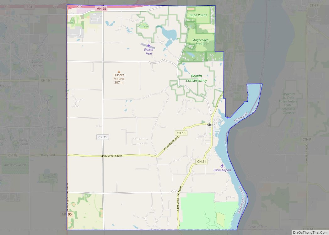
Afton Road Map
Afton city Satellite Map
Geography
The city has a total area of 26.42 square miles (68.43 km); 25.05 square miles (64.88 km) is land and 1.37 square miles (3.55 km) is water. Main routes include Hudson Road, County Roads 18, 21, and 71; and Minnesota Highway 95. Afton borders Lake St. Croix Beach, Lakeland, and St. Mary’s Point to the east. It also borders West Lakeland Township to the north, Denmark Township to the south, and Woodbury to the west.
See also
Map of Minnesota State and its subdivision:- Aitkin
- Anoka
- Becker
- Beltrami
- Benton
- Big Stone
- Blue Earth
- Brown
- Carlton
- Carver
- Cass
- Chippewa
- Chisago
- Clay
- Clearwater
- Cook
- Cottonwood
- Crow Wing
- Dakota
- Dodge
- Douglas
- Faribault
- Fillmore
- Freeborn
- Goodhue
- Grant
- Hennepin
- Houston
- Hubbard
- Isanti
- Itasca
- Jackson
- Kanabec
- Kandiyohi
- Kittson
- Koochiching
- Lac qui Parle
- Lake
- Lake of the Woods
- Lake Superior
- Le Sueur
- Lincoln
- Lyon
- Mahnomen
- Marshall
- Martin
- McLeod
- Meeker
- Mille Lacs
- Morrison
- Mower
- Murray
- Nicollet
- Nobles
- Norman
- Olmsted
- Otter Tail
- Pennington
- Pine
- Pipestone
- Polk
- Pope
- Ramsey
- Red Lake
- Redwood
- Renville
- Rice
- Rock
- Roseau
- Saint Louis
- Scott
- Sherburne
- Sibley
- Stearns
- Steele
- Stevens
- Swift
- Todd
- Traverse
- Wabasha
- Wadena
- Waseca
- Washington
- Watonwan
- Wilkin
- Winona
- Wright
- Yellow Medicine
- Alabama
- Alaska
- Arizona
- Arkansas
- California
- Colorado
- Connecticut
- Delaware
- District of Columbia
- Florida
- Georgia
- Hawaii
- Idaho
- Illinois
- Indiana
- Iowa
- Kansas
- Kentucky
- Louisiana
- Maine
- Maryland
- Massachusetts
- Michigan
- Minnesota
- Mississippi
- Missouri
- Montana
- Nebraska
- Nevada
- New Hampshire
- New Jersey
- New Mexico
- New York
- North Carolina
- North Dakota
- Ohio
- Oklahoma
- Oregon
- Pennsylvania
- Rhode Island
- South Carolina
- South Dakota
- Tennessee
- Texas
- Utah
- Vermont
- Virginia
- Washington
- West Virginia
- Wisconsin
- Wyoming

