Hastings (/ˈheɪstɪŋz/ HAY-stingz) is a city mostly in Dakota County, Minnesota, of which it is the county seat, with a portion in Washington County, Minnesota, United States. It is near the confluence of the Mississippi, Vermillion, and St. Croix Rivers. The population was 22,154 at the 2020 census. It is named for the first elected governor of Minnesota, Henry Hastings Sibley.
The advantages of Hastings’s location that led to its original growth are that it is well-drained, provides a good riverboat port, and is close to a hydropower resource at the falls of the Vermillion River. Other sites closer to the river confluence are either too swampy (Dakota County) or too hilly (Washington County and Pierce County, Wisconsin).
U.S. Highway 61 and Minnesota State Highways 55 and 316 are three of Hastings’s main routes.
| Name: | Hastings city |
|---|---|
| LSAD Code: | 25 |
| LSAD Description: | city (suffix) |
| State: | Minnesota |
| County: | Dakota County, Washington County |
| Founded: | 1853 |
| Incorporated: | March 7, 1857 |
| Elevation: | 801 ft (244 m) |
| Land Area: | 10.35 sq mi (26.81 km²) |
| Water Area: | 0.85 sq mi (2.20 km²) |
| Population Density: | 2,139.86/sq mi (826.20/km²) |
| ZIP code: | 55033 |
| Area code: | 651 |
| FIPS code: | 2727530 |
| GNISfeature ID: | 2394320 |
| Website: | hastingsmn.gov |
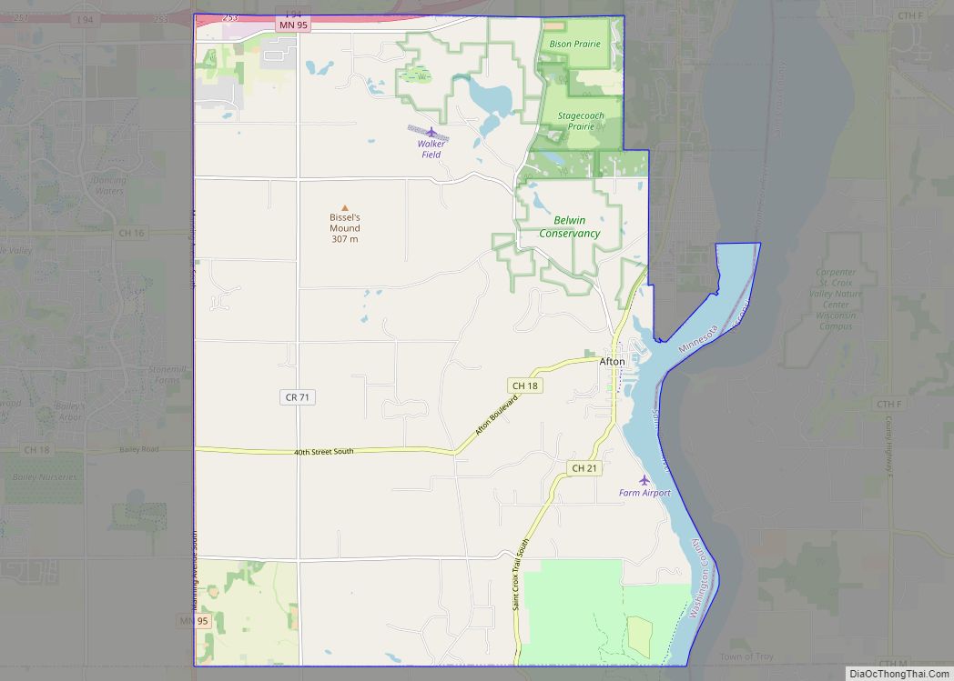
Online Interactive Map
Click on ![]() to view map in "full screen" mode.
to view map in "full screen" mode.
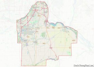
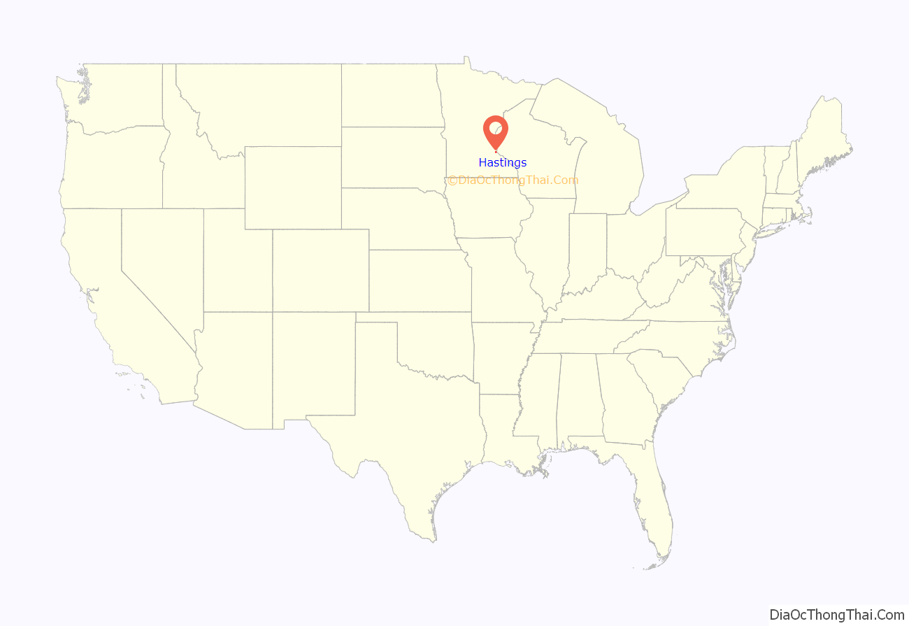
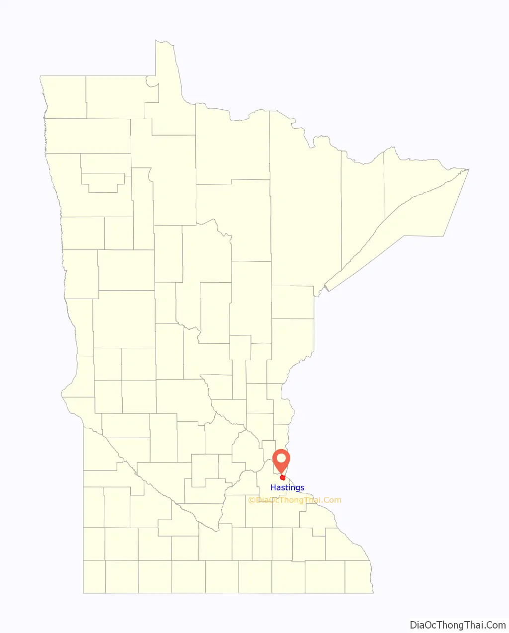
Hastings location map. Where is Hastings city?
History
In the winter of 1820, a military detachment from Fort Snelling settled the area around Hastings to guard a blocked shipment of supplies. Lieutenant William G. Oliver camped in an area that came to be known as Oliver’s Grove; in 1833 a trading post was opened there. After the Treaty of Mendota of 1851 opened the area for white settlement, Oliver’s Grove was surveyed and incorporated as a city in 1857, a year before Minnesota’s admission to the Union. The same year, Hastings was named the county seat of Dakota County. The name “Hastings” was drawn out of a hat from suggestions placed in it by several of the original founders.
In the mid-19th century, Hastings, Prescott, Wisconsin, and the adjacent township of Nininger were areas of tremendous land speculation. Ignatius L. Donnelly promoted the area as a potential “New Chicago.” The Panic of 1857 put an end to this dream. The speculation and panic caused the cities’ growth to be less than expected given their location at the confluence of two significant rivers; today, their combined population is approximately 25,000, and all that remains of Nininger is a few building ruins.
Hastings has Minnesota’s second-oldest surviving county courthouse (after Washington County Courthouse, Stillwater), finished in 1871 at a cost of $63,000. The county administration began moving to a new facility in 1974, and in 1989 the City of Hastings purchased the old building. It was rededicated in 1993 as City Hall.
In 1895 a spiral bridge was built over the Mississippi River, designed to slow down horse-drawn traffic as it entered downtown. The novel design became a tourist attraction, but the bridge was demolished in 1951 because it could not handle modern vehicles. The 1951 bridge was itself demolished and its replacement opened in 2013.
In 1930, the Army Corps of Engineers completed Lock and Dam No. 2 at Hastings, part of the canal lock systems on the Mississippi that stretch from Minneapolis to St. Louis. Lock and Dam No. 2 is the site of the nation’s first commercial, federally licensed hydrokinetic power facility, a partnership between the City of Hastings and Hydro Green Energy, LLC of Westmont, Illinois.
Fasbender Clinic, designed by Frank Lloyd Wright, is a city landmark.
Railroads
Hastings’s name was affixed to two major Minnesota railroads, the Hastings & Dakota Railway and the Stillwater & Hastings Railway.
In 1867 civic leaders William LeDuc, John Meloy, Stephen Gardner, E. D. Allen, and P. Van Auken—with financial backing from investors John B Alley, Oliver Ames, William Ames and Peter Butler—incorporated the Hastings & Dakota Railway with the goal to “cross the Rocky Mountains and meet the Pacific Ocean”. In the 1870s the H&D was completed from Hastings to the South Dakota border at Ortonville. During this time, the H&D became part of the Chicago, Milwaukee & St. Paul Railroad (Milwaukee Road) and became known as the H&D Division of the Milwaukee Road. The H&D also built the famous “Lake Street Depression” in Minneapolis, which gave the H&D two districts around Minneapolis and St. Paul: the south district from Hastings to Cologne via Chaska, and the north district from Hastings to Cologne via St. Paul/Minneapolis. The H&D never made it to the Pacific on its own, but the H&D Division became the mainline of the Milwaukee’s Coast Extension to Seattle, which the Milwaukee completed in 1909.
In 1880 a new branch line, the Stillwater & Hastings, was built between the two cities. It funneled logging and agriculture products from Stillwater to Hastings, allowing Hastings to become an important railroad switching hub. In 1882 the Milwaukee Road gained control of the S&H and operated it as a profitable branch line. The Milwaukee abandoned the S&H line in 1979, after 99 years of service.
The north H&D district remains intact from Minneapolis to Ortonville—except for the Lake Street Depression—and is operated by the Twin Cities & Western Railroad from Minneapolis to Hanley Falls and by BNSF Railway between Hanley Falls and Ortonville. Nearly all of the south H&D district was abandoned over time, with the last section between Shakopee and Cologne abandoned in the early 1970s. The Canadian Pacific Railway spur from downtown Hastings to the Ardent Mills mill atop Vermillion Falls is all that remains of the south H&D district. The old H&D trestle over the Vermillion River at Hastings—which was replaced four different times—is now part of a bicycle path. The H&D bridge over the Minnesota River at Chaska remained until 1995, when the Army Corps of Engineers removed it as the Chaska levees were rebuilt.
Canadian Pacific Railway now operates the former Milwaukee mainline through town as well as the Ardent Mills spur.
Hastings Road Map

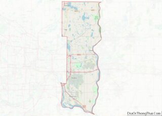
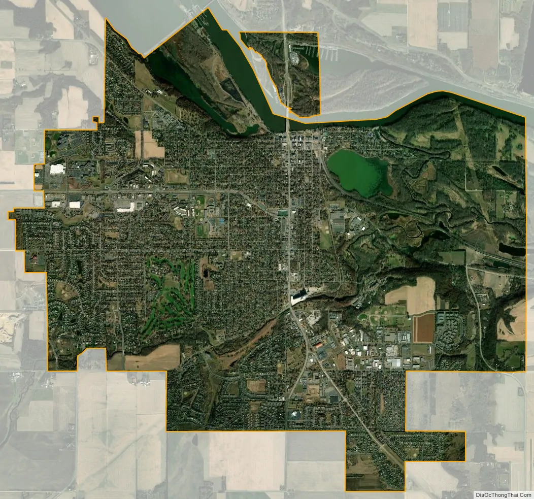
Hastings city Satellite Map
Geography
According to the United States Census Bureau, the city has an area of 11.18 square miles (28.96 km); 10.24 square miles (26.52 km) is land and 0.94 square miles (2.43 km) is water. The Mississippi River forms most of Hastings’s northern border, while the Vermillion River flows through the southern part of town, over a falls adjacent to a ConAgra grain elevator. Bluffs lie along the northern shore of the Mississippi and there is a gorge surrounding the Vermillion below the falls. Hastings is home to two small lakes, Lake Rebecca and Lake Isabel. Both drain into the Mississippi River. The northeast corner of town, an area of soggy marshland and flood plain for the Mississippi and Vermillion Rivers, is known as “Cow Town”.
Hastings is on the Mississippi side of the confluence with the St. Croix River, so that the St. Croix is “across” the Mississippi River. Prescott, Wisconsin is on the Wisconsin side of the confluence.
See also
Map of Minnesota State and its subdivision:- Aitkin
- Anoka
- Becker
- Beltrami
- Benton
- Big Stone
- Blue Earth
- Brown
- Carlton
- Carver
- Cass
- Chippewa
- Chisago
- Clay
- Clearwater
- Cook
- Cottonwood
- Crow Wing
- Dakota
- Dodge
- Douglas
- Faribault
- Fillmore
- Freeborn
- Goodhue
- Grant
- Hennepin
- Houston
- Hubbard
- Isanti
- Itasca
- Jackson
- Kanabec
- Kandiyohi
- Kittson
- Koochiching
- Lac qui Parle
- Lake
- Lake of the Woods
- Lake Superior
- Le Sueur
- Lincoln
- Lyon
- Mahnomen
- Marshall
- Martin
- McLeod
- Meeker
- Mille Lacs
- Morrison
- Mower
- Murray
- Nicollet
- Nobles
- Norman
- Olmsted
- Otter Tail
- Pennington
- Pine
- Pipestone
- Polk
- Pope
- Ramsey
- Red Lake
- Redwood
- Renville
- Rice
- Rock
- Roseau
- Saint Louis
- Scott
- Sherburne
- Sibley
- Stearns
- Steele
- Stevens
- Swift
- Todd
- Traverse
- Wabasha
- Wadena
- Waseca
- Washington
- Watonwan
- Wilkin
- Winona
- Wright
- Yellow Medicine
- Alabama
- Alaska
- Arizona
- Arkansas
- California
- Colorado
- Connecticut
- Delaware
- District of Columbia
- Florida
- Georgia
- Hawaii
- Idaho
- Illinois
- Indiana
- Iowa
- Kansas
- Kentucky
- Louisiana
- Maine
- Maryland
- Massachusetts
- Michigan
- Minnesota
- Mississippi
- Missouri
- Montana
- Nebraska
- Nevada
- New Hampshire
- New Jersey
- New Mexico
- New York
- North Carolina
- North Dakota
- Ohio
- Oklahoma
- Oregon
- Pennsylvania
- Rhode Island
- South Carolina
- South Dakota
- Tennessee
- Texas
- Utah
- Vermont
- Virginia
- Washington
- West Virginia
- Wisconsin
- Wyoming