Bigelow is a city in Nobles County, Minnesota, United States. The population was 235 at the 2010 census.
| Name: | Bigelow city |
|---|---|
| LSAD Code: | 25 |
| LSAD Description: | city (suffix) |
| State: | Minnesota |
| County: | Nobles County |
| Elevation: | 1,644 ft (501 m) |
| Total Area: | 0.39 sq mi (1.02 km²) |
| Land Area: | 0.39 sq mi (1.02 km²) |
| Water Area: | 0.00 sq mi (0.00 km²) |
| Total Population: | 227 |
| Population Density: | 577.61/sq mi (222.96/km²) |
| ZIP code: | 56117 |
| Area code: | 507 |
| FIPS code: | 2705644 |
| GNISfeature ID: | 0640150 |
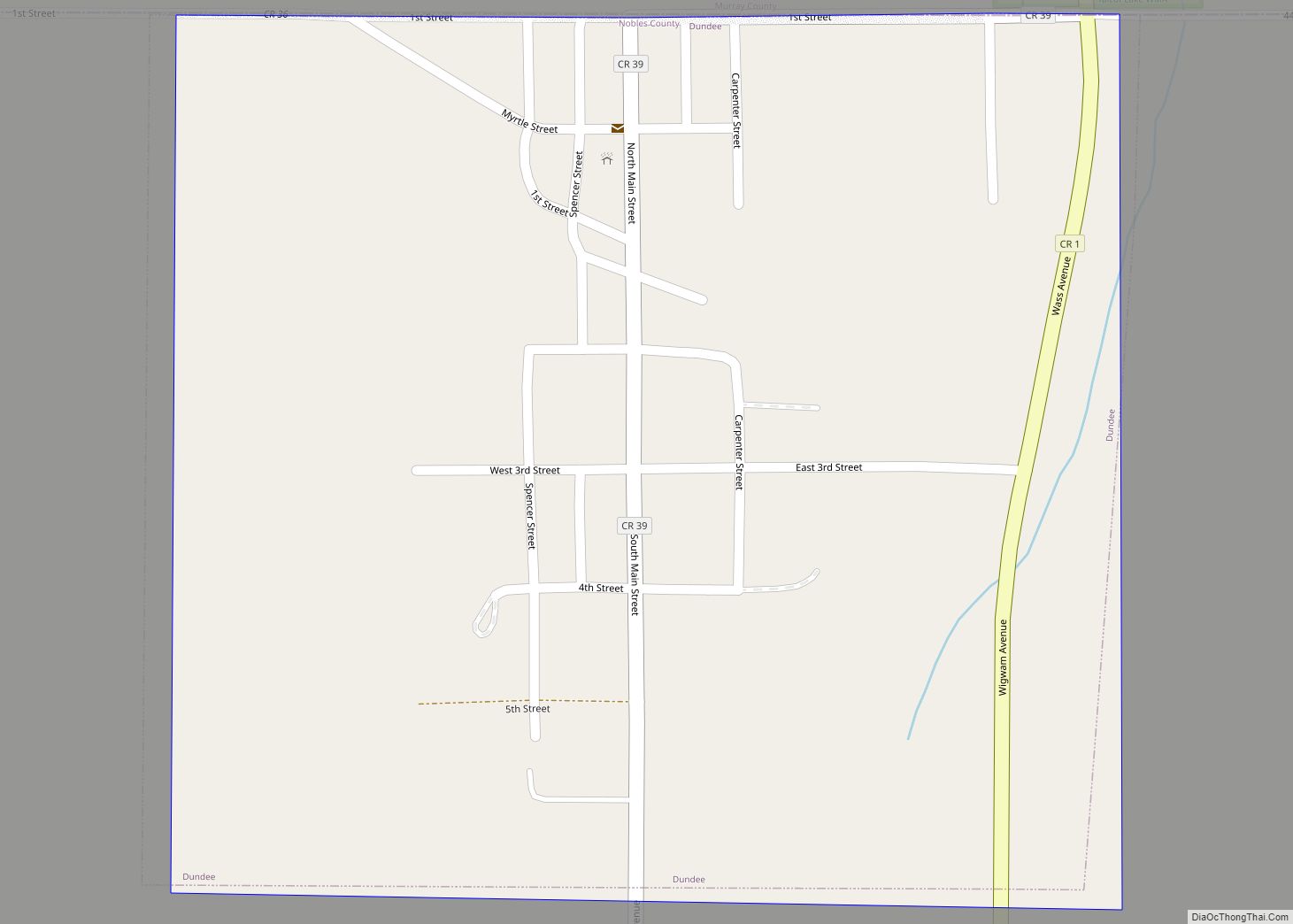
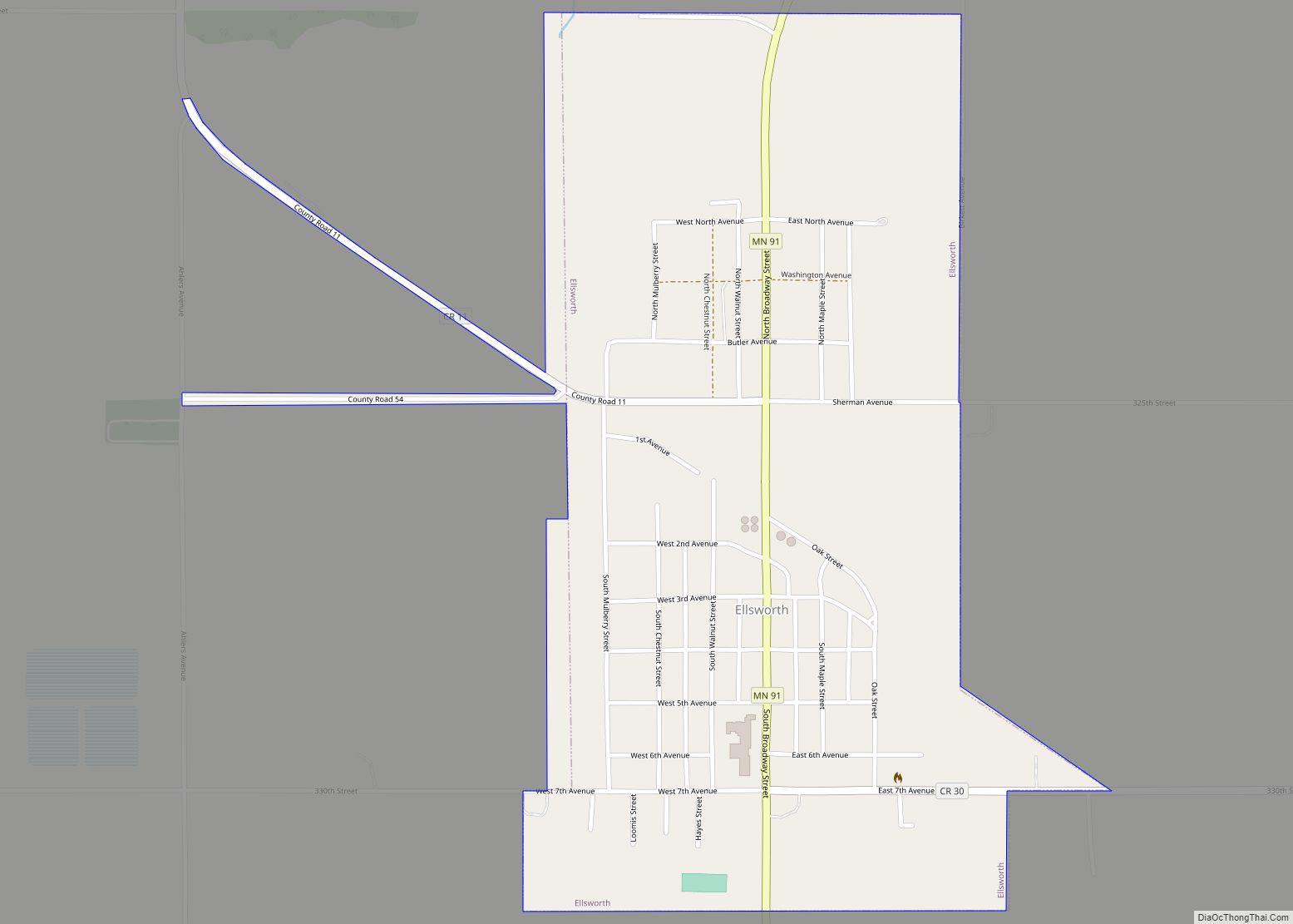
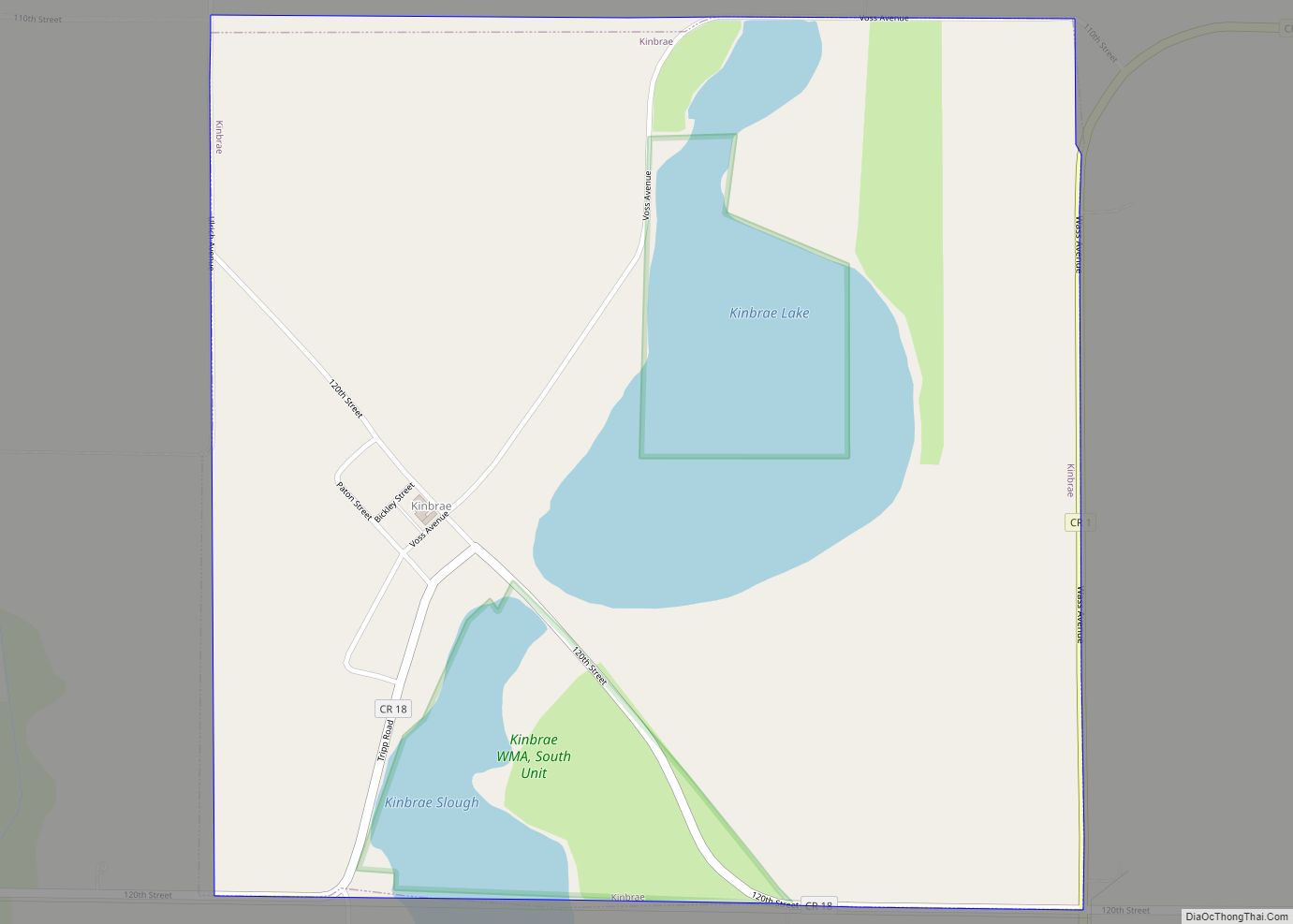
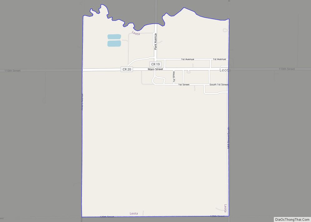
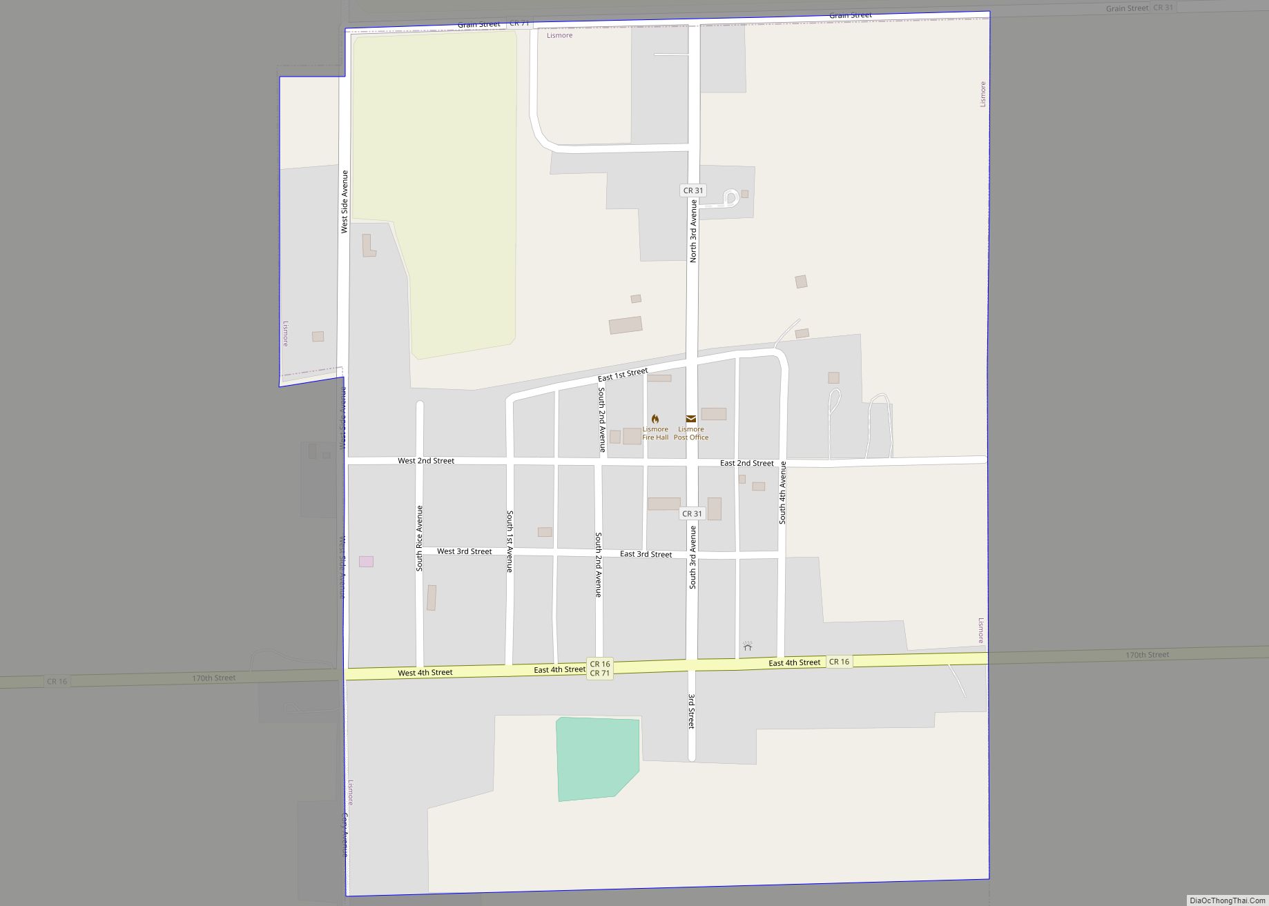
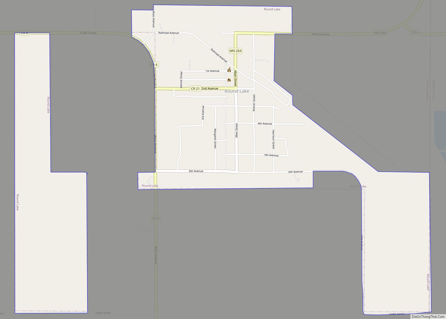
Online Interactive Map
Click on ![]() to view map in "full screen" mode.
to view map in "full screen" mode.
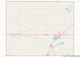
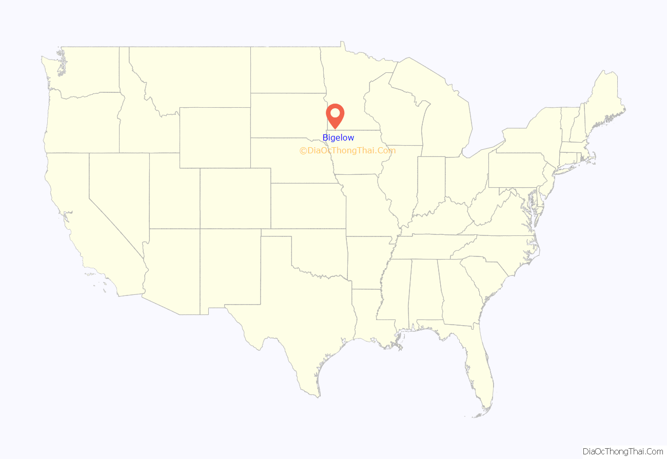
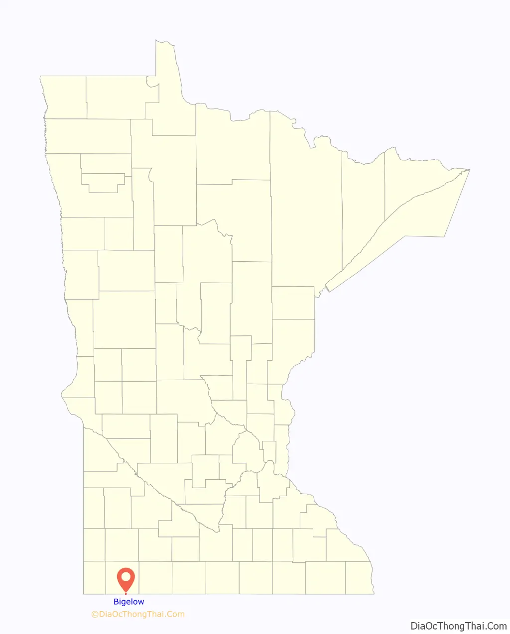
Bigelow location map. Where is Bigelow city?
History
Beginnings: The town of Bigelow was the third community to come into existence in Nobles County. The first two were Worthington and Brewster. All three towns appeared on the map in 1871, though Bigelow remained nothing more than that – a spot on a map – until the spring of 1872, when the tracks of the St. Paul & Sioux City Railway reached the site of the present-day town. Throughout the summer of 1872, the site was occupied only by a large tent which furnished shelter for the construction crew. A railroad depot was constructed in September 1872, and Mr. S. O. Morse assumed duties as station agent. He went into partnership with a man named Frothingham, and the two established a small grocery store in the depot. This was the only business established in 1872.
Source of name: Even before railroad tracks had reached present-day Bigelow, the town’s future name had been decided. It was named after Charles H. Bigelow. He was also a director of the St. Paul & Sioux City Railway, and the board decided to flatter him by naming a new town after him. Bigelow Township was also named after Mr. Bigelow. There is no record of Charles Bigelow visiting the town that bears his name, though it is likely he passed through on the railroad that he helped to create.
Incorporation: The townsite was platted and a dedication was made on September 24, 1873. Two new business came to town in 1873. S. D. Tinnes opened a general merchandise store and John DeBoos and John Colvin opened a hardware store. A grain dealer, a lumber yard, and a coal business were established in 1874. A school house was also built in that year and began that fall with 24 students. The village grew slowly. The 1880 census gave Bigelow a population of only 28. (One must assume that many of the 24 students enrolled in the Bigelow school resided on farms outside of the village.) Charles L. Davidson, of Hull, Iowa, purchased the townsite on January 25, 1892, and decided to “boom the town”, or attract investment and settlers. His efforts apparently paid off, for by 1894, Bigelow claimed 150 residents. A census taken on November 16, 1899, counted 224 residents. On February 13, 1900, an election was held, and by a vote of 37 to 6 it was decided that the time had come for municipal government. The first president of Bigelow was a Mr. W. C. Wyatt.
Bigelow today: According to the 2010 census, Bigelow has a population of 235. Perhaps a half-dozen businesses exist in the town. In recent years, Minnesota State Highway 60, which once passed directly through town, was upgraded to four-lanes, and bypassed Bigelow entirely. Bigelow does not have a public school. Children attend school either in nearby Worthington or in Ellsworth. Minnesota’s open-enrollment law gives them this option.
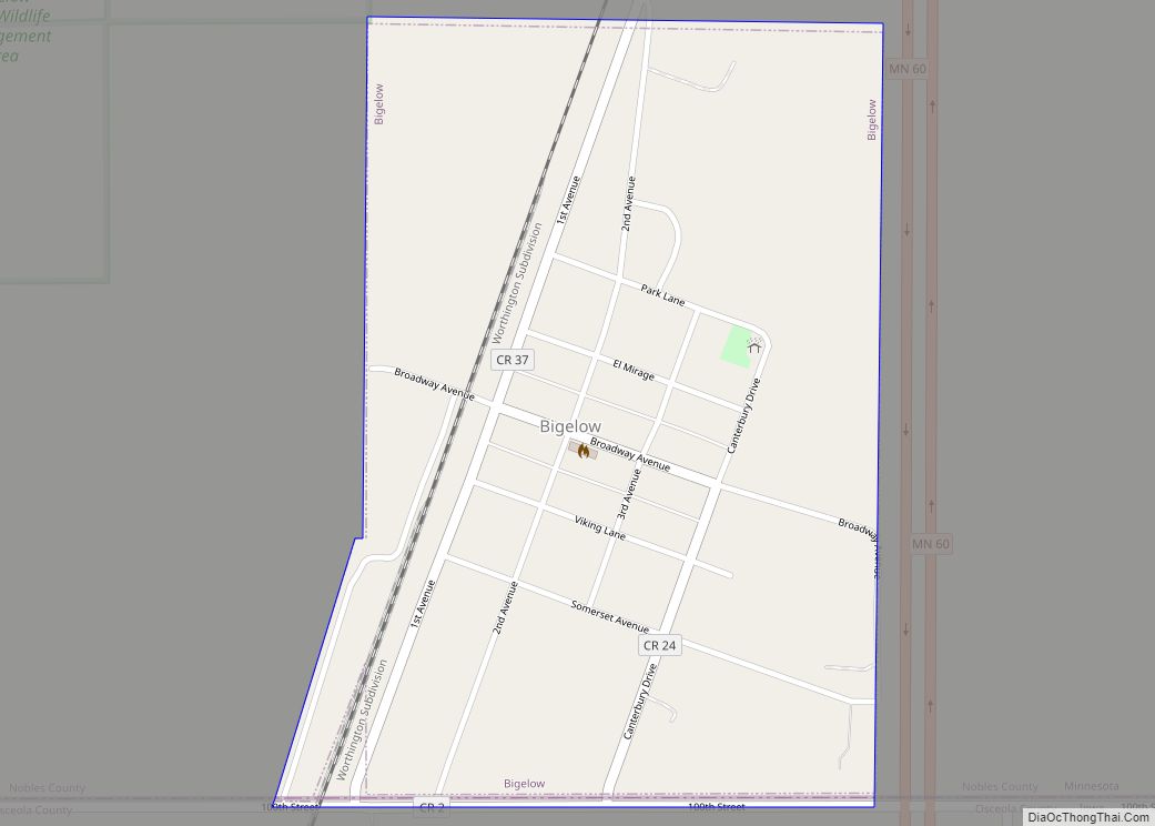
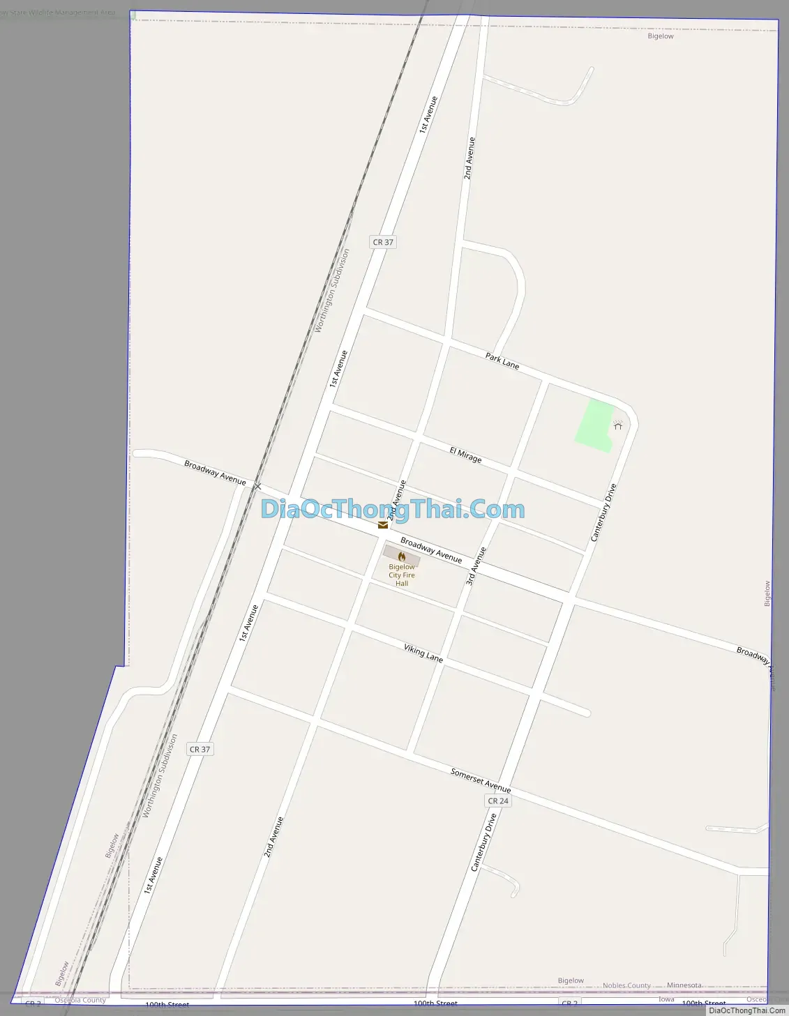
Bigelow Road Map
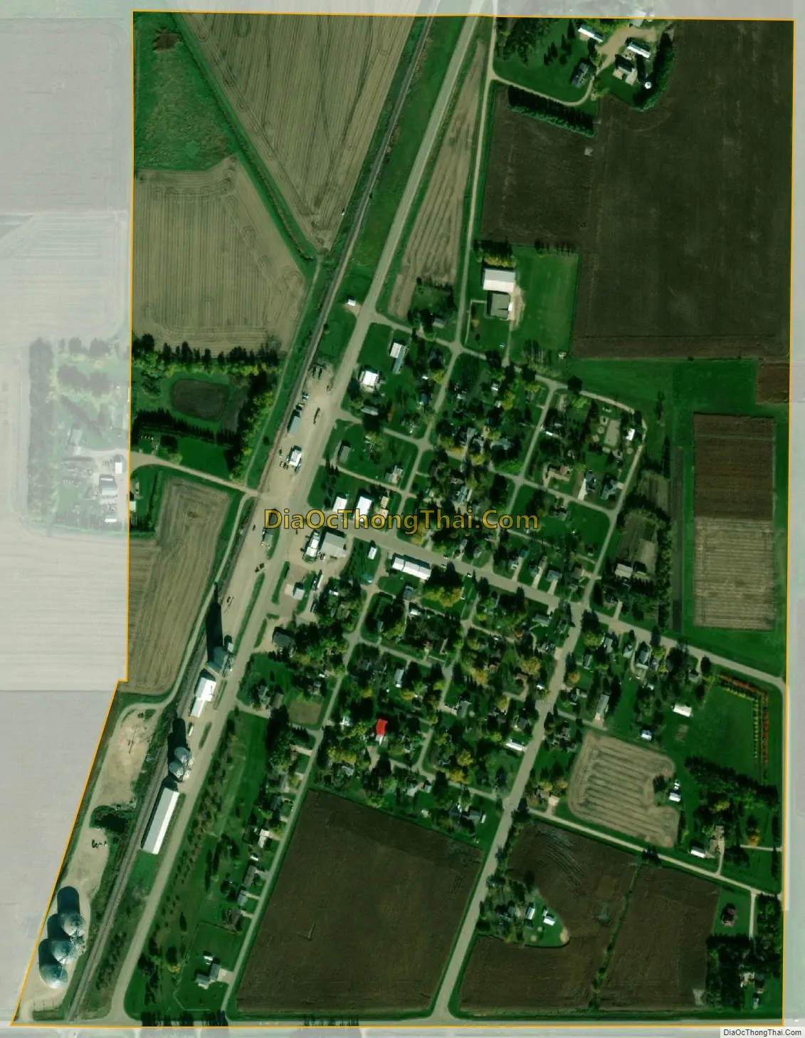
Bigelow city Satellite Map
Geography
According to the United States Census Bureau, the city has a total area of 0.40 square miles (1.04 km), all land. The town of Bigelow is located in southcentral Nobles County in section 31 of Bigelow Township. The southern corporate limit of the town is defined by the Iowa border.
Main highway is:
- Minnesota State Highway 60
Other important transportation:
- Union Pacific Railroad
See also
Map of Minnesota State and its subdivision:- Aitkin
- Anoka
- Becker
- Beltrami
- Benton
- Big Stone
- Blue Earth
- Brown
- Carlton
- Carver
- Cass
- Chippewa
- Chisago
- Clay
- Clearwater
- Cook
- Cottonwood
- Crow Wing
- Dakota
- Dodge
- Douglas
- Faribault
- Fillmore
- Freeborn
- Goodhue
- Grant
- Hennepin
- Houston
- Hubbard
- Isanti
- Itasca
- Jackson
- Kanabec
- Kandiyohi
- Kittson
- Koochiching
- Lac qui Parle
- Lake
- Lake of the Woods
- Lake Superior
- Le Sueur
- Lincoln
- Lyon
- Mahnomen
- Marshall
- Martin
- McLeod
- Meeker
- Mille Lacs
- Morrison
- Mower
- Murray
- Nicollet
- Nobles
- Norman
- Olmsted
- Otter Tail
- Pennington
- Pine
- Pipestone
- Polk
- Pope
- Ramsey
- Red Lake
- Redwood
- Renville
- Rice
- Rock
- Roseau
- Saint Louis
- Scott
- Sherburne
- Sibley
- Stearns
- Steele
- Stevens
- Swift
- Todd
- Traverse
- Wabasha
- Wadena
- Waseca
- Washington
- Watonwan
- Wilkin
- Winona
- Wright
- Yellow Medicine
- Alabama
- Alaska
- Arizona
- Arkansas
- California
- Colorado
- Connecticut
- Delaware
- District of Columbia
- Florida
- Georgia
- Hawaii
- Idaho
- Illinois
- Indiana
- Iowa
- Kansas
- Kentucky
- Louisiana
- Maine
- Maryland
- Massachusetts
- Michigan
- Minnesota
- Mississippi
- Missouri
- Montana
- Nebraska
- Nevada
- New Hampshire
- New Jersey
- New Mexico
- New York
- North Carolina
- North Dakota
- Ohio
- Oklahoma
- Oregon
- Pennsylvania
- Rhode Island
- South Carolina
- South Dakota
- Tennessee
- Texas
- Utah
- Vermont
- Virginia
- Washington
- West Virginia
- Wisconsin
- Wyoming