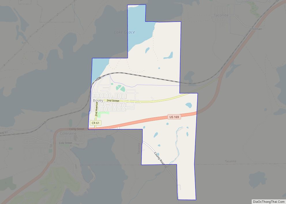
Bovey is a city in Itasca County, Minnesota, United States. It is part of Minnesota’s Iron Range. The population was 804 at the 2010 census.
| Name: | Bovey city |
|---|---|
| LSAD Code: | 25 |
| LSAD Description: | city (suffix) |
| State: | Minnesota |
| County: | Itasca County |
| Elevation: | 1,319 ft (402 m) |
| Total Area: | 2.29 sq mi (5.94 km²) |
| Land Area: | 2.29 sq mi (5.92 km²) |
| Water Area: | 0.01 sq mi (0.02 km²) |
| Total Population: | 829 |
| Population Density: | 362.64/sq mi (140.00/km²) |
| ZIP code: | 55709 |
| Area code: | 218 |
| FIPS code: | 2707048 |
| GNISfeature ID: | 0655489 |
| Website: | www.cityofbovey.org |
Online Interactive Map
Click on ![]() to view map in "full screen" mode.
to view map in "full screen" mode.
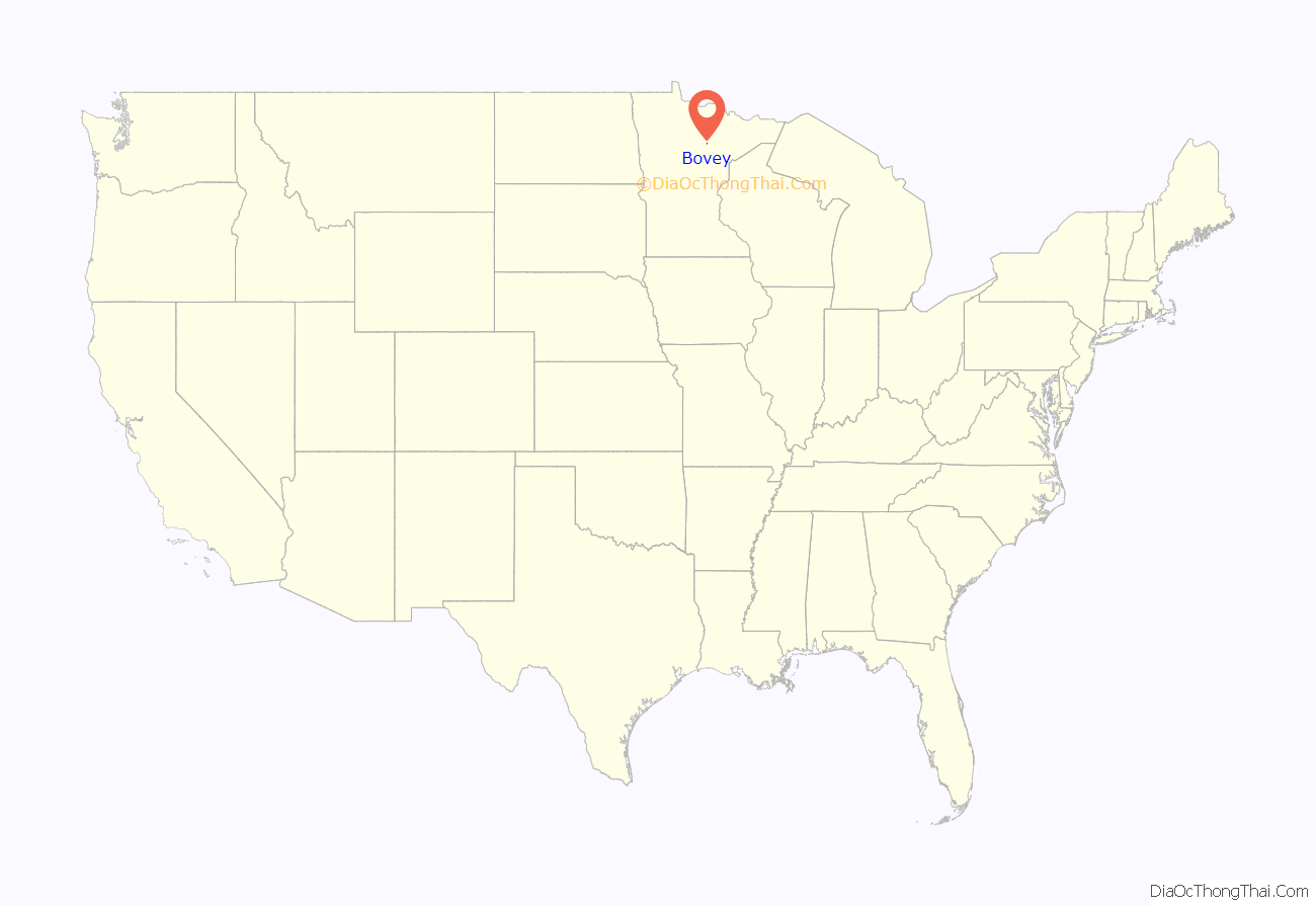
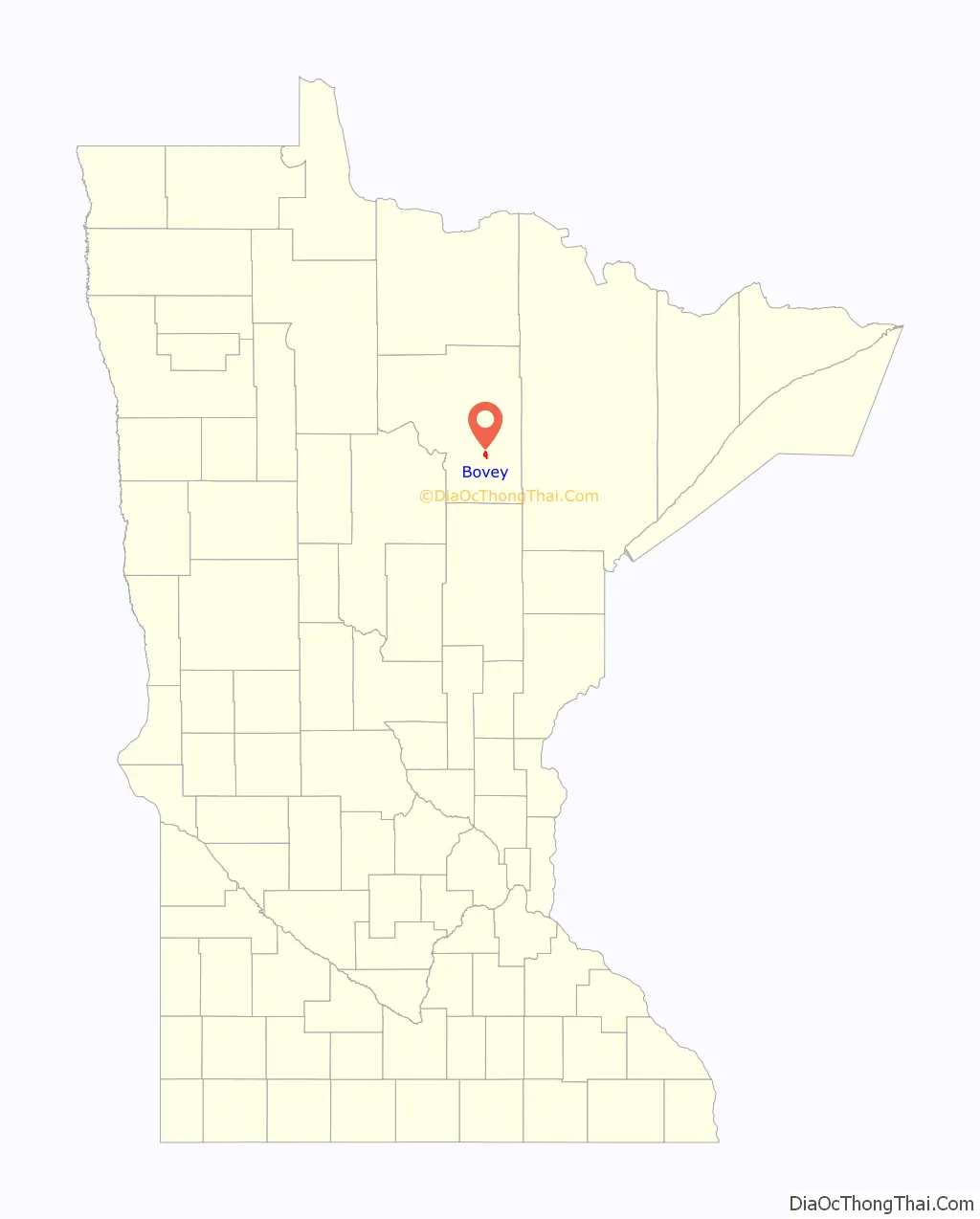
Bovey location map. Where is Bovey city?
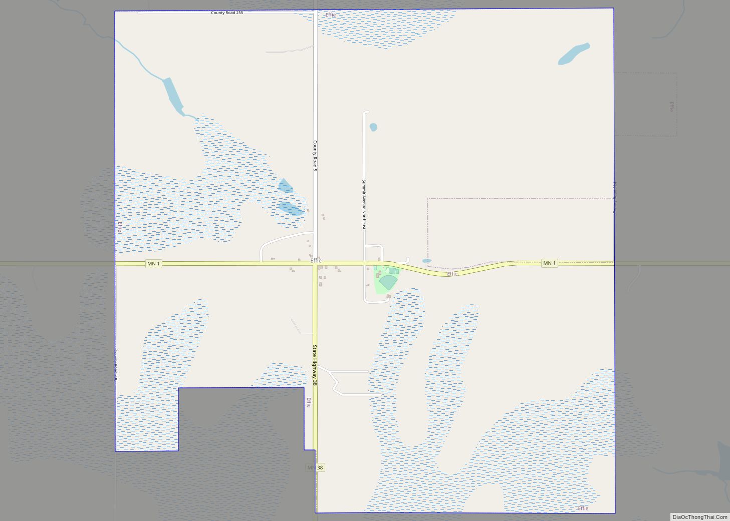
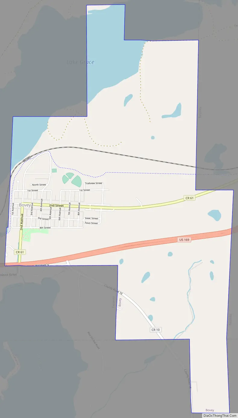
Bovey Road Map
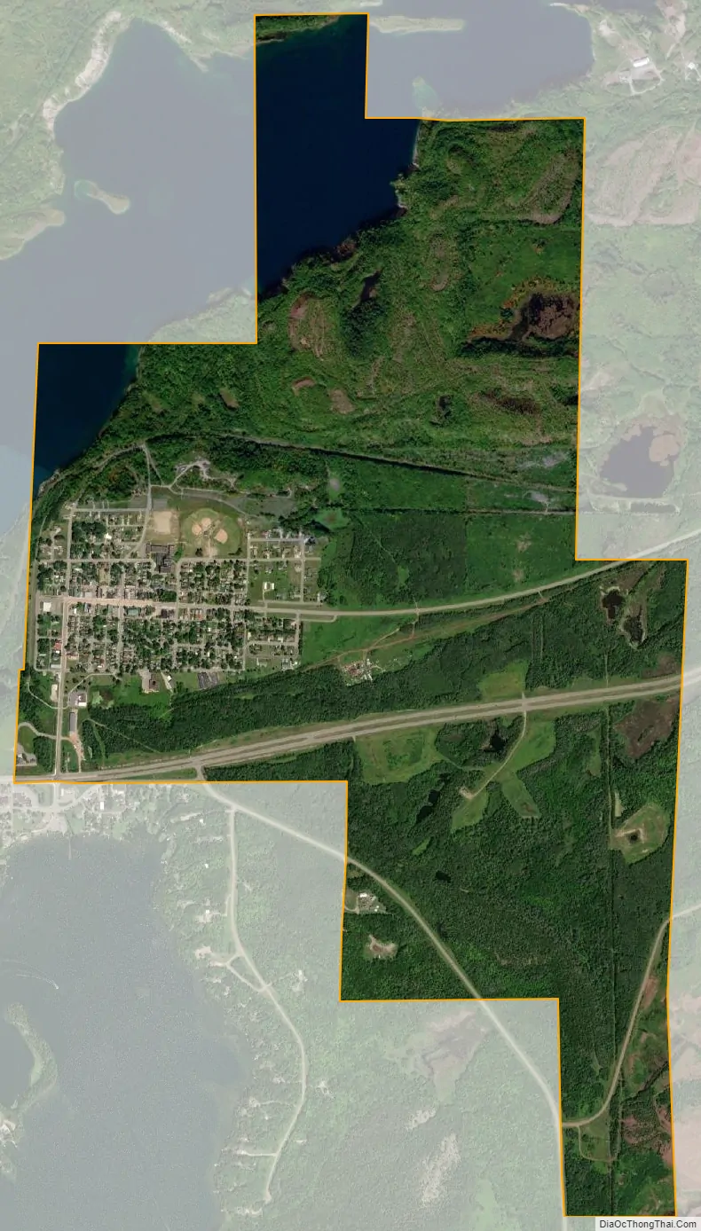
Bovey city Satellite Map
Geography
According to the United States Census Bureau, the city has a total area of 2.30 square miles (5.96 km), of which 2.29 square miles (5.93 km) is land and 0.01 square miles (0.03 km) is water.
In recent years the city, along with its neighbors Coleraine and Taconite, has been under a serious threat of flooding from the nearby Canisteo Mine Pit. The pit, which comprises a series of 19 mines that ceased to be worked in 1985, has now become a lake some 4.8 miles long and up to 300 ft deep. In June 2011 the water level was recorded as having reached 1316.1 feet above sea level, higher than low-lying areas of the town. A project to drain some of the lake to prevent it overflowing and swamping the town was due to commence in mid-2011. The most recent pit water level is 1316.60 MSL.
See also
Map of Minnesota State and its subdivision:- Aitkin
- Anoka
- Becker
- Beltrami
- Benton
- Big Stone
- Blue Earth
- Brown
- Carlton
- Carver
- Cass
- Chippewa
- Chisago
- Clay
- Clearwater
- Cook
- Cottonwood
- Crow Wing
- Dakota
- Dodge
- Douglas
- Faribault
- Fillmore
- Freeborn
- Goodhue
- Grant
- Hennepin
- Houston
- Hubbard
- Isanti
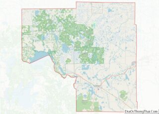
- Itasca
- Jackson
- Kanabec
- Kandiyohi
- Kittson
- Koochiching
- Lac qui Parle
- Lake
- Lake of the Woods
- Lake Superior
- Le Sueur
- Lincoln
- Lyon
- Mahnomen
- Marshall
- Martin
- McLeod
- Meeker
- Mille Lacs
- Morrison
- Mower
- Murray
- Nicollet
- Nobles
- Norman
- Olmsted
- Otter Tail
- Pennington
- Pine
- Pipestone
- Polk
- Pope
- Ramsey
- Red Lake
- Redwood
- Renville
- Rice
- Rock
- Roseau
- Saint Louis
- Scott
- Sherburne
- Sibley
- Stearns
- Steele
- Stevens
- Swift
- Todd
- Traverse
- Wabasha
- Wadena
- Waseca
- Washington
- Watonwan
- Wilkin
- Winona
- Wright
- Yellow Medicine
- Alabama
- Alaska
- Arizona
- Arkansas
- California
- Colorado
- Connecticut
- Delaware
- District of Columbia
- Florida
- Georgia
- Hawaii
- Idaho
- Illinois
- Indiana
- Iowa
- Kansas
- Kentucky
- Louisiana
- Maine
- Maryland
- Massachusetts
- Michigan
- Minnesota
- Mississippi
- Missouri
- Montana
- Nebraska
- Nevada
- New Hampshire
- New Jersey
- New Mexico
- New York
- North Carolina
- North Dakota
- Ohio
- Oklahoma
- Oregon
- Pennsylvania
- Rhode Island
- South Carolina
- South Dakota
- Tennessee
- Texas
- Utah
- Vermont
- Virginia
- Washington
- West Virginia
- Wisconsin
- Wyoming