Brooks is a city in Red Lake County, Minnesota, United States. The population was 117 at the 2020 census.
| Name: | Brooks city |
|---|---|
| LSAD Code: | 25 |
| LSAD Description: | city (suffix) |
| State: | Minnesota |
| County: | Red Lake County |
| Elevation: | 1,129 ft (344 m) |
| Total Area: | 1.15 sq mi (2.98 km²) |
| Land Area: | 1.15 sq mi (2.98 km²) |
| Water Area: | 0.00 sq mi (0.00 km²) |
| Total Population: | 117 |
| Population Density: | 101.56/sq mi (39.20/km²) |
| ZIP code: | 56715 |
| Area code: | 218 |
| FIPS code: | 2708038 |
| GNISfeature ID: | 0640513 |
| Website: | brooksmn.com |
Online Interactive Map
Click on ![]() to view map in "full screen" mode.
to view map in "full screen" mode.
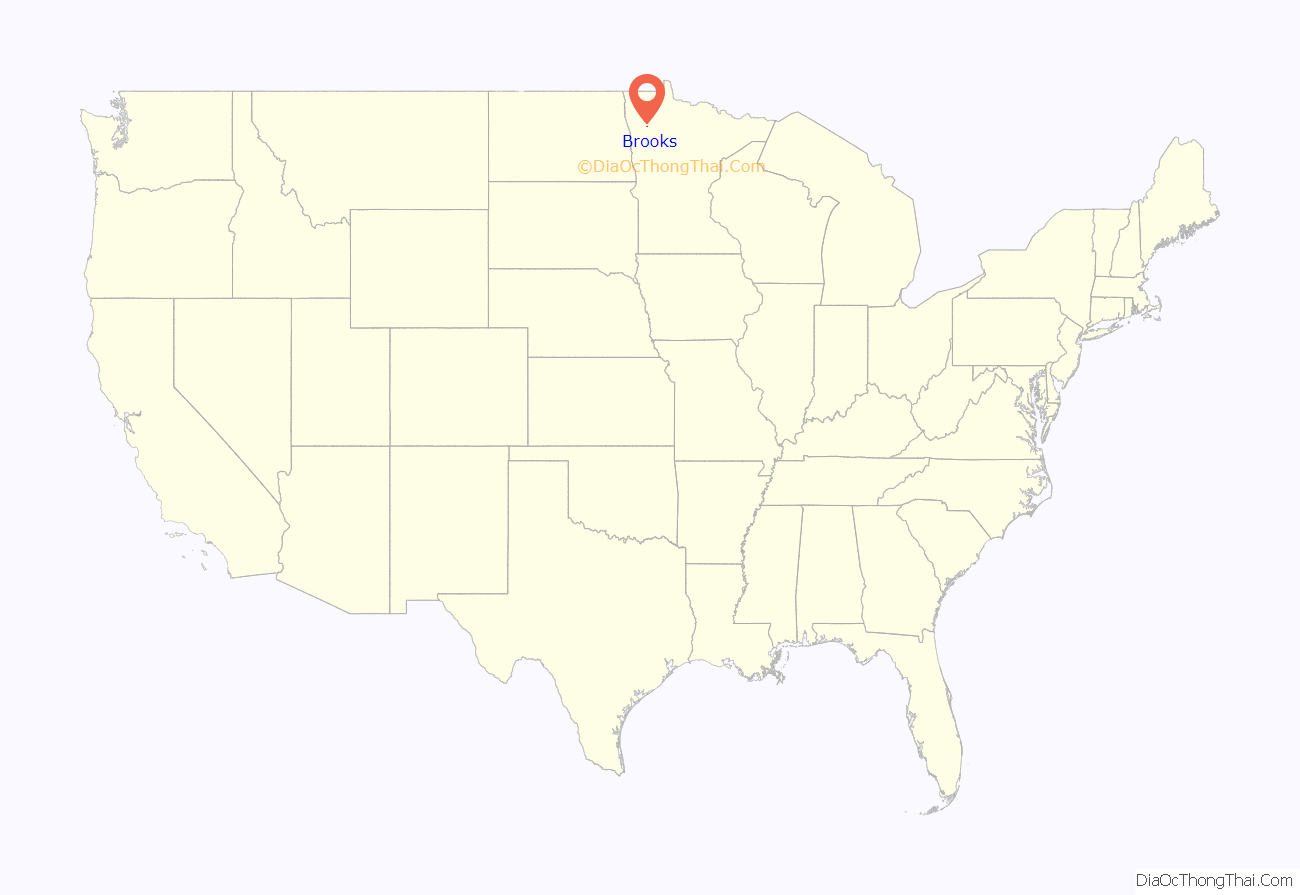
Brooks location map. Where is Brooks city?
History
Brooks was established in 1904 as a station on the Soo Line Railroad. By 1926, Brooks had two general stores, a grocery store, a bank, hardware store, butcher shop, blacksmith shop, a livery barn, two saloons, a community hall and a hotel to accommodate travelers. Brooks was primarily a service town for the surrounding agricultural townships, and a creamery was established as the local dairying business developed on neighboring farms. After the invention of the cream separator, family farms in adjoining townships of Polk and Red Lake counties switched from subsistence agriculture to a market economy and became a part of the dairy industry.
Brooks Cheese Company
In 1926, the Brooks creamery was purchased by the owners of the cheese factory in nearby Terrebonne, who moved their operation to Brooks. The business was widely known as the Brooks Cheese Company. It was a cheese factory owned by the Parenteau family, which sold its product to the Kraft Foods company, and marketed its products throughout the Midwest. Local farmers would process the milk from their own cows by removing the butterfat or cream, which was hauled in cream cans to the cheese factory, while the skim milk or whey was fed to hogs raised on the same farm. The Brooks Cheese Company continued in business until the late 1970s, at which point the decline of the family farm and the predominance of monoculture and industrial agriculture eliminated the mixed agriculture that formerly had predominated in the area of Brooks.
Although the local history of Red Lake County blames the National Farmers Organization for organizing farmers to cooperative actions in withholding milk shipments, the reality is that Brooks Cheese Company could not compete with the major industrial cheese manufacturers and the development of agribusiness which portended the demise of the family farm. By the beginning of the 21st century, few dairy cows could be found within twenty miles of Brooks, whereas at one time virtually every quarter section could be counted on for the cream produced by 10 or 15 cows. Nonetheless, Brooks continues to be the site of an agricultural supply business, a gas station, and several other local businesses, as well as one church.
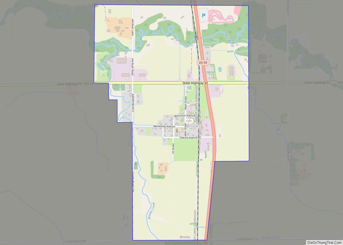
Brooks Road Map
Brooks city Satellite Map
Geography
According to the United States Census Bureau, the city has a total area of 1.17 square miles (3.03 km), all land.
U.S. Highway 59 and Minnesota Highway 92 are two of the main routes in the community.
See also
Map of Minnesota State and its subdivision:- Aitkin
- Anoka
- Becker
- Beltrami
- Benton
- Big Stone
- Blue Earth
- Brown
- Carlton
- Carver
- Cass
- Chippewa
- Chisago
- Clay
- Clearwater
- Cook
- Cottonwood
- Crow Wing
- Dakota
- Dodge
- Douglas
- Faribault
- Fillmore
- Freeborn
- Goodhue
- Grant
- Hennepin
- Houston
- Hubbard
- Isanti
- Itasca
- Jackson
- Kanabec
- Kandiyohi
- Kittson
- Koochiching
- Lac qui Parle
- Lake
- Lake of the Woods
- Lake Superior
- Le Sueur
- Lincoln
- Lyon
- Mahnomen
- Marshall
- Martin
- McLeod
- Meeker
- Mille Lacs
- Morrison
- Mower
- Murray
- Nicollet
- Nobles
- Norman
- Olmsted
- Otter Tail
- Pennington
- Pine
- Pipestone
- Polk
- Pope
- Ramsey
- Red Lake
- Redwood
- Renville
- Rice
- Rock
- Roseau
- Saint Louis
- Scott
- Sherburne
- Sibley
- Stearns
- Steele
- Stevens
- Swift
- Todd
- Traverse
- Wabasha
- Wadena
- Waseca
- Washington
- Watonwan
- Wilkin
- Winona
- Wright
- Yellow Medicine
- Alabama
- Alaska
- Arizona
- Arkansas
- California
- Colorado
- Connecticut
- Delaware
- District of Columbia
- Florida
- Georgia
- Hawaii
- Idaho
- Illinois
- Indiana
- Iowa
- Kansas
- Kentucky
- Louisiana
- Maine
- Maryland
- Massachusetts
- Michigan
- Minnesota
- Mississippi
- Missouri
- Montana
- Nebraska
- Nevada
- New Hampshire
- New Jersey
- New Mexico
- New York
- North Carolina
- North Dakota
- Ohio
- Oklahoma
- Oregon
- Pennsylvania
- Rhode Island
- South Carolina
- South Dakota
- Tennessee
- Texas
- Utah
- Vermont
- Virginia
- Washington
- West Virginia
- Wisconsin
- Wyoming
