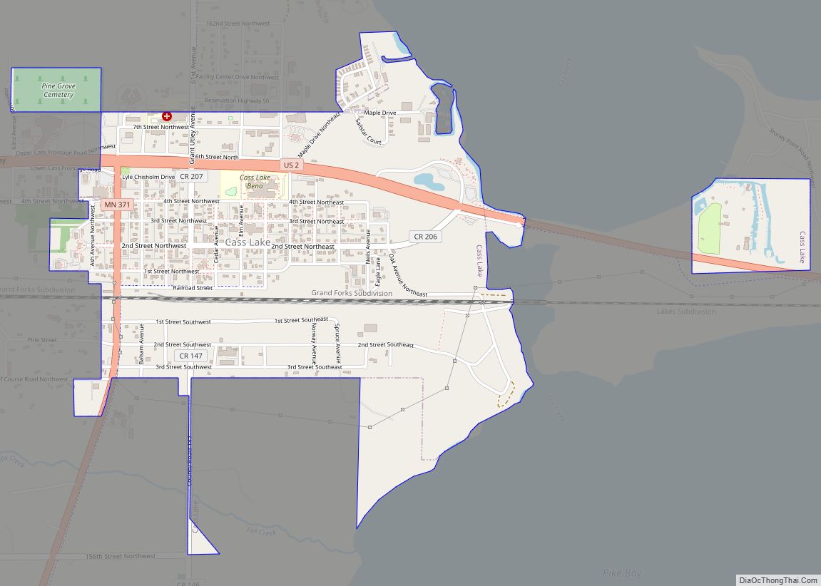
Cass Lake is a city in Cass County, Minnesota, United States, located within the boundaries of the Leech Lake Indian Reservation. It is surrounded by Pike Bay Township. Cass Lake had a population of 675 in the 2020 census. It is notable as the headquarters location of Minnesota Chippewa Tribe and Leech Lake Band of Ojibwe, as well as the Chippewa National Forest.
The city is located on the shore of its namesake Cass Lake, which was named in honor of Michigan Governor Lewis Cass.
Cass Lake is part of the Brainerd Micropolitan Statistical Area. It reached its peak of population of over 2,100 in 1920. Since 1950, the combination of decline of small town retailers, suburbanization, and decreased employment in forest industries have resulted in steadily decreasing population.
| Name: | Cass Lake city |
|---|---|
| LSAD Code: | 25 |
| LSAD Description: | city (suffix) |
| State: | Minnesota |
| County: | Cass County |
| Elevation: | 1,332 ft (406 m) |
| Total Area: | 1.09 sq mi (2.83 km²) |
| Land Area: | 1.09 sq mi (2.82 km²) |
| Water Area: | 0.00 sq mi (0.00 km²) |
| Total Population: | 675 |
| Population Density: | 619.27/sq mi (239.01/km²) |
| ZIP code: | 56633 |
| Area code: | 218 |
| FIPS code: | 2710252 |
| GNISfeature ID: | 0655663 |
| Website: | ci.casslake.mn.us |
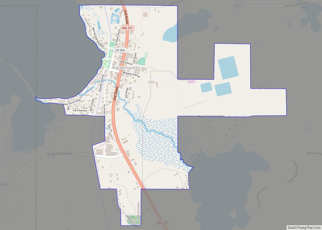
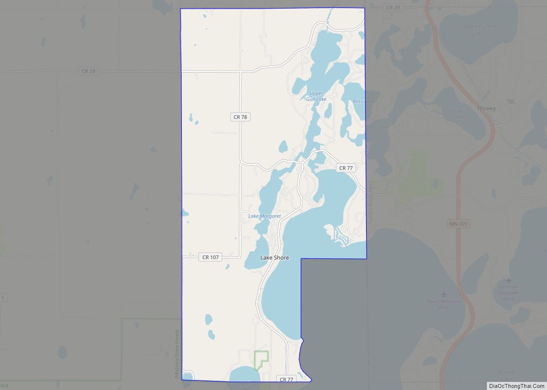
Online Interactive Map
Click on ![]() to view map in "full screen" mode.
to view map in "full screen" mode.
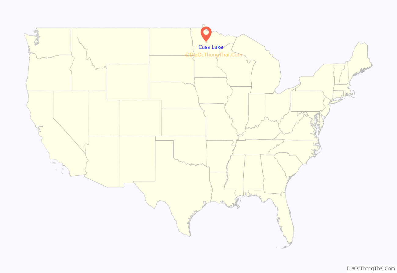
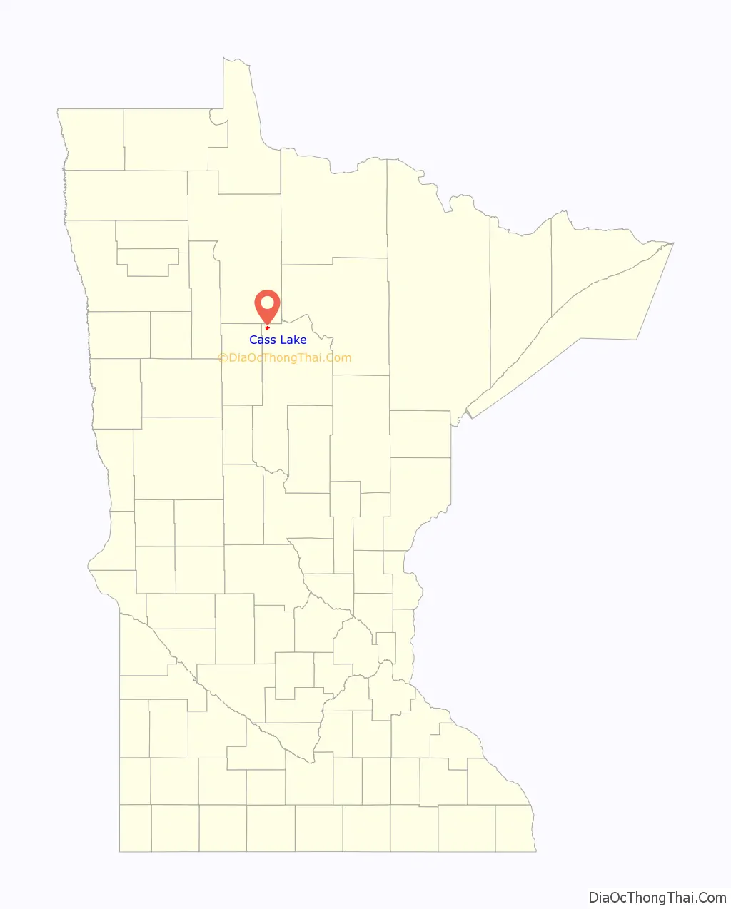
Cass Lake location map. Where is Cass Lake city?
History
The area was inhabited for thousands of years by succeeding cultures of indigenous peoples. In historic times, the Ojibwe/Chippewa moved west and south from the Great Lakes region, settling across present-day Minnesota.
The village was established in 1898 with the construction of the Great North Railway. The post office was originally established as ‘Tuller’ in December 1898, named after the brother-in-law of the first postmaster. When this was known, residents quickly lodged protests with the Postmaster General and by the end of March 1899, it was renamed ‘Cass Lake’.
The forest industry has historically supplied many jobs, but has been susceptible to boom-and-bust cycle. Between 1898 and 1923, the city was dependent on lumber mills utilizing pine from the surrounding forests. Depletion of the pine resource was followed by utilization of lower value species at a box factory which operated until 1950, and a wood treatment plant operated by Wheeler Lumber between 1949 and 1985. From 1983 until 2009, Potlatch Corporation and its successor Ainsworth operated an oriented strand board plant in nearby Farden Township, which provided employment to many residents. Cass Forest Products, an employee-owned company, operates a sawmill that has been in operation since 1939, and is one of the largest forest product producers in Minnesota. The former wood-treating plant operated by Wheeler Lumber within the city limits has been designated a Federal Superfund site, due to soil and groundwater contamination by the wood treating compounds creosote, pentachlorophenol, and ammoniacal copper arsenate.
In 2003, Elaine Fleming was the first Native American to be elected as mayor of the town.
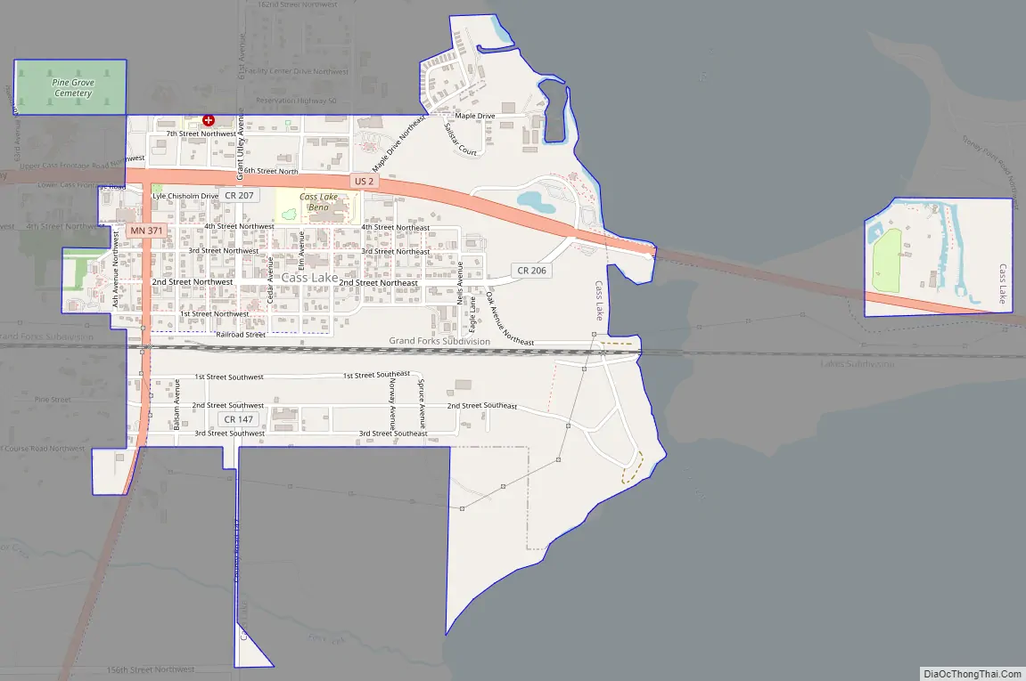
Cass Lake Road Map
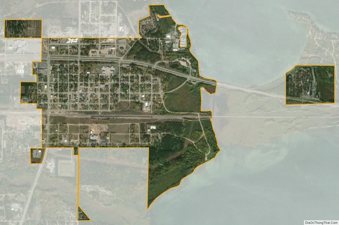
Cass Lake city Satellite Map
Geography
According to the United States Census Bureau, the city has a total area of 1.09 square miles (2.8 km), all of it land.
Cass Lake has a humid continental climate (Köppen Climate Classification Dfb), with warm summers and long, cold winters.
See also
Map of Minnesota State and its subdivision:- Aitkin
- Anoka
- Becker
- Beltrami
- Benton
- Big Stone
- Blue Earth
- Brown
- Carlton
- Carver
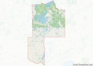
- Cass
- Chippewa
- Chisago
- Clay
- Clearwater
- Cook
- Cottonwood
- Crow Wing
- Dakota
- Dodge
- Douglas
- Faribault
- Fillmore
- Freeborn
- Goodhue
- Grant
- Hennepin
- Houston
- Hubbard
- Isanti
- Itasca
- Jackson
- Kanabec
- Kandiyohi
- Kittson
- Koochiching
- Lac qui Parle
- Lake
- Lake of the Woods
- Lake Superior
- Le Sueur
- Lincoln
- Lyon
- Mahnomen
- Marshall
- Martin
- McLeod
- Meeker
- Mille Lacs
- Morrison
- Mower
- Murray
- Nicollet
- Nobles
- Norman
- Olmsted
- Otter Tail
- Pennington
- Pine
- Pipestone
- Polk
- Pope
- Ramsey
- Red Lake
- Redwood
- Renville
- Rice
- Rock
- Roseau
- Saint Louis
- Scott
- Sherburne
- Sibley
- Stearns
- Steele
- Stevens
- Swift
- Todd
- Traverse
- Wabasha
- Wadena
- Waseca
- Washington
- Watonwan
- Wilkin
- Winona
- Wright
- Yellow Medicine
- Alabama
- Alaska
- Arizona
- Arkansas
- California
- Colorado
- Connecticut
- Delaware
- District of Columbia
- Florida
- Georgia
- Hawaii
- Idaho
- Illinois
- Indiana
- Iowa
- Kansas
- Kentucky
- Louisiana
- Maine
- Maryland
- Massachusetts
- Michigan
- Minnesota
- Mississippi
- Missouri
- Montana
- Nebraska
- Nevada
- New Hampshire
- New Jersey
- New Mexico
- New York
- North Carolina
- North Dakota
- Ohio
- Oklahoma
- Oregon
- Pennsylvania
- Rhode Island
- South Carolina
- South Dakota
- Tennessee
- Texas
- Utah
- Vermont
- Virginia
- Washington
- West Virginia
- Wisconsin
- Wyoming