Clarks Grove is a city in Freeborn County, Minnesota, United States. The population was 706 at the 2010 census.
| Name: | Clarks Grove city |
|---|---|
| LSAD Code: | 25 |
| LSAD Description: | city (suffix) |
| State: | Minnesota |
| County: | Freeborn County |
| Elevation: | 1,312 ft (400 m) |
| Total Area: | 0.64 sq mi (1.65 km²) |
| Land Area: | 0.60 sq mi (1.55 km²) |
| Water Area: | 0.04 sq mi (0.10 km²) |
| Total Population: | 694 |
| Population Density: | 1,158.60/sq mi (447.41/km²) |
| ZIP code: | 56016 |
| Area code: | 507 |
| FIPS code: | 2711674 |
| GNISfeature ID: | 0641253 |
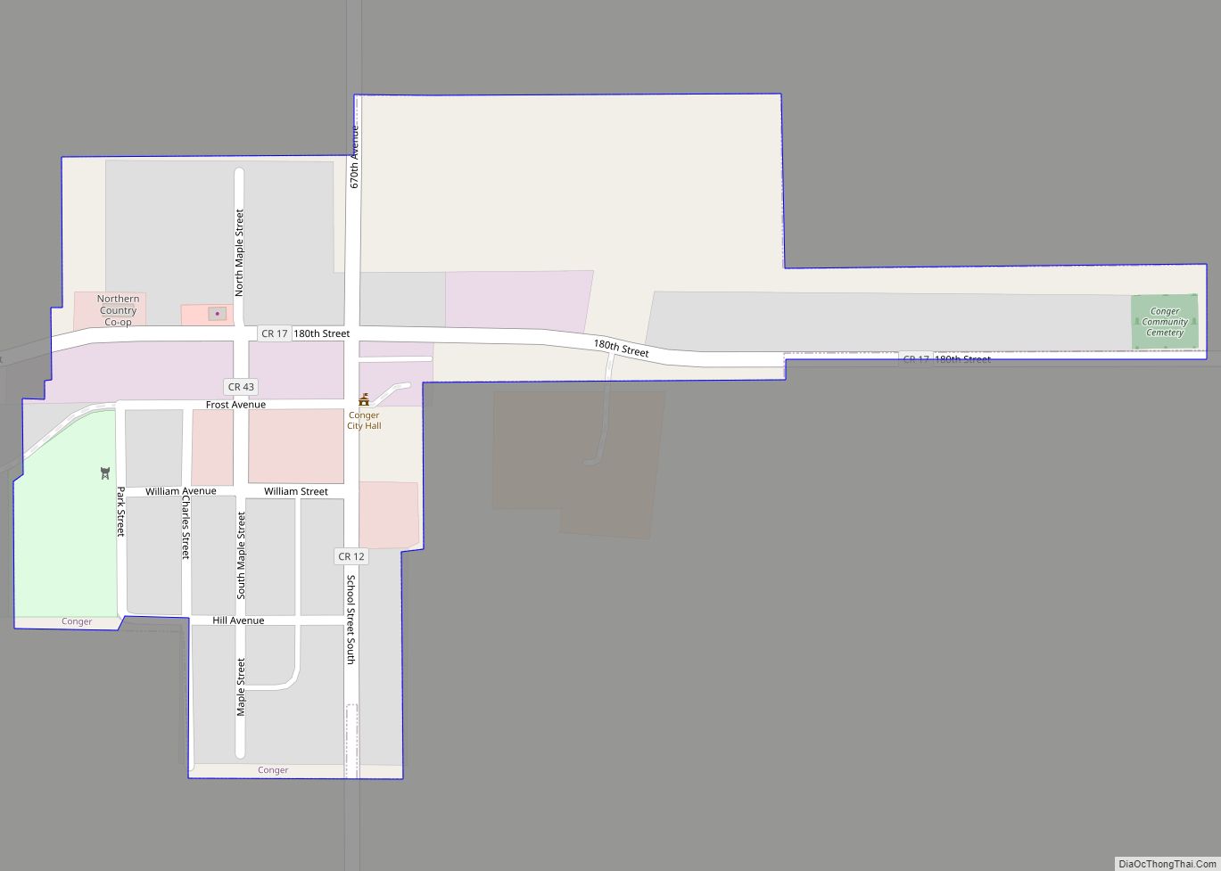
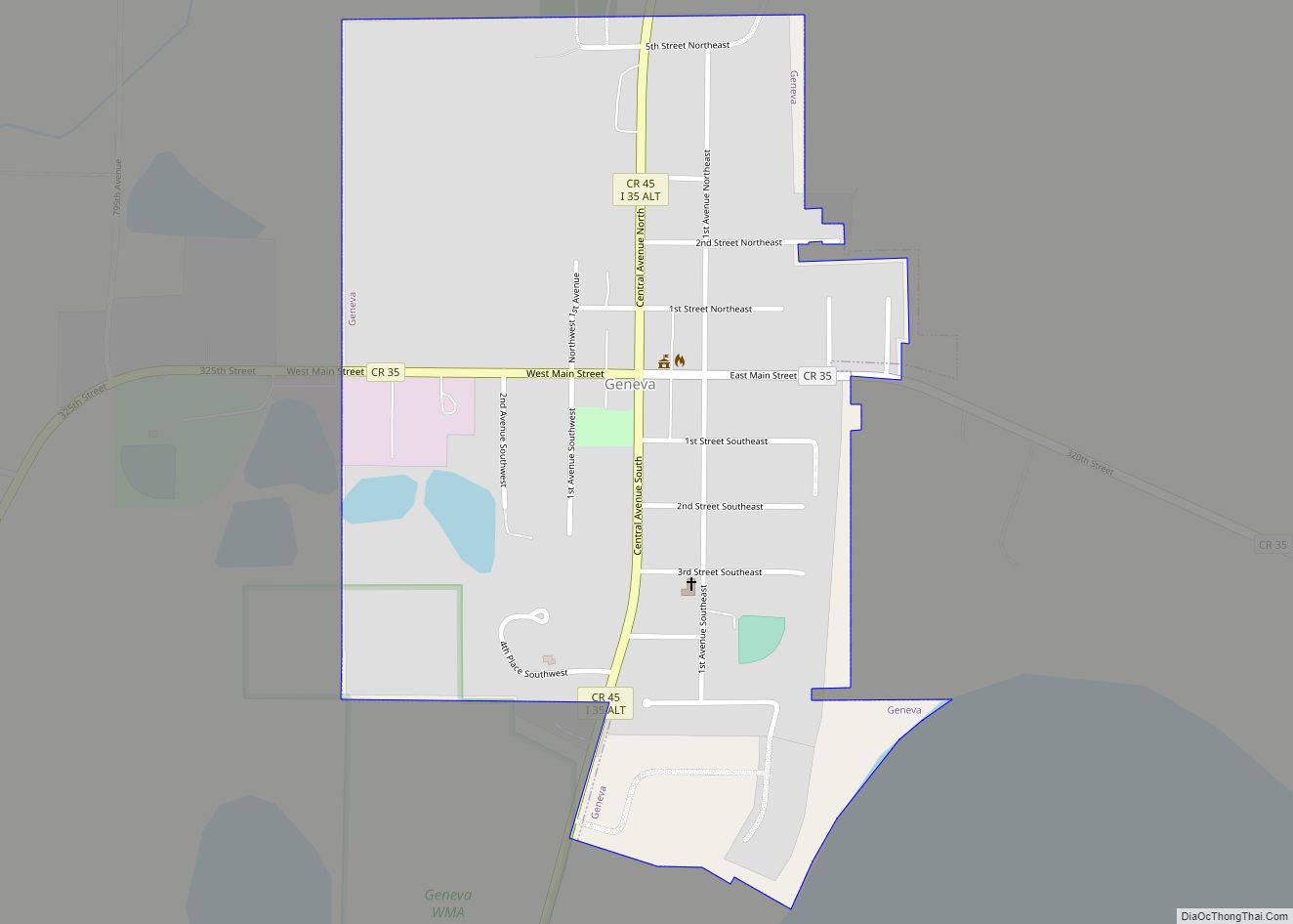
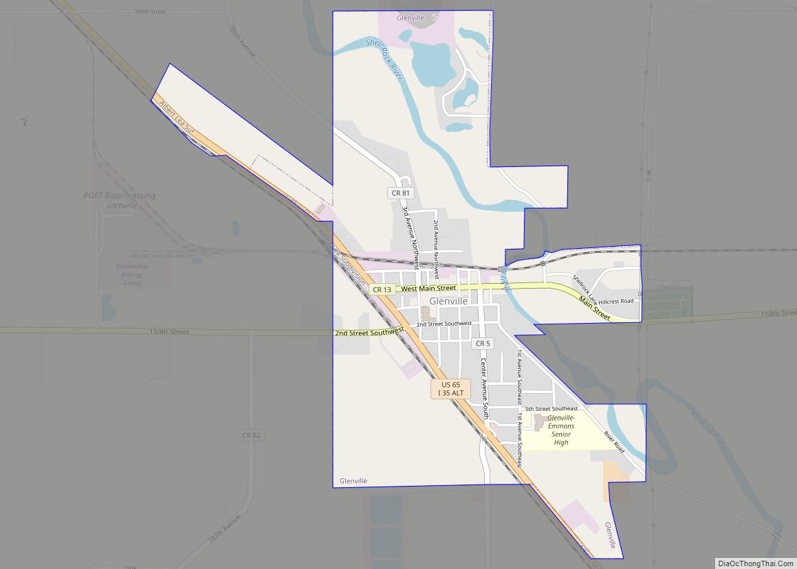
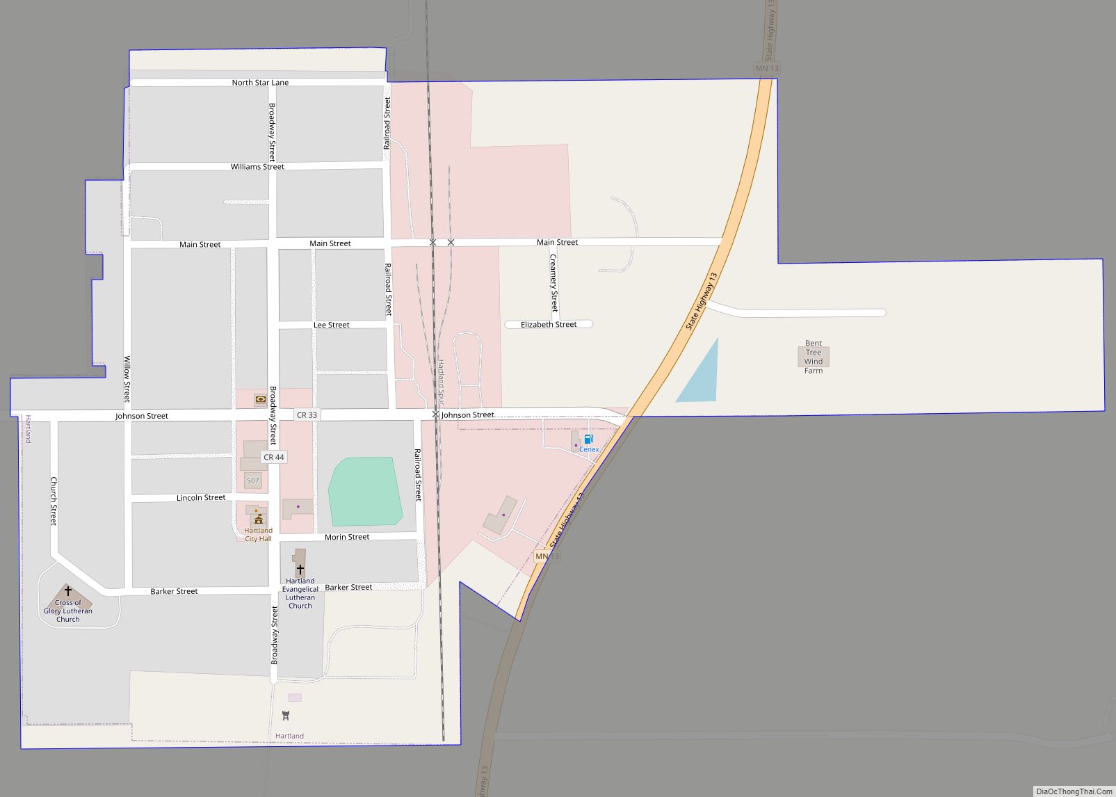
Online Interactive Map
Click on ![]() to view map in "full screen" mode.
to view map in "full screen" mode.
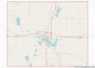
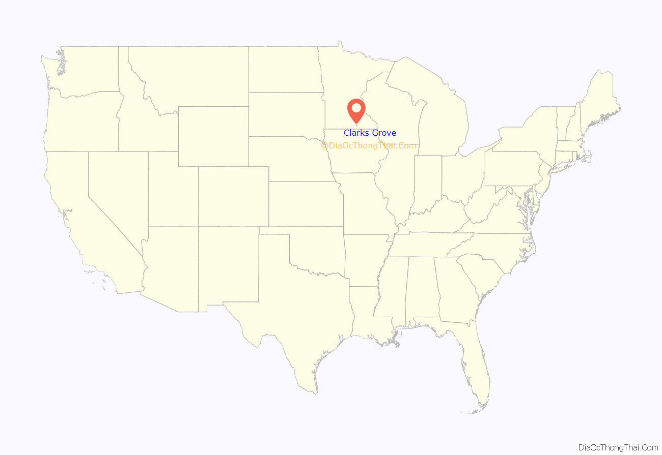
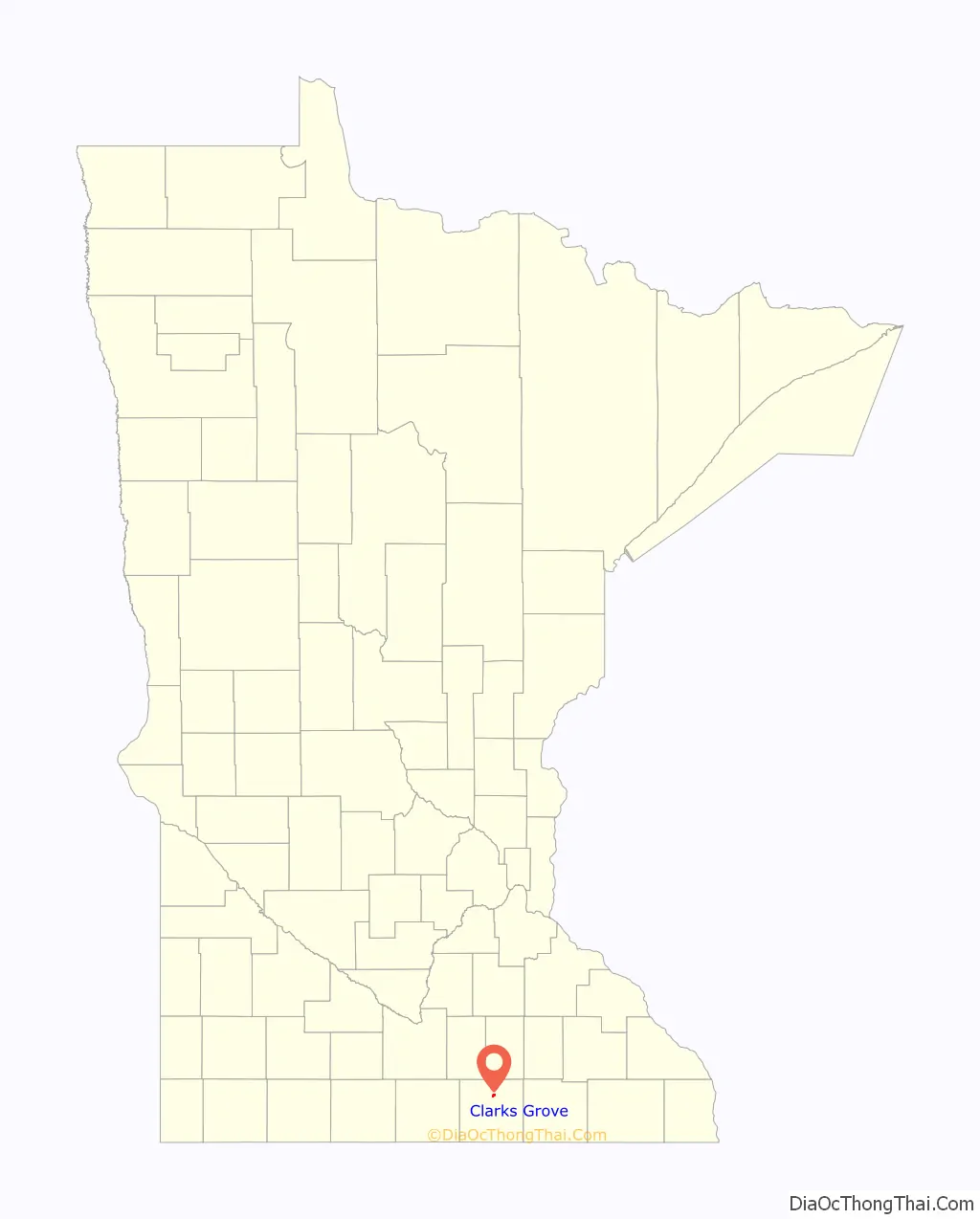
Clarks Grove location map. Where is Clarks Grove city?
History
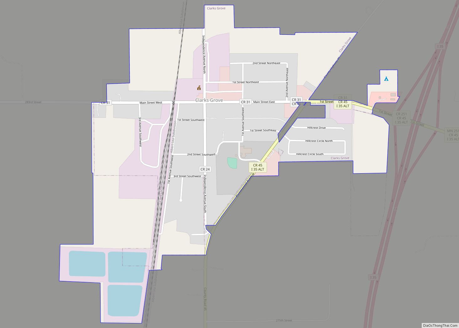
Clarks Grove was laid out in 1890, about ten years before the railroad was extended to that point. It was incorporated as a village on February 27, 1920, and had a station of the Chicago and Northwestern Railway, sometimes listed as James. Its post office began in 1857 with Clark as postmaster.
Clarks Grove Cooperative Creamery, founded in 1890 by Danish American farmers, was one of the first successful cooperative creameries in the state.
In March 2017, buildings in the community were damaged by a tornado.
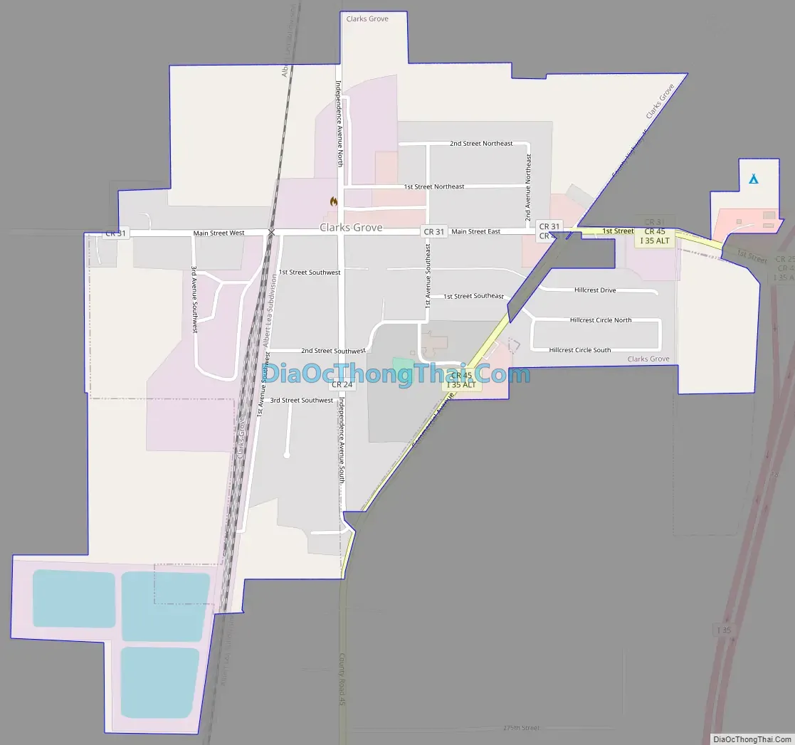
Clarks Grove Road Map
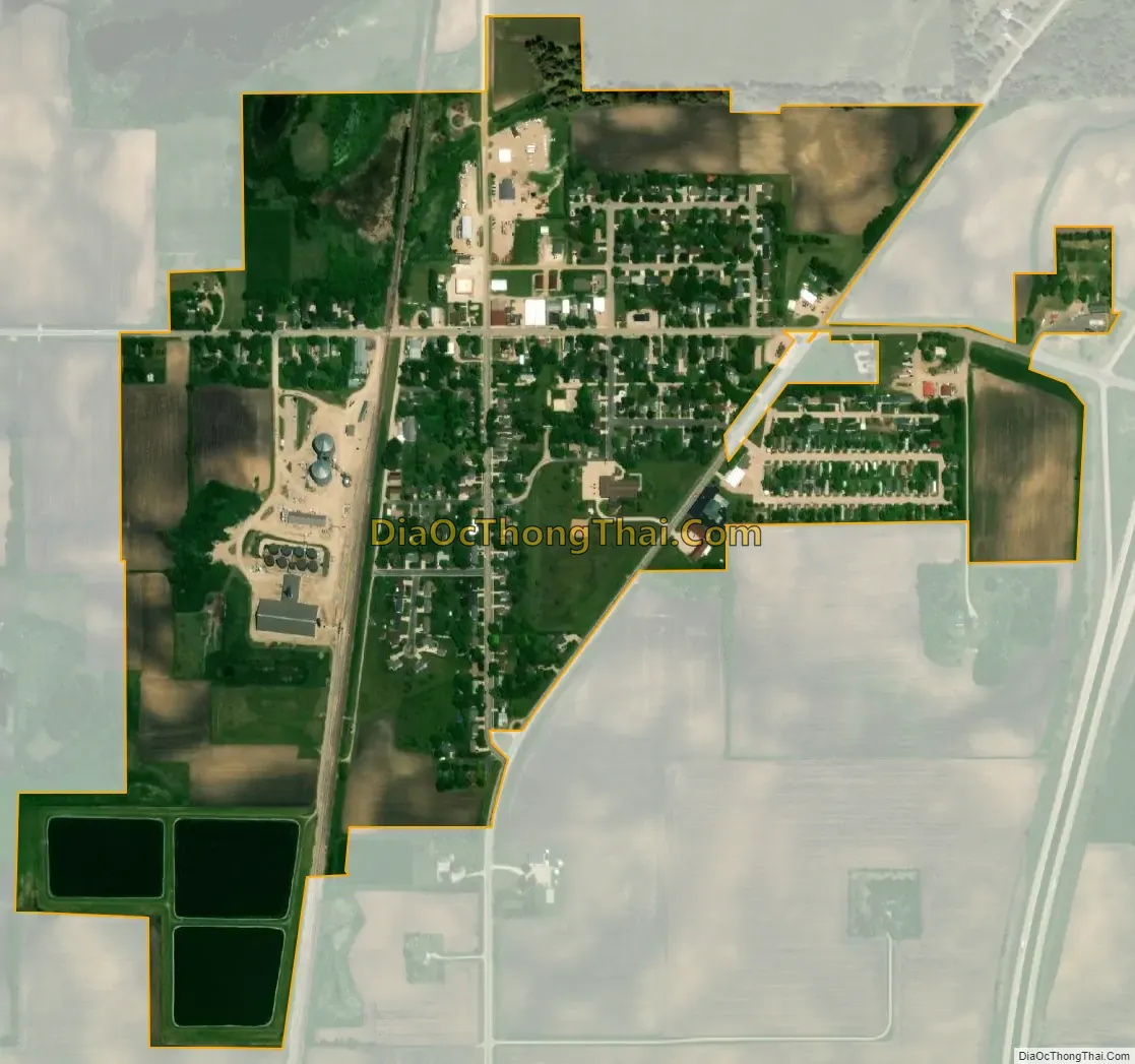
Clarks Grove city Satellite Map
Geography
According to the United States Census Bureau, the city has a total area of 0.59 square miles (1.53 km), of which 0.55 square miles (1.42 km) is land and 0.04 square miles (0.10 km) is water. Clarks Grove is along Interstate 35, State Highway 251 (MN 251), and County Roads 31 and 45.
See also
Map of Minnesota State and its subdivision:- Aitkin
- Anoka
- Becker
- Beltrami
- Benton
- Big Stone
- Blue Earth
- Brown
- Carlton
- Carver
- Cass
- Chippewa
- Chisago
- Clay
- Clearwater
- Cook
- Cottonwood
- Crow Wing
- Dakota
- Dodge
- Douglas
- Faribault
- Fillmore
- Freeborn
- Goodhue
- Grant
- Hennepin
- Houston
- Hubbard
- Isanti
- Itasca
- Jackson
- Kanabec
- Kandiyohi
- Kittson
- Koochiching
- Lac qui Parle
- Lake
- Lake of the Woods
- Lake Superior
- Le Sueur
- Lincoln
- Lyon
- Mahnomen
- Marshall
- Martin
- McLeod
- Meeker
- Mille Lacs
- Morrison
- Mower
- Murray
- Nicollet
- Nobles
- Norman
- Olmsted
- Otter Tail
- Pennington
- Pine
- Pipestone
- Polk
- Pope
- Ramsey
- Red Lake
- Redwood
- Renville
- Rice
- Rock
- Roseau
- Saint Louis
- Scott
- Sherburne
- Sibley
- Stearns
- Steele
- Stevens
- Swift
- Todd
- Traverse
- Wabasha
- Wadena
- Waseca
- Washington
- Watonwan
- Wilkin
- Winona
- Wright
- Yellow Medicine
- Alabama
- Alaska
- Arizona
- Arkansas
- California
- Colorado
- Connecticut
- Delaware
- District of Columbia
- Florida
- Georgia
- Hawaii
- Idaho
- Illinois
- Indiana
- Iowa
- Kansas
- Kentucky
- Louisiana
- Maine
- Maryland
- Massachusetts
- Michigan
- Minnesota
- Mississippi
- Missouri
- Montana
- Nebraska
- Nevada
- New Hampshire
- New Jersey
- New Mexico
- New York
- North Carolina
- North Dakota
- Ohio
- Oklahoma
- Oregon
- Pennsylvania
- Rhode Island
- South Carolina
- South Dakota
- Tennessee
- Texas
- Utah
- Vermont
- Virginia
- Washington
- West Virginia
- Wisconsin
- Wyoming