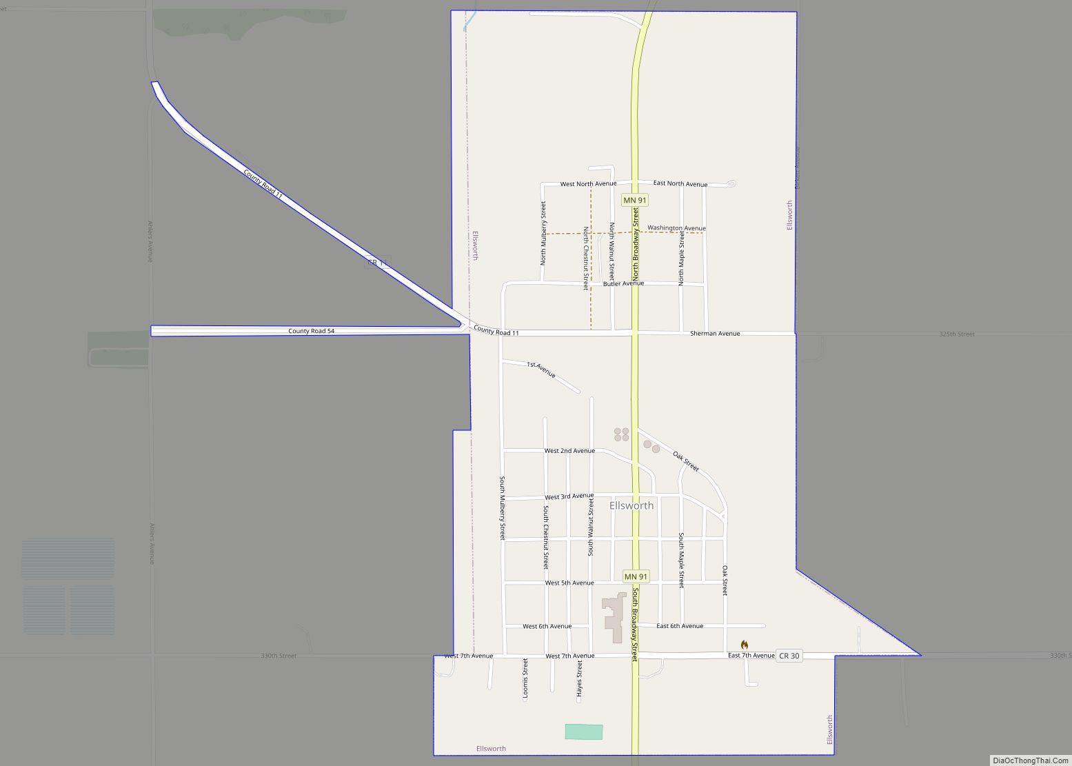
Ellsworth is a city in Nobles County, Minnesota, United States. The population was 463 at the 2010 census. The local school district is the Ellsworth Public School.
| Name: | Ellsworth city |
|---|---|
| LSAD Code: | 25 |
| LSAD Description: | city (suffix) |
| State: | Minnesota |
| County: | Nobles County |
| Elevation: | 1,450 ft (442 m) |
| Total Area: | 0.66 sq mi (1.71 km²) |
| Land Area: | 0.66 sq mi (1.71 km²) |
| Water Area: | 0.00 sq mi (0.00 km²) |
| Total Population: | 497 |
| Population Density: | 754.17/sq mi (291.05/km²) |
| ZIP code: | 56129 |
| Area code: | 507 |
| FIPS code: | 2718836 |
| GNISfeature ID: | 0643292 |
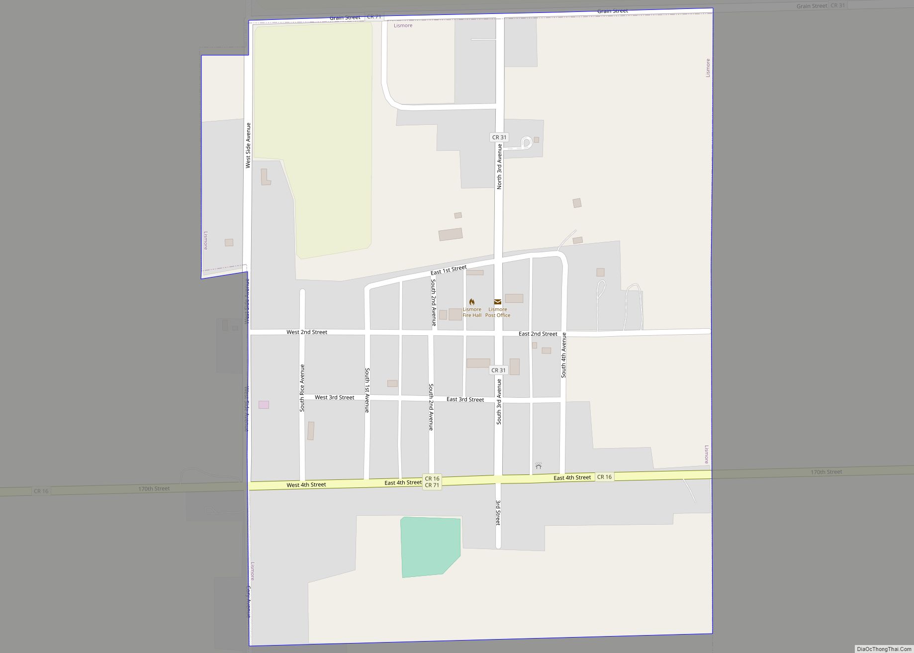
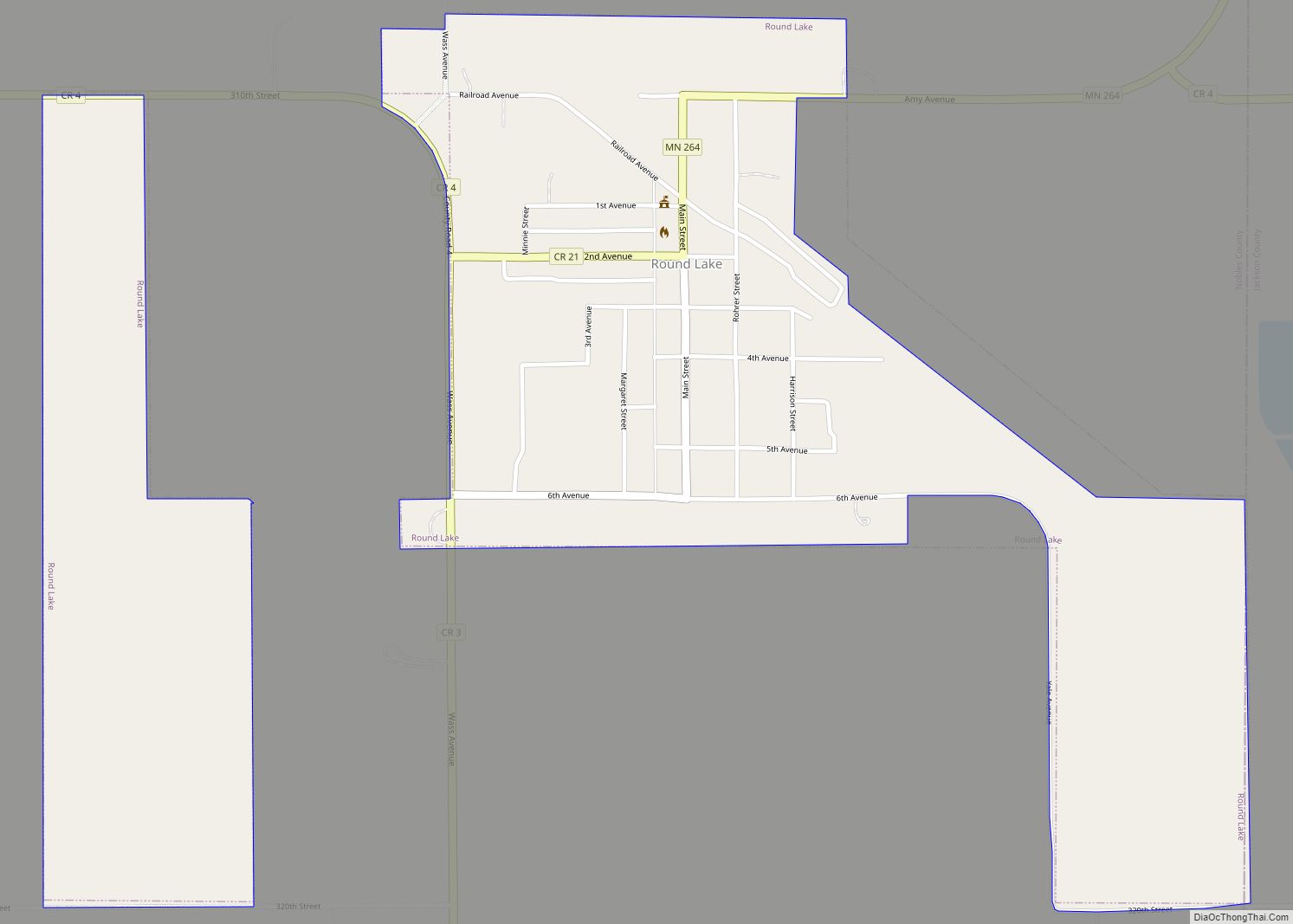
Online Interactive Map
Click on ![]() to view map in "full screen" mode.
to view map in "full screen" mode.
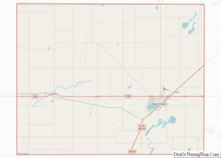
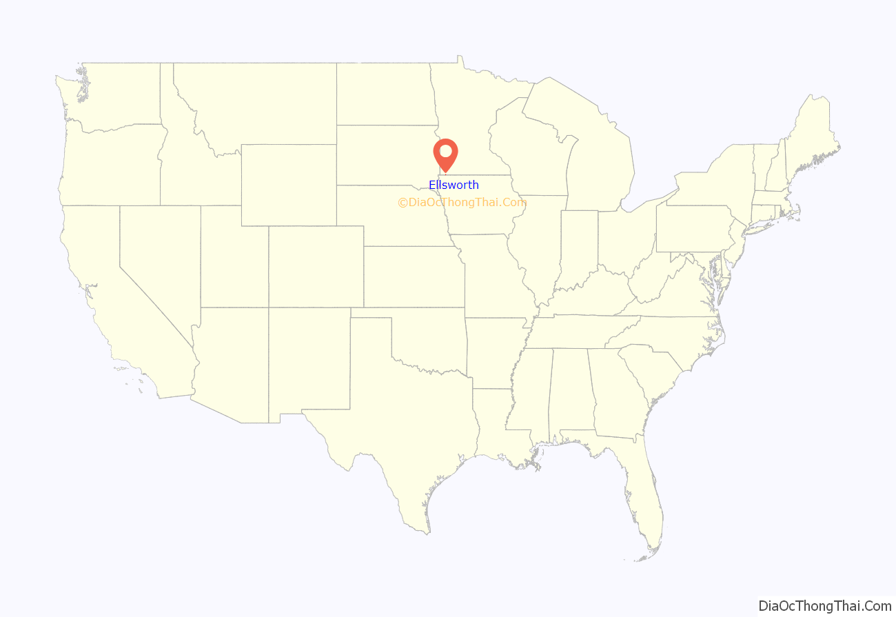
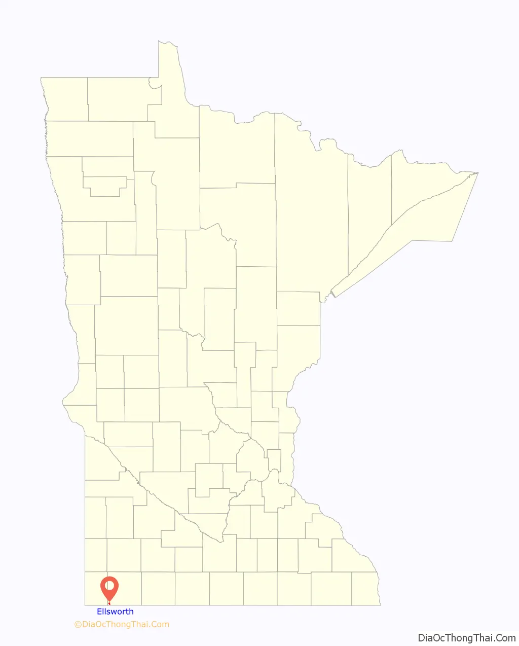
Ellsworth location map. Where is Ellsworth city?
History
Early history: Ellsworth is located in Grand Prairie Township in the extreme southwestern corner of Nobles County. The township was organized in 1873, though settlers had taken up residence in the township as early as 1871. One of these early settlers is known in history only as “Uncle” Stillwell. Mr Stillwell made a claim to the land where Ellsworth now stands, and he established a small store on his farmstead, supplying the needs of local farmers. He also operated a peddler’s wagon in the vicinity. Mr. Stillwell had great confidence in the future of the region, and often remarked that a town would one day be located on his property, or very near to it. However, Stillwell packed up and left the area two years before the town of Ellsworth was eventually established in 1884. Ellsworth sits on Stillwell’s former claim, and the business district of the town is located less than 1/2 mile west of Stillwell’s cabin.
A new railroad town: The town of Ellsworth was named in honor of Eugene Ellsworth of Cedar Falls, Iowa, and came into existence as a result of construction of the Burlington Railroad in the summer of 1884. The site was selected by agents of the Cedar Rapids, Iowa & Northwestern Land & Town Lot Company. The site was surveyed by F. D. Randall, and dedication of the plat was made on September 29, 1884, by S. L. Dows and James B. Close, president and secretary, respectively, of the town lot company. When the rail line was completed, a box car was set off to the side, and this served as a depot until a more substantial structure could be built. The first structure in town was a saloon completed by Sam Stevens and Phil Lattenberger in September 1884. Construction of a dozen or more buildings were started at this same time, and before the close of the year, the booming town had about 150 inhabitants. During the winter of 1884–85, the Ellsworth postoffice was established with B. F. Garmer as postmaster.
In the early fall of 1886, the town was selected as a division point of the Burlington railroad. The company built a five-stall roundhouse, put in a turntable, erected a substantial depot, and built a branch line from Ellsworth to Rock Rapids, Iowa.
Incorporation: The necessary steps were taken to bring about incorporation at a county board meeting held in Worthington on December 10, 1886. An election was held on January 13, 1887, and municipal government began in February. The census of 1890 gave Ellsworth a population of 258. The population in 2000 was 540.
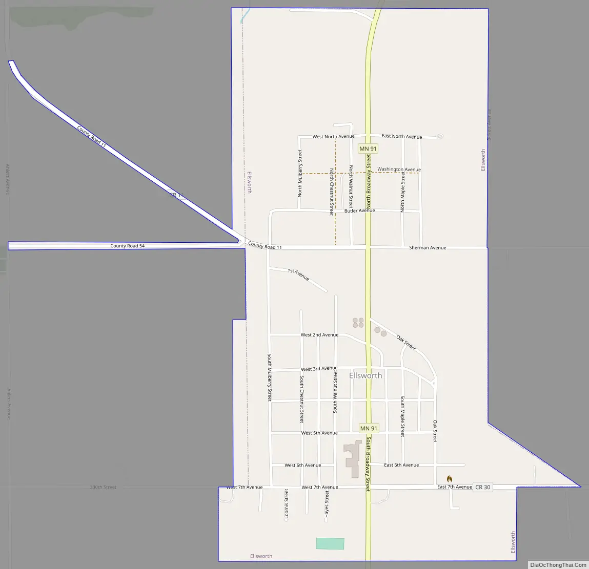
Ellsworth Road Map
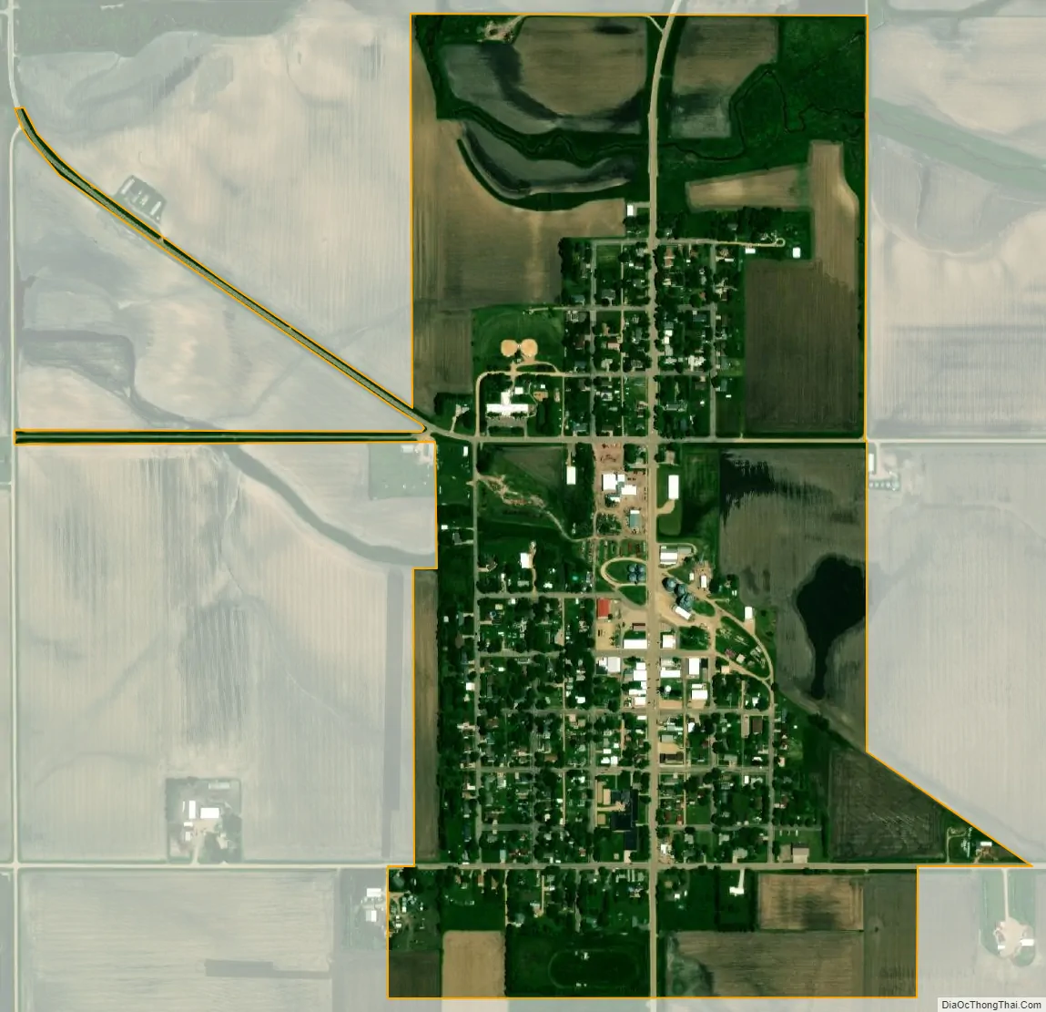
Ellsworth city Satellite Map
Geography
According to the United States Census Bureau, the city has a total area of 0.63 square miles (1.63 km), all land. It is located in Grand Prairie Township in the far southwestern corner of Nobles County.
Main highways include:
- Minnesota State Highway 91
- Nobles County Road 6
See also
Map of Minnesota State and its subdivision:- Aitkin
- Anoka
- Becker
- Beltrami
- Benton
- Big Stone
- Blue Earth
- Brown
- Carlton
- Carver
- Cass
- Chippewa
- Chisago
- Clay
- Clearwater
- Cook
- Cottonwood
- Crow Wing
- Dakota
- Dodge
- Douglas
- Faribault
- Fillmore
- Freeborn
- Goodhue
- Grant
- Hennepin
- Houston
- Hubbard
- Isanti
- Itasca
- Jackson
- Kanabec
- Kandiyohi
- Kittson
- Koochiching
- Lac qui Parle
- Lake
- Lake of the Woods
- Lake Superior
- Le Sueur
- Lincoln
- Lyon
- Mahnomen
- Marshall
- Martin
- McLeod
- Meeker
- Mille Lacs
- Morrison
- Mower
- Murray
- Nicollet
- Nobles
- Norman
- Olmsted
- Otter Tail
- Pennington
- Pine
- Pipestone
- Polk
- Pope
- Ramsey
- Red Lake
- Redwood
- Renville
- Rice
- Rock
- Roseau
- Saint Louis
- Scott
- Sherburne
- Sibley
- Stearns
- Steele
- Stevens
- Swift
- Todd
- Traverse
- Wabasha
- Wadena
- Waseca
- Washington
- Watonwan
- Wilkin
- Winona
- Wright
- Yellow Medicine
- Alabama
- Alaska
- Arizona
- Arkansas
- California
- Colorado
- Connecticut
- Delaware
- District of Columbia
- Florida
- Georgia
- Hawaii
- Idaho
- Illinois
- Indiana
- Iowa
- Kansas
- Kentucky
- Louisiana
- Maine
- Maryland
- Massachusetts
- Michigan
- Minnesota
- Mississippi
- Missouri
- Montana
- Nebraska
- Nevada
- New Hampshire
- New Jersey
- New Mexico
- New York
- North Carolina
- North Dakota
- Ohio
- Oklahoma
- Oregon
- Pennsylvania
- Rhode Island
- South Carolina
- South Dakota
- Tennessee
- Texas
- Utah
- Vermont
- Virginia
- Washington
- West Virginia
- Wisconsin
- Wyoming