Eyota (/iˈjoʊtə/ ee-YOH-tə) is a city in Olmsted County, Minnesota, United States. The population was 1,977 at the 2010 census.
| Name: | Eyota city |
|---|---|
| LSAD Code: | 25 |
| LSAD Description: | city (suffix) |
| State: | Minnesota |
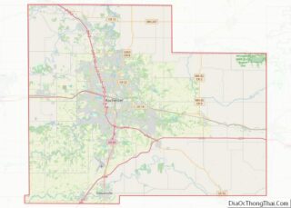
| County: | Olmsted County |
| Elevation: | 1,240 ft (378 m) |
| Total Area: | 1.69 sq mi (4.37 km²) |
| Land Area: | 1.69 sq mi (4.37 km²) |
| Water Area: | 0.00 sq mi (0.00 km²) |
| Total Population: | 2,006 |
| Population Density: | 1,188.39/sq mi (458.78/km²) |
| ZIP code: | 55934 |
| Area code: | 507 |
| FIPS code: | 2720114 |
| GNISfeature ID: | 0643483 |
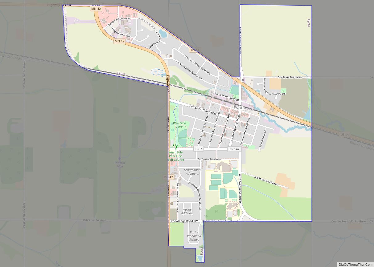
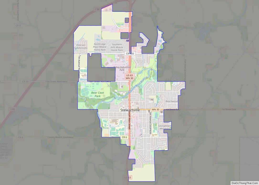
Online Interactive Map
Click on ![]() to view map in "full screen" mode.
to view map in "full screen" mode.
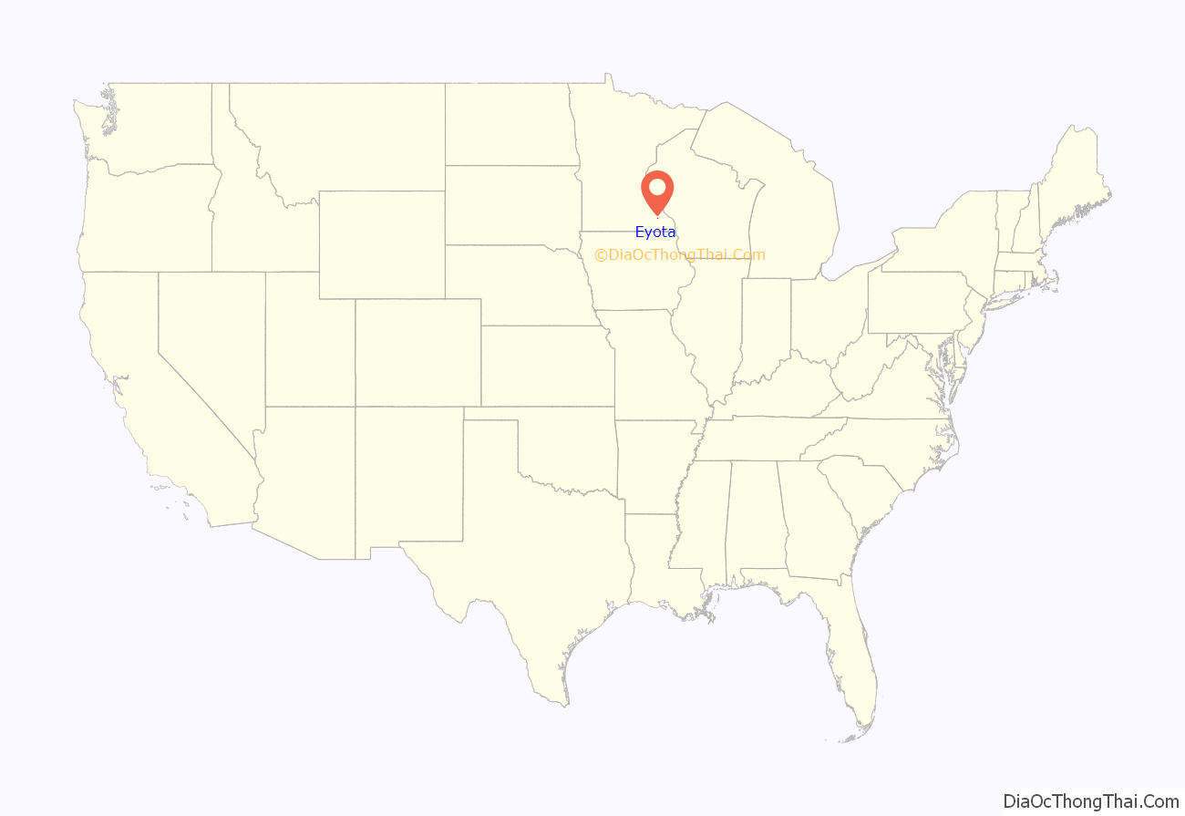
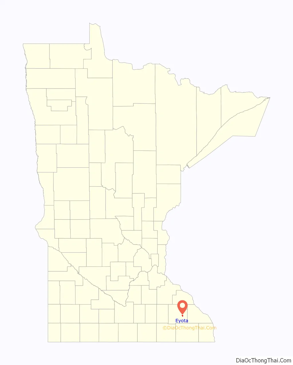
Eyota location map. Where is Eyota city?
History
Eyota was platted in 1864. The name Eyota is derived from the Sioux Indian word iyotak, meaning “greatest” or “most”. A post office has been in operation at Eyota since 1864. The city was incorporated on February 16, 1875.
Settlers had begun arriving in the area and staking claims in 1854. The earliest, Benjamin Bear, initially came in 1853 to choose a prime site with an ever-flowing spring, then returned the following year with his family. A stream called Bear Creek starts from this spring. (Today Chester Woods Lake is formed around a portion of Bear Creek that was held back behind a dam built to protect nearby Rochester from flooding.)
In the early years Eyota was an important destination for business travelers and mail, and shipping point for locally raised grain and cattle. It was located only a mile from a wye with rail extensions going north to Plainview and south to Chatfield, making Eyota a stopping point for travelers on their way to other places. (Daily trains to Chatfield and Plainview left from the Eyota depot.) The railroad was an important local employer, The railroad later became the Chicago & North Western Railway.
Eyota streets were laid out on the farmland of Milo Matteson by investor Samuel E. Everett, a speculator from New York State. A downtown district, built only on the south side of the street, faced the busy railroad yard. A large hotel, frequented by business travelers, called the Everett House, was located along this street (South Front Street).
Charles P. Russell, another early investor, built a store on the corner of South Front Street and Center Avenue in 1865. Russell continued living in the community (whereas Mr. Everett soon moved on). He built a fine two-story home and bought grain from local farmers with his business partner O.H. Jackson. Years later, in 1910, Charles Russell partnered in the banking and mercantile businesses with his son, Fred Russell.
A whole line of stores flanked on the ends by the C.P Russell building and the Everett House faced the railroad depot and yard to the north. Establishments included hardware, lumber, wagon and harness makers, livery, drug store, general mercantile, hotels and several saloons.
Doctor Augustus Stinchfield was Eyota’s first medical doctor, who came to town after Eyota druggist E.D. Dyar invited him to visit. Both Stinchfield and Dyar once lived in Strong, Maine. Dr. Stinchfield built up an extensive practice, having another office in nearby St. Charles and using part of his home as a hospital. Stinchfield married Martha Bear, the daughter of early settler Benjamin Bear. He arrived in 1873 and left in 1892 when the Mayos from Rochester convinced him to become the first non-family member to partner in their practice.
Dr. Rollo C. Dugan, the son of local settler Elijah Dugan, followed Stinchfield’s local practice. He built the Eyota Hospital, an eight-bed facility on Second Street in 1900.
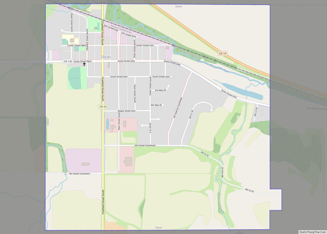
Eyota Road Map
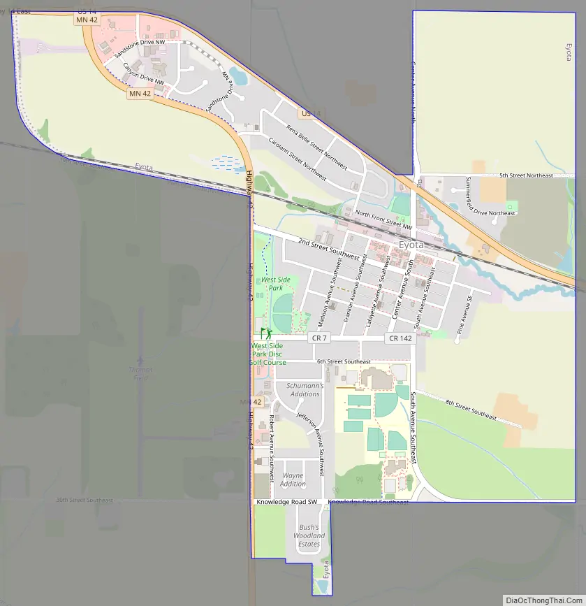
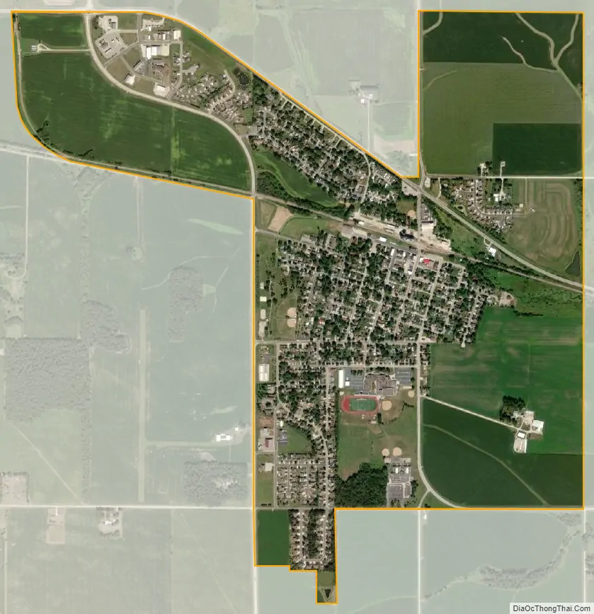
Eyota city Satellite Map
Geography
According to the United States Census Bureau, the city has a total area of 1.69 square miles (4.38 km), all land.
The south branch of the Whitewater River passes through the northern edge of the city.
U.S. Route 14 and Minnesota State Highway 42 are two of the main routes in the community. Interstate 90 is immediately south of the city.
See also
Map of Minnesota State and its subdivision:- Aitkin
- Anoka
- Becker
- Beltrami
- Benton
- Big Stone
- Blue Earth
- Brown
- Carlton
- Carver
- Cass
- Chippewa
- Chisago
- Clay
- Clearwater
- Cook
- Cottonwood
- Crow Wing
- Dakota
- Dodge
- Douglas
- Faribault
- Fillmore
- Freeborn
- Goodhue
- Grant
- Hennepin
- Houston
- Hubbard
- Isanti
- Itasca
- Jackson
- Kanabec
- Kandiyohi
- Kittson
- Koochiching
- Lac qui Parle
- Lake
- Lake of the Woods
- Lake Superior
- Le Sueur
- Lincoln
- Lyon
- Mahnomen
- Marshall
- Martin
- McLeod
- Meeker
- Mille Lacs
- Morrison
- Mower
- Murray
- Nicollet
- Nobles
- Norman
- Olmsted
- Otter Tail
- Pennington
- Pine
- Pipestone
- Polk
- Pope
- Ramsey
- Red Lake
- Redwood
- Renville
- Rice
- Rock
- Roseau
- Saint Louis
- Scott
- Sherburne
- Sibley
- Stearns
- Steele
- Stevens
- Swift
- Todd
- Traverse
- Wabasha
- Wadena
- Waseca
- Washington
- Watonwan
- Wilkin
- Winona
- Wright
- Yellow Medicine
- Alabama
- Alaska
- Arizona
- Arkansas
- California
- Colorado
- Connecticut
- Delaware
- District of Columbia
- Florida
- Georgia
- Hawaii
- Idaho
- Illinois
- Indiana
- Iowa
- Kansas
- Kentucky
- Louisiana
- Maine
- Maryland
- Massachusetts
- Michigan
- Minnesota
- Mississippi
- Missouri
- Montana
- Nebraska
- Nevada
- New Hampshire
- New Jersey
- New Mexico
- New York
- North Carolina
- North Dakota
- Ohio
- Oklahoma
- Oregon
- Pennsylvania
- Rhode Island
- South Carolina
- South Dakota
- Tennessee
- Texas
- Utah
- Vermont
- Virginia
- Washington
- West Virginia
- Wisconsin
- Wyoming