Freeborn is a city in Freeborn County, Minnesota, United States. The population was 297 at the 2010 census.
| Name: | Freeborn city |
|---|---|
| LSAD Code: | 25 |
| LSAD Description: | city (suffix) |
| State: | Minnesota |
| County: | Freeborn County |
| Elevation: | 1,234 ft (376 m) |
| Total Area: | 0.18 sq mi (0.47 km²) |
| Land Area: | 0.18 sq mi (0.47 km²) |
| Water Area: | 0.00 sq mi (0.00 km²) |
| Total Population: | 264 |
| Population Density: | 1,442.62/sq mi (556.38/km²) |
| ZIP code: | 56032 |
| Area code: | 507 |
| FIPS code: | 2722526 |
| GNISfeature ID: | 0643914 |
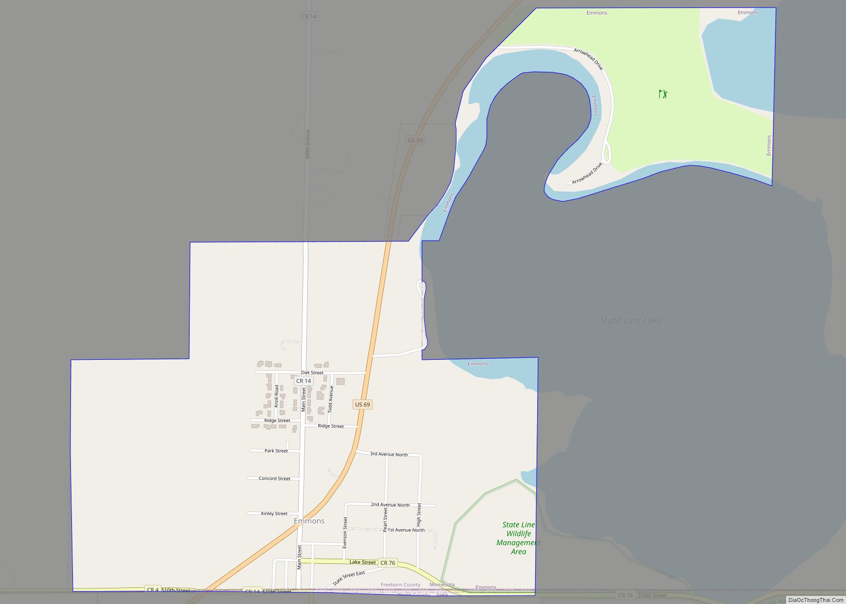
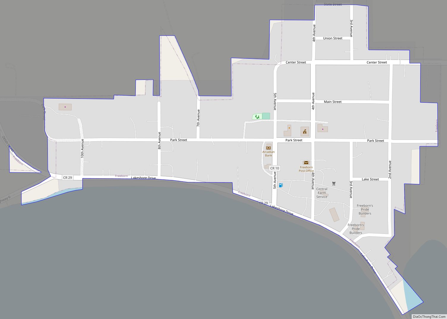
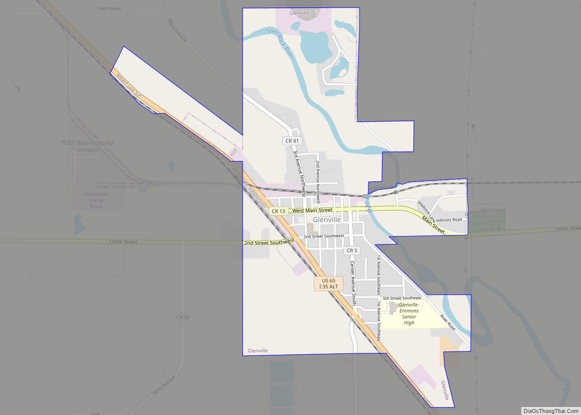
Online Interactive Map
Click on ![]() to view map in "full screen" mode.
to view map in "full screen" mode.
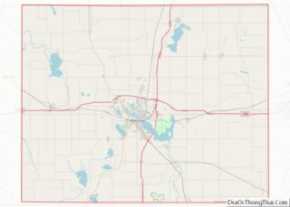
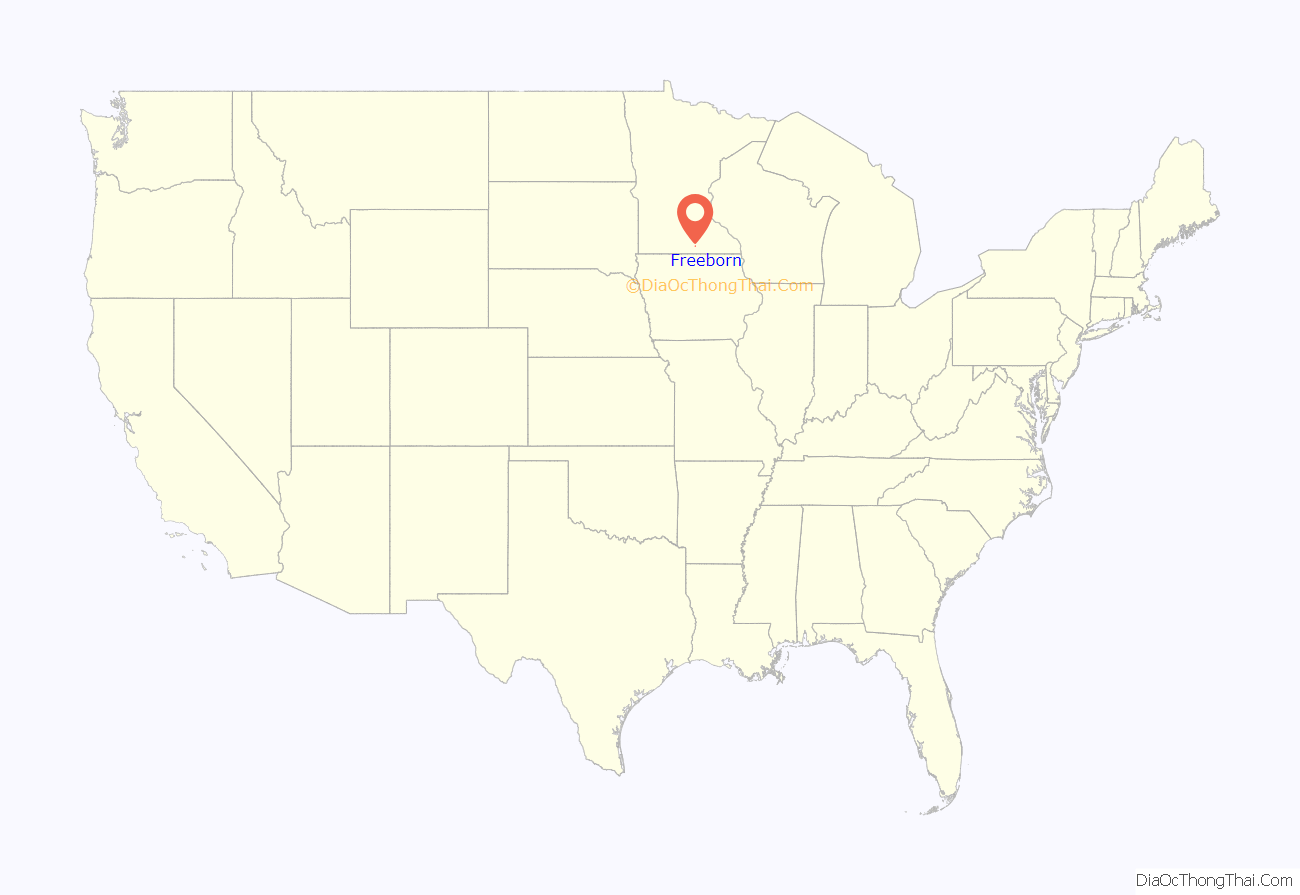
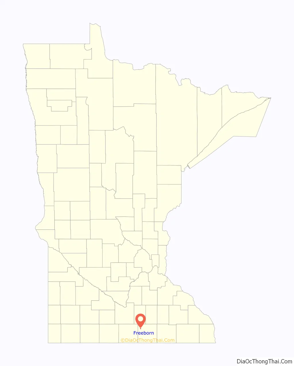
Freeborn location map. Where is Freeborn city?
History
Freeborn was platted in 1857, and was incorporated in 1949. The city of Freeborn, like its namesake county, the surrounding township, and Freeborn Lake, upon which the city is situated, derives its name from William Freeborn, a member of Minnesota’s Territorial Legislature. A post office has remained in continuous operation at Freeborn since 1857.
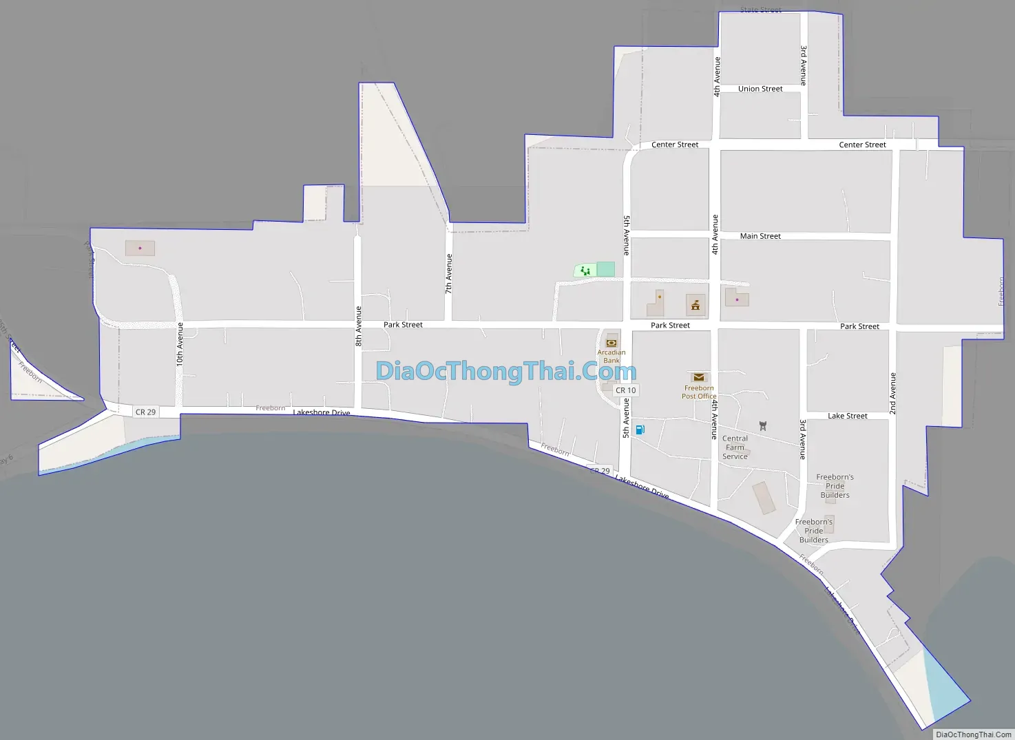
Freeborn Road Map
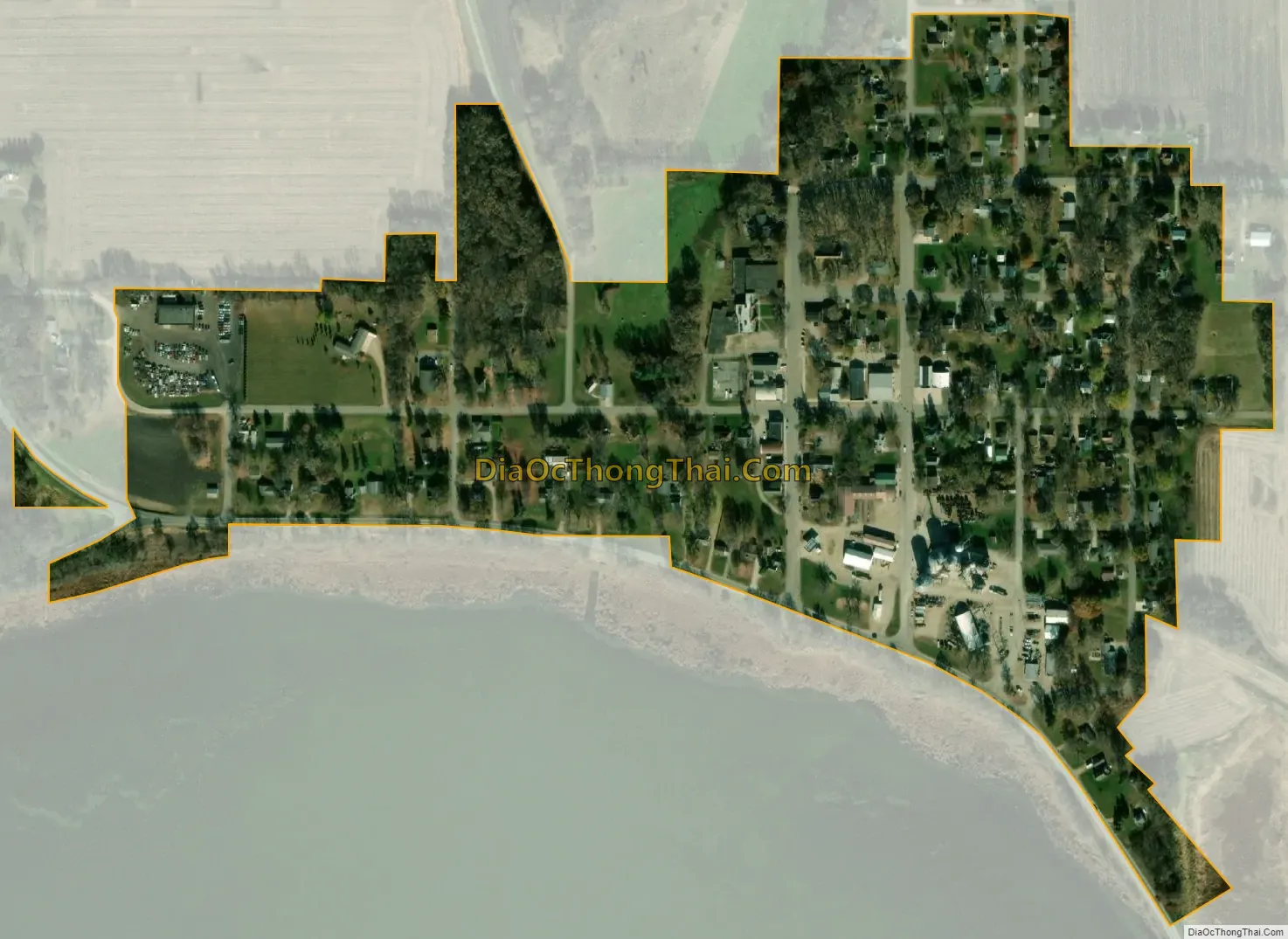
Freeborn city Satellite Map
Geography
According to the United States Census Bureau, the city has a total area of 0.18 square miles (0.47 km), all land.
Freeborn is located within Freeborn Township, in the far northwestern corner of Freeborn County, some 15 miles northwest of Albert Lea, the county seat. The City is at the junction of three County highways; County Hwy 29, which runs generally east and west, connecting State Hwy 13 and State Hwy 107, respectively; County Highway 6, which runs generally north and south along the westernmost edge of town; and County Highway 10, which originates at its intersection with County 29, and runs generally northward, ending at MN Hwy 30.
See also
Map of Minnesota State and its subdivision:- Aitkin
- Anoka
- Becker
- Beltrami
- Benton
- Big Stone
- Blue Earth
- Brown
- Carlton
- Carver
- Cass
- Chippewa
- Chisago
- Clay
- Clearwater
- Cook
- Cottonwood
- Crow Wing
- Dakota
- Dodge
- Douglas
- Faribault
- Fillmore
- Freeborn
- Goodhue
- Grant
- Hennepin
- Houston
- Hubbard
- Isanti
- Itasca
- Jackson
- Kanabec
- Kandiyohi
- Kittson
- Koochiching
- Lac qui Parle
- Lake
- Lake of the Woods
- Lake Superior
- Le Sueur
- Lincoln
- Lyon
- Mahnomen
- Marshall
- Martin
- McLeod
- Meeker
- Mille Lacs
- Morrison
- Mower
- Murray
- Nicollet
- Nobles
- Norman
- Olmsted
- Otter Tail
- Pennington
- Pine
- Pipestone
- Polk
- Pope
- Ramsey
- Red Lake
- Redwood
- Renville
- Rice
- Rock
- Roseau
- Saint Louis
- Scott
- Sherburne
- Sibley
- Stearns
- Steele
- Stevens
- Swift
- Todd
- Traverse
- Wabasha
- Wadena
- Waseca
- Washington
- Watonwan
- Wilkin
- Winona
- Wright
- Yellow Medicine
- Alabama
- Alaska
- Arizona
- Arkansas
- California
- Colorado
- Connecticut
- Delaware
- District of Columbia
- Florida
- Georgia
- Hawaii
- Idaho
- Illinois
- Indiana
- Iowa
- Kansas
- Kentucky
- Louisiana
- Maine
- Maryland
- Massachusetts
- Michigan
- Minnesota
- Mississippi
- Missouri
- Montana
- Nebraska
- Nevada
- New Hampshire
- New Jersey
- New Mexico
- New York
- North Carolina
- North Dakota
- Ohio
- Oklahoma
- Oregon
- Pennsylvania
- Rhode Island
- South Carolina
- South Dakota
- Tennessee
- Texas
- Utah
- Vermont
- Virginia
- Washington
- West Virginia
- Wisconsin
- Wyoming