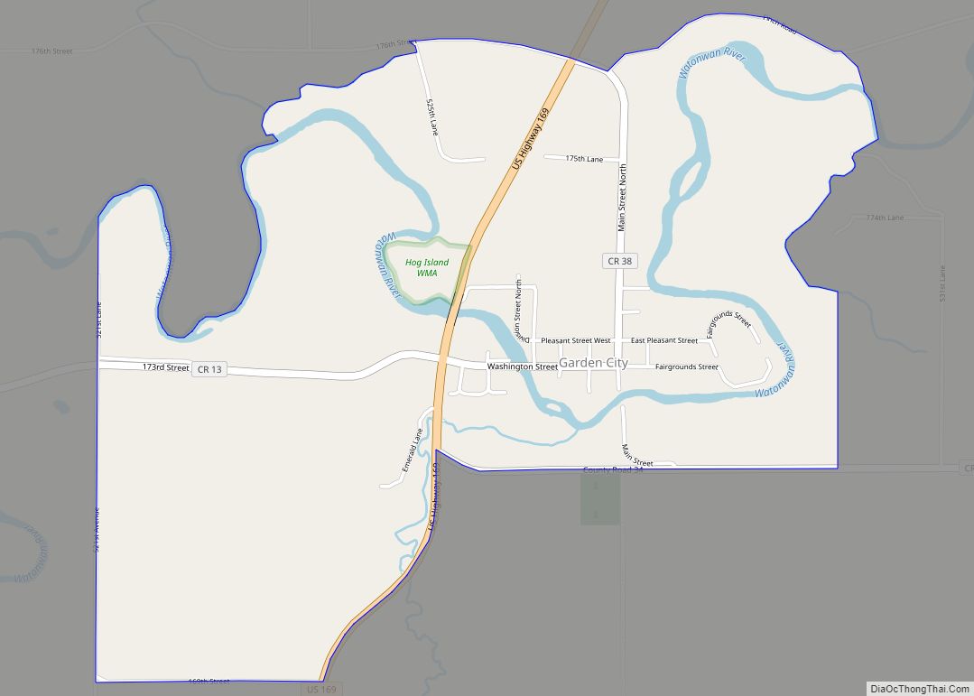
Garden City is an unincorporated community and census-designated place (CDP) in Garden City Township, Blue Earth County, Minnesota, United States. Its population was 255 as of the 2010 census.
| Name: | Garden City CDP |
|---|---|
| LSAD Code: | 57 |
| LSAD Description: | CDP (suffix) |
| State: | Minnesota |
| County: | Blue Earth County |
| Elevation: | 919 ft (280 m) |
| Total Area: | 1.89 sq mi (4.89 km²) |
| Land Area: | 1.79 sq mi (4.65 km²) |
| Water Area: | 0.09 sq mi (0.24 km²) |
| Total Population: | 339 |
| Population Density: | 188.96/sq mi (72.95/km²) |
| Area code: | 507 |
| FIPS code: | 2723084 |
| GNISfeature ID: | 644024 |
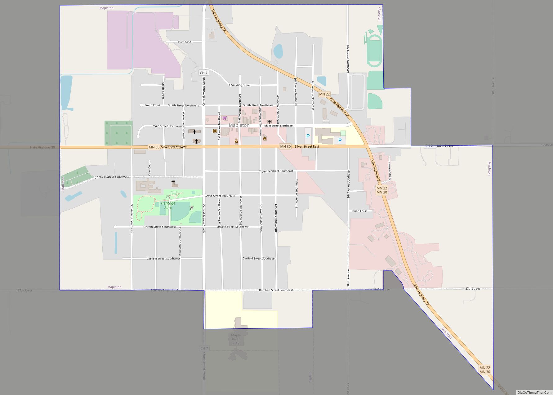
Online Interactive Map
Click on ![]() to view map in "full screen" mode.
to view map in "full screen" mode.
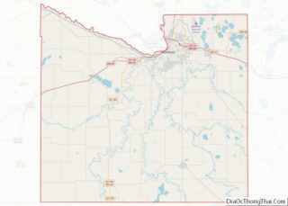
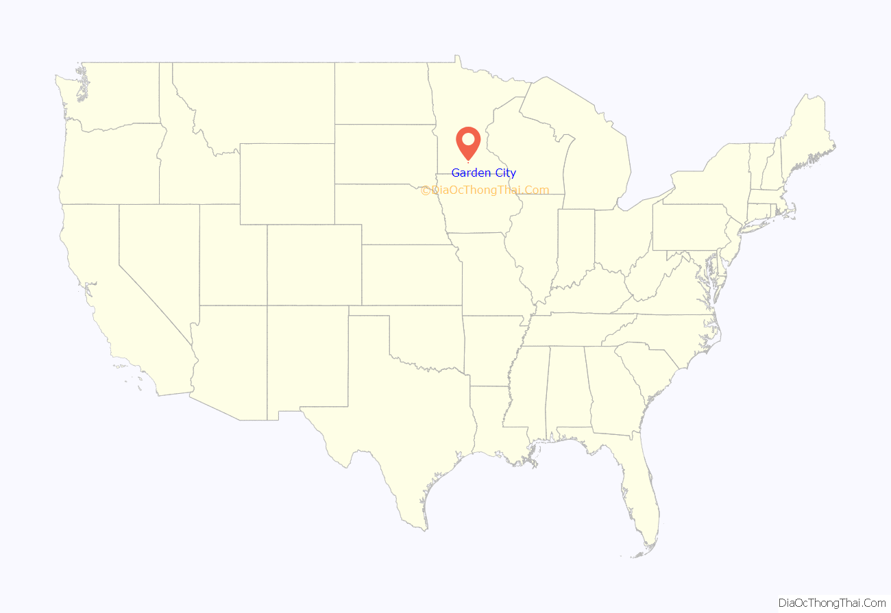
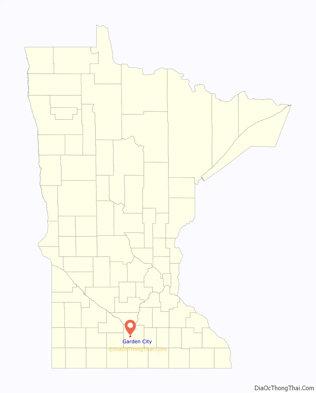
Garden City location map. Where is Garden City CDP?
History
A post office called Garden City was established in 1857. The community was named from the garden-like setting of the original town site. The First Baptist Church building was completed in 1868.
The Blue Earth County Fair has been held in Garden City since 1860 with the exception of a few years the fair was cancelled.
In 1921, on a visit from London, Henry Wellcome donated land he had purchased to the hamlet of Garden City to build a consolidated school. The school that was built on the site became Wellcome Memorial school, eventually combining with Rapidan, Vernon Center, and Lake Crystal school districts. The building now serves as the site of Wellcome Manor Family Services.
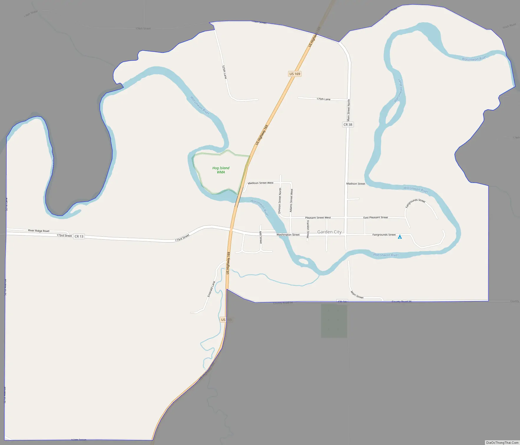
Garden City Road Map
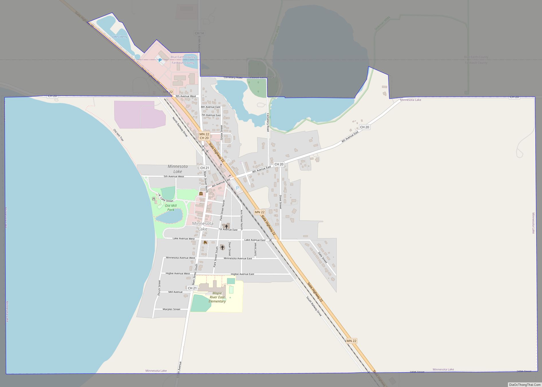
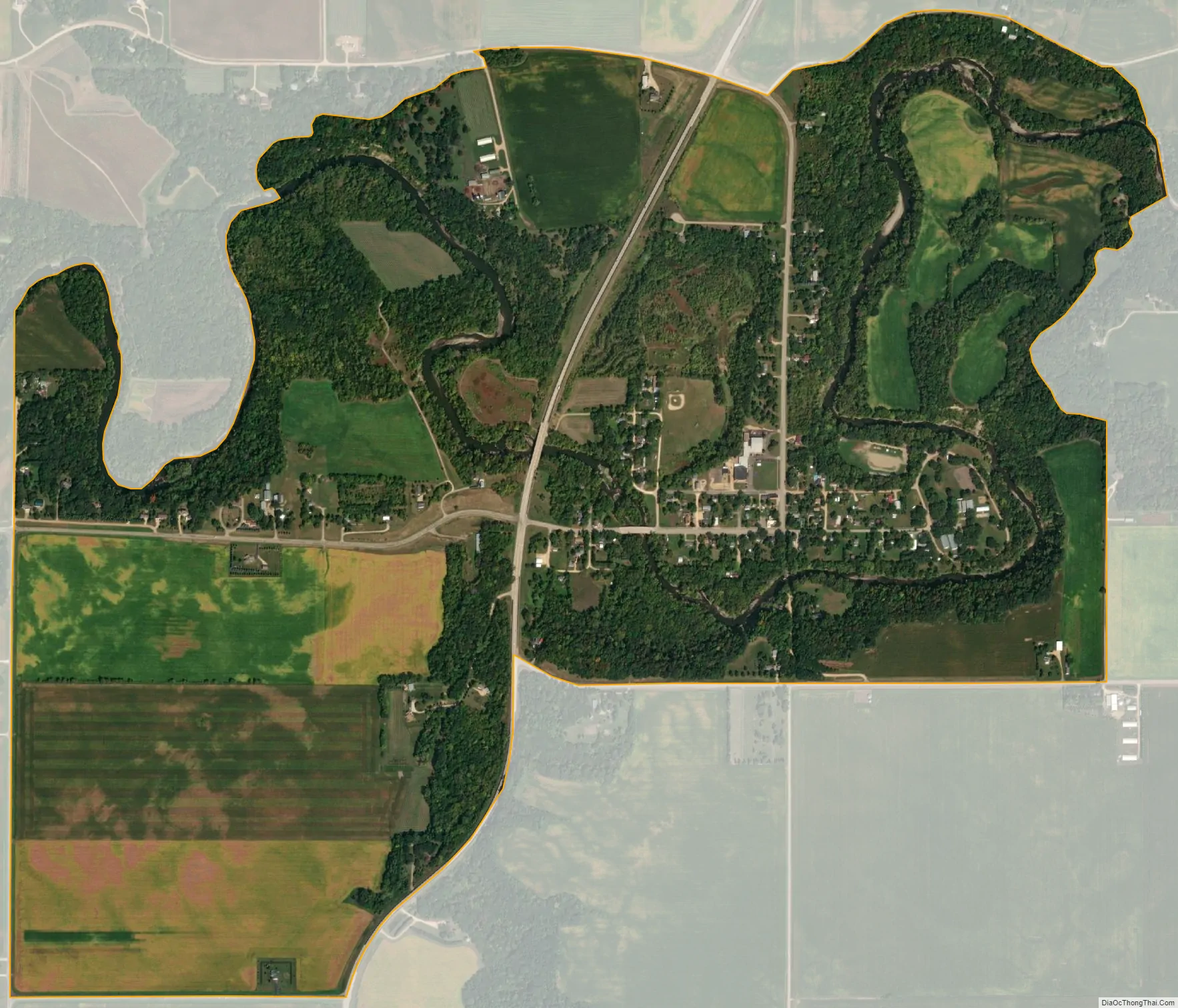
Garden City city Satellite Map
See also
Map of Minnesota State and its subdivision:- Aitkin
- Anoka
- Becker
- Beltrami
- Benton
- Big Stone
- Blue Earth
- Brown
- Carlton
- Carver
- Cass
- Chippewa
- Chisago
- Clay
- Clearwater
- Cook
- Cottonwood
- Crow Wing
- Dakota
- Dodge
- Douglas
- Faribault
- Fillmore
- Freeborn
- Goodhue
- Grant
- Hennepin
- Houston
- Hubbard
- Isanti
- Itasca
- Jackson
- Kanabec
- Kandiyohi
- Kittson
- Koochiching
- Lac qui Parle
- Lake
- Lake of the Woods
- Lake Superior
- Le Sueur
- Lincoln
- Lyon
- Mahnomen
- Marshall
- Martin
- McLeod
- Meeker
- Mille Lacs
- Morrison
- Mower
- Murray
- Nicollet
- Nobles
- Norman
- Olmsted
- Otter Tail
- Pennington
- Pine
- Pipestone
- Polk
- Pope
- Ramsey
- Red Lake
- Redwood
- Renville
- Rice
- Rock
- Roseau
- Saint Louis
- Scott
- Sherburne
- Sibley
- Stearns
- Steele
- Stevens
- Swift
- Todd
- Traverse
- Wabasha
- Wadena
- Waseca
- Washington
- Watonwan
- Wilkin
- Winona
- Wright
- Yellow Medicine
- Alabama
- Alaska
- Arizona
- Arkansas
- California
- Colorado
- Connecticut
- Delaware
- District of Columbia
- Florida
- Georgia
- Hawaii
- Idaho
- Illinois
- Indiana
- Iowa
- Kansas
- Kentucky
- Louisiana
- Maine
- Maryland
- Massachusetts
- Michigan
- Minnesota
- Mississippi
- Missouri
- Montana
- Nebraska
- Nevada
- New Hampshire
- New Jersey
- New Mexico
- New York
- North Carolina
- North Dakota
- Ohio
- Oklahoma
- Oregon
- Pennsylvania
- Rhode Island
- South Carolina
- South Dakota
- Tennessee
- Texas
- Utah
- Vermont
- Virginia
- Washington
- West Virginia
- Wisconsin
- Wyoming