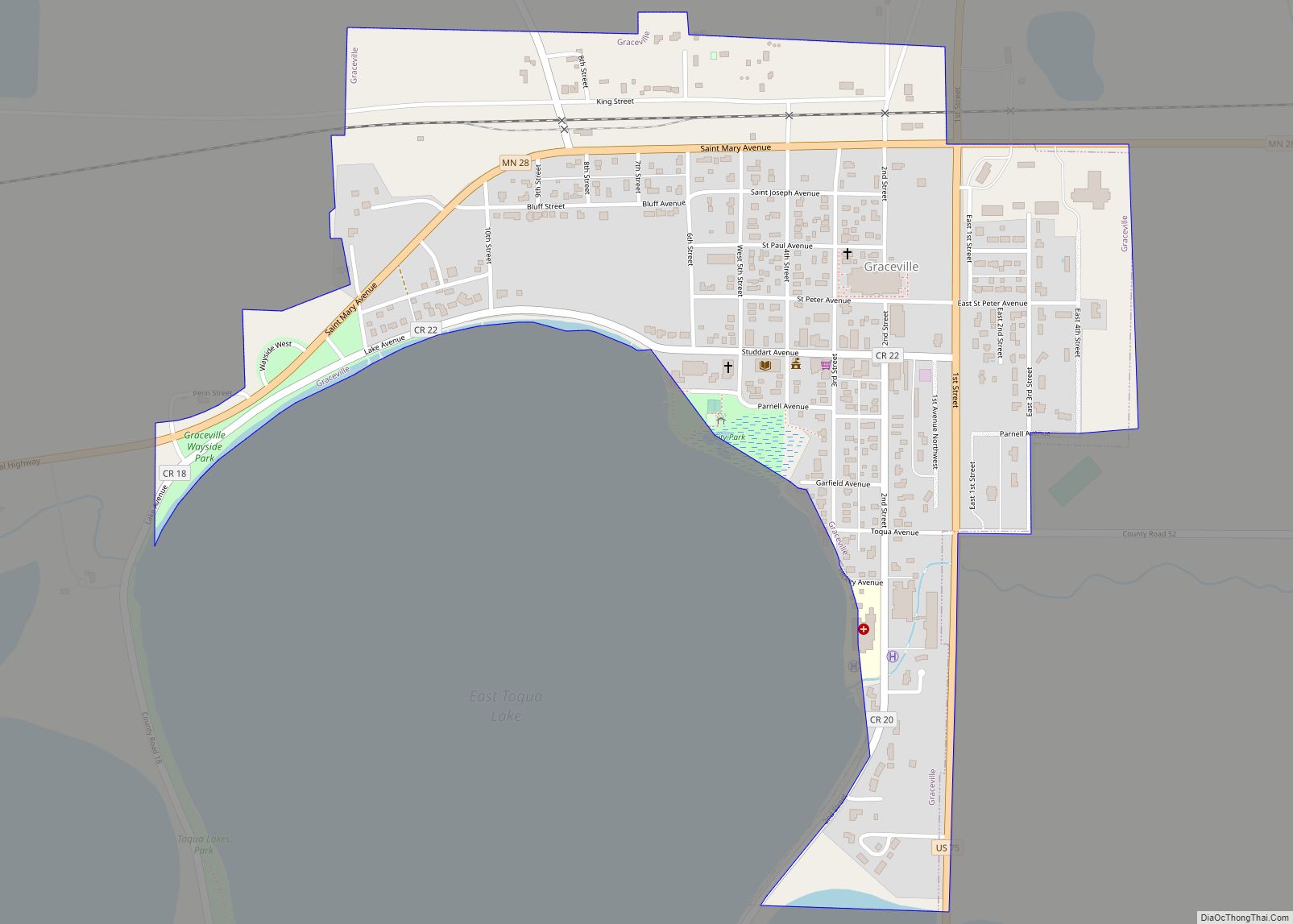
Graceville is a city in Big Stone County, Minnesota, United States. The population was 529 at the 2020 census.
| Name: | Graceville city |
|---|---|
| LSAD Code: | 25 |
| LSAD Description: | city (suffix) |
| State: | Minnesota |
| County: | Big Stone County |
| Elevation: | 1,112 ft (339 m) |
| Total Area: | 0.58 sq mi (1.50 km²) |
| Land Area: | 0.58 sq mi (1.50 km²) |
| Water Area: | 0.00 sq mi (0.00 km²) |
| Total Population: | 529 |
| Population Density: | 913.64/sq mi (352.65/km²) |
| ZIP code: | 56240 |
| Area code: | 320 |
| FIPS code: | 2724758 |
| GNISfeature ID: | 0644309 |
Online Interactive Map
Click on ![]() to view map in "full screen" mode.
to view map in "full screen" mode.
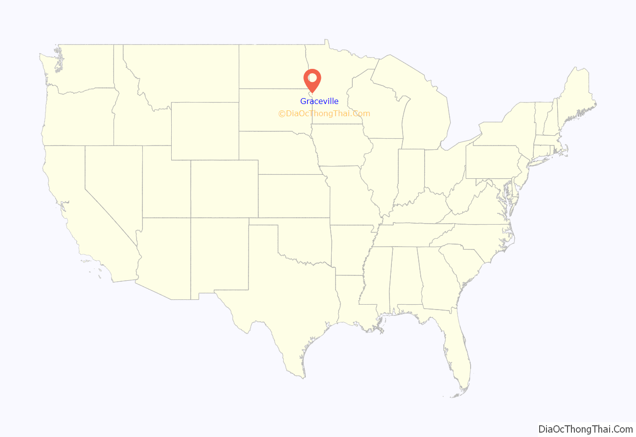
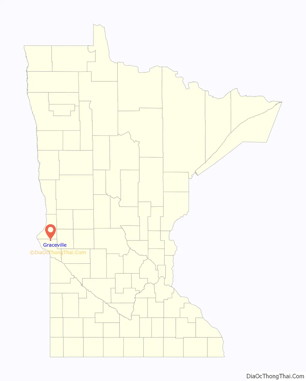
Graceville location map. Where is Graceville city?
History
Graceville was founded in the 1870s by a colony of Catholics and named for Thomas Langdon Grace, the second Roman Catholic Bishop of Saint Paul, Minnesota.
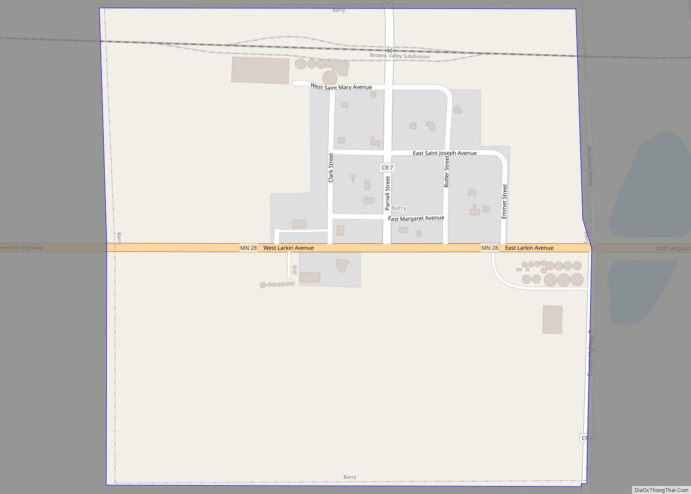
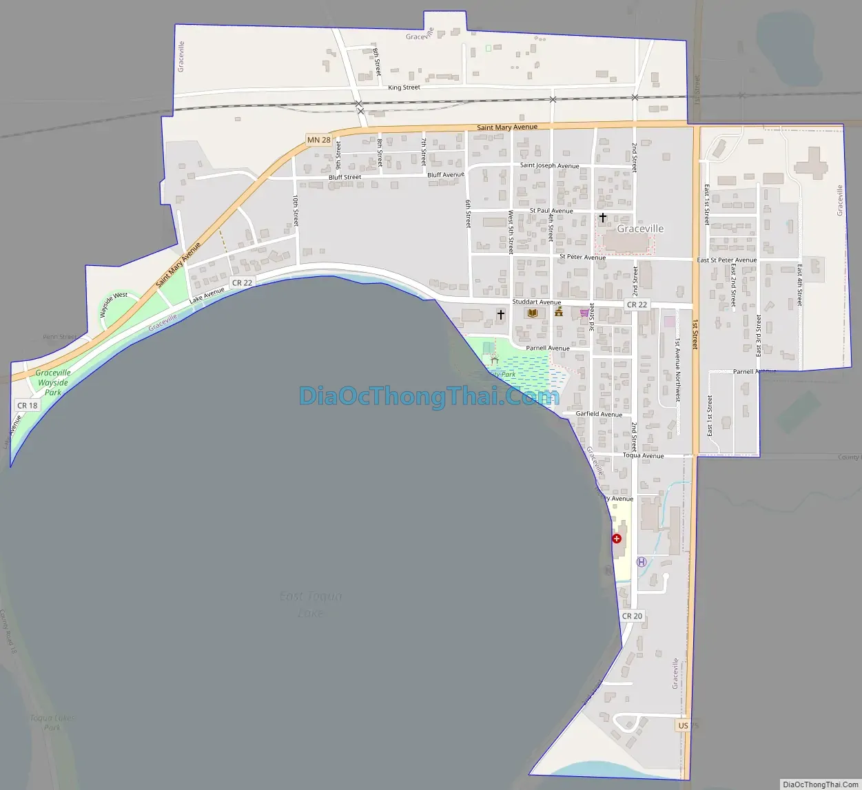
Graceville Road Map
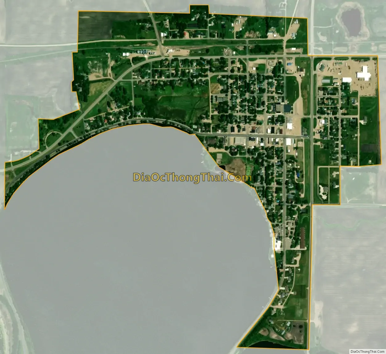
Graceville city Satellite Map
Geography
According to the United States Census Bureau, the city has an area of 0.58 square miles (1.50 km), all land.
U.S. Route 75 and Minnesota State Highway 28 are the two major highways that run through the community. The town’s main street is Studdart Avenue. The town is on the northeast corner of Toqua Lake, a recreational lake surrounded by two campgrounds, a golf course, and a shooting club.
Graceville is in a natural area called a wet prairie, which is a mix of prairie land, swamp and numerous small lakes and ponds.
See also
Map of Minnesota State and its subdivision:- Aitkin
- Anoka
- Becker
- Beltrami
- Benton
- Big Stone
- Blue Earth
- Brown
- Carlton
- Carver
- Cass
- Chippewa
- Chisago
- Clay
- Clearwater
- Cook
- Cottonwood
- Crow Wing
- Dakota
- Dodge
- Douglas
- Faribault
- Fillmore
- Freeborn
- Goodhue
- Grant
- Hennepin
- Houston
- Hubbard
- Isanti
- Itasca
- Jackson
- Kanabec
- Kandiyohi
- Kittson
- Koochiching
- Lac qui Parle
- Lake
- Lake of the Woods
- Lake Superior
- Le Sueur
- Lincoln
- Lyon
- Mahnomen
- Marshall
- Martin
- McLeod
- Meeker
- Mille Lacs
- Morrison
- Mower
- Murray
- Nicollet
- Nobles
- Norman
- Olmsted
- Otter Tail
- Pennington
- Pine
- Pipestone
- Polk
- Pope
- Ramsey
- Red Lake
- Redwood
- Renville
- Rice
- Rock
- Roseau
- Saint Louis
- Scott
- Sherburne
- Sibley
- Stearns
- Steele
- Stevens
- Swift
- Todd
- Traverse
- Wabasha
- Wadena
- Waseca
- Washington
- Watonwan
- Wilkin
- Winona
- Wright
- Yellow Medicine
- Alabama
- Alaska
- Arizona
- Arkansas
- California
- Colorado
- Connecticut
- Delaware
- District of Columbia
- Florida
- Georgia
- Hawaii
- Idaho
- Illinois
- Indiana
- Iowa
- Kansas
- Kentucky
- Louisiana
- Maine
- Maryland
- Massachusetts
- Michigan
- Minnesota
- Mississippi
- Missouri
- Montana
- Nebraska
- Nevada
- New Hampshire
- New Jersey
- New Mexico
- New York
- North Carolina
- North Dakota
- Ohio
- Oklahoma
- Oregon
- Pennsylvania
- Rhode Island
- South Carolina
- South Dakota
- Tennessee
- Texas
- Utah
- Vermont
- Virginia
- Washington
- West Virginia
- Wisconsin
- Wyoming