Halstad is a city in Norman County, Minnesota. The population was 564 at the time of the 2020 census. The city is known for its production of sugar beets, and has a statue of a sugar beet, known as the world’s largest sugar beet, to commemorate this status.
| Name: | Halstad city |
|---|---|
| LSAD Code: | 25 |
| LSAD Description: | city (suffix) |
| State: | Minnesota |
| County: | Norman County |
| Elevation: | 873 ft (266 m) |
| Total Area: | 0.36 sq mi (0.94 km²) |
| Land Area: | 0.36 sq mi (0.94 km²) |
| Water Area: | 0.00 sq mi (0.00 km²) |
| Total Population: | 564 |
| Population Density: | 1,553.72/sq mi (600.35/km²) |
| ZIP code: | 56548 |
| Area code: | 218 |
| FIPS code: | 2726630 |
| GNISfeature ID: | 0644588 |
| Website: | halstad.com |
Online Interactive Map
Click on ![]() to view map in "full screen" mode.
to view map in "full screen" mode.
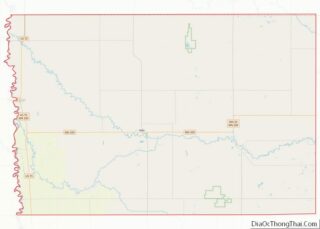
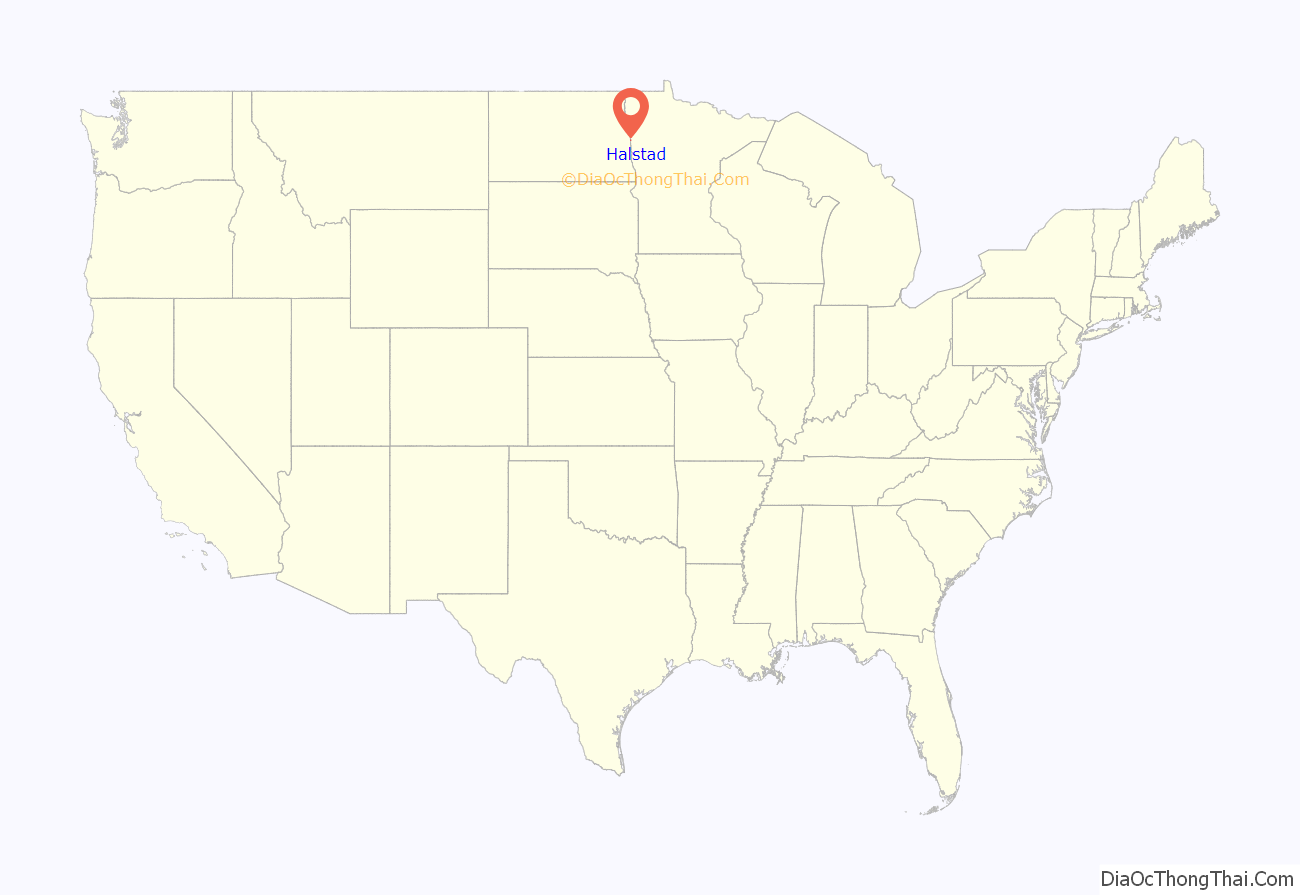
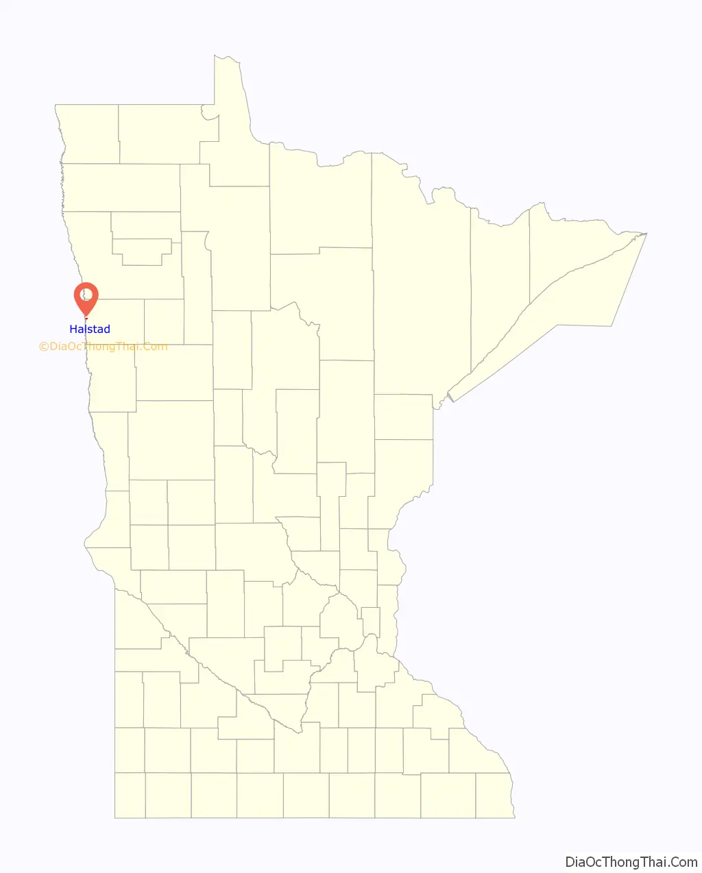
Halstad location map. Where is Halstad city?
History
The town of Halstad came into being on Sept. 23rd, 1883, when the railroad was extended to it. It was platted for C.G. Comstock and wife and A.A. White and wife on that date. It appeared to the majority most fitting to use the same name for the town as had been adopted for its post office – hence the name Halstad was adopted. This was moved into town in 1884 from Ole Halstad’s rural home. Less than a year after Halstad became a town, the construction of a school within the village was begun.
The city’s unofficial motto is “You Can’t Beet Halstad,” based on its prominent crop, the sugar beet. In 2020, the town founded Sugar Beet Park, featuring a sculpture of the “World’s Largest Sugar Beet” created by artist Josh Porter and formed around the base of a concrete mixer truck drum.
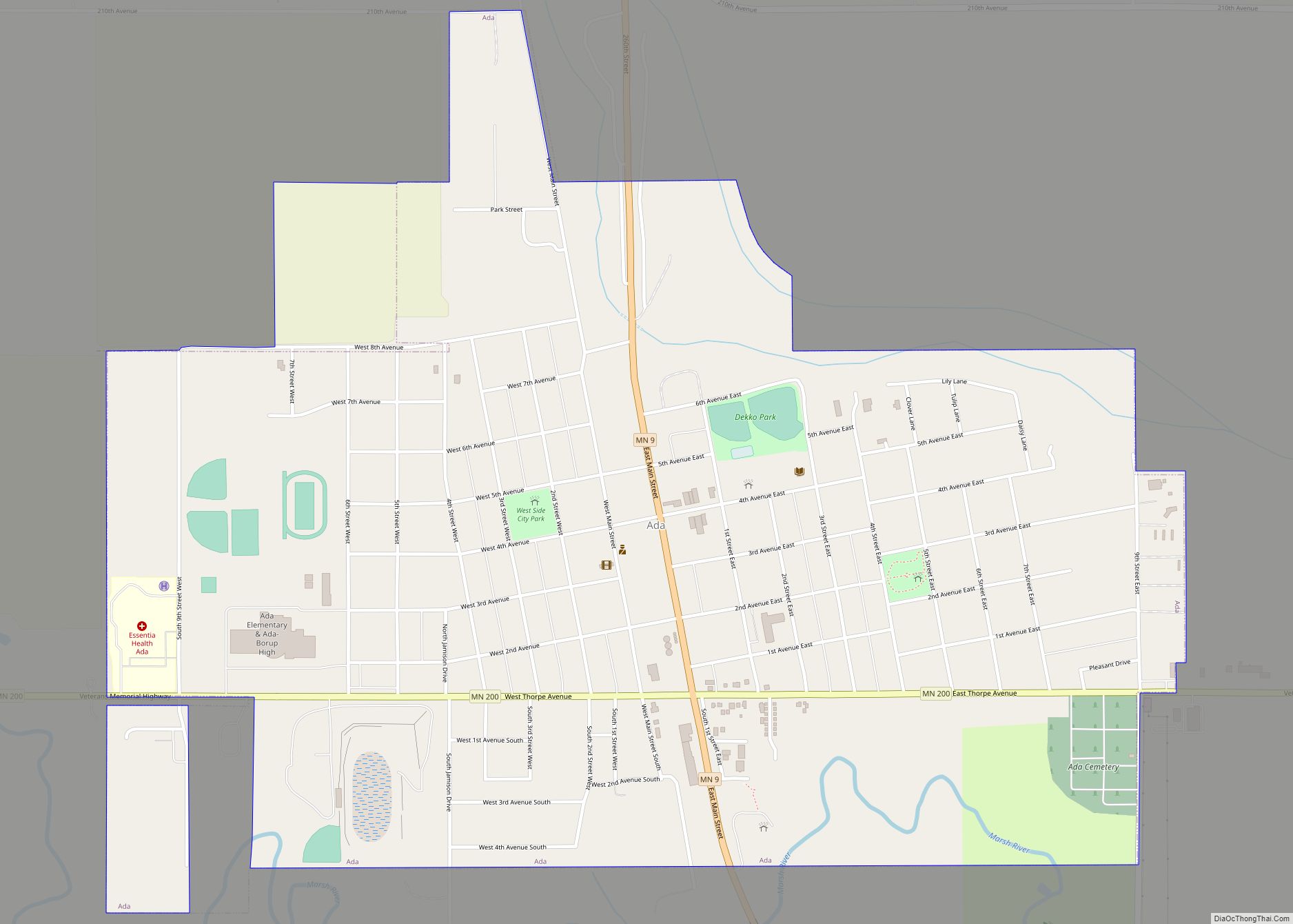
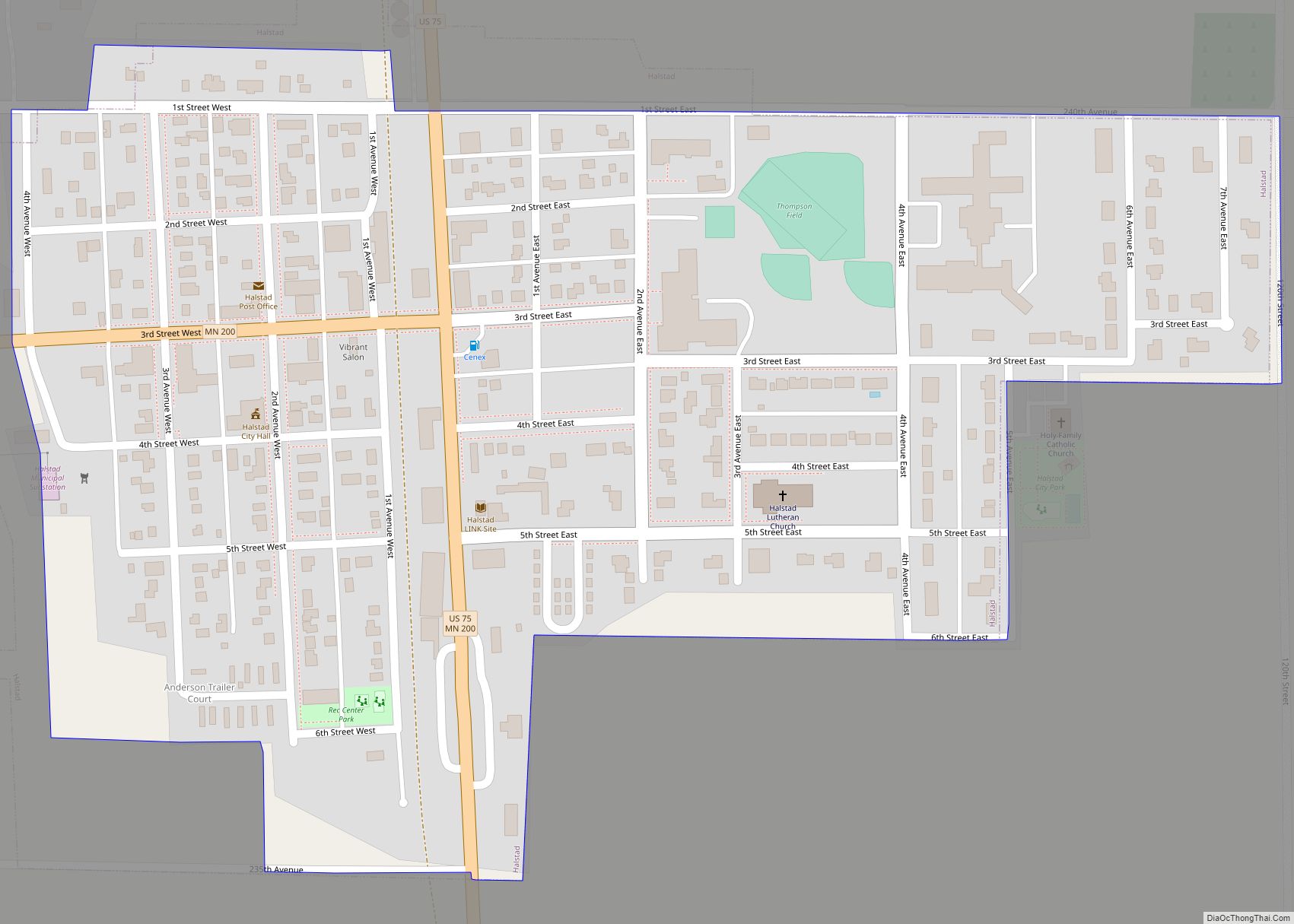
Halstad Road Map
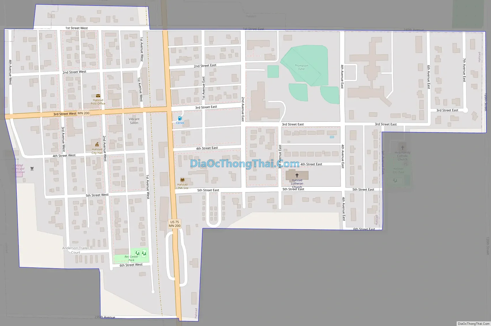
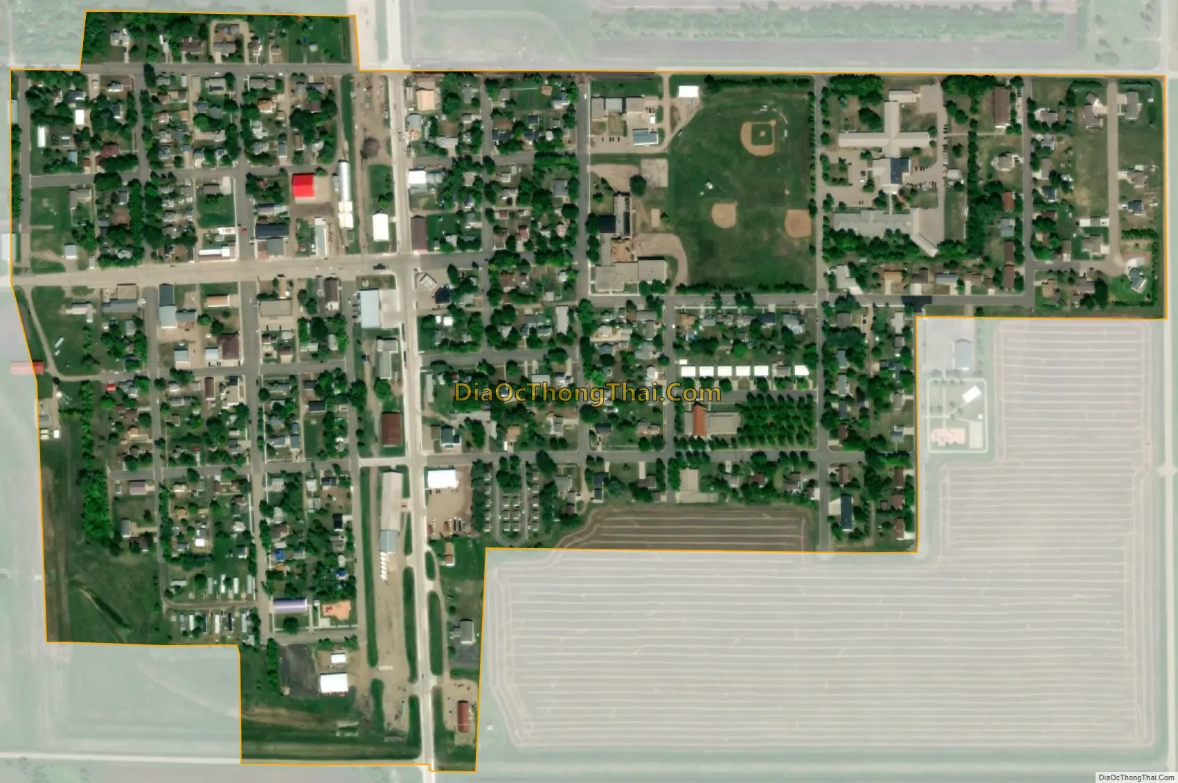
Halstad city Satellite Map
Geography
According to the United States Census Bureau, the city has a total area of 0.31 square miles (0.80 km), all land.
The Highway 200 bridge that crosses the Red River was replaced in the late 1990s, after constant flooding found it under water and impassable. Directly across the Red River on the north side of Highway 200, a small pond called Grandin Lake has provided the only close example of a freshwater ecosystem that is not a river. The table top topography of this region is impressive. There are regions of the Red River that have a one-inch change in elevation per mile.
See also
Map of Minnesota State and its subdivision:- Aitkin
- Anoka
- Becker
- Beltrami
- Benton
- Big Stone
- Blue Earth
- Brown
- Carlton
- Carver
- Cass
- Chippewa
- Chisago
- Clay
- Clearwater
- Cook
- Cottonwood
- Crow Wing
- Dakota
- Dodge
- Douglas
- Faribault
- Fillmore
- Freeborn
- Goodhue
- Grant
- Hennepin
- Houston
- Hubbard
- Isanti
- Itasca
- Jackson
- Kanabec
- Kandiyohi
- Kittson
- Koochiching
- Lac qui Parle
- Lake
- Lake of the Woods
- Lake Superior
- Le Sueur
- Lincoln
- Lyon
- Mahnomen
- Marshall
- Martin
- McLeod
- Meeker
- Mille Lacs
- Morrison
- Mower
- Murray
- Nicollet
- Nobles
- Norman
- Olmsted
- Otter Tail
- Pennington
- Pine
- Pipestone
- Polk
- Pope
- Ramsey
- Red Lake
- Redwood
- Renville
- Rice
- Rock
- Roseau
- Saint Louis
- Scott
- Sherburne
- Sibley
- Stearns
- Steele
- Stevens
- Swift
- Todd
- Traverse
- Wabasha
- Wadena
- Waseca
- Washington
- Watonwan
- Wilkin
- Winona
- Wright
- Yellow Medicine
- Alabama
- Alaska
- Arizona
- Arkansas
- California
- Colorado
- Connecticut
- Delaware
- District of Columbia
- Florida
- Georgia
- Hawaii
- Idaho
- Illinois
- Indiana
- Iowa
- Kansas
- Kentucky
- Louisiana
- Maine
- Maryland
- Massachusetts
- Michigan
- Minnesota
- Mississippi
- Missouri
- Montana
- Nebraska
- Nevada
- New Hampshire
- New Jersey
- New Mexico
- New York
- North Carolina
- North Dakota
- Ohio
- Oklahoma
- Oregon
- Pennsylvania
- Rhode Island
- South Carolina
- South Dakota
- Tennessee
- Texas
- Utah
- Vermont
- Virginia
- Washington
- West Virginia
- Wisconsin
- Wyoming