Jordan is a city in Scott County, Minnesota, United States. The population was 6,656 at the 2020 census.
| Name: | Jordan city |
|---|---|
| LSAD Code: | 25 |
| LSAD Description: | city (suffix) |
| State: | Minnesota |
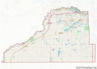
| County: | Scott County |
| Founded: | 1853 |
| Incorporated: | 1891 |
| Elevation: | 771 ft (235 m) |
| Total Area: | 3.29 sq mi (8.53 km²) |
| Land Area: | 3.27 sq mi (8.47 km²) |
| Water Area: | 0.02 sq mi (0.06 km²) |
| Total Population: | 6,656 |
| Population Density: | 2,035.47/sq mi (785.90/km²) |
| ZIP code: | 55352 |
| Area code: | 952 |
| FIPS code: | 2732174 |
| GNISfeature ID: | 0645735 |
| Website: | jordanmn.gov |
Online Interactive Map
Click on ![]() to view map in "full screen" mode.
to view map in "full screen" mode.
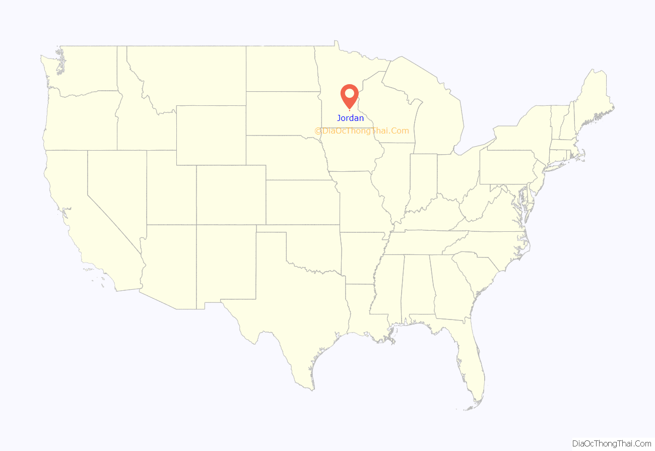
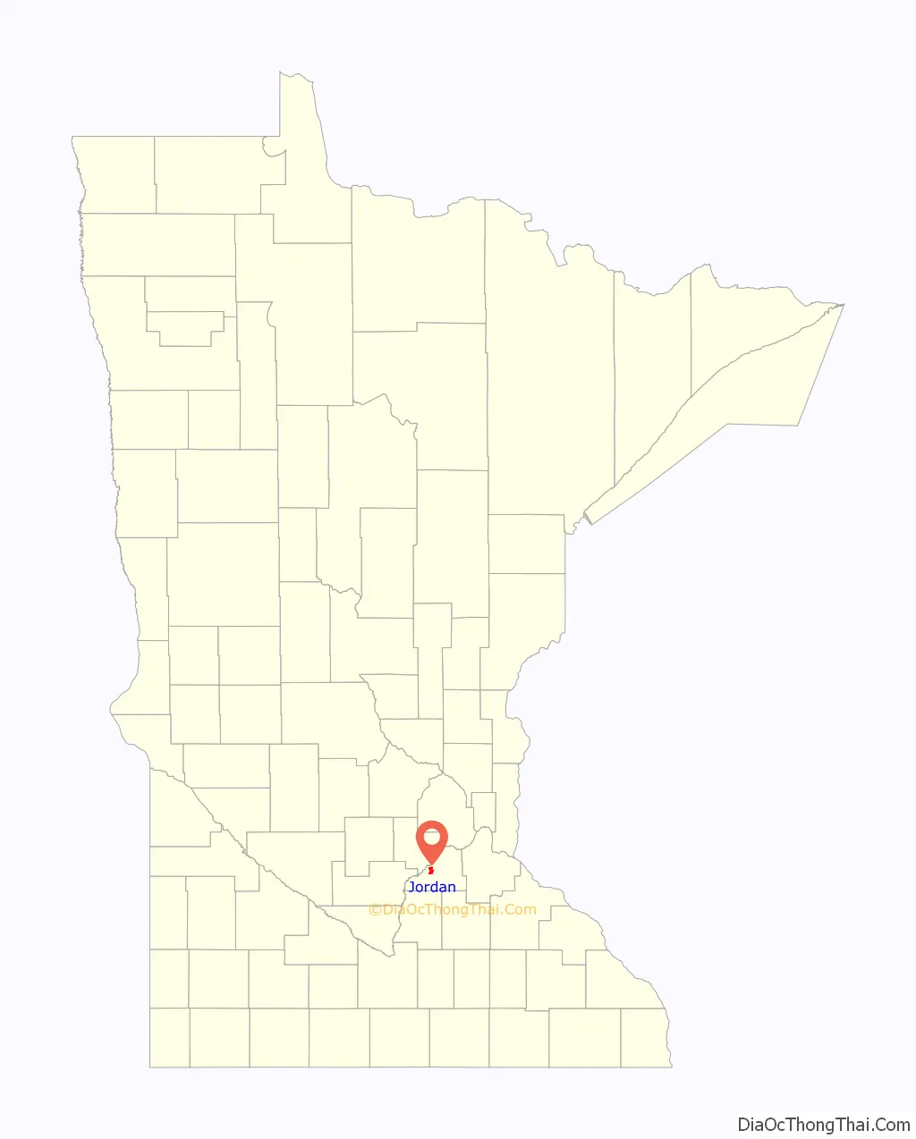
Jordan location map. Where is Jordan city?
History
The city of Jordan began on November 27, 1853, when Thomas A. Holmes ordered the construction of a sawmill. This establishment gave Jordan its first name, Holmes Mill.
A year after the mill’s founding, Thomas’s brother William Holmes moved to the site and began platting a settlement. By 1855, he successfully surveyed and recorded his settlement as Jordan City, after the Jordan River in Palestine. Jordan City accumulated some success in 1855 and 1856 with the addition of a post office and a handful of a businesses.
In 1860, the neighboring settlement of Brentwood was surveyed by S. A. Hooper, J. H. Gardner and R. W. Thomas. The two settlements competed until a legislative action consolidated them into the village of Jordan in 1872. The consolidation only helped the settlement and by 1880 the population had boomed to 915 along with a boom in businesses in the village. A few of these businesses were breweries, which became especially successful until prohibition in 1919 temporarily caused their closure.
Jordan was finally incorporated as a city in 1891.
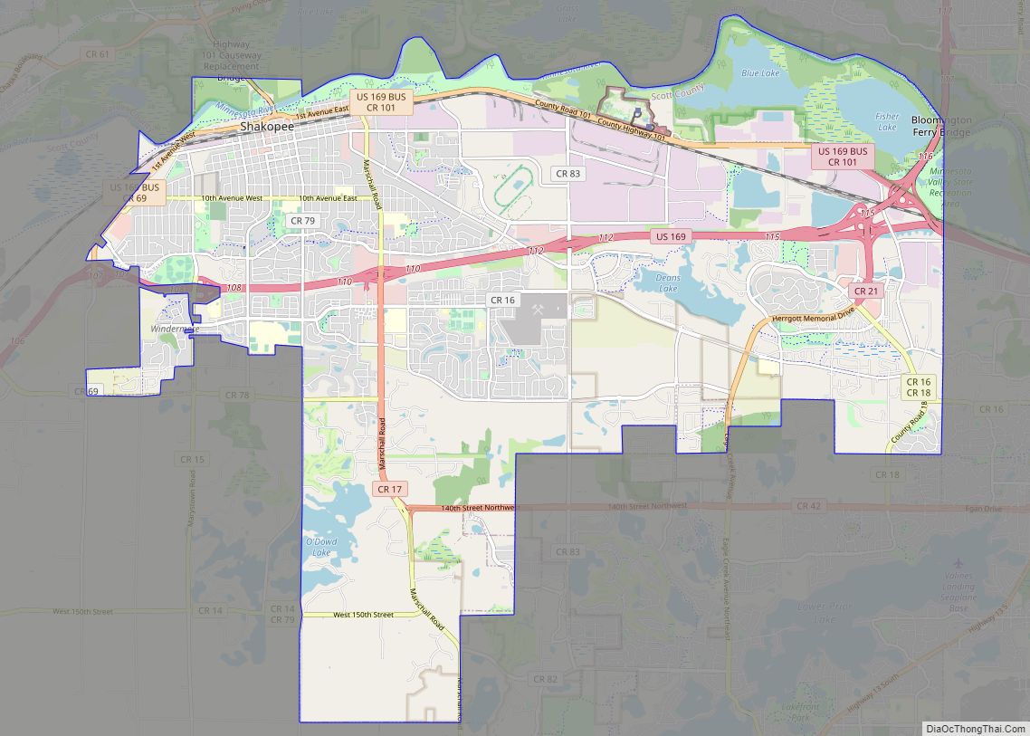
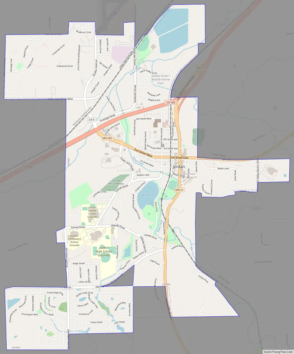
Jordan Road Map
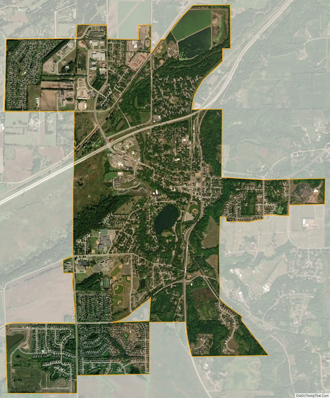
Jordan city Satellite Map
Geography
According to the United States Census Bureau, the city has a total area of 3.31 square miles (8.57 km); 3.29 square miles (8.52 km) is land and 0.02 square miles (0.05 km) is water.
U.S. Highway 169, and State Highways 21 and 282 are three of the main routes in the community.
The architects and civil engineers known for designing the layout of the streets of Jordan, also founded the neighboring town of Belle Plaine.
See also
Map of Minnesota State and its subdivision:- Aitkin
- Anoka
- Becker
- Beltrami
- Benton
- Big Stone
- Blue Earth
- Brown
- Carlton
- Carver
- Cass
- Chippewa
- Chisago
- Clay
- Clearwater
- Cook
- Cottonwood
- Crow Wing
- Dakota
- Dodge
- Douglas
- Faribault
- Fillmore
- Freeborn
- Goodhue
- Grant
- Hennepin
- Houston
- Hubbard
- Isanti
- Itasca
- Jackson
- Kanabec
- Kandiyohi
- Kittson
- Koochiching
- Lac qui Parle
- Lake
- Lake of the Woods
- Lake Superior
- Le Sueur
- Lincoln
- Lyon
- Mahnomen
- Marshall
- Martin
- McLeod
- Meeker
- Mille Lacs
- Morrison
- Mower
- Murray
- Nicollet
- Nobles
- Norman
- Olmsted
- Otter Tail
- Pennington
- Pine
- Pipestone
- Polk
- Pope
- Ramsey
- Red Lake
- Redwood
- Renville
- Rice
- Rock
- Roseau
- Saint Louis
- Scott
- Sherburne
- Sibley
- Stearns
- Steele
- Stevens
- Swift
- Todd
- Traverse
- Wabasha
- Wadena
- Waseca
- Washington
- Watonwan
- Wilkin
- Winona
- Wright
- Yellow Medicine
- Alabama
- Alaska
- Arizona
- Arkansas
- California
- Colorado
- Connecticut
- Delaware
- District of Columbia
- Florida
- Georgia
- Hawaii
- Idaho
- Illinois
- Indiana
- Iowa
- Kansas
- Kentucky
- Louisiana
- Maine
- Maryland
- Massachusetts
- Michigan
- Minnesota
- Mississippi
- Missouri
- Montana
- Nebraska
- Nevada
- New Hampshire
- New Jersey
- New Mexico
- New York
- North Carolina
- North Dakota
- Ohio
- Oklahoma
- Oregon
- Pennsylvania
- Rhode Island
- South Carolina
- South Dakota
- Tennessee
- Texas
- Utah
- Vermont
- Virginia
- Washington
- West Virginia
- Wisconsin
- Wyoming