Shakopee (/ˈʃɑːkəpiː/ SHAH-kə-pee) is a city in and the county seat of Scott County, Minnesota, United States. It is located southwest of Minneapolis. Sited on the south bank bend of the Minnesota River, Shakopee and nearby suburbs comprise the southwest portion of Minneapolis-Saint Paul, the sixteenth-largest metropolitan area in the United States, with 3.7 million people. The population was 43,698 at the 2020 census.
The river bank’s Shakopee Historic District contains burial mounds built by prehistoric cultures. In the 18th century, Chief Shakopee of the Mdewakanton Dakota established his village on the east end of this area near the water. Trading led to the city’s establishment in the 19th century. Shakopee boomed as a commerce exchange site between river and rail at Murphy’s Landing.
Once an isolated city in the Minnesota River Valley, by the 1960s the economy of Shakopee was tied to that of the expanding metropolitan area. Significant growth as a bedroom community occurred after U.S. Highway 169 was realigned in 1996 toward the new Bloomington Ferry Bridge.
The city is known for the Valleyfair amusement park and the Canterbury Park racetrack.
| Name: | Shakopee city |
|---|---|
| LSAD Code: | 25 |
| LSAD Description: | city (suffix) |
| State: | Minnesota |
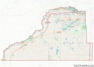
| County: | Scott County |
| Incorporated: | 1857 |
| Elevation: | 770 ft (234 m) |
| Land Area: | 28.87 sq mi (74.77 km²) |
| Water Area: | 1.35 sq mi (3.49 km²) 4.47% |
| Population Density: | 1,513.72/sq mi (584.45/km²) |
| ZIP code: | 55379 |
| Area code: | 952 |
| FIPS code: | 2759350 |
| GNISfeature ID: | 0651898 |
| Website: | shakopeemn.gov |
Online Interactive Map
Click on ![]() to view map in "full screen" mode.
to view map in "full screen" mode.
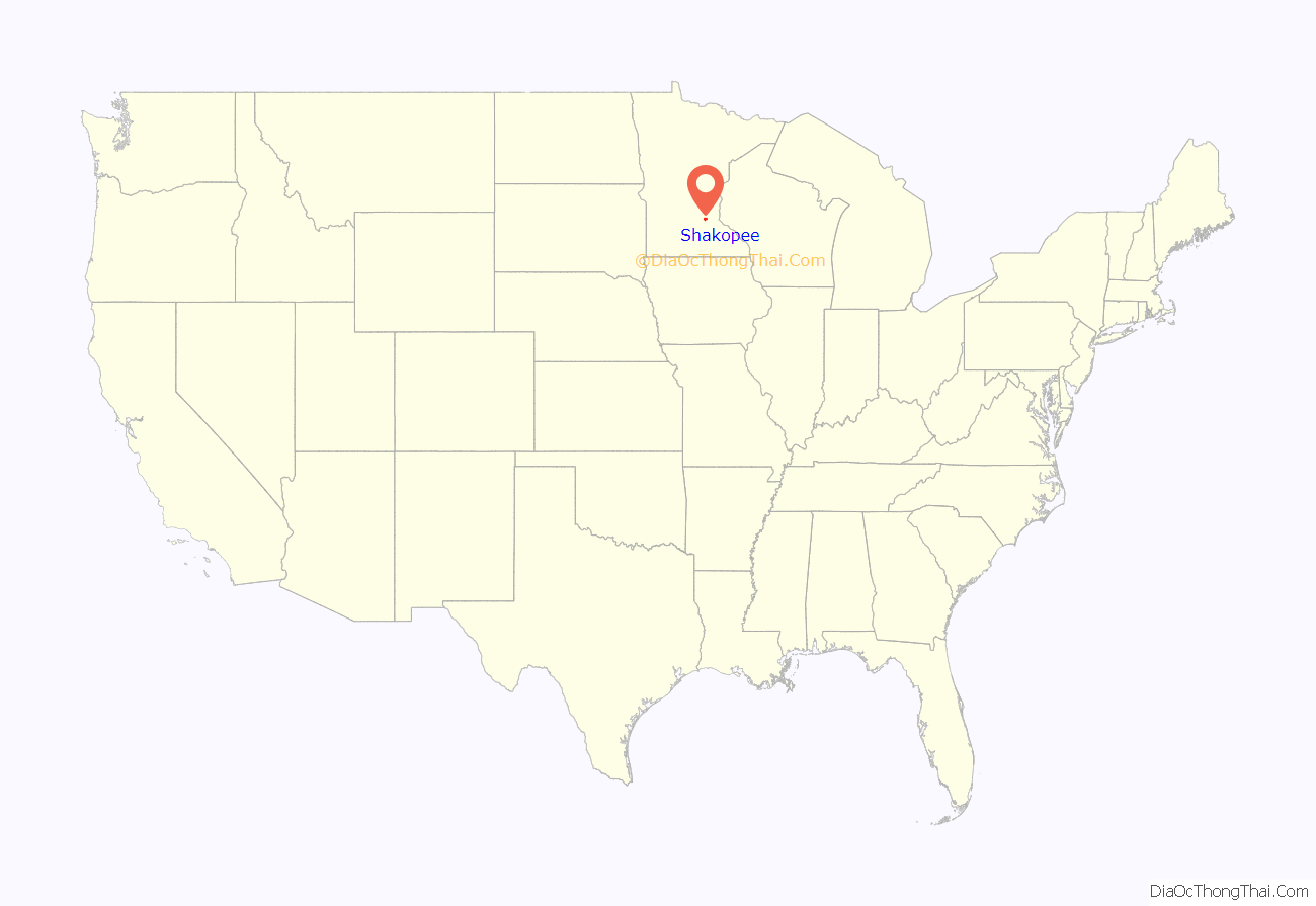
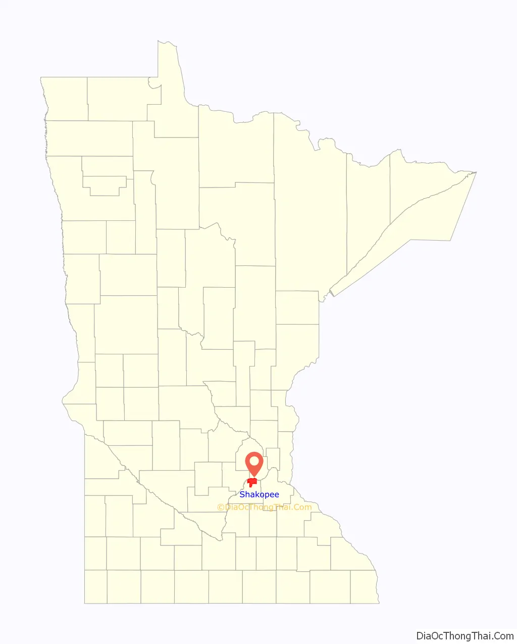
Shakopee location map. Where is Shakopee city?
History
Burial mounds along the Minnesota River bluff, located within the present-day Veterans Memorial Park, have been dated between 500 and 2,000 years old.
Nicollet referred to the “Village of the Six,” a permanent Dakota village south of the river, as acting as a boundary to the Ojibwa. However, historians have since situated it east of the present downtown. He noted the village and locality was commonly called the “village of the prairie” (published as tinta ottonwe). The Shakopee band lived in summer bark lodges and winter tipis. They followed the changes of the season when they planted their cornfields.
By the Treaty of Traverse des Sioux, the Sioux tribe ceded land in 1851 and many relocated to Chief Shakopee II’s village. The latter people had moved south to what was later assigned to them as the current Shakopee-Mdewakanton Indian Reservation in nearby Prior Lake.
In 1851, Thomas A. Holmes established a trading post west of the Dakota and platted Shakopee Village in 1854, named after Chief Shakopee II. The city quickly grew, incorporating in 1857. It surrendered its charter in 1861 due to conflicts in the Dakota War. As tensions lifted, the city incorporated again in 1870. The western end was left in township status and was renamed as Jackson Township, Minnesota in 1861, likely after President Andrew Jackson.
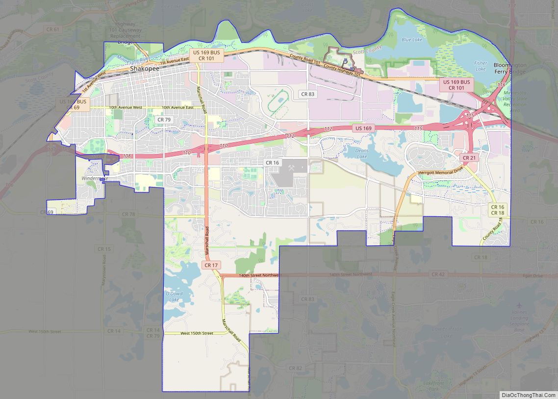
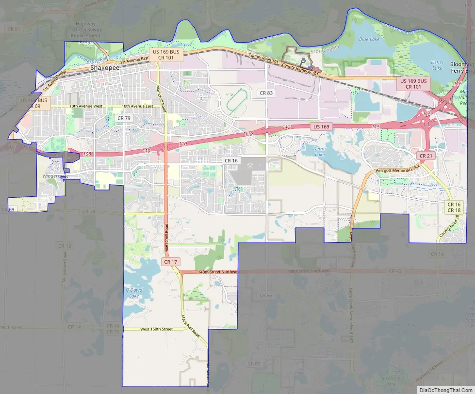
Shakopee Road Map
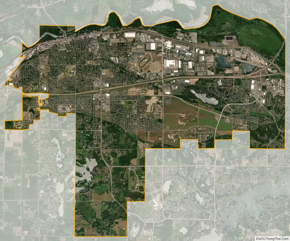
Shakopee city Satellite Map
Geography
According to the United States Census Bureau, the city has a total area of 29.32 square miles (75.94 km); 28.01 square miles (72.55 km) is land and 1.31 square miles (3.39 km) is water.
U.S. Highway 169 and County Highway 101 are two of the main routes in Shakopee. Highway 169 and nearby State Highway 13 connect Shakopee to the rest of the Minneapolis – Saint Paul region. County Highway 101 serves as a major east–west connector route of historic downtown Shakopee.
See also
Map of Minnesota State and its subdivision:- Aitkin
- Anoka
- Becker
- Beltrami
- Benton
- Big Stone
- Blue Earth
- Brown
- Carlton
- Carver
- Cass
- Chippewa
- Chisago
- Clay
- Clearwater
- Cook
- Cottonwood
- Crow Wing
- Dakota
- Dodge
- Douglas
- Faribault
- Fillmore
- Freeborn
- Goodhue
- Grant
- Hennepin
- Houston
- Hubbard
- Isanti
- Itasca
- Jackson
- Kanabec
- Kandiyohi
- Kittson
- Koochiching
- Lac qui Parle
- Lake
- Lake of the Woods
- Lake Superior
- Le Sueur
- Lincoln
- Lyon
- Mahnomen
- Marshall
- Martin
- McLeod
- Meeker
- Mille Lacs
- Morrison
- Mower
- Murray
- Nicollet
- Nobles
- Norman
- Olmsted
- Otter Tail
- Pennington
- Pine
- Pipestone
- Polk
- Pope
- Ramsey
- Red Lake
- Redwood
- Renville
- Rice
- Rock
- Roseau
- Saint Louis
- Scott
- Sherburne
- Sibley
- Stearns
- Steele
- Stevens
- Swift
- Todd
- Traverse
- Wabasha
- Wadena
- Waseca
- Washington
- Watonwan
- Wilkin
- Winona
- Wright
- Yellow Medicine
- Alabama
- Alaska
- Arizona
- Arkansas
- California
- Colorado
- Connecticut
- Delaware
- District of Columbia
- Florida
- Georgia
- Hawaii
- Idaho
- Illinois
- Indiana
- Iowa
- Kansas
- Kentucky
- Louisiana
- Maine
- Maryland
- Massachusetts
- Michigan
- Minnesota
- Mississippi
- Missouri
- Montana
- Nebraska
- Nevada
- New Hampshire
- New Jersey
- New Mexico
- New York
- North Carolina
- North Dakota
- Ohio
- Oklahoma
- Oregon
- Pennsylvania
- Rhode Island
- South Carolina
- South Dakota
- Tennessee
- Texas
- Utah
- Vermont
- Virginia
- Washington
- West Virginia
- Wisconsin
- Wyoming