Kandiyohi (/ˌkændiˈjoʊhaɪ/ KAN-dee-YOH-hy) is a city in Kandiyohi County, Minnesota, United States. The population was 491 at the 2010 census.
| Name: | Kandiyohi city |
|---|---|
| LSAD Code: | 25 |
| LSAD Description: | city (suffix) |
| State: | Minnesota |
| County: | Kandiyohi County |
| Elevation: | 1,224 ft (373 m) |
| Total Area: | 0.39 sq mi (1.01 km²) |
| Land Area: | 0.39 sq mi (1.01 km²) |
| Water Area: | 0.00 sq mi (0.00 km²) |
| Total Population: | 569 |
| Population Density: | 1,455.24/sq mi (562.55/km²) |
| ZIP code: | 56251 |
| Area code: | 320 |
| FIPS code: | 2732372 |
| GNISfeature ID: | 0646033 |
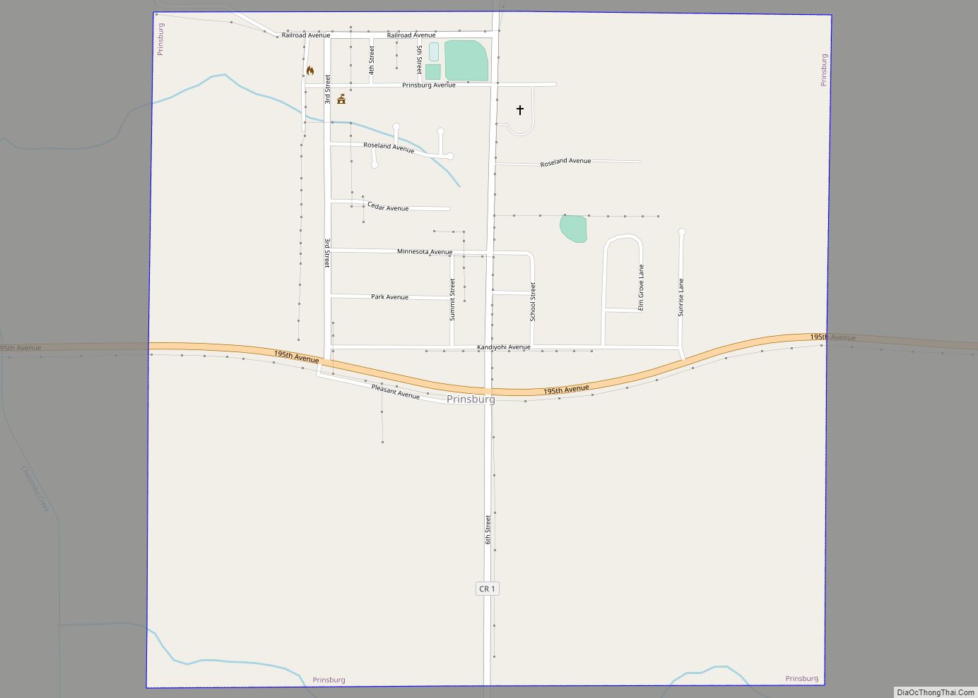
Online Interactive Map
Click on ![]() to view map in "full screen" mode.
to view map in "full screen" mode.
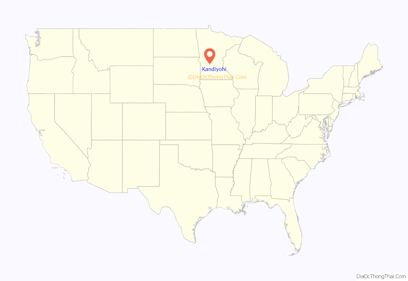
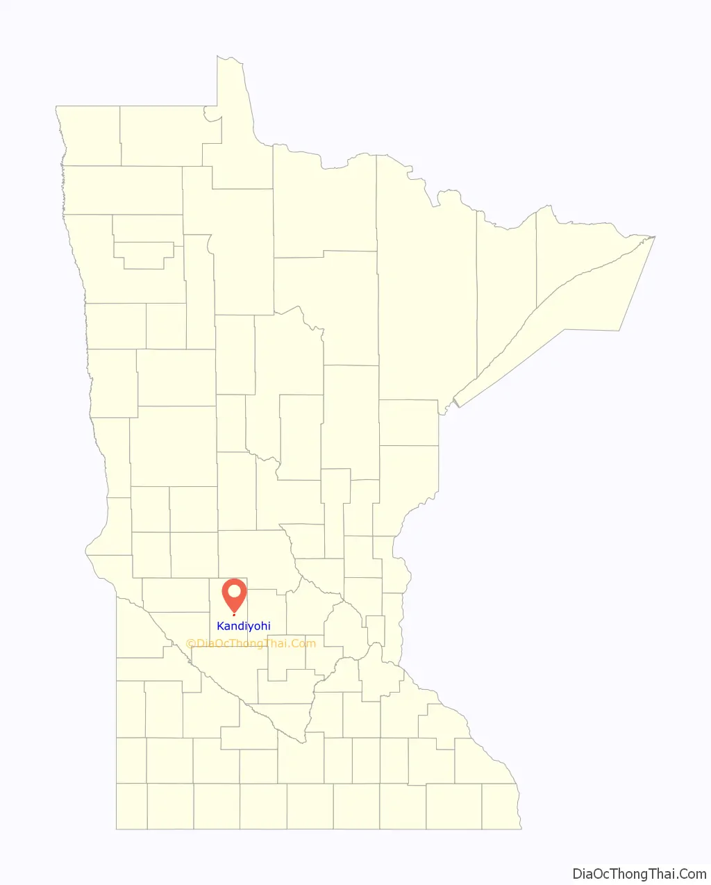
Kandiyohi location map. Where is Kandiyohi city?
History
Kandiyohi was laid out in 1869, when the railroad was extended to that point. In 1869 the Minnesota legislature voted Kandiyohi to be the new state capital due to its central location. The bill was vetoed by governor William Rainey Marshall on the grounds that “[t]he western treeless districts” further out from Kandiyohi would place the capital away from the likely population center.
Kandiyohi was derived from a Sioux name meaning “where the buffalo fish come from”.
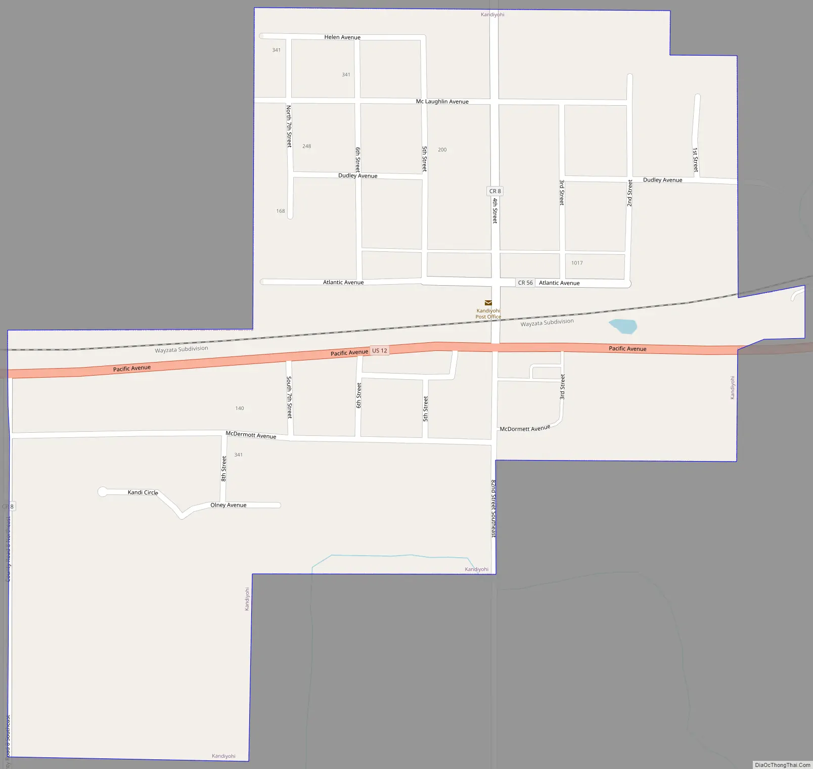
Kandiyohi Road Map
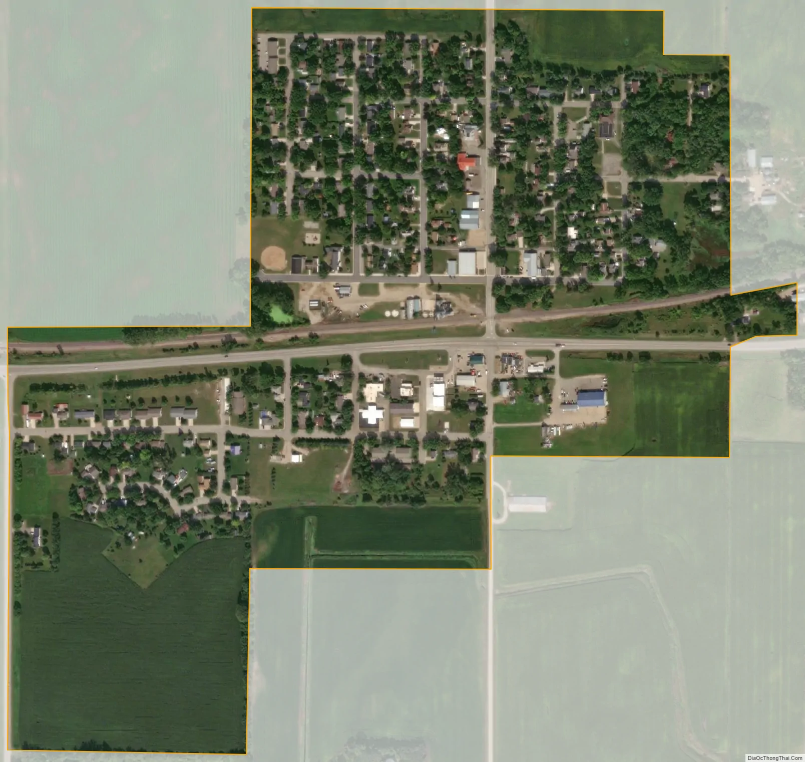
Kandiyohi city Satellite Map
Geography
According to the United States Census Bureau, the city has a total area of 0.34 square miles (0.88 km), all land. Including five family-friendly parks.
U.S. Route 12 serves as a main route in the community.
See also
Map of Minnesota State and its subdivision:- Aitkin
- Anoka
- Becker
- Beltrami
- Benton
- Big Stone
- Blue Earth
- Brown
- Carlton
- Carver
- Cass
- Chippewa
- Chisago
- Clay
- Clearwater
- Cook
- Cottonwood
- Crow Wing
- Dakota
- Dodge
- Douglas
- Faribault
- Fillmore
- Freeborn
- Goodhue
- Grant
- Hennepin
- Houston
- Hubbard
- Isanti
- Itasca
- Jackson
- Kanabec
- Kandiyohi
- Kittson
- Koochiching
- Lac qui Parle
- Lake
- Lake of the Woods
- Lake Superior
- Le Sueur
- Lincoln
- Lyon
- Mahnomen
- Marshall
- Martin
- McLeod
- Meeker
- Mille Lacs
- Morrison
- Mower
- Murray
- Nicollet
- Nobles
- Norman
- Olmsted
- Otter Tail
- Pennington
- Pine
- Pipestone
- Polk
- Pope
- Ramsey
- Red Lake
- Redwood
- Renville
- Rice
- Rock
- Roseau
- Saint Louis
- Scott
- Sherburne
- Sibley
- Stearns
- Steele
- Stevens
- Swift
- Todd
- Traverse
- Wabasha
- Wadena
- Waseca
- Washington
- Watonwan
- Wilkin
- Winona
- Wright
- Yellow Medicine
- Alabama
- Alaska
- Arizona
- Arkansas
- California
- Colorado
- Connecticut
- Delaware
- District of Columbia
- Florida
- Georgia
- Hawaii
- Idaho
- Illinois
- Indiana
- Iowa
- Kansas
- Kentucky
- Louisiana
- Maine
- Maryland
- Massachusetts
- Michigan
- Minnesota
- Mississippi
- Missouri
- Montana
- Nebraska
- Nevada
- New Hampshire
- New Jersey
- New Mexico
- New York
- North Carolina
- North Dakota
- Ohio
- Oklahoma
- Oregon
- Pennsylvania
- Rhode Island
- South Carolina
- South Dakota
- Tennessee
- Texas
- Utah
- Vermont
- Virginia
- Washington
- West Virginia
- Wisconsin
- Wyoming