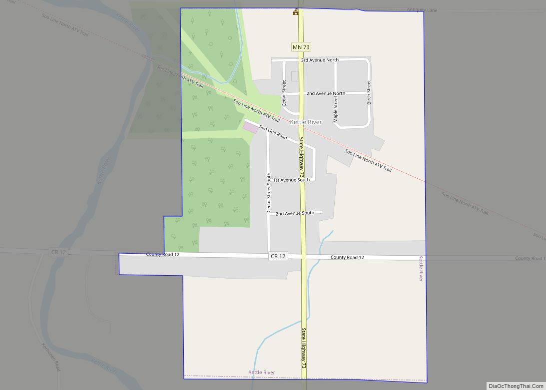
Kettle River is a city in Carlton County, Minnesota, along the Kettle River, for which it was named. The population was 180 at the time of the 2010 census. It was incorporated in 1921.
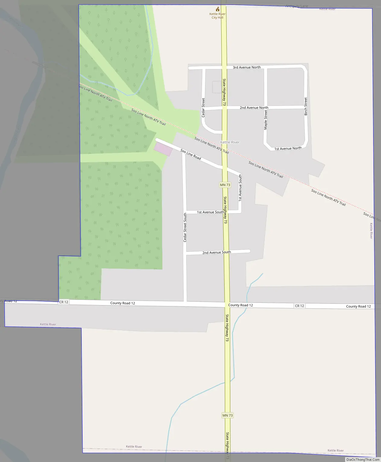
Minnesota State Highway 73 serves as a main route in Kettle River.
| Name: | Kettle River city |
|---|---|
| LSAD Code: | 25 |
| LSAD Description: | city (suffix) |
| State: | Minnesota |
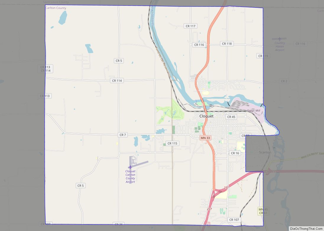
| County: | Carlton County |
| Elevation: | 1,181 ft (360 m) |
| Total Area: | 0.39 sq mi (1.00 km²) |
| Land Area: | 0.39 sq mi (1.00 km²) |
| Water Area: | 0.00 sq mi (0.00 km²) |
| Total Population: | 166 |
| Population Density: | 430.05/sq mi (165.84/km²) |
| ZIP code: | 55757 |
| Area code: | 218 |
| FIPS code: | 2732966 |
| GNISfeature ID: | 0646127 |
| Website: | http://www.ci.kettle-river.mn.us/ |
Online Interactive Map
Click on ![]() to view map in "full screen" mode.
to view map in "full screen" mode.
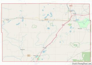
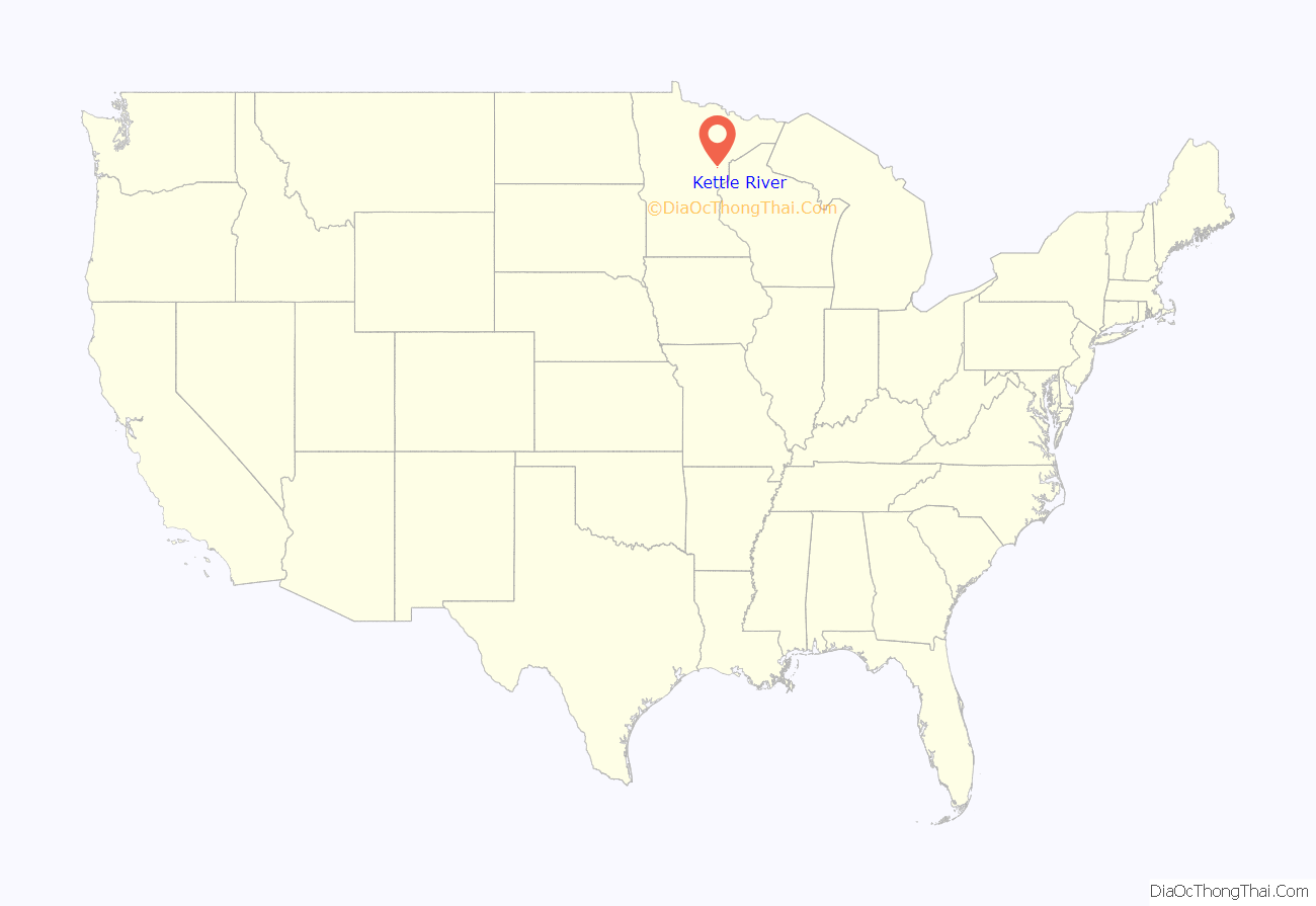
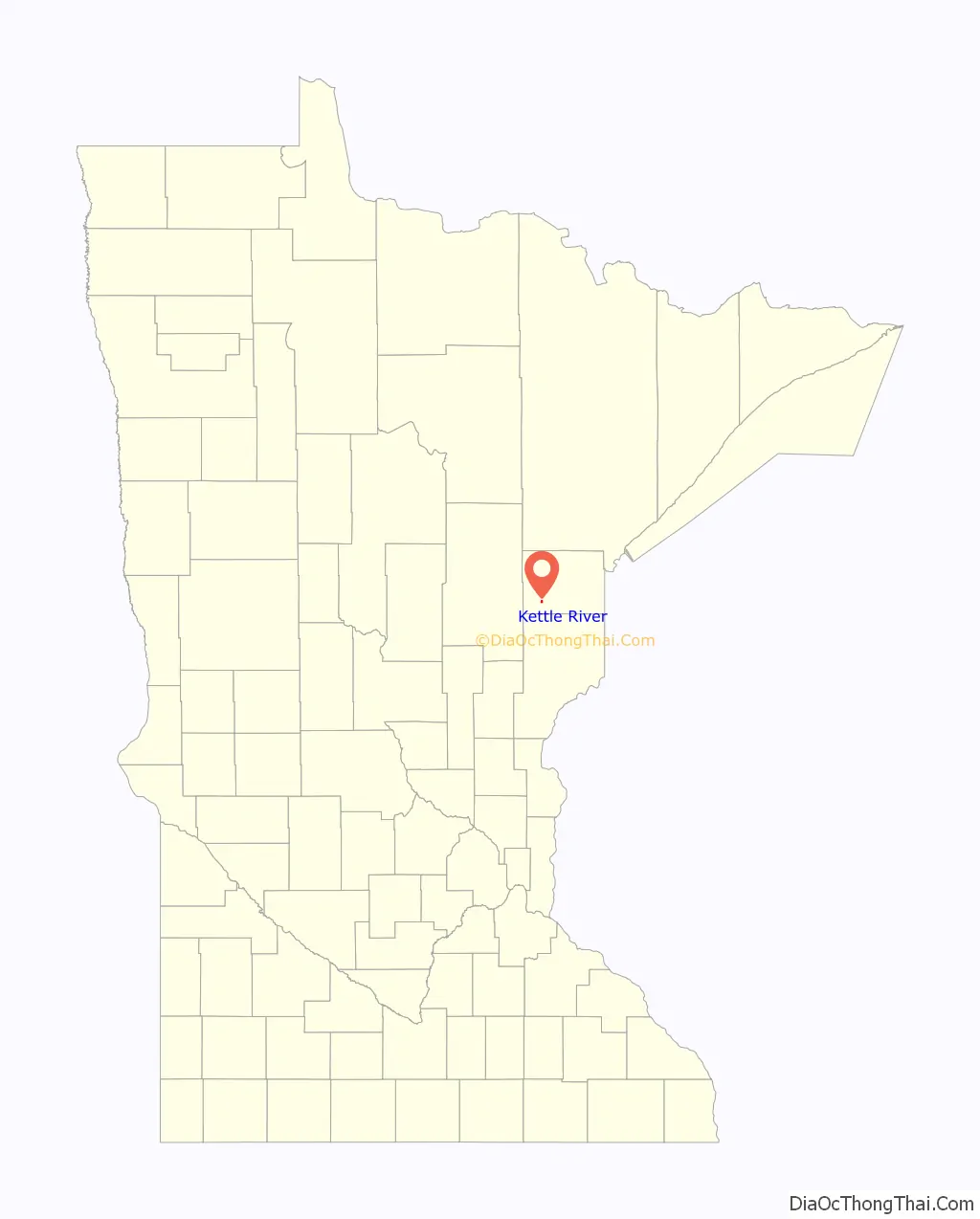
Kettle River location map. Where is Kettle River city?
History
The Kettle River area of Carlton County, Minnesota, was settled by a large concentration of Finnish Immigrants in the years leading up to the First World War and the influence of those immigrants is still noticeable even today.
On October 12, 1918, the Cloquet fire caused by sparks on the local railroads left much of western Carlton County area devastated. Several hundred persons were killed by the fire and thousands more left homeless. The only building left standing in Kettle River following the fire was the bank that was made of brick. This building still stands in Kettle River, near the center of the town on the west side of State Highway 73.
Following the fire, with most people homeless and destitute, the Spanish flu outbreak of 1918 caused more damage to the community.
Every August, the town hosts Ma and Pa Kettle Days, an annual festival; that includes a pancake breakfast, parade, pageant, and street dances.
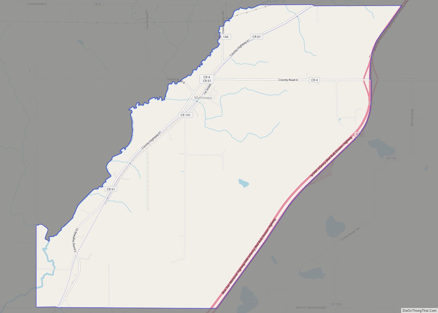
Kettle River Road Map
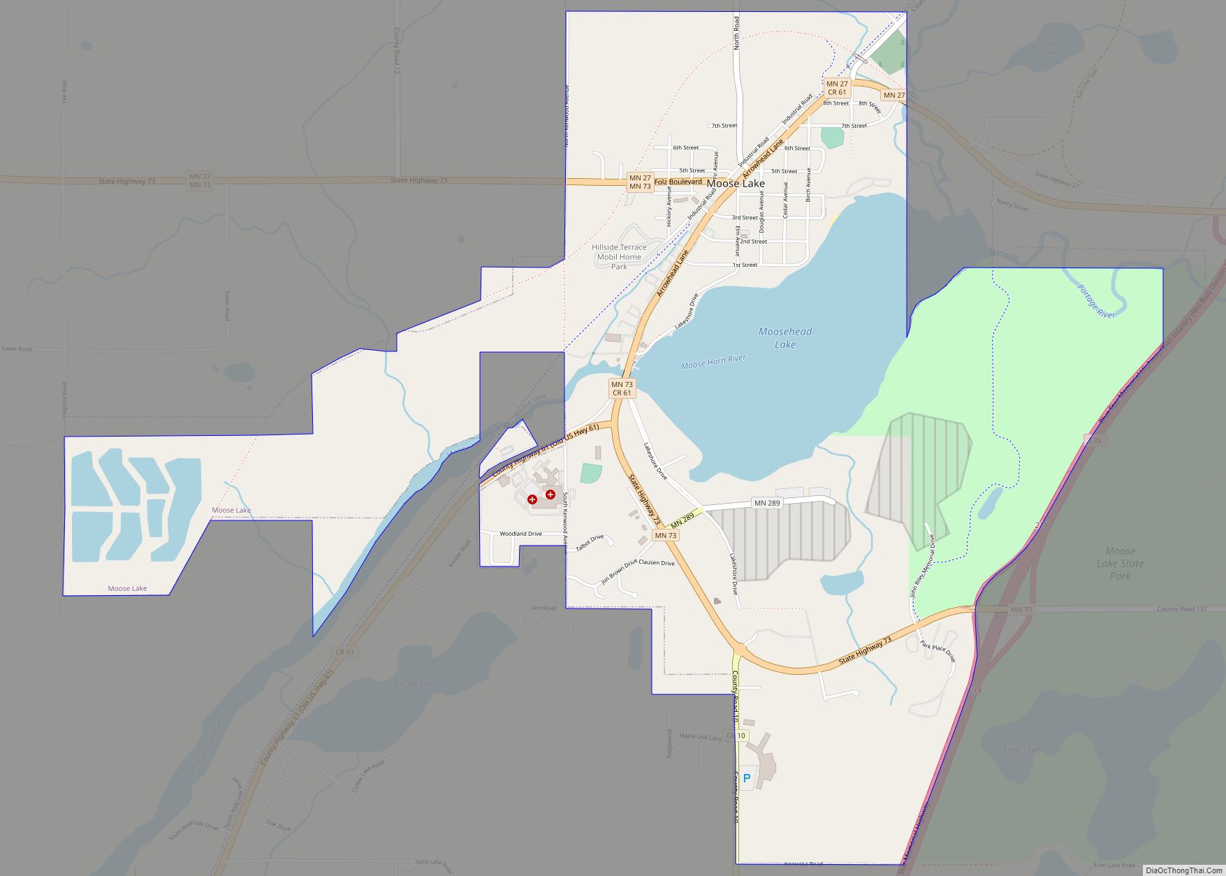
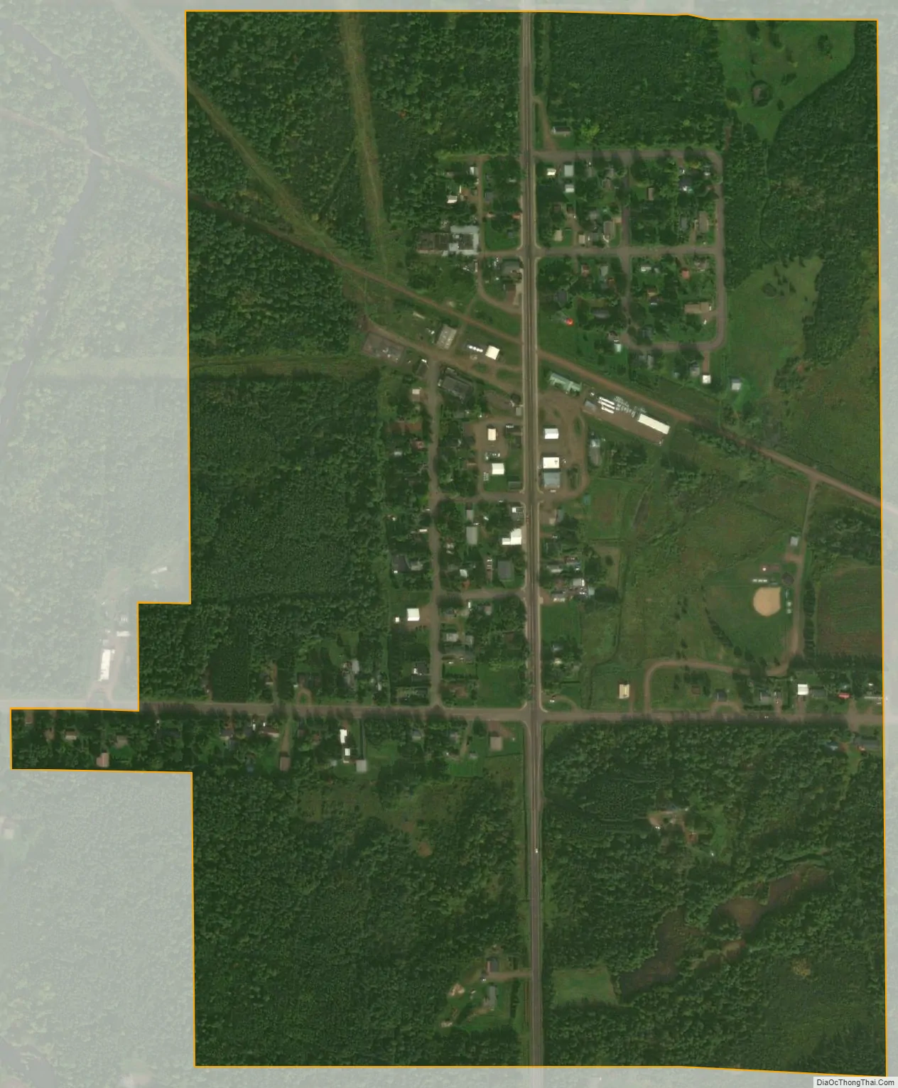
Kettle River city Satellite Map
Geography
According to the United States Census Bureau, the city has a total area of 0.38 square miles (0.98 km), all land.
Kettle River is located seven miles west-northwest of Moose Lake. Kettle River is located 30 miles southwest of Cloquet.
See also
Map of Minnesota State and its subdivision:- Aitkin
- Anoka
- Becker
- Beltrami
- Benton
- Big Stone
- Blue Earth
- Brown
- Carlton
- Carver
- Cass
- Chippewa
- Chisago
- Clay
- Clearwater
- Cook
- Cottonwood
- Crow Wing
- Dakota
- Dodge
- Douglas
- Faribault
- Fillmore
- Freeborn
- Goodhue
- Grant
- Hennepin
- Houston
- Hubbard
- Isanti
- Itasca
- Jackson
- Kanabec
- Kandiyohi
- Kittson
- Koochiching
- Lac qui Parle
- Lake
- Lake of the Woods
- Lake Superior
- Le Sueur
- Lincoln
- Lyon
- Mahnomen
- Marshall
- Martin
- McLeod
- Meeker
- Mille Lacs
- Morrison
- Mower
- Murray
- Nicollet
- Nobles
- Norman
- Olmsted
- Otter Tail
- Pennington
- Pine
- Pipestone
- Polk
- Pope
- Ramsey
- Red Lake
- Redwood
- Renville
- Rice
- Rock
- Roseau
- Saint Louis
- Scott
- Sherburne
- Sibley
- Stearns
- Steele
- Stevens
- Swift
- Todd
- Traverse
- Wabasha
- Wadena
- Waseca
- Washington
- Watonwan
- Wilkin
- Winona
- Wright
- Yellow Medicine
- Alabama
- Alaska
- Arizona
- Arkansas
- California
- Colorado
- Connecticut
- Delaware
- District of Columbia
- Florida
- Georgia
- Hawaii
- Idaho
- Illinois
- Indiana
- Iowa
- Kansas
- Kentucky
- Louisiana
- Maine
- Maryland
- Massachusetts
- Michigan
- Minnesota
- Mississippi
- Missouri
- Montana
- Nebraska
- Nevada
- New Hampshire
- New Jersey
- New Mexico
- New York
- North Carolina
- North Dakota
- Ohio
- Oklahoma
- Oregon
- Pennsylvania
- Rhode Island
- South Carolina
- South Dakota
- Tennessee
- Texas
- Utah
- Vermont
- Virginia
- Washington
- West Virginia
- Wisconsin
- Wyoming