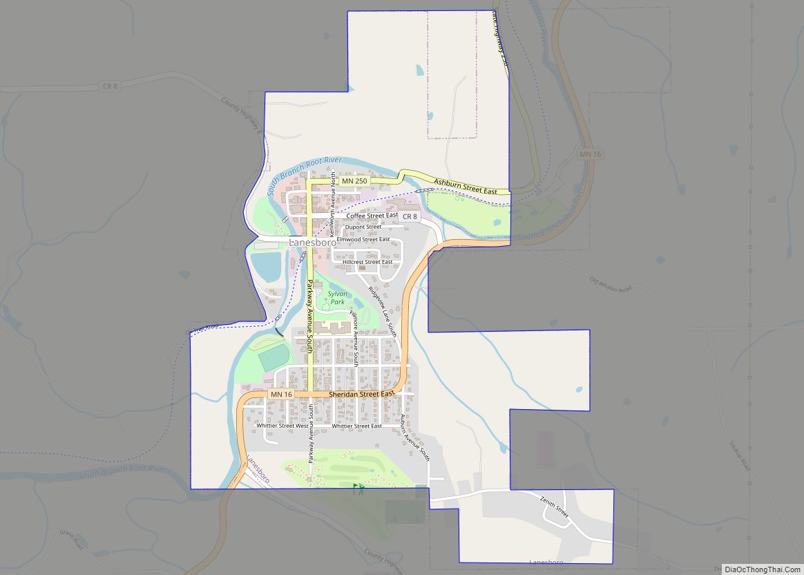
Lanesboro is a city in Fillmore County, Minnesota, United States. The population was 754 at the 2010 census. It was named after F. A. Lane, an early landowner.
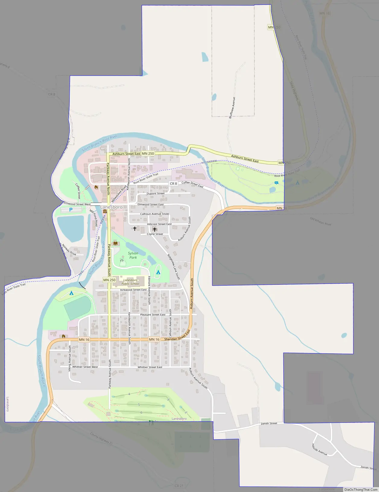
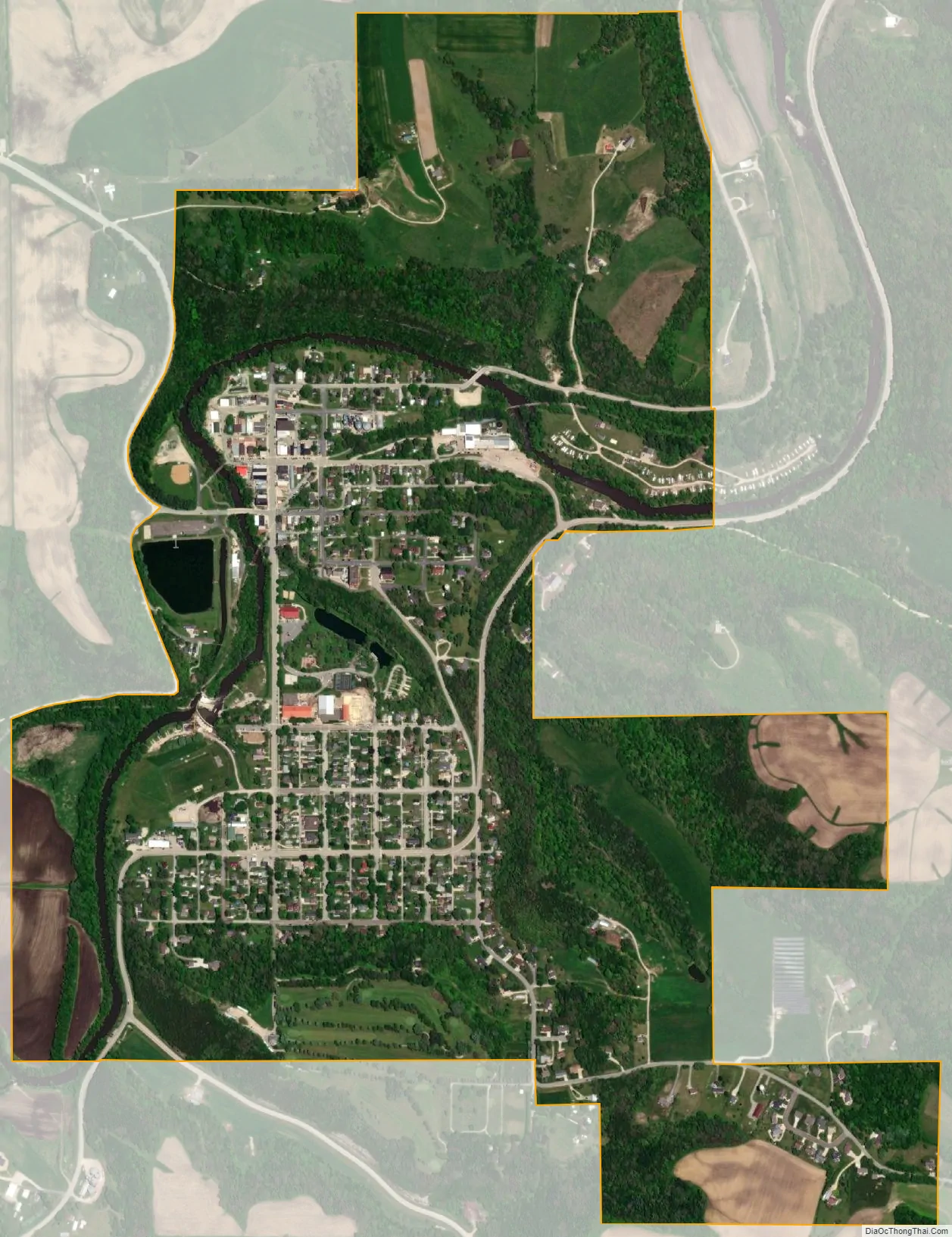
The South Fork of the Root River flows through it, with a waterfall dam across from Sylvan Park. The Root River State Trail and other bike paths also serve the town. An Amish community is in the area and the town is home to many unique shops and restaurants, and a professional stage theater.
| Name: | Lanesboro city |
|---|---|
| LSAD Code: | 25 |
| LSAD Description: | city (suffix) |
| State: | Minnesota |
| County: | Fillmore County |
| Elevation: | 856 ft (261 m) |
| Total Area: | 1.28 sq mi (3.33 km²) |
| Land Area: | 1.28 sq mi (3.33 km²) |
| Water Area: | 0.00 sq mi (0.00 km²) |
| Total Population: | 724 |
| Population Density: | 563.42/sq mi (217.46/km²) |
| ZIP code: | 55949 |
| Area code: | 507 |
| FIPS code: | 2735450 |
| GNISfeature ID: | 0646474 |
Online Interactive Map
Click on ![]() to view map in "full screen" mode.
to view map in "full screen" mode.
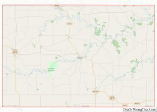
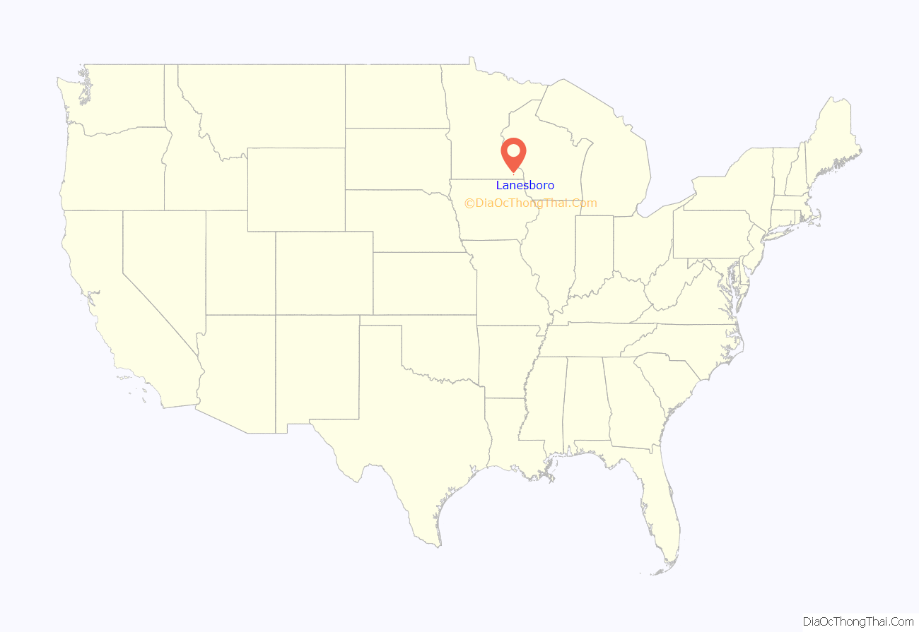
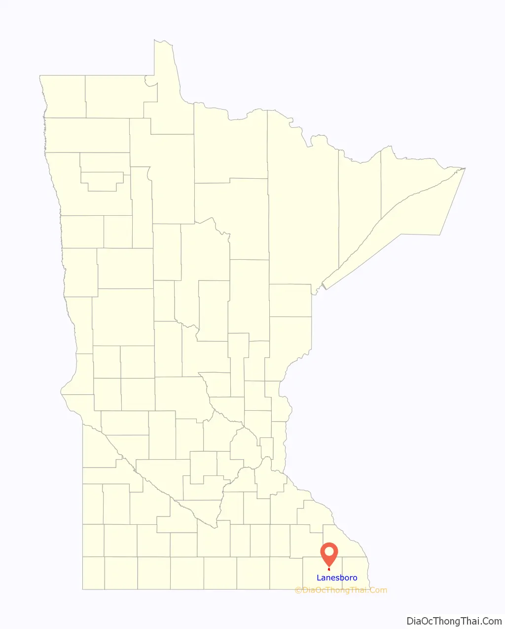
Lanesboro location map. Where is Lanesboro city?
History
Lanesboro was platted in 1868. A post office was established as Lanesboro in 1868, and the name was changed to Lanesboro in 1883. The city was named for one of its founders, F. A. Lane.
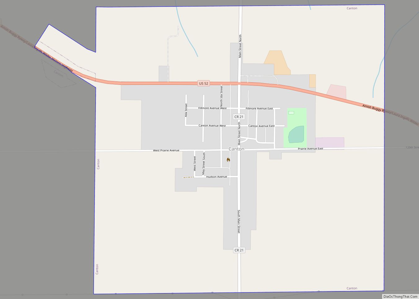
Lanesboro Road Map
Lanesboro city Satellite Map
Geography
According to the United States Census Bureau, the city has a total area of 1.32 square miles (3.42 km), all land.
Minnesota State Highways 16 and 250 and County Roads 8 and 21 are four of the main routes in Lanesboro.
See also
Map of Minnesota State and its subdivision:- Aitkin
- Anoka
- Becker
- Beltrami
- Benton
- Big Stone
- Blue Earth
- Brown
- Carlton
- Carver
- Cass
- Chippewa
- Chisago
- Clay
- Clearwater
- Cook
- Cottonwood
- Crow Wing
- Dakota
- Dodge
- Douglas
- Faribault
- Fillmore
- Freeborn
- Goodhue
- Grant
- Hennepin
- Houston
- Hubbard
- Isanti
- Itasca
- Jackson
- Kanabec
- Kandiyohi
- Kittson
- Koochiching
- Lac qui Parle
- Lake
- Lake of the Woods
- Lake Superior
- Le Sueur
- Lincoln
- Lyon
- Mahnomen
- Marshall
- Martin
- McLeod
- Meeker
- Mille Lacs
- Morrison
- Mower
- Murray
- Nicollet
- Nobles
- Norman
- Olmsted
- Otter Tail
- Pennington
- Pine
- Pipestone
- Polk
- Pope
- Ramsey
- Red Lake
- Redwood
- Renville
- Rice
- Rock
- Roseau
- Saint Louis
- Scott
- Sherburne
- Sibley
- Stearns
- Steele
- Stevens
- Swift
- Todd
- Traverse
- Wabasha
- Wadena
- Waseca
- Washington
- Watonwan
- Wilkin
- Winona
- Wright
- Yellow Medicine
- Alabama
- Alaska
- Arizona
- Arkansas
- California
- Colorado
- Connecticut
- Delaware
- District of Columbia
- Florida
- Georgia
- Hawaii
- Idaho
- Illinois
- Indiana
- Iowa
- Kansas
- Kentucky
- Louisiana
- Maine
- Maryland
- Massachusetts
- Michigan
- Minnesota
- Mississippi
- Missouri
- Montana
- Nebraska
- Nevada
- New Hampshire
- New Jersey
- New Mexico
- New York
- North Carolina
- North Dakota
- Ohio
- Oklahoma
- Oregon
- Pennsylvania
- Rhode Island
- South Carolina
- South Dakota
- Tennessee
- Texas
- Utah
- Vermont
- Virginia
- Washington
- West Virginia
- Wisconsin
- Wyoming