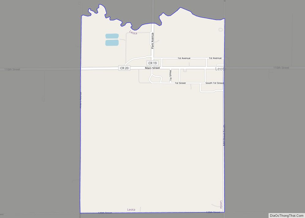
Leota is a census-designated place (CDP) in Leota Township, Nobles County, Minnesota, United States. The population was 209 at the 2000 census.
| Name: | Leota CDP |
|---|---|
| LSAD Code: | 57 |
| LSAD Description: | CDP (suffix) |
| State: | Minnesota |
| County: | Nobles County |
| Elevation: | 1,722 ft (525 m) |
| Total Area: | 1.52 sq mi (3.93 km²) |
| Land Area: | 1.52 sq mi (3.93 km²) |
| Water Area: | 0.00 sq mi (0.00 km²) |
| Total Population: | 202 |
| Population Density: | 133.07/sq mi (51.37/km²) |
| ZIP code: | 56153 |
| Area code: | 507 |
| FIPS code: | 2736548 |
| GNISfeature ID: | 0646606 |
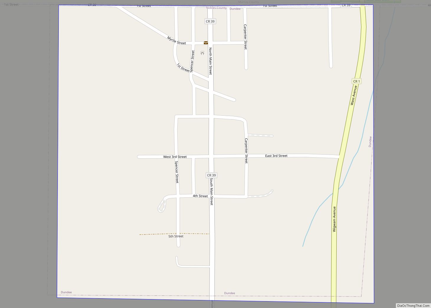
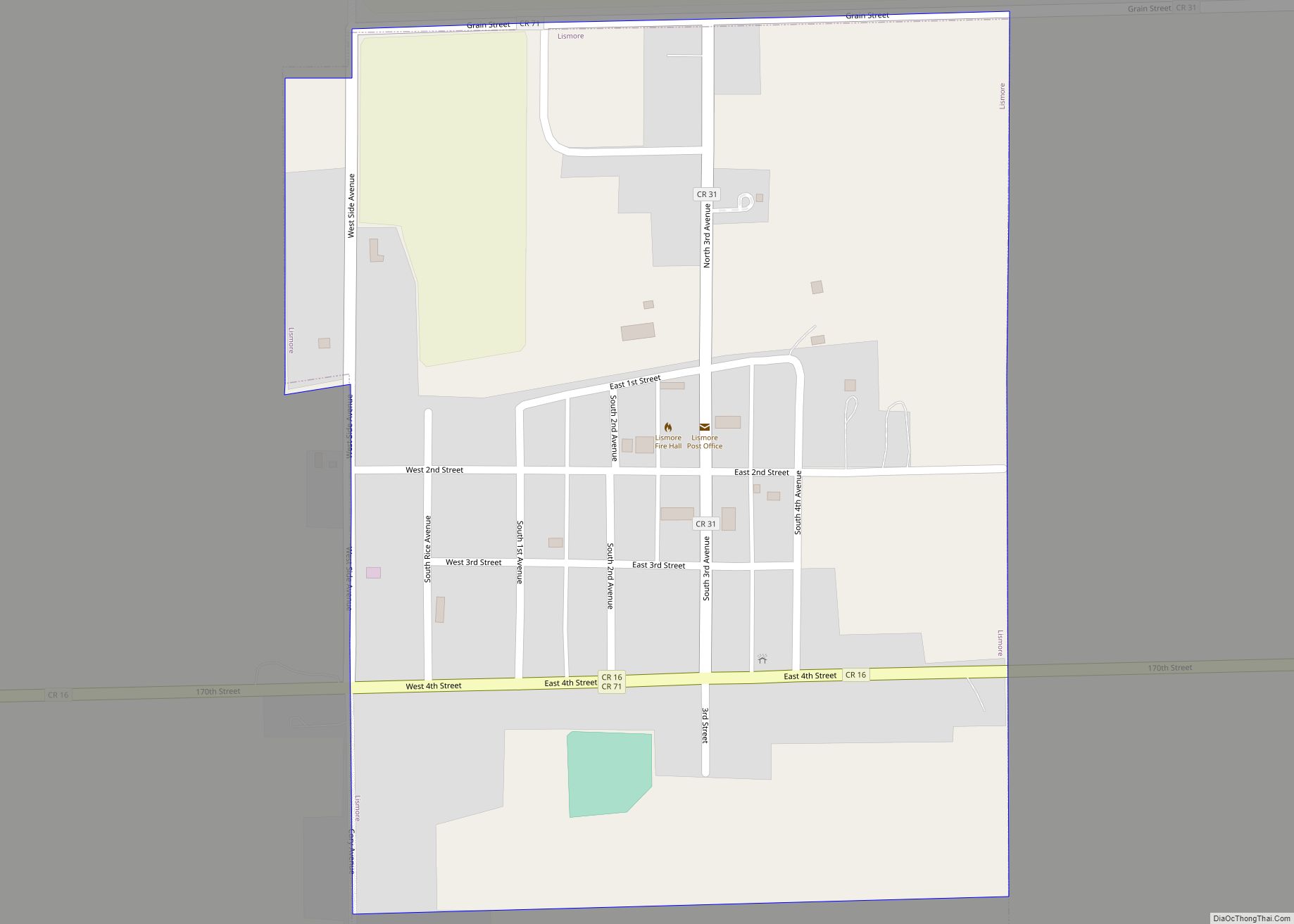
Online Interactive Map
Click on ![]() to view map in "full screen" mode.
to view map in "full screen" mode.
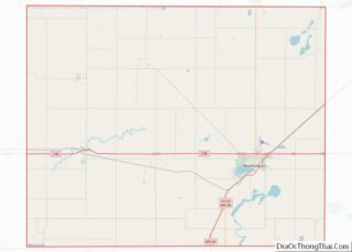
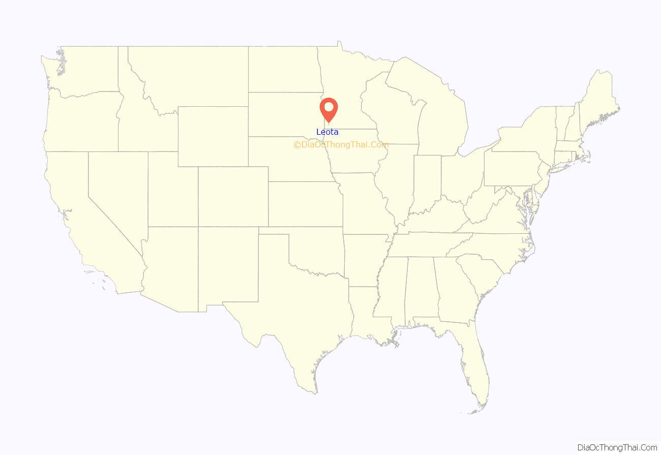
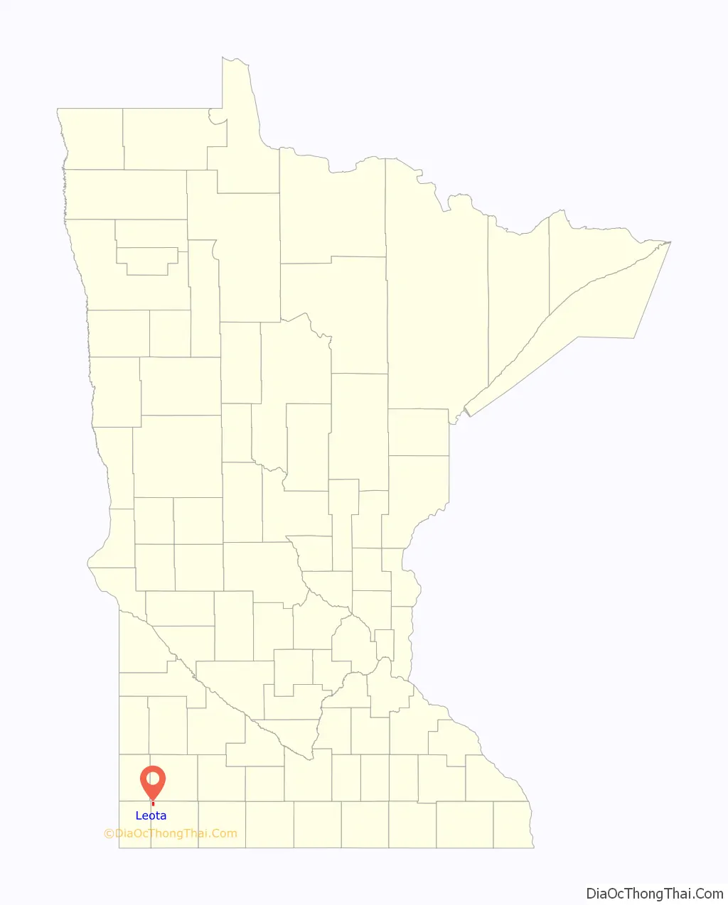
Leota location map. Where is Leota CDP?
History
The town of Leota was named after Leota Township in which it is located. The story has it that Leota was the name of a young Indian woman who figured in a romantic story familiar to W. G. Barnard, one of the township’s first residents. However existence of such a story cannot be verified. If true, Leota Township (and the town of Leota) are the only place names in all of Nobles County that memorialize specific Native Americans. The town of Leota is situated on sections 5 and 8 of the township. Leota was established in 1891 as a settlement of Dutch Farmers who migrated northward from another Dutch Settlement in Orange City, Iowa. The first building erected in Leota was the Dutch Reformed Church. Later in 1891, John DeBoer, Nick DeBoer, and James TenCate erected a second building that became Leota’s first general store. A post office was established in 1893, and the Christian Reformed Church was built in 1898. The town was surveyed by M. S. Smith for James TenCate, and the plat was dedicated on January 1, 1902. Leota was never incorporated, though it remains a thriving community. The U. S. Census Bureau classifies Leota as a census-designated place (CDP). CDPs are populated areas that lack separate municipal government, but which otherwise physically resemble incorporated places.
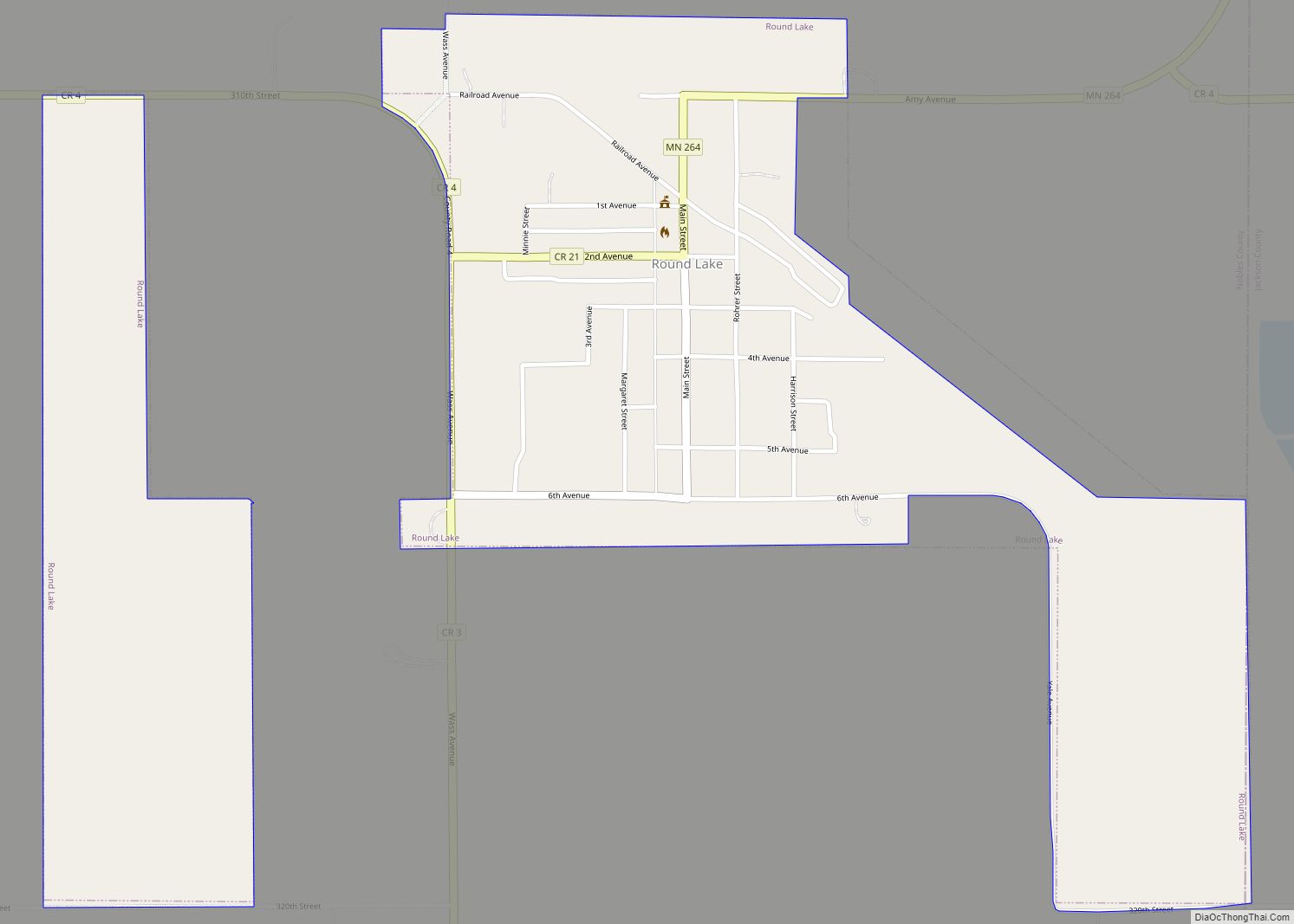
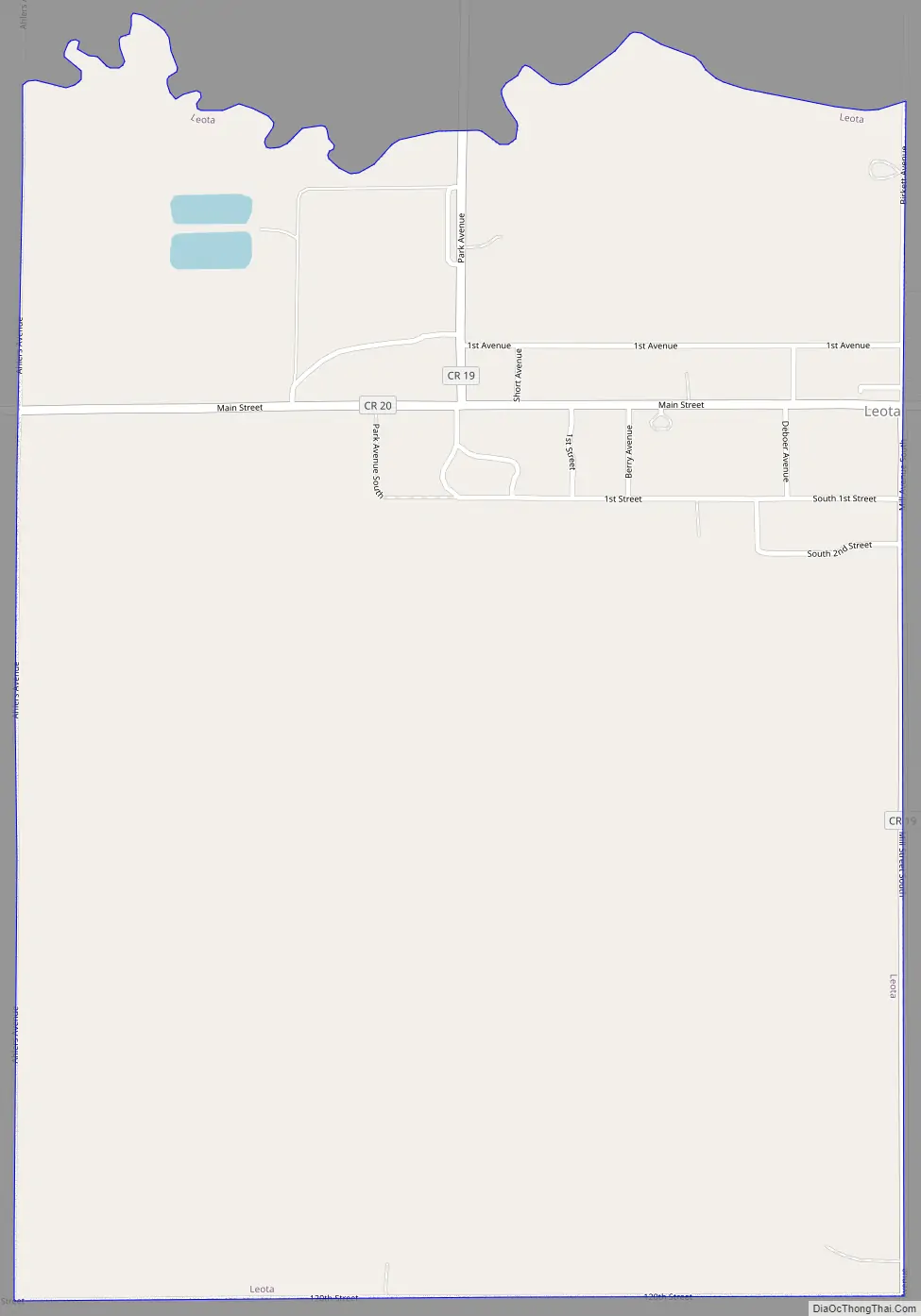
Leota Road Map
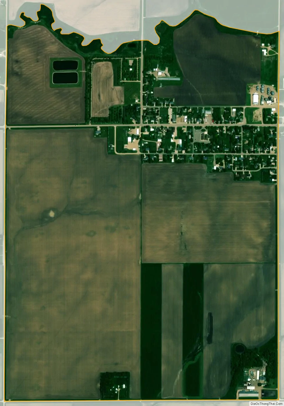
Leota city Satellite Map
Geography
According to the United States Census Bureau, the CDP has a total area of 1.4 square miles (3.6 km), all land. Leota is situated on the western side of the Buffalo Ridge, the drainage divide between the Mississippi River and Missouri River systems.
Main highways include:
- Nobles County Road 19
- Nobles County Road 20
See also
Map of Minnesota State and its subdivision:- Aitkin
- Anoka
- Becker
- Beltrami
- Benton
- Big Stone
- Blue Earth
- Brown
- Carlton
- Carver
- Cass
- Chippewa
- Chisago
- Clay
- Clearwater
- Cook
- Cottonwood
- Crow Wing
- Dakota
- Dodge
- Douglas
- Faribault
- Fillmore
- Freeborn
- Goodhue
- Grant
- Hennepin
- Houston
- Hubbard
- Isanti
- Itasca
- Jackson
- Kanabec
- Kandiyohi
- Kittson
- Koochiching
- Lac qui Parle
- Lake
- Lake of the Woods
- Lake Superior
- Le Sueur
- Lincoln
- Lyon
- Mahnomen
- Marshall
- Martin
- McLeod
- Meeker
- Mille Lacs
- Morrison
- Mower
- Murray
- Nicollet
- Nobles
- Norman
- Olmsted
- Otter Tail
- Pennington
- Pine
- Pipestone
- Polk
- Pope
- Ramsey
- Red Lake
- Redwood
- Renville
- Rice
- Rock
- Roseau
- Saint Louis
- Scott
- Sherburne
- Sibley
- Stearns
- Steele
- Stevens
- Swift
- Todd
- Traverse
- Wabasha
- Wadena
- Waseca
- Washington
- Watonwan
- Wilkin
- Winona
- Wright
- Yellow Medicine
- Alabama
- Alaska
- Arizona
- Arkansas
- California
- Colorado
- Connecticut
- Delaware
- District of Columbia
- Florida
- Georgia
- Hawaii
- Idaho
- Illinois
- Indiana
- Iowa
- Kansas
- Kentucky
- Louisiana
- Maine
- Maryland
- Massachusetts
- Michigan
- Minnesota
- Mississippi
- Missouri
- Montana
- Nebraska
- Nevada
- New Hampshire
- New Jersey
- New Mexico
- New York
- North Carolina
- North Dakota
- Ohio
- Oklahoma
- Oregon
- Pennsylvania
- Rhode Island
- South Carolina
- South Dakota
- Tennessee
- Texas
- Utah
- Vermont
- Virginia
- Washington
- West Virginia
- Wisconsin
- Wyoming