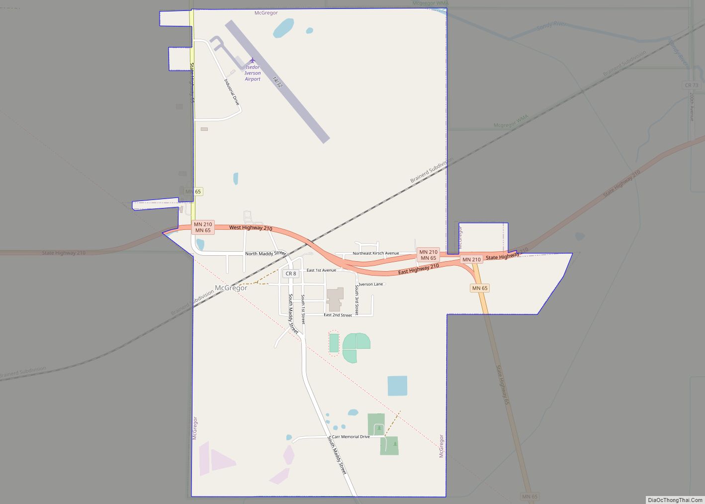
McGregor is a city in Aitkin County, Minnesota, United States. The population was 391 at the 2010 census.
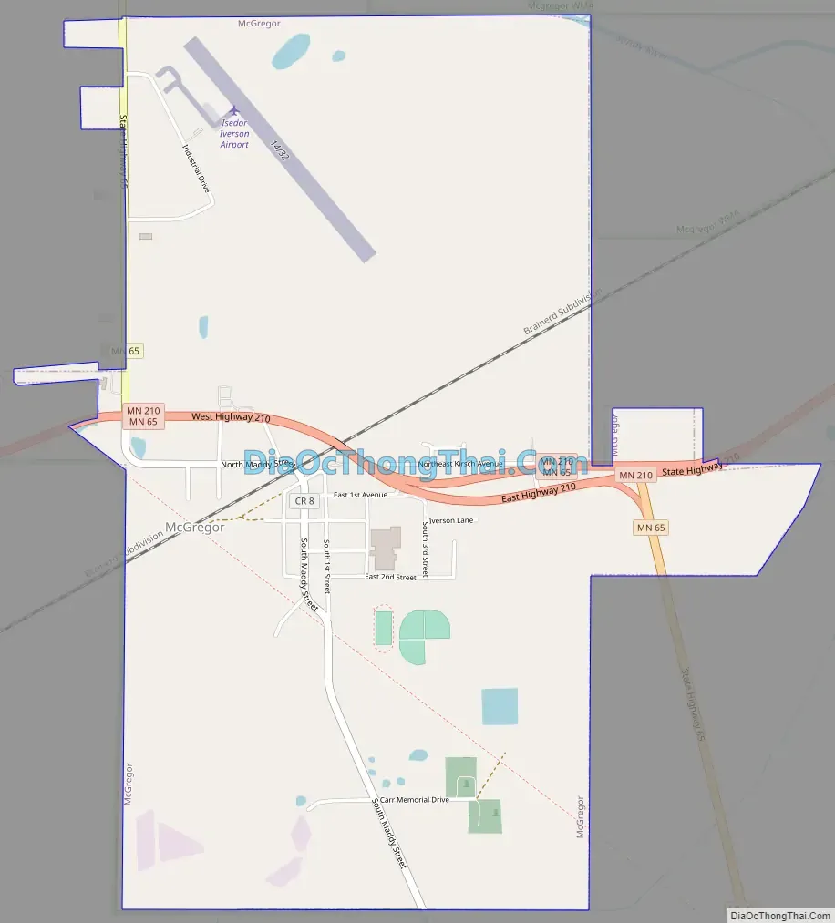
McGregor is located along Minnesota State Highways 65 and 210. Other routes include Aitkin County Road 8, Maddy Street.
| Name: | McGregor city |
|---|---|
| LSAD Code: | 25 |
| LSAD Description: | city (suffix) |
| State: | Minnesota |
| County: | Aitkin County |
| Incorporated: | August 27, 1903 |
| Elevation: | 1,230 ft (375 m) |
| Total Area: | 2.27 sq mi (5.87 km²) |
| Land Area: | 2.14 sq mi (5.54 km²) |
| Water Area: | 0.13 sq mi (0.33 km²) |
| Total Population: | 384 |
| Population Density: | 179.52/sq mi (69.32/km²) |
| ZIP code: | 55760 |
| Area code: | 218 |
| FIPS code: | 2739014 |
| GNISfeature ID: | 0647683 |
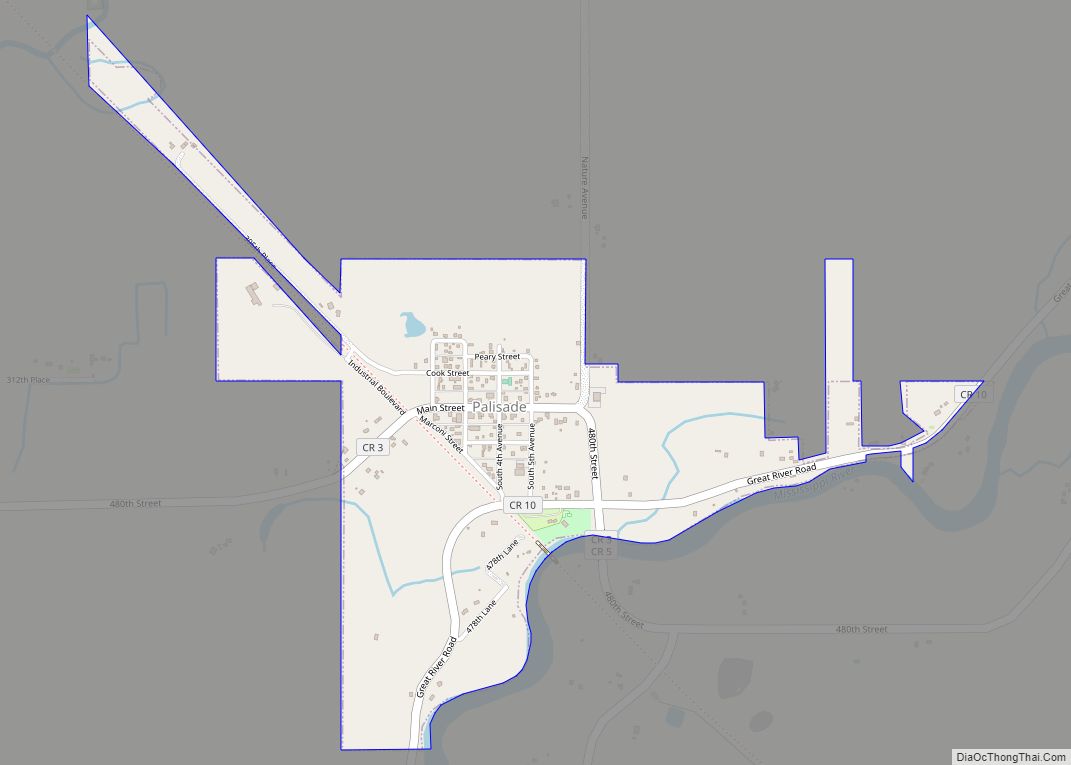
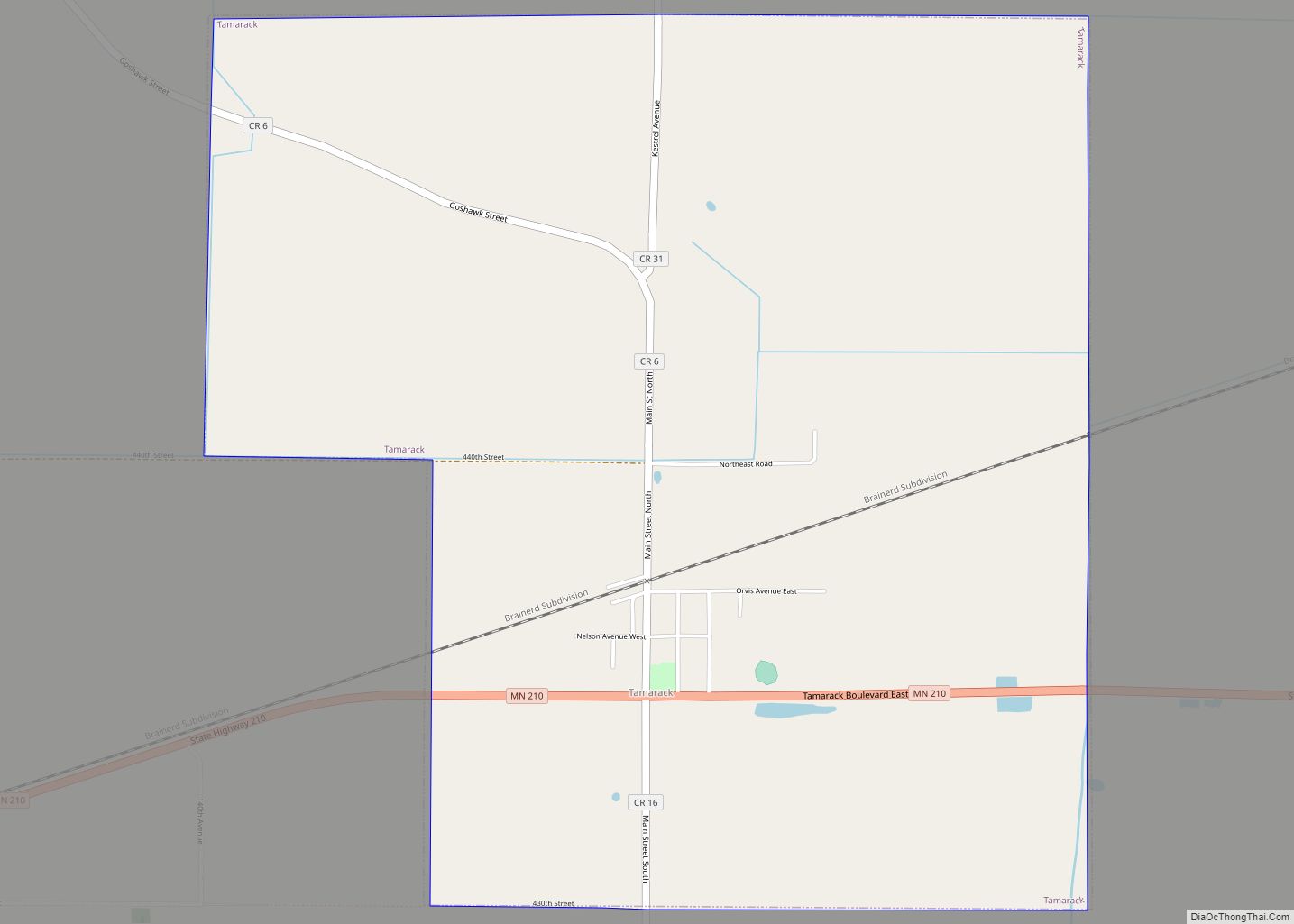
Online Interactive Map
Click on ![]() to view map in "full screen" mode.
to view map in "full screen" mode.
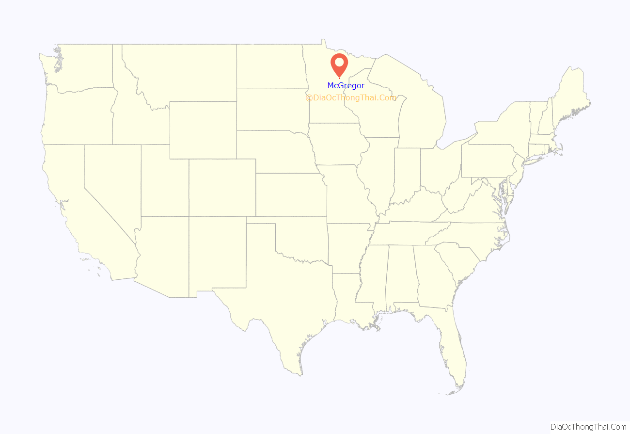
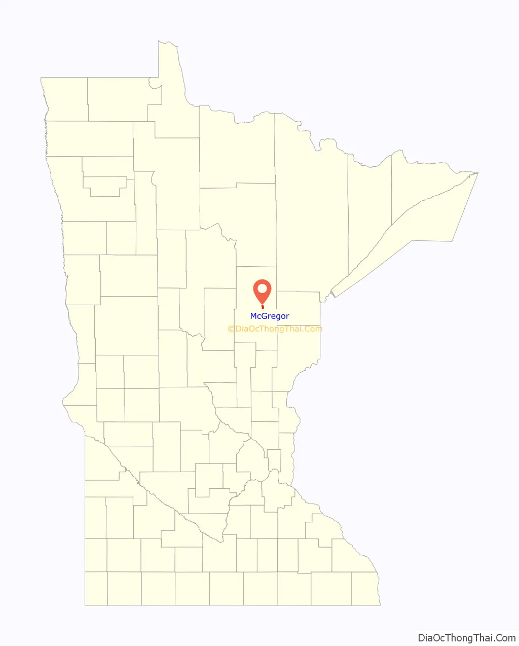
McGregor location map. Where is McGregor city?
History
McGregor was incorporated in 1903, and separated from surrounding McGregor Township in 1919. McGregor was named either for a hunter and trapper named McGregor who came from New York, or for Major John G. MacGregor of Minneapolis. The post office began in 1890.
McGregor Road Map
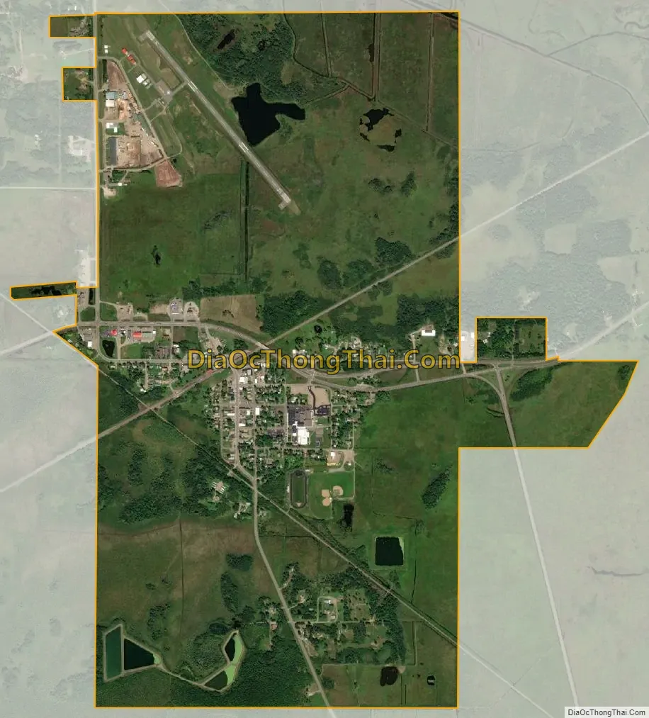
McGregor city Satellite Map
Geography
According to the United States Census Bureau, the city has a total area of 2.11 square miles (5.46 km), of which 1.98 square miles (5.13 km) is land and 0.13 square miles (0.34 km) is water.
The Sandy River flows nearby. The Soo Line North ATV Trail is also nearby.
See also
Map of Minnesota State and its subdivision:- Aitkin
- Anoka
- Becker
- Beltrami
- Benton
- Big Stone
- Blue Earth
- Brown
- Carlton
- Carver
- Cass
- Chippewa
- Chisago
- Clay
- Clearwater
- Cook
- Cottonwood
- Crow Wing
- Dakota
- Dodge
- Douglas
- Faribault
- Fillmore
- Freeborn
- Goodhue
- Grant
- Hennepin
- Houston
- Hubbard
- Isanti
- Itasca
- Jackson
- Kanabec
- Kandiyohi
- Kittson
- Koochiching
- Lac qui Parle
- Lake
- Lake of the Woods
- Lake Superior
- Le Sueur
- Lincoln
- Lyon
- Mahnomen
- Marshall
- Martin
- McLeod
- Meeker
- Mille Lacs
- Morrison
- Mower
- Murray
- Nicollet
- Nobles
- Norman
- Olmsted
- Otter Tail
- Pennington
- Pine
- Pipestone
- Polk
- Pope
- Ramsey
- Red Lake
- Redwood
- Renville
- Rice
- Rock
- Roseau
- Saint Louis
- Scott
- Sherburne
- Sibley
- Stearns
- Steele
- Stevens
- Swift
- Todd
- Traverse
- Wabasha
- Wadena
- Waseca
- Washington
- Watonwan
- Wilkin
- Winona
- Wright
- Yellow Medicine
- Alabama
- Alaska
- Arizona
- Arkansas
- California
- Colorado
- Connecticut
- Delaware
- District of Columbia
- Florida
- Georgia
- Hawaii
- Idaho
- Illinois
- Indiana
- Iowa
- Kansas
- Kentucky
- Louisiana
- Maine
- Maryland
- Massachusetts
- Michigan
- Minnesota
- Mississippi
- Missouri
- Montana
- Nebraska
- Nevada
- New Hampshire
- New Jersey
- New Mexico
- New York
- North Carolina
- North Dakota
- Ohio
- Oklahoma
- Oregon
- Pennsylvania
- Rhode Island
- South Carolina
- South Dakota
- Tennessee
- Texas
- Utah
- Vermont
- Virginia
- Washington
- West Virginia
- Wisconsin
- Wyoming