Montevideo (/ˌmɒntəˈvɪdi.oʊ/ MON-tə-VIH-dee-oh) is a city in Chippewa County, Minnesota, United States. The population was 5,383 at the 2010 census. It is the county seat of Chippewa County. The town’s mayor is Erich Winter, and the Council President is Nathan Schmidt.
The area around Montevideo was populated by Native Americans and fur traders during the first half of the 19th Century. After the Dakota War of 1862, the US government opened the area to homesteaders. Railroads were built, and settlers followed, including Civil War veterans, Norwegians, Germans, Swedes, Dutch, and Irish. Montevideo was incorporated in 1879.
| Name: | Montevideo city |
|---|---|
| LSAD Code: | 25 |
| LSAD Description: | city (suffix) |
| State: | Minnesota |
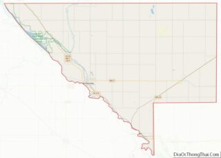
| County: | Chippewa County |
| Elevation: | 929 ft (283 m) |
| Total Area: | 4.80 sq mi (12.44 km²) |
| Land Area: | 4.71 sq mi (12.20 km²) |
| Water Area: | 0.09 sq mi (0.23 km²) |
| Total Population: | 5,398 |
| Population Density: | 1,145.59/sq mi (442.31/km²) |
| ZIP code: | 56265 |
| Area code: | 320 |
| FIPS code: | 2743720 |
| GNISfeature ID: | 0648046 |
| Website: | www.montevideomn.org |
Online Interactive Map
Click on ![]() to view map in "full screen" mode.
to view map in "full screen" mode.
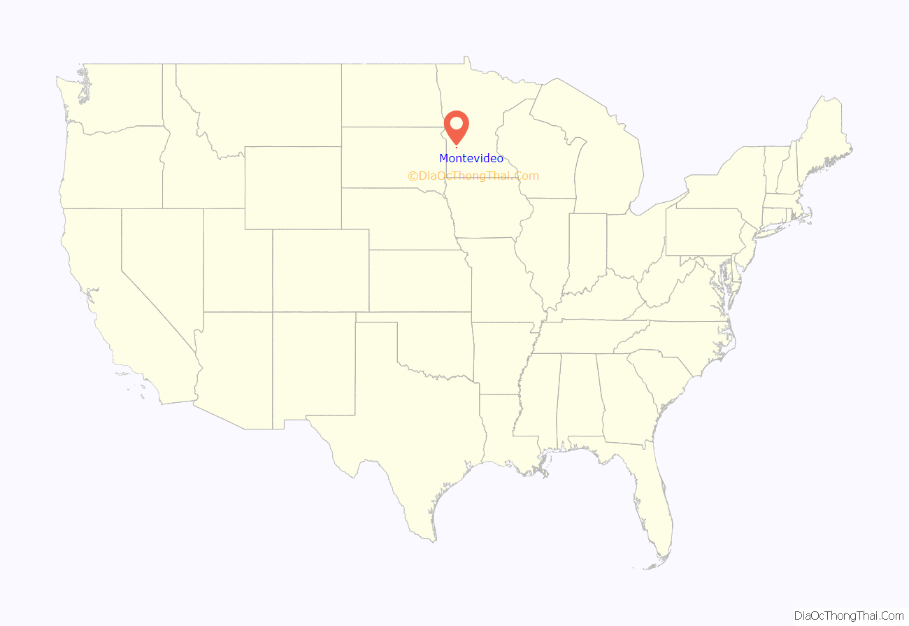
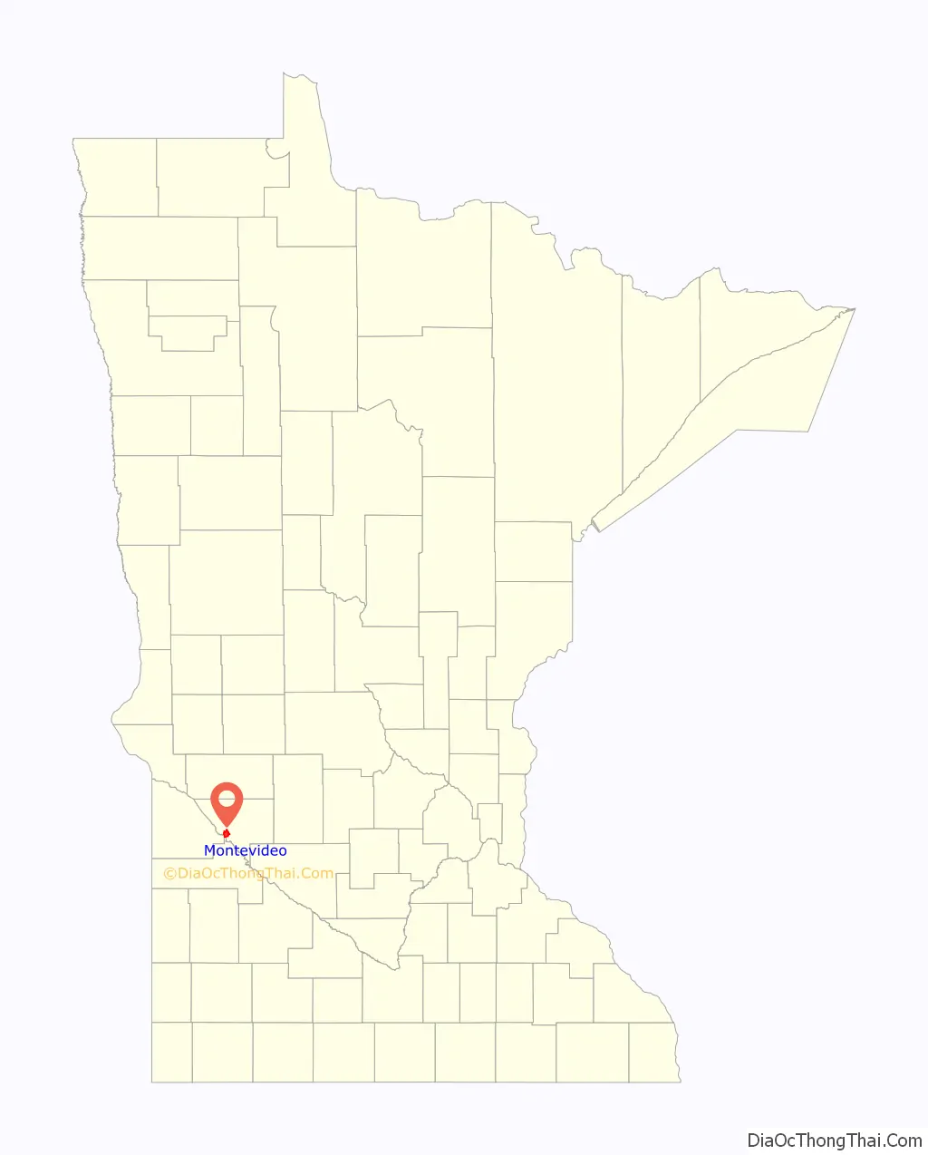
Montevideo location map. Where is Montevideo city?
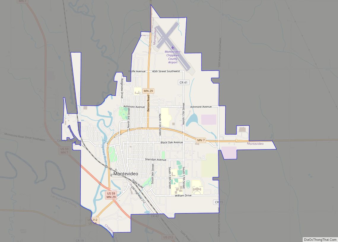
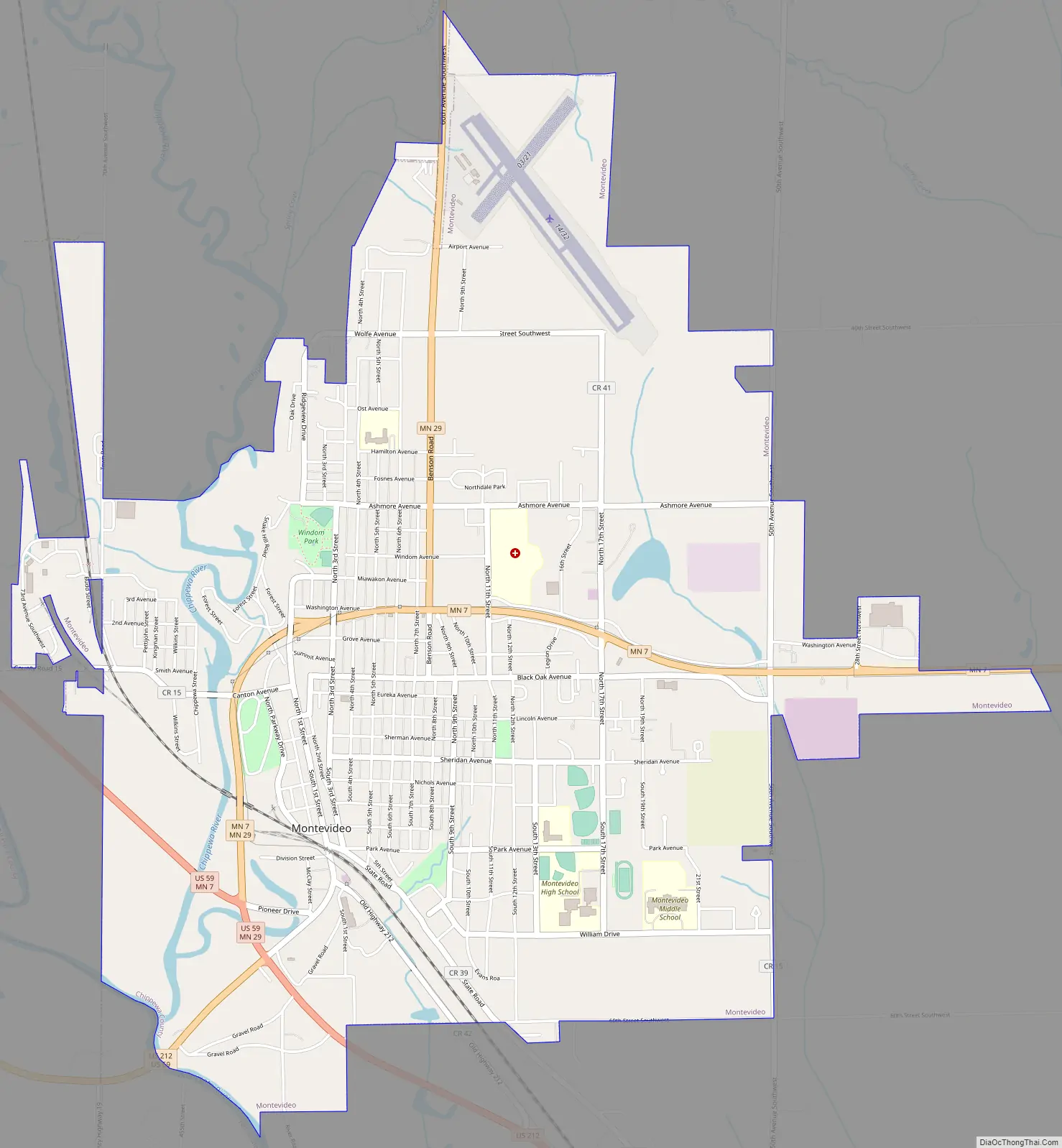
Montevideo Road Map
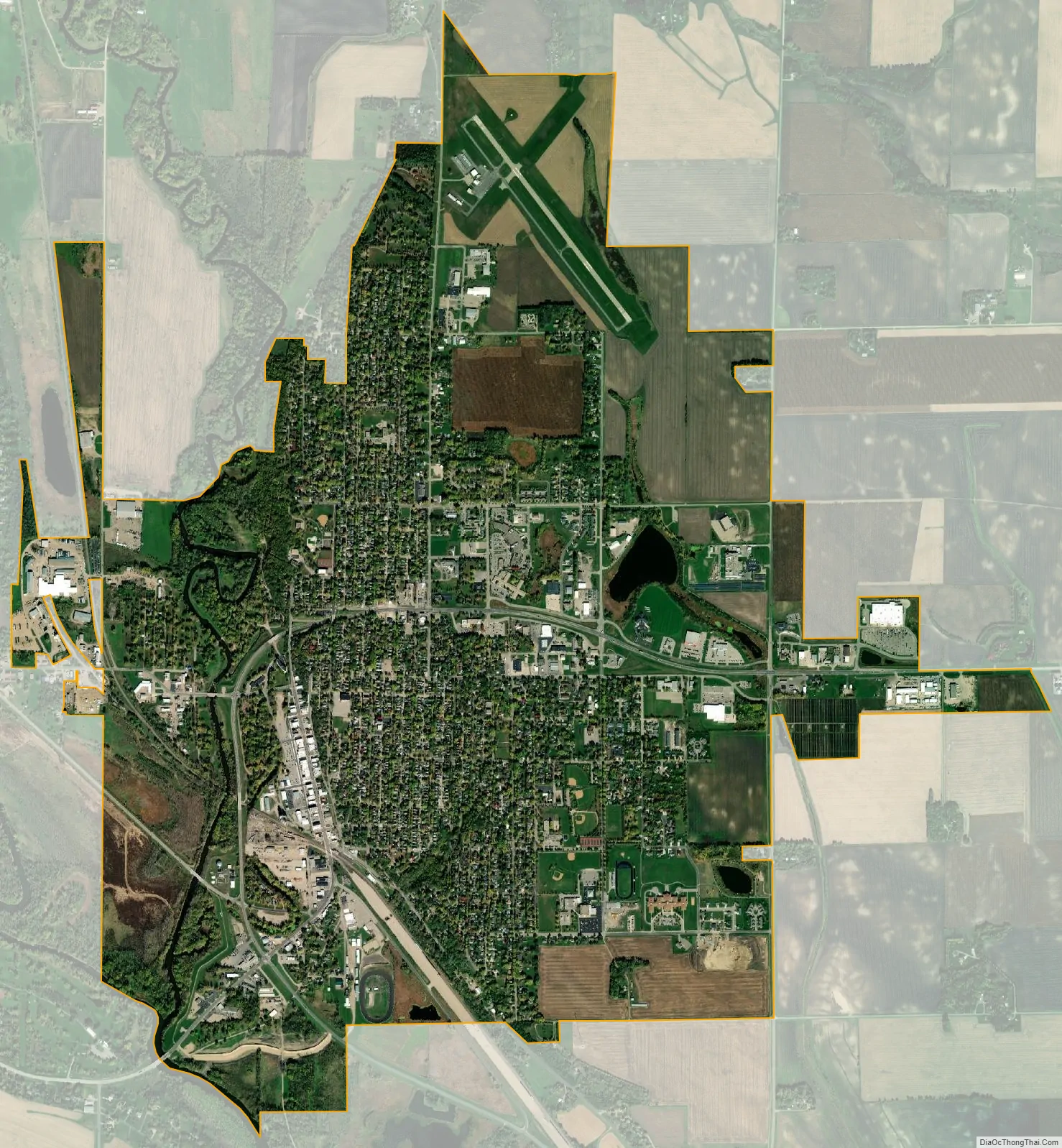
Montevideo city Satellite Map
Geography
Montevideo is in a double river valley where the Minnesota and Chippewa rivers converge, about 140 miles (230 km) west of Minneapolis, at the junction of U.S. Highways 59 and 212 with Minnesota State Highways 7 and 29.
The surrounding topography is dominated by farmland and prairies, as well as river valleys with many scenic overlooks and small bluffs.
According to the United States Census Bureau, the city has an area of 4.85 square miles (12.56 km), of which 4.76 square miles (12.33 km) is land and 0.09 square miles (0.23 km) is water.
See also
Map of Minnesota State and its subdivision:- Aitkin
- Anoka
- Becker
- Beltrami
- Benton
- Big Stone
- Blue Earth
- Brown
- Carlton
- Carver
- Cass
- Chippewa
- Chisago
- Clay
- Clearwater
- Cook
- Cottonwood
- Crow Wing
- Dakota
- Dodge
- Douglas
- Faribault
- Fillmore
- Freeborn
- Goodhue
- Grant
- Hennepin
- Houston
- Hubbard
- Isanti
- Itasca
- Jackson
- Kanabec
- Kandiyohi
- Kittson
- Koochiching
- Lac qui Parle
- Lake
- Lake of the Woods
- Lake Superior
- Le Sueur
- Lincoln
- Lyon
- Mahnomen
- Marshall
- Martin
- McLeod
- Meeker
- Mille Lacs
- Morrison
- Mower
- Murray
- Nicollet
- Nobles
- Norman
- Olmsted
- Otter Tail
- Pennington
- Pine
- Pipestone
- Polk
- Pope
- Ramsey
- Red Lake
- Redwood
- Renville
- Rice
- Rock
- Roseau
- Saint Louis
- Scott
- Sherburne
- Sibley
- Stearns
- Steele
- Stevens
- Swift
- Todd
- Traverse
- Wabasha
- Wadena
- Waseca
- Washington
- Watonwan
- Wilkin
- Winona
- Wright
- Yellow Medicine
- Alabama
- Alaska
- Arizona
- Arkansas
- California
- Colorado
- Connecticut
- Delaware
- District of Columbia
- Florida
- Georgia
- Hawaii
- Idaho
- Illinois
- Indiana
- Iowa
- Kansas
- Kentucky
- Louisiana
- Maine
- Maryland
- Massachusetts
- Michigan
- Minnesota
- Mississippi
- Missouri
- Montana
- Nebraska
- Nevada
- New Hampshire
- New Jersey
- New Mexico
- New York
- North Carolina
- North Dakota
- Ohio
- Oklahoma
- Oregon
- Pennsylvania
- Rhode Island
- South Carolina
- South Dakota
- Tennessee
- Texas
- Utah
- Vermont
- Virginia
- Washington
- West Virginia
- Wisconsin
- Wyoming