Morris is a city in and the county seat of Stevens County, Minnesota, United States. The population was 5,105 at the 2020 census.
Morris is surrounded by some of the nation’s richest agricultural land, and agribusiness is important to the local economy. Headquartered in Morris, Riverview LLP is Minnesota’s largest dairy milking operation and one of the largest in the nation. Other large economic contributors are beef feedlots and swine producers, manufacturing, education, and healthcare industries.
The town is home to the University of Minnesota Morris (UMM), part of the University of Minnesota system. It was established as a public college in 1960 on the grounds of a former industrial school for Native Americans. Today the campus has a population of approximately 1,900 and is ranked as a “Top 10 Public Liberal Arts College” by U.S. News & World Report and one of “America’s Top Colleges” by Forbes.
| Name: | Morris city |
|---|---|
| LSAD Code: | 25 |
| LSAD Description: | city (suffix) |
| State: | Minnesota |
| County: | Stevens County |
| Founded: | 1871 |
| Elevation: | 1,132 ft (345 m) |
| Total Area: | 4.90 sq mi (12.70 km²) |
| Land Area: | 4.70 sq mi (12.17 km²) |
| Water Area: | 0.20 sq mi (0.52 km²) |
| Total Population: | 5,105 |
| Population Density: | 1,086.40/sq mi (419.46/km²) |
| ZIP code: | 56267 |
| Area code: | 320 |
| FIPS code: | 2744242 |
| GNISfeature ID: | 0648116 |
| Website: | ci.morris.mn.us |
Online Interactive Map
Click on ![]() to view map in "full screen" mode.
to view map in "full screen" mode.
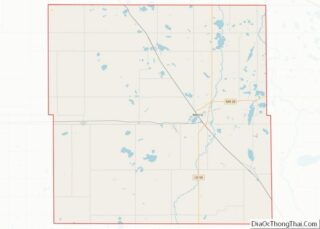
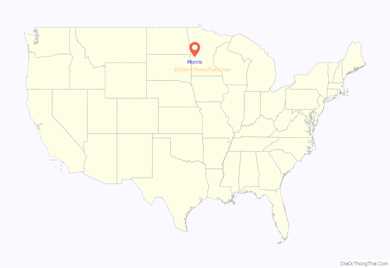
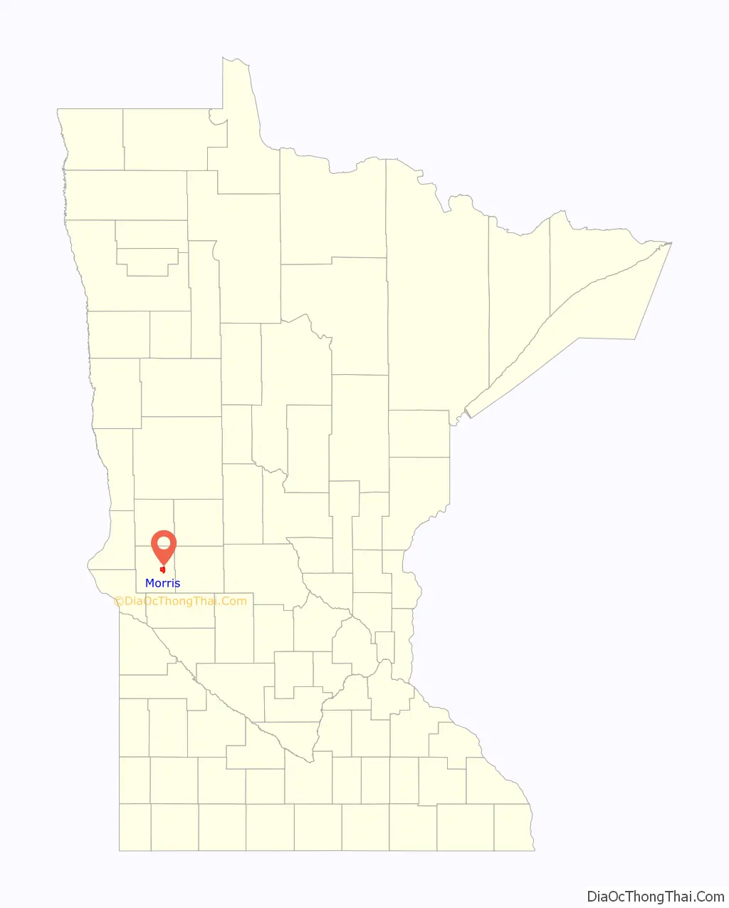
Morris location map. Where is Morris city?
History
Morris was platted in 1869 and named for Charles A. Morris, a railroad official. A post office has been in operation at Morris since 1871. It was incorporated as a city in 1902.
The federal government and state in the 19th century had programs to assimilate Native Americans to the majority culture. The Sisters of Mercy Roman Catholic order, led by Mary Joseph Lynch, established a boarding school for Indians in Morris, operating it from 1887 to 1896 under contract to the federal government. Initially, most students came from the Turtle Mountain Band of Chippewa Indians, which had many Catholic converts. The Morris Industrial School for Indians was to prepare students for jobs in the industrializing culture.
The federal government then appointed staff to manage the school into the early 20th century, before transferring it to the state. After the state took over the school in the early 20th century for general education, it taught agricultural topics. Agriculture has continued to be a major part of the economy. In 1909 the University of Minnesota established the West Central School of Agriculture (WCSA), and Morris closed.
When the state announced a phase-out plan for Morris and similar agricultural schools, a grassroots citizens’ movement convinced the state to establish a public college on the Morris campus. In the fall of 1960, the University of Minnesota Morris opened to students seeking a liberal arts education. It has been ranked a “Top 10 Public Liberal Arts College” by U.S. News & World Report and one of “America’s Top Colleges” by Forbes.
The city contains five properties listed on the National Register of Historic Places: the 1881 Lewis H. Stanton House, the 1899 Morris Industrial School for Indians Dormitory, the 1905 Morris Carnegie Library, and the early-20th-century West Central School of Agriculture and Experiment Station Historic District. Morris High School, begun in 1914, is also listed, even though it was demolished in 2013.
The 1975 Morris earthquake occurred on July 9, and was the state’s largest 20th-century earthquake, rated at 4.6 Mn. On June 4, 1993, another quake slightly shook the community. This one measured 4.1 in magnitude and was the third-largest earthquake in Minnesota in the 20th century.
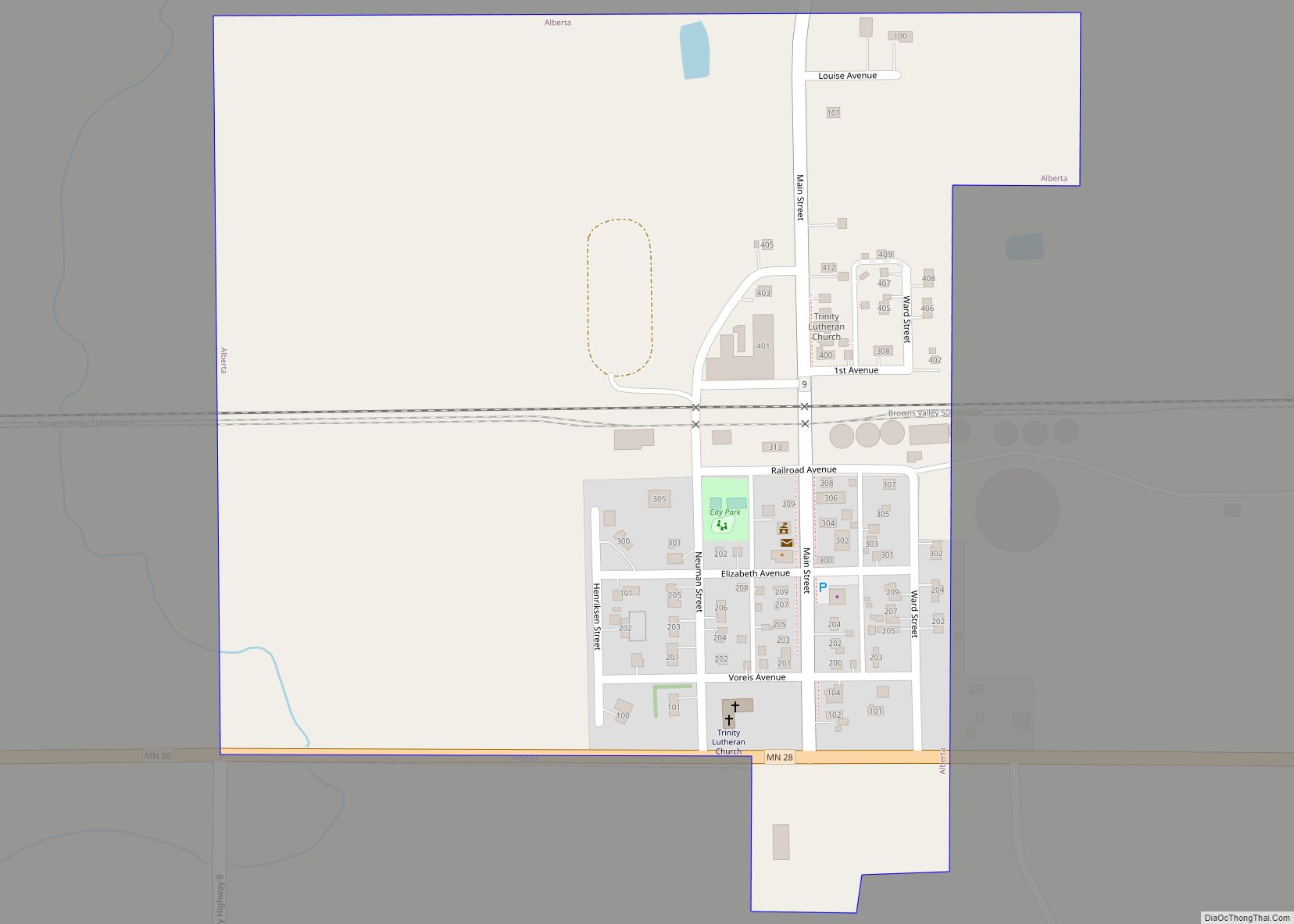
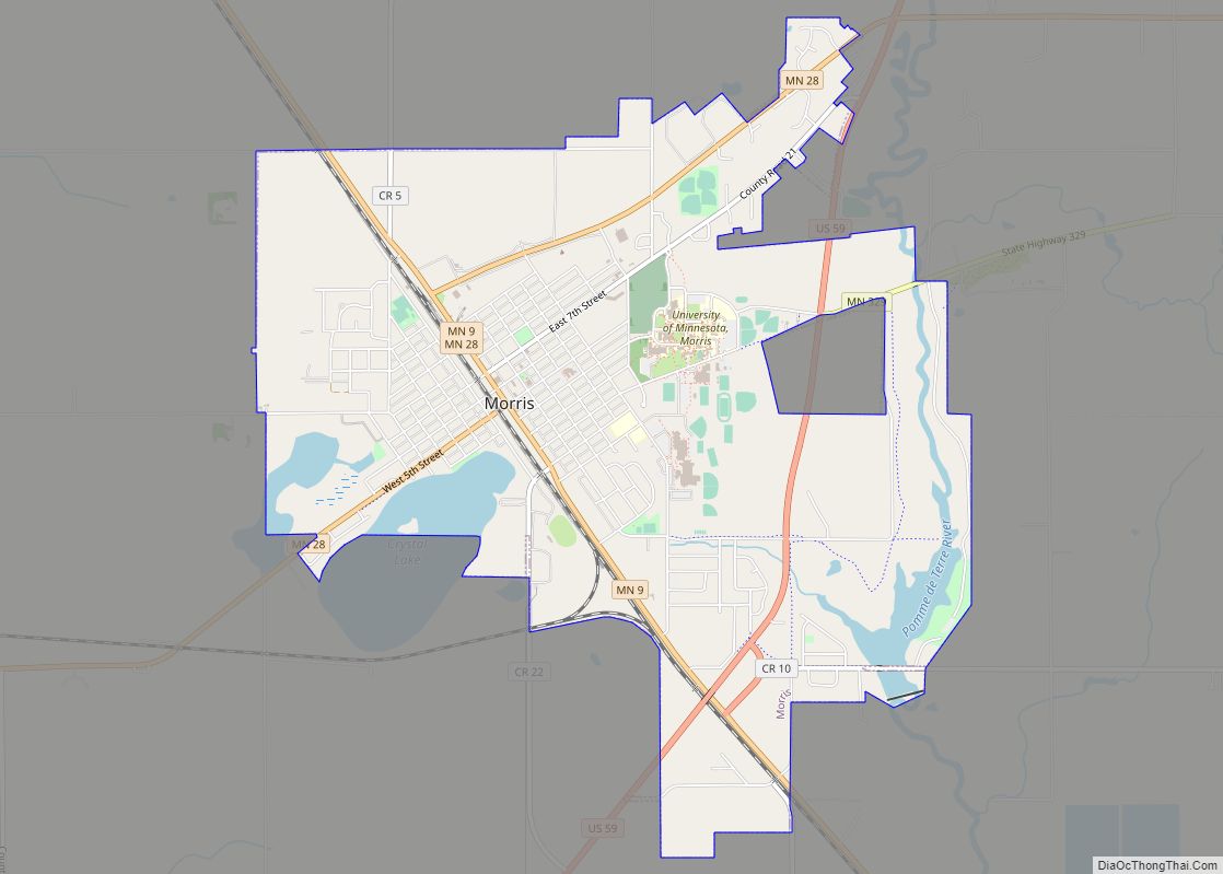
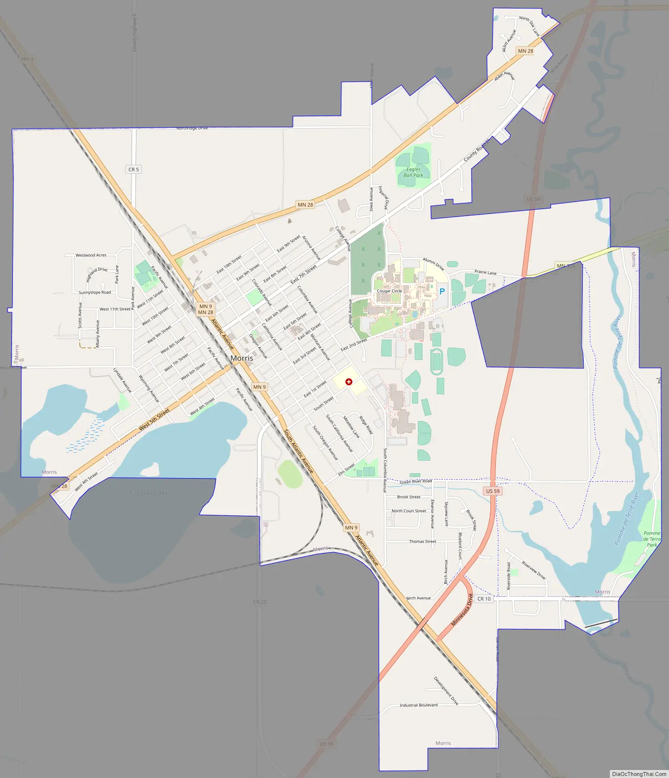
Morris Road Map
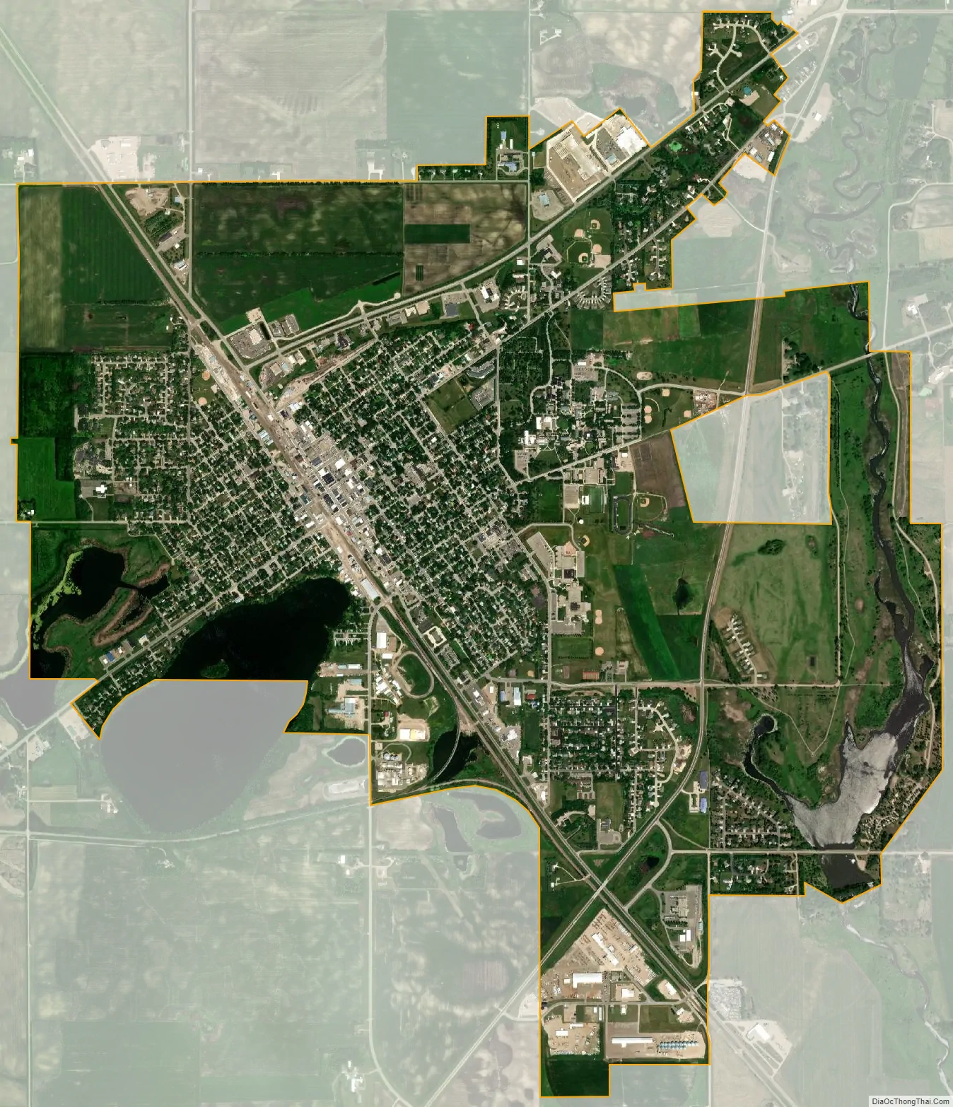
Morris city Satellite Map
Geography
According to the United States Census Bureau, Morris has an area of 5.02 square miles (13.00 km); 4.80 square miles (12.43 km) is land and 0.22 square miles (0.57 km) is water. Lake Crystal is in the southwestern part of town; the Pomme de Terre River flows through the town’s eastern extremity. U.S. Highway 59 and Minnesota State Highways 9 and 28 are three of the main routes in the town.
Climate
According to the Köppen Climate Classification system, Morris has a warm-summer humid continental climate, abbreviated “Dfb” on climate maps. The hottest temperature recorded in Morris was 109 °F (42.8 °C) on July 18, 1940, while the coldest temperature recorded was −41 °F (−40.6 °C) on February 16, 1936.
See also
Map of Minnesota State and its subdivision:- Aitkin
- Anoka
- Becker
- Beltrami
- Benton
- Big Stone
- Blue Earth
- Brown
- Carlton
- Carver
- Cass
- Chippewa
- Chisago
- Clay
- Clearwater
- Cook
- Cottonwood
- Crow Wing
- Dakota
- Dodge
- Douglas
- Faribault
- Fillmore
- Freeborn
- Goodhue
- Grant
- Hennepin
- Houston
- Hubbard
- Isanti
- Itasca
- Jackson
- Kanabec
- Kandiyohi
- Kittson
- Koochiching
- Lac qui Parle
- Lake
- Lake of the Woods
- Lake Superior
- Le Sueur
- Lincoln
- Lyon
- Mahnomen
- Marshall
- Martin
- McLeod
- Meeker
- Mille Lacs
- Morrison
- Mower
- Murray
- Nicollet
- Nobles
- Norman
- Olmsted
- Otter Tail
- Pennington
- Pine
- Pipestone
- Polk
- Pope
- Ramsey
- Red Lake
- Redwood
- Renville
- Rice
- Rock
- Roseau
- Saint Louis
- Scott
- Sherburne
- Sibley
- Stearns
- Steele
- Stevens
- Swift
- Todd
- Traverse
- Wabasha
- Wadena
- Waseca
- Washington
- Watonwan
- Wilkin
- Winona
- Wright
- Yellow Medicine
- Alabama
- Alaska
- Arizona
- Arkansas
- California
- Colorado
- Connecticut
- Delaware
- District of Columbia
- Florida
- Georgia
- Hawaii
- Idaho
- Illinois
- Indiana
- Iowa
- Kansas
- Kentucky
- Louisiana
- Maine
- Maryland
- Massachusetts
- Michigan
- Minnesota
- Mississippi
- Missouri
- Montana
- Nebraska
- Nevada
- New Hampshire
- New Jersey
- New Mexico
- New York
- North Carolina
- North Dakota
- Ohio
- Oklahoma
- Oregon
- Pennsylvania
- Rhode Island
- South Carolina
- South Dakota
- Tennessee
- Texas
- Utah
- Vermont
- Virginia
- Washington
- West Virginia
- Wisconsin
- Wyoming