Northome is a city located in the southwestern corner of Koochiching County, Minnesota, United States. The population was 155 at the 2020 census. The county seat is International Falls, about 70 miles (110 km) away.
U.S. Highway 71 and State Highways 1 and 46 meet in Northome.
| Name: | Northome city |
|---|---|
| LSAD Code: | 25 |
| LSAD Description: | city (suffix) |
| State: | Minnesota |
| County: | Koochiching County |
| Elevation: | 1,440 ft (439 m) |
| Total Area: | 1.76 sq mi (4.56 km²) |
| Land Area: | 1.46 sq mi (3.77 km²) |
| Water Area: | 0.30 sq mi (0.79 km²) |
| Total Population: | 155 |
| Population Density: | 106.38/sq mi (41.06/km²) |
| ZIP code: | 56661 |
| Area code: | 218 |
| FIPS code: | 2747122 |
| GNISfeature ID: | 0657633 |
| Website: | ci.northome.mn.us |
Online Interactive Map
Click on ![]() to view map in "full screen" mode.
to view map in "full screen" mode.
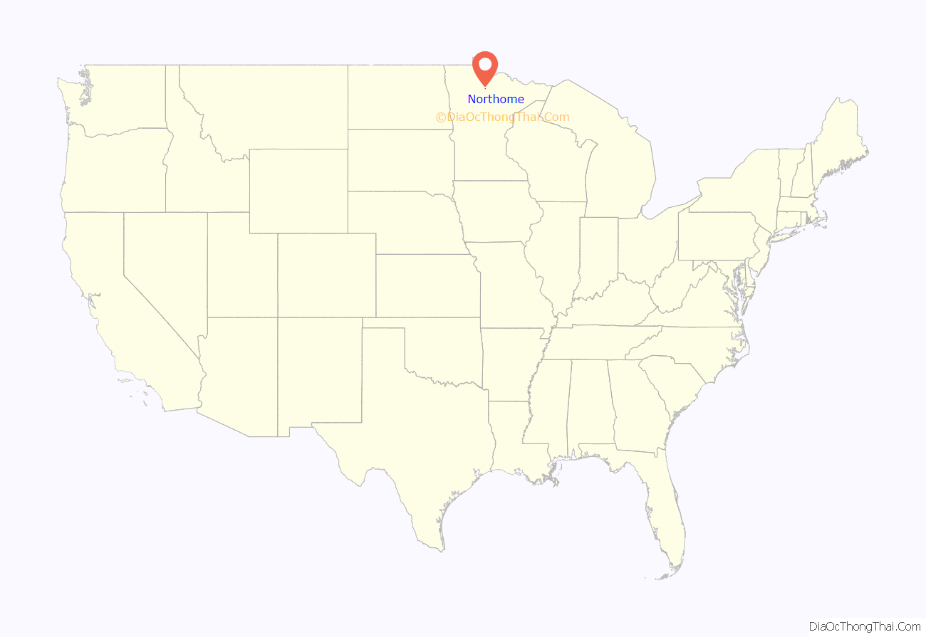
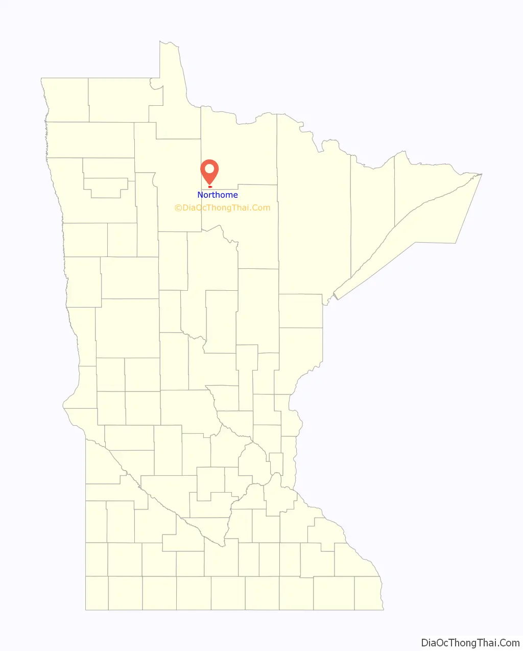
Northome location map. Where is Northome city?
History
Northome was founded in 1903 and enjoyed a boom time early in the 20th century as a logging town.
By the 1930s the big white and red pines were gone and pine trees were essentially locally extirpated due to the unsustainable logging practices of the time, and farming gained importance. Many farmers relocated here from the Dust Bowl conditions in the Dakotas at that time.
The Burlington Northern Railroad had a depot in Northome until the 1980s, although passenger service discontinued in 1960. Today the abandoned railroad bed forms the Blue Ox section of a large network of snowmobile trails.
It is possible that the name “Northome” is derived from the Norwegian place name “Norheim”, which is found in four places in Norway. The name literally means north home.
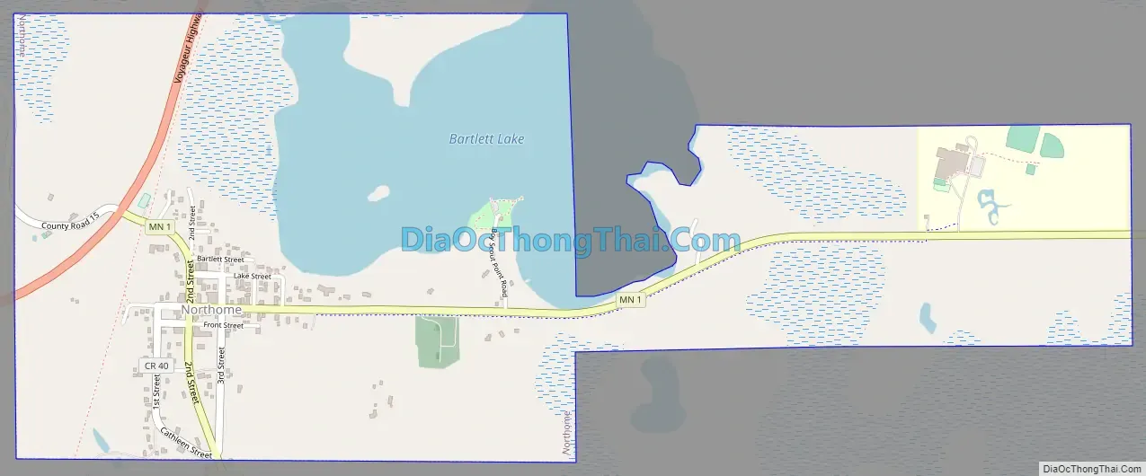
Northome Road Map
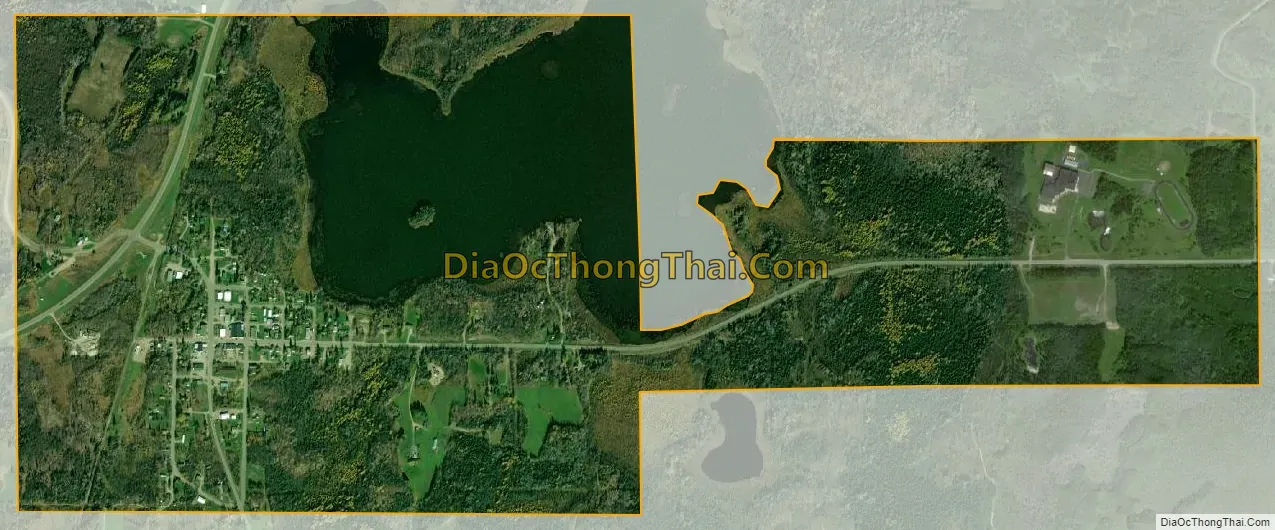
Northome city Satellite Map
Geography
According to the United States Census Bureau, the city has a total area of 1.90 square miles (4.92 km), of which 1.51 square miles (3.91 km) is land and 0.39 square miles (1.01 km) is water.
Northome is located at 47°52′19″N 94°16′48″W / 47.87194°N 94.28000°W / 47.87194; -94.28000 (47.871986, -94.280248).
There are named former townships around Northome (Bridgie, Englewood, Wildwood, etc.) but in Koochiching County all townships are unorganized. Therefore, for Census and other government purposes, the city of Northome also lends its name to the surrounding Unorganized Territory of Northome (approximately 300 square miles (800 km) of SW Koochiching County, excluding Northome and Mizpah, with 500 people in the 2000 census).
Economy
Important sources of employment in the area include the Northome School, independent resorts, logging and farming, and the Shining Light Cafe. The local newspaper was the Northome Record, produced from 1905 to 2007. Shortly after the Northome Record ceased the Northome Area News was created by a local family.
The nearest stop light is 40 miles away in Bemidji, the regional shopping hub.
Wildlife
The town is on the shores of Bartlett Lake; to the south is Island Lake, popular for fishing and swimming. The lake holds Northern Pike, crappie, perch, and Bull Head. Other smaller lakes are in the area as well, together supporting a variety of fish including walleye and northern pike. Unlike most of the rest of the Lower 48 states, timber wolves (the grey wolf) were never eradicated from this area, and wolves can still be heard at night, though rarely seen. Bald eagles and black bears are commonly sighted. There have also been occasional reports of cougar sightings. This area is in the southern part of the Taiga, or boreal forest, with a mix of quaking aspen (colloquially called popple), balsam fir, cedar and others, including some remaining white pine and Norway pine.
See also
Map of Minnesota State and its subdivision:- Aitkin
- Anoka
- Becker
- Beltrami
- Benton
- Big Stone
- Blue Earth
- Brown
- Carlton
- Carver
- Cass
- Chippewa
- Chisago
- Clay
- Clearwater
- Cook
- Cottonwood
- Crow Wing
- Dakota
- Dodge
- Douglas
- Faribault
- Fillmore
- Freeborn
- Goodhue
- Grant
- Hennepin
- Houston
- Hubbard
- Isanti
- Itasca
- Jackson
- Kanabec
- Kandiyohi
- Kittson
- Koochiching
- Lac qui Parle
- Lake
- Lake of the Woods
- Lake Superior
- Le Sueur
- Lincoln
- Lyon
- Mahnomen
- Marshall
- Martin
- McLeod
- Meeker
- Mille Lacs
- Morrison
- Mower
- Murray
- Nicollet
- Nobles
- Norman
- Olmsted
- Otter Tail
- Pennington
- Pine
- Pipestone
- Polk
- Pope
- Ramsey
- Red Lake
- Redwood
- Renville
- Rice
- Rock
- Roseau
- Saint Louis
- Scott
- Sherburne
- Sibley
- Stearns
- Steele
- Stevens
- Swift
- Todd
- Traverse
- Wabasha
- Wadena
- Waseca
- Washington
- Watonwan
- Wilkin
- Winona
- Wright
- Yellow Medicine
- Alabama
- Alaska
- Arizona
- Arkansas
- California
- Colorado
- Connecticut
- Delaware
- District of Columbia
- Florida
- Georgia
- Hawaii
- Idaho
- Illinois
- Indiana
- Iowa
- Kansas
- Kentucky
- Louisiana
- Maine
- Maryland
- Massachusetts
- Michigan
- Minnesota
- Mississippi
- Missouri
- Montana
- Nebraska
- Nevada
- New Hampshire
- New Jersey
- New Mexico
- New York
- North Carolina
- North Dakota
- Ohio
- Oklahoma
- Oregon
- Pennsylvania
- Rhode Island
- South Carolina
- South Dakota
- Tennessee
- Texas
- Utah
- Vermont
- Virginia
- Washington
- West Virginia
- Wisconsin
- Wyoming


