Owatonna (/ˌoʊwəˈtɒnə/ OH-wə-TON-ə) is a city in Steele County, Minnesota, United States. The population was 26,420 at the 2020 census. It is the county seat of Steele County. Owatonna is home to the Steele County Fairgrounds, which hosts the Steele County Free Fair in August.
Interstate 35 and U.S. Highways 14, and 218 are three of the main routes in the city.
| Name: | Owatonna city |
|---|---|
| LSAD Code: | 25 |
| LSAD Description: | city (suffix) |
| State: | Minnesota |
| County: | Steele County |
| Elevation: | 1,152 ft (351 m) |
| Total Area: | 15.20 sq mi (39.36 km²) |
| Land Area: | 15.11 sq mi (39.14 km²) |
| Water Area: | 0.09 sq mi (0.22 km²) |
| Total Population: | 26,420 |
| Population Density: | 1,748.16/sq mi (674.98/km²) |
| ZIP code: | 55060 |
| Area code: | 507 |
| FIPS code: | 2749300 |
| GNISfeature ID: | 0649095 |
| Website: | owatonna.gov |
Online Interactive Map
Click on ![]() to view map in "full screen" mode.
to view map in "full screen" mode.
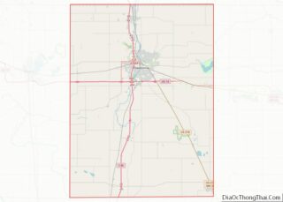
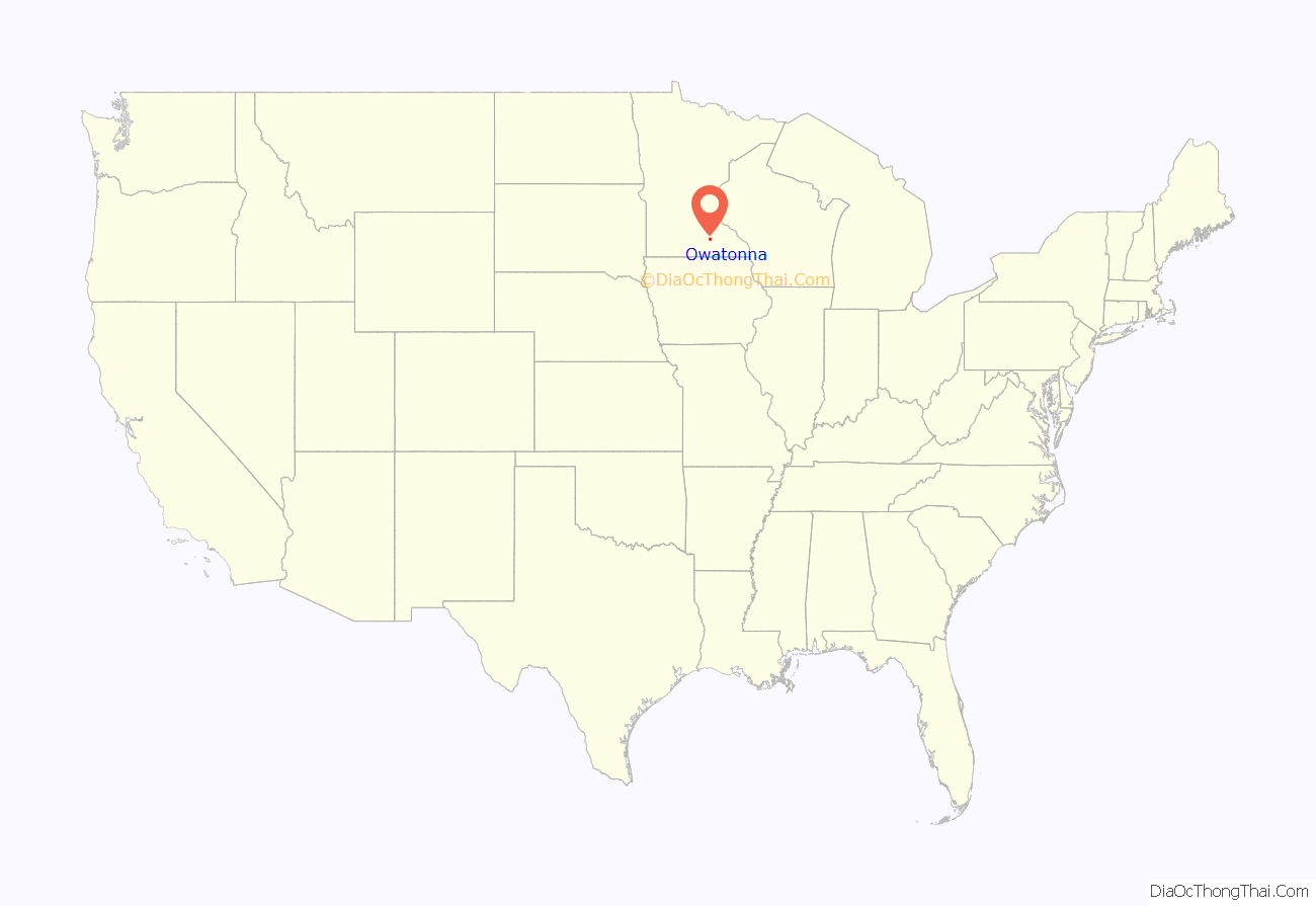
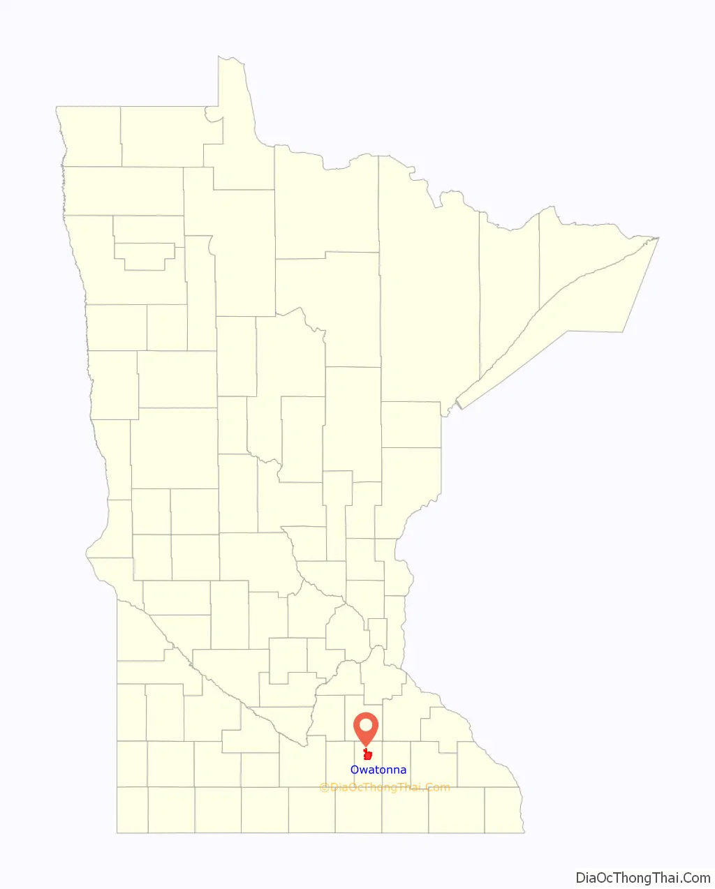
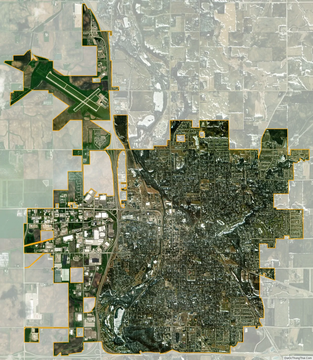
Owatonna location map. Where is Owatonna city?
History
Owatonna was first settled in 1853 around the Straight River. The community was named after the Straight River, which in the Dakota language is Wakpá Owóthaŋna. A popular, but apocryphal, story is that the town is named after “Princess Owatonna”, the daughter of local Native American Chief Wadena who was supposedly healed by a nearby spring’s magic waters, which were said to be rich in iron and sulfur. The earliest the Owatonna area was settled was in 1854. It was platted in September 1855, incorporated as a town on August 9, 1858, and as a city on February 23, 1865.
In 1856, Josef Karel Kaplan emigrated from the village of Dlouhá Třebová, southeast of Prague, Bohemia (now the Czech Republic), and selected a quarter section [160 acres (65 ha)] of land near the town of Owatonna. Kaplan described Owatonna as having just 50 small homes, but predicted 100 within a year, along with a railroad. With just four stores and a pharmacy, Owatonna quickly prospered and grew to 1,500 inhabitants in just 5 years. Kaplan wrote about the Owatonna area in letters donated to the Minnesota Historical Society. In them, he described often seeing the indigenous people with “tough constitutions…brown skin and good dispositions”, adding: “When you read about battles between whites and Indians, it is the whites who are to blame.” In 1866, Kaplan helped organize the Catholic cemetery, and a year later, the Bohemian National Cemetery of Owatonna.
Kaplan’s Woods is part of the land originally owned by Josef Kaplan, and later Victor and Anna Kaplan. The State of Minnesota created Kaplan’s Wood State Park, which was later transferred to the City of Owatonna. The Kaplan’s Woods Parkway contains over 6 miles (10 km) of hiking and cross country skiing trails, and nearly 2 miles (3 km) of hard-surfaced, handicapped-accessible trail. The parkway includes Lake Kohlmier, a 35-acre (14 ha) lake.
The Minnesota State Public School for Dependent and Neglected Children was built in 1886. The school took in orphans from around the state and taught them “the value of drill, discipline, and labor.” The children who died in the institution were interred in the Children’s Cemetery behind the school. In 1945, the orphanage closed and in 1947 the State Public School was officially abolished and all its lands, buildings, property, and funds were transferred to the newly established the Owatonna State School, which provided academic and vocational training for the developmentally disabled. The Owatonna State School was closed June 30, 1970. In 1974, the City purchased the compound for its office space. Renamed “West Hills,” it continues to serve as the City’s administration complex and home to many nonprofit civic organizations including a senior activity center, the Owatonna Arts Center, two nonprofit daycare centers, a chemical dependency halfway house, and Big Brothers/Big Sisters, among others.
In July 2008, a Raytheon Hawker 800 corporate jet crashed near Owatonna, resulting in eight deaths.
On October 31, 2010, Owl City’s Adam Young held a hometown concert in the Owatonna Senior High School gym.
On November 3, 2015, the Owatonna Public School District passed a bond referendum to fund school facilities improvements focusing on deferred maintenance, safety, and Elementary school crowding. As a result, the school district received $77.9 million to repair all buildings, replace out-of-date equipment, update security in all seven public school buildings, switch the use for two school buildings, and reconfigure grades from K-5, 6, 7-8, 9-12 to K-5, 6-8, 9-12. All facility changes and projects were completed by September 2018.
The Steele County Historical Society “preserves Steele County’s past, shares the county’s stories, and connects people with history in meaningful ways, for today and for tomorrow.” Established in 1949 to preserve the history of Steele County, it has become one of the largest and most prestigious historical societies in the state. In 1962, the Society permanently leased part of the southeast section of the fairgrounds to begin a pioneer village, the Village of Yesteryear, which has grown in the years since through the additional move of historic structures, as well as museum buildings built on site.
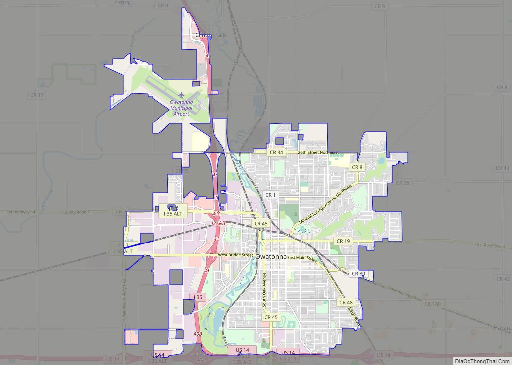
Owatonna Road Map
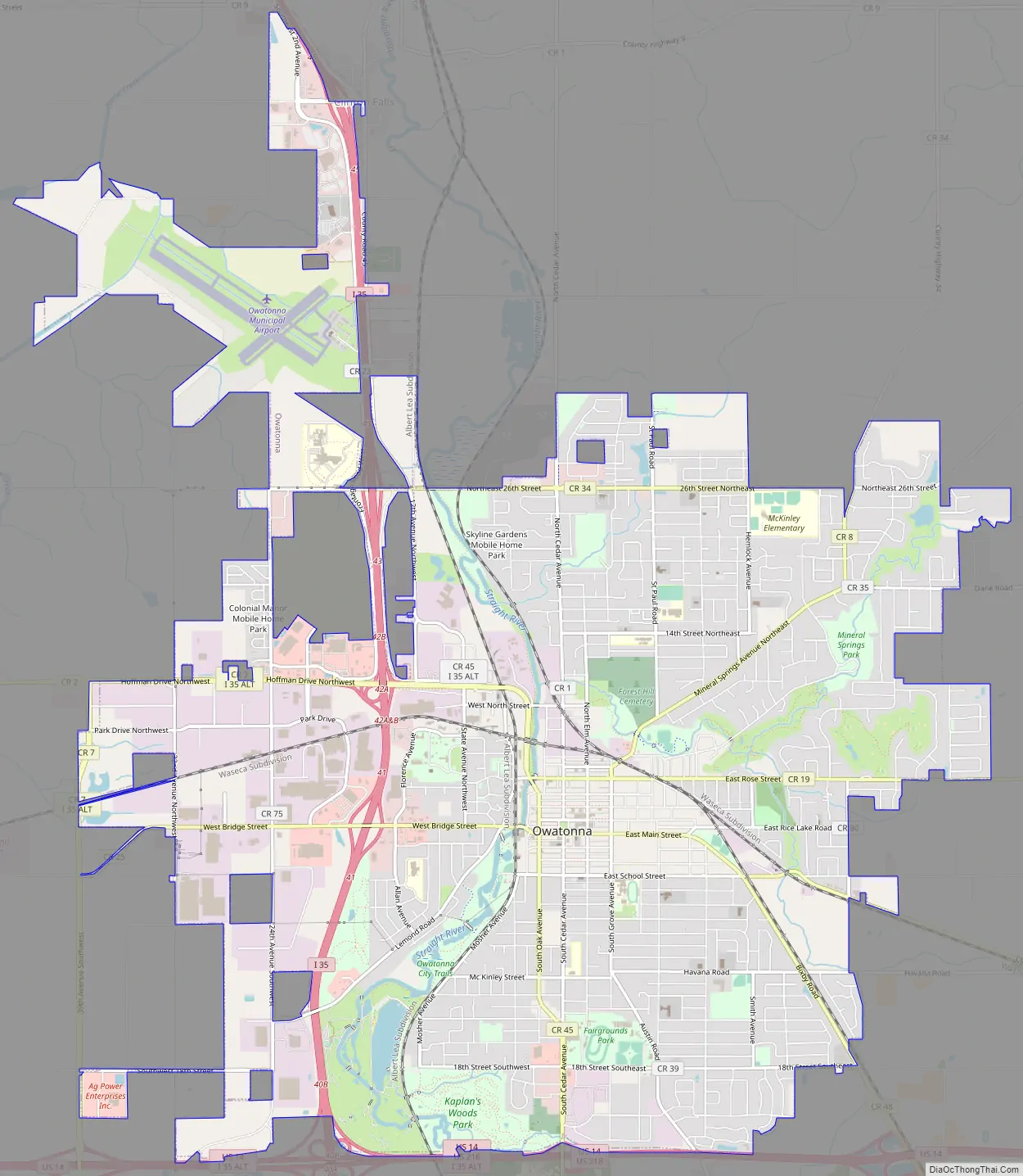
Owatonna city Satellite Map
Geography
According to the United States Census Bureau, the city has an area of 14.62 square miles (37.87 km); 14.53 square miles (37.63 km) is land and 0.09 square miles (0.23 km) is water. The oldest part of the city (including the downtown area) is on a low-lying area on the eastern bank of the Straight River, extending towards the south from Maple Creek. The city has grown in all directions, and now lies on both sides of the river, as well as above the ridge north of Maple Creek. Significant growth in recent years has occurred to the northeast, where homes have been built along the ravine of Maple Creek as well as alongside Brooktree Golf Course, to the north, and to the southeast. Geographical landmarks of note include Kaplan’s Woods, a hardwood nature preserve on the southern border of the city; Cinder Hill, a steep 60-foot hill on Linn Avenue overlooking downtown that local athletes use for training; the Straight River dam, originally used to power a mill and now reconstructed to include a fish ladder; and the Forest Hill Cemetery, an old wooded cemetery on the ridge north of Maple Creek that marks the boundary between the oldest parts of the city and more recent developments.
Record rainfall events from September 22 to 24, 2010, caused flooding of the Straight River and Maple Creek in and near Owatonna, with developments in the floodplains of both streams completely inundated.
Climate
See also
Map of Minnesota State and its subdivision:- Aitkin
- Anoka
- Becker
- Beltrami
- Benton
- Big Stone
- Blue Earth
- Brown
- Carlton
- Carver
- Cass
- Chippewa
- Chisago
- Clay
- Clearwater
- Cook
- Cottonwood
- Crow Wing
- Dakota
- Dodge
- Douglas
- Faribault
- Fillmore
- Freeborn
- Goodhue
- Grant
- Hennepin
- Houston
- Hubbard
- Isanti
- Itasca
- Jackson
- Kanabec
- Kandiyohi
- Kittson
- Koochiching
- Lac qui Parle
- Lake
- Lake of the Woods
- Lake Superior
- Le Sueur
- Lincoln
- Lyon
- Mahnomen
- Marshall
- Martin
- McLeod
- Meeker
- Mille Lacs
- Morrison
- Mower
- Murray
- Nicollet
- Nobles
- Norman
- Olmsted
- Otter Tail
- Pennington
- Pine
- Pipestone
- Polk
- Pope
- Ramsey
- Red Lake
- Redwood
- Renville
- Rice
- Rock
- Roseau
- Saint Louis
- Scott
- Sherburne
- Sibley
- Stearns
- Steele
- Stevens
- Swift
- Todd
- Traverse
- Wabasha
- Wadena
- Waseca
- Washington
- Watonwan
- Wilkin
- Winona
- Wright
- Yellow Medicine
- Alabama
- Alaska
- Arizona
- Arkansas
- California
- Colorado
- Connecticut
- Delaware
- District of Columbia
- Florida
- Georgia
- Hawaii
- Idaho
- Illinois
- Indiana
- Iowa
- Kansas
- Kentucky
- Louisiana
- Maine
- Maryland
- Massachusetts
- Michigan
- Minnesota
- Mississippi
- Missouri
- Montana
- Nebraska
- Nevada
- New Hampshire
- New Jersey
- New Mexico
- New York
- North Carolina
- North Dakota
- Ohio
- Oklahoma
- Oregon
- Pennsylvania
- Rhode Island
- South Carolina
- South Dakota
- Tennessee
- Texas
- Utah
- Vermont
- Virginia
- Washington
- West Virginia
- Wisconsin
- Wyoming