Roseau (/roʊˈzoʊ/) (pronounced row – zo) is a city in, and the county seat of, Roseau County, Minnesota. Its population was 2,744 at the time of the 2020 census.
| Name: | Roseau city |
|---|---|
| LSAD Code: | 25 |
| LSAD Description: | city (suffix) |
| State: | Minnesota |
| County: | Roseau County |
| Elevation: | 1,047 ft (319 m) |
| Total Area: | 2.67 sq mi (6.92 km²) |
| Land Area: | 2.67 sq mi (6.92 km²) |
| Water Area: | 0.00 sq mi (0.00 km²) |
| Total Population: | 2,744 |
| Population Density: | 1,026.56/sq mi (396.34/km²) |
| ZIP code: | 56751 |
| Area code: | 218 |
| FIPS code: | 2755546 |
| GNISfeature ID: | 0650278 |
| Website: | city.roseau.mn.us |
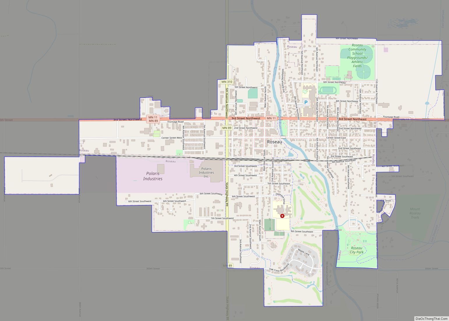
Online Interactive Map
Click on ![]() to view map in "full screen" mode.
to view map in "full screen" mode.
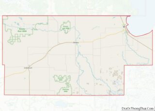
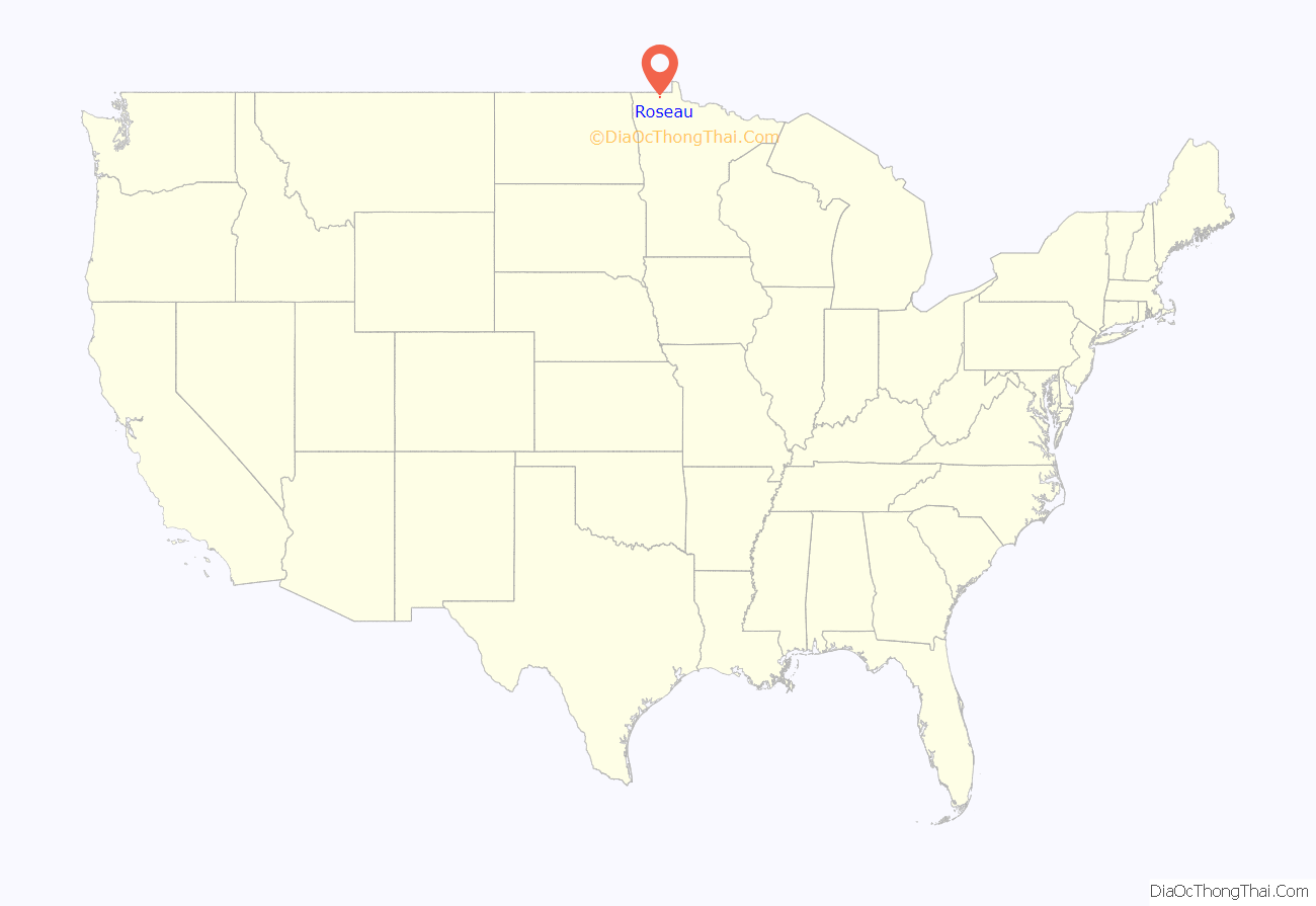
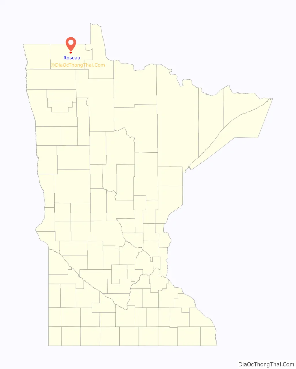
Roseau location map. Where is Roseau city?
History
A post office called Roseau has been in operation since 1895. The city took its name from the nearby Roseau River.
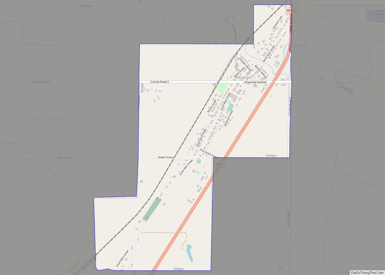
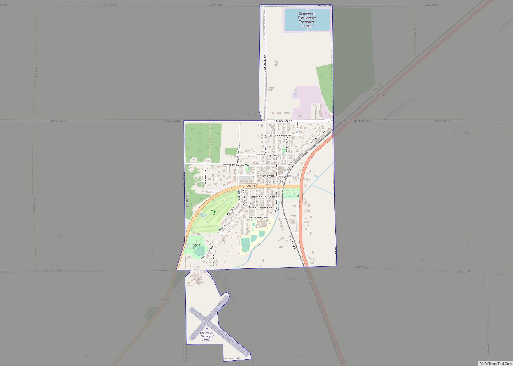
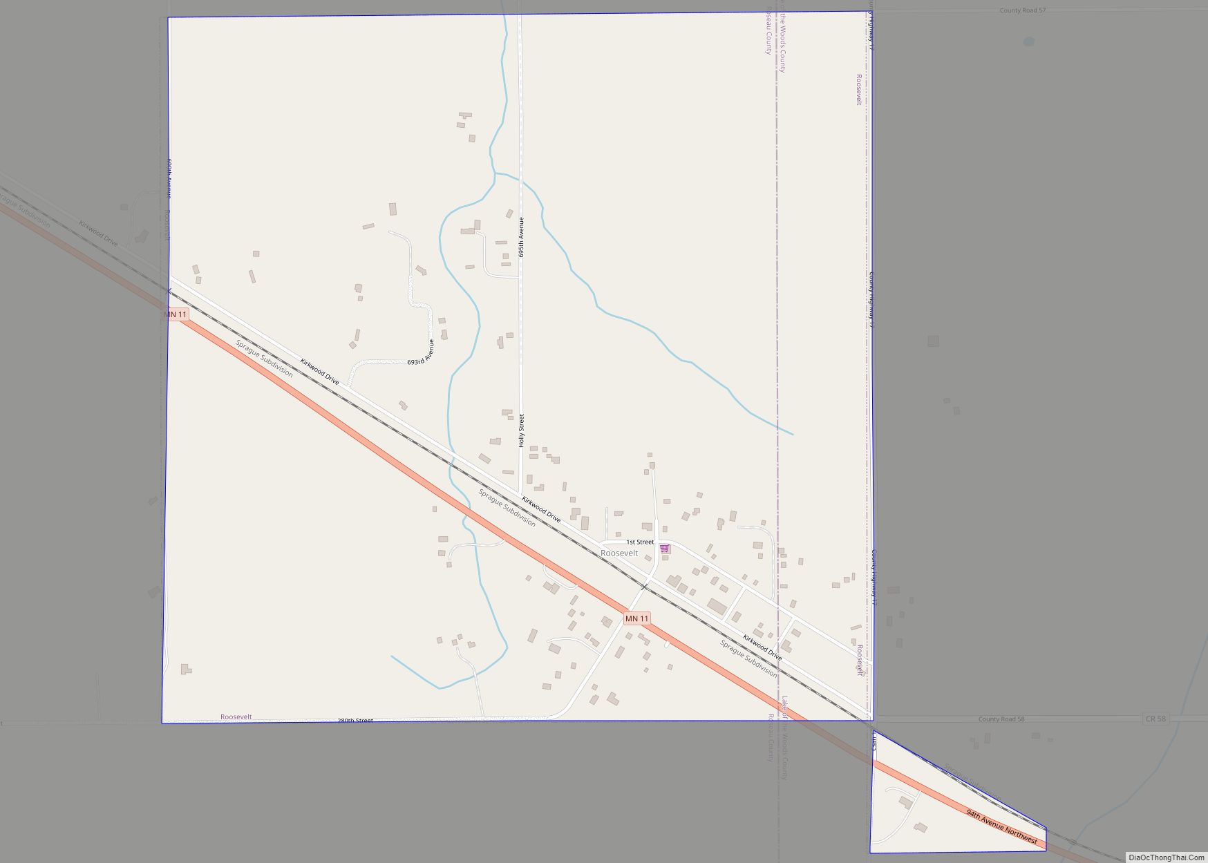
Roseau Road Map

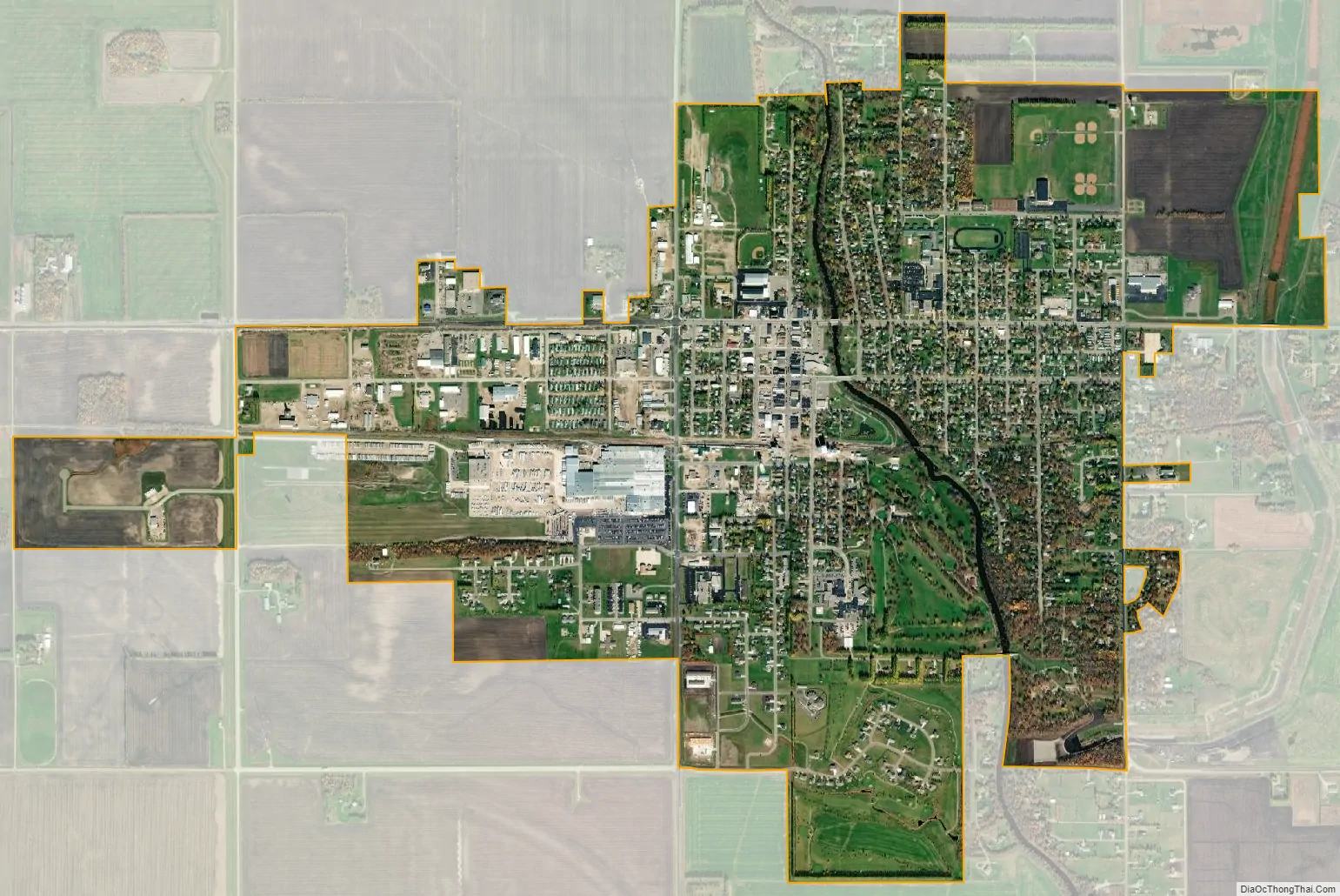
Roseau city Satellite Map
Geography
According to the United States Census Bureau, the city has a total area of 2.67 square miles (6.92 km), all land.
Hayes Lake State Park is nearby.
Climate
Roseau has a humid continental climate (Köppen climate classification Dfb) with warm summers and severely cold winters. Precipitation is significantly higher in summer than at other times of the year.
See also
Map of Minnesota State and its subdivision:- Aitkin
- Anoka
- Becker
- Beltrami
- Benton
- Big Stone
- Blue Earth
- Brown
- Carlton
- Carver
- Cass
- Chippewa
- Chisago
- Clay
- Clearwater
- Cook
- Cottonwood
- Crow Wing
- Dakota
- Dodge
- Douglas
- Faribault
- Fillmore
- Freeborn
- Goodhue
- Grant
- Hennepin
- Houston
- Hubbard
- Isanti
- Itasca
- Jackson
- Kanabec
- Kandiyohi
- Kittson
- Koochiching
- Lac qui Parle
- Lake
- Lake of the Woods
- Lake Superior
- Le Sueur
- Lincoln
- Lyon
- Mahnomen
- Marshall
- Martin
- McLeod
- Meeker
- Mille Lacs
- Morrison
- Mower
- Murray
- Nicollet
- Nobles
- Norman
- Olmsted
- Otter Tail
- Pennington
- Pine
- Pipestone
- Polk
- Pope
- Ramsey
- Red Lake
- Redwood
- Renville
- Rice
- Rock
- Roseau
- Saint Louis
- Scott
- Sherburne
- Sibley
- Stearns
- Steele
- Stevens
- Swift
- Todd
- Traverse
- Wabasha
- Wadena
- Waseca
- Washington
- Watonwan
- Wilkin
- Winona
- Wright
- Yellow Medicine
- Alabama
- Alaska
- Arizona
- Arkansas
- California
- Colorado
- Connecticut
- Delaware
- District of Columbia
- Florida
- Georgia
- Hawaii
- Idaho
- Illinois
- Indiana
- Iowa
- Kansas
- Kentucky
- Louisiana
- Maine
- Maryland
- Massachusetts
- Michigan
- Minnesota
- Mississippi
- Missouri
- Montana
- Nebraska
- Nevada
- New Hampshire
- New Jersey
- New Mexico
- New York
- North Carolina
- North Dakota
- Ohio
- Oklahoma
- Oregon
- Pennsylvania
- Rhode Island
- South Carolina
- South Dakota
- Tennessee
- Texas
- Utah
- Vermont
- Virginia
- Washington
- West Virginia
- Wisconsin
- Wyoming