Round Lake is a city in Nobles County, Minnesota, United States. The population was 376 at the 2010 census.
| Name: | Round Lake city |
|---|---|
| LSAD Code: | 25 |
| LSAD Description: | city (suffix) |
| State: | Minnesota |
| County: | Nobles County |
| Elevation: | 1,555 ft (474 m) |
| Total Area: | 0.73 sq mi (1.89 km²) |
| Land Area: | 0.72 sq mi (1.88 km²) |
| Water Area: | 0.01 sq mi (0.01 km²) |
| Total Population: | 377 |
| Population Density: | 520.00/sq mi (200.69/km²) |
| ZIP code: | 56167 |
| Area code: | 507 |
| FIPS code: | 2756086 |
| GNISfeature ID: | 0650354 |
| Website: | roundlk.net |
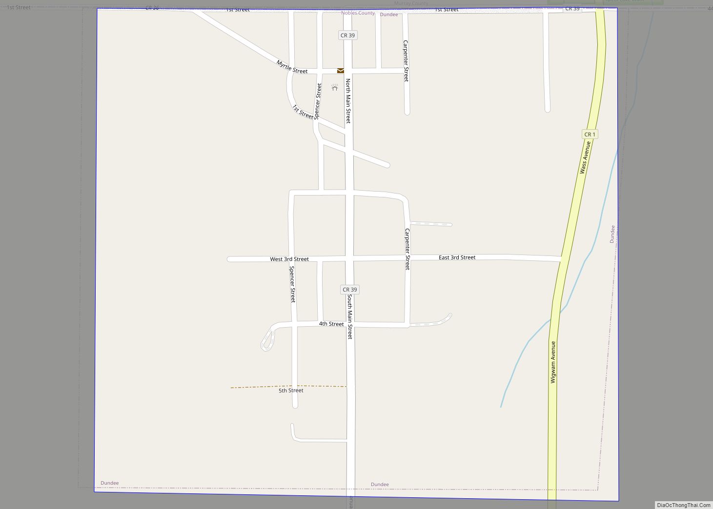
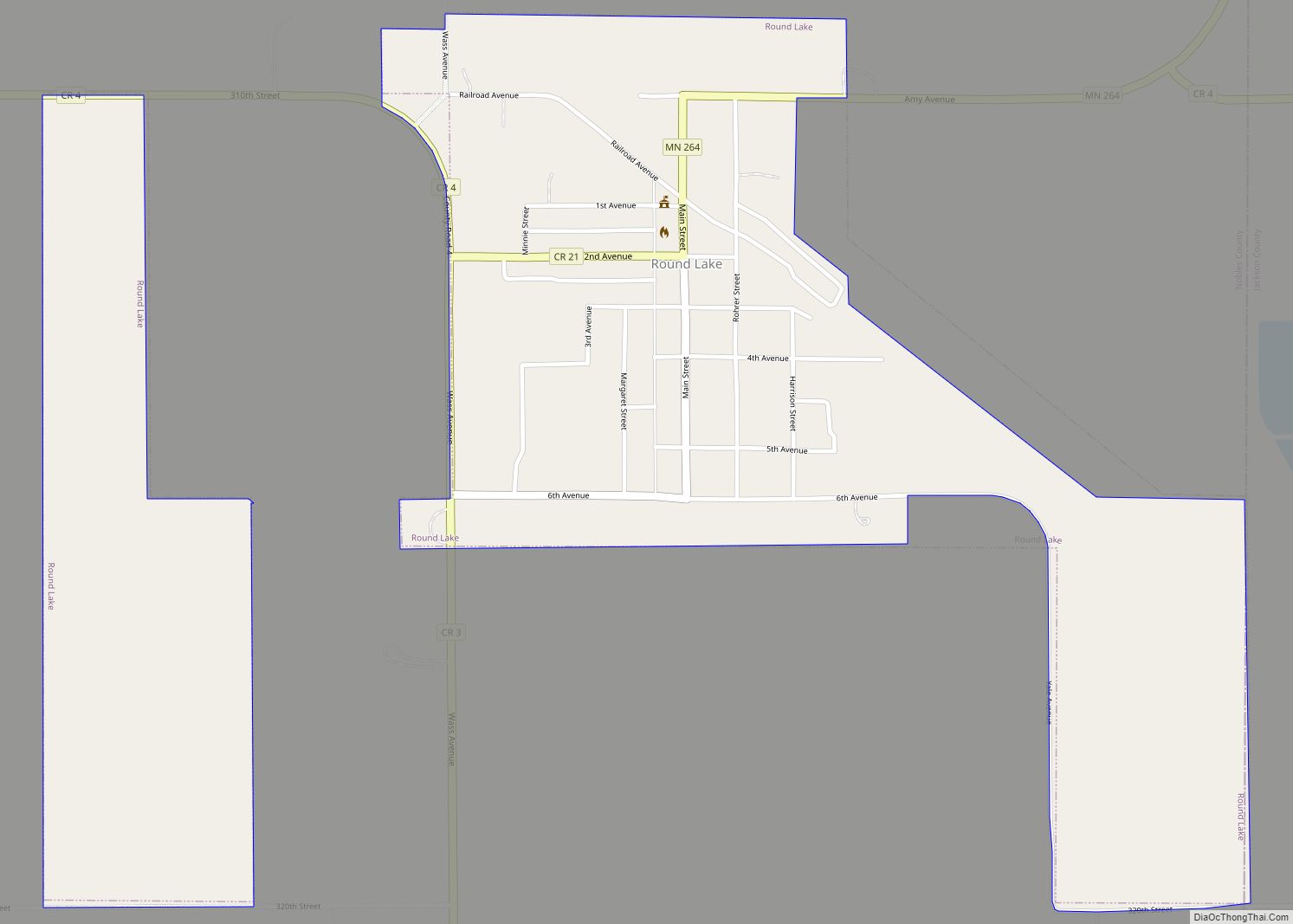
Online Interactive Map
Click on ![]() to view map in "full screen" mode.
to view map in "full screen" mode.
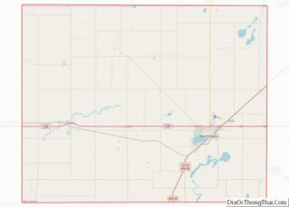
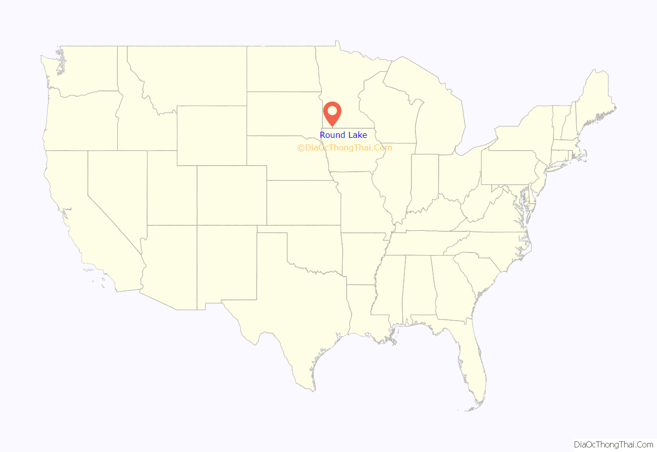
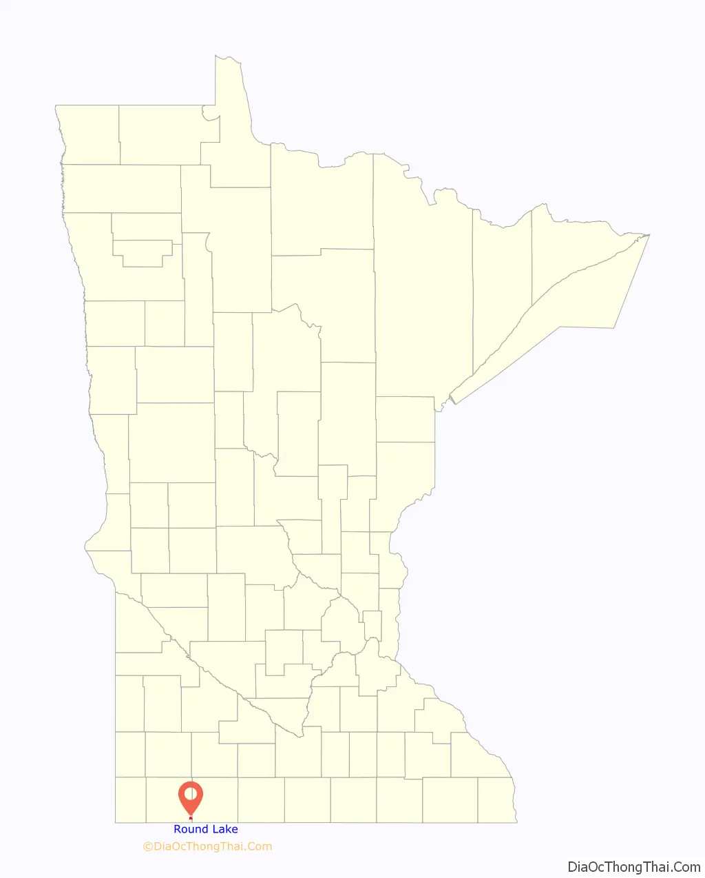
Round Lake location map. Where is Round Lake city?
History
Founding of Round Lake: Round Lake was established in 1882 when the Burlington Railroad built a line connecting Lake Park, Iowa, to Worthington, Minnesota. A site for a railroad station was chosen in fall of 1882, and the initial choice of name was Indian Lake, after the township in which it was located. However, a wealthy Chicago Board of Trade operator named Mr. O. H. Roche donated 20 acres (81,000 m) of land for a townsite, and it was his wish that it be called Round Lake. Mr. Roche owned nearly 2,000 acres (8.1 km) of land on nearby Round Lake in Jackson County, and he was apparently fond of the name Round Lake. A town was platted in December 1882 and the site was divided into 100 lots, not one of which were sold. Only two buildings were built in that first year, and both were constructed by the railroad. The railroad section foreman and his crew were the only residents of the new town, until October 1883 when E. A. Tripp came to town to assume duties as station agent. A post office named Indian Lake was established in March 1884, and Mr. Tripp became the postmaster. When another post office with the name Round Lake (located on Round Lake in Jackson County) was closed, the post office in the town of Round Lake assumed the name of that town. A few businesses moved to town, but by 1887, the town had a mere 34 residents. In 1889, the town was re-platted, correcting some legal issues with the original plat, and real growth began. Nine years later, Round Lake boasted numerous businesses, a bank, a newspaper, and 179 residents. Residents voted to incorporate the town, and on October 11, 1898, the first election was held, and town government began under President A. F. Diehn. A new $2,000 school was erected at this time.
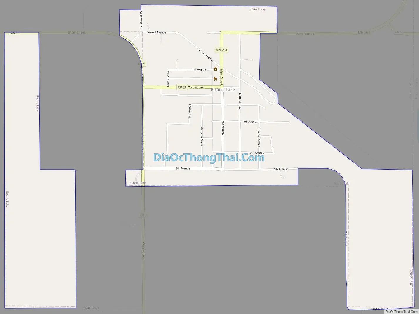
Round Lake Road Map
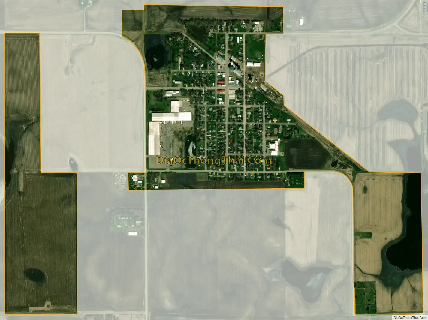
Round Lake city Satellite Map
Geography
According to the United States Census Bureau, the city has a total area of 1.04 square miles (2.69 km), of which 1.03 square miles (2.67 km) is land and 0.01 square miles (0.03 km) is water. A lake, also called Round Lake, is just outside the city to the northeast. The town of Round Lake is located in the extreme southeast corner of Nobles County. It lies one-half miles west of the Jackson County line, and two miles (3 km) north of Iowa.
Main highways include:
- Minnesota State Highway 264
- Nobles County Road 1
- Nobles County Road 3
See also
Map of Minnesota State and its subdivision:- Aitkin
- Anoka
- Becker
- Beltrami
- Benton
- Big Stone
- Blue Earth
- Brown
- Carlton
- Carver
- Cass
- Chippewa
- Chisago
- Clay
- Clearwater
- Cook
- Cottonwood
- Crow Wing
- Dakota
- Dodge
- Douglas
- Faribault
- Fillmore
- Freeborn
- Goodhue
- Grant
- Hennepin
- Houston
- Hubbard
- Isanti
- Itasca
- Jackson
- Kanabec
- Kandiyohi
- Kittson
- Koochiching
- Lac qui Parle
- Lake
- Lake of the Woods
- Lake Superior
- Le Sueur
- Lincoln
- Lyon
- Mahnomen
- Marshall
- Martin
- McLeod
- Meeker
- Mille Lacs
- Morrison
- Mower
- Murray
- Nicollet
- Nobles
- Norman
- Olmsted
- Otter Tail
- Pennington
- Pine
- Pipestone
- Polk
- Pope
- Ramsey
- Red Lake
- Redwood
- Renville
- Rice
- Rock
- Roseau
- Saint Louis
- Scott
- Sherburne
- Sibley
- Stearns
- Steele
- Stevens
- Swift
- Todd
- Traverse
- Wabasha
- Wadena
- Waseca
- Washington
- Watonwan
- Wilkin
- Winona
- Wright
- Yellow Medicine
- Alabama
- Alaska
- Arizona
- Arkansas
- California
- Colorado
- Connecticut
- Delaware
- District of Columbia
- Florida
- Georgia
- Hawaii
- Idaho
- Illinois
- Indiana
- Iowa
- Kansas
- Kentucky
- Louisiana
- Maine
- Maryland
- Massachusetts
- Michigan
- Minnesota
- Mississippi
- Missouri
- Montana
- Nebraska
- Nevada
- New Hampshire
- New Jersey
- New Mexico
- New York
- North Carolina
- North Dakota
- Ohio
- Oklahoma
- Oregon
- Pennsylvania
- Rhode Island
- South Carolina
- South Dakota
- Tennessee
- Texas
- Utah
- Vermont
- Virginia
- Washington
- West Virginia
- Wisconsin
- Wyoming