Rushford is a city in Fillmore County, Minnesota, United States. The population was 1,860 at the 2020 census.
| Name: | Rushford city |
|---|---|
| LSAD Code: | 25 |
| LSAD Description: | city (suffix) |
| State: | Minnesota |
| County: | Fillmore County |
| Elevation: | 728 ft (222 m) |
| Total Area: | 1.67 sq mi (4.32 km²) |
| Land Area: | 1.65 sq mi (4.27 km²) |
| Water Area: | 0.02 sq mi (0.05 km²) |
| Total Population: | 1,860 |
| Population Density: | 1,127.27/sq mi (435.20/km²) |
| ZIP code: | 55971 |
| Area code: | 507 |
| FIPS code: | 2756284 |
| GNISfeature ID: | 2396449 |
| Website: | www.rushford.govoffice.com |
Online Interactive Map
Click on ![]() to view map in "full screen" mode.
to view map in "full screen" mode.
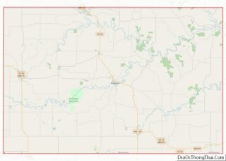
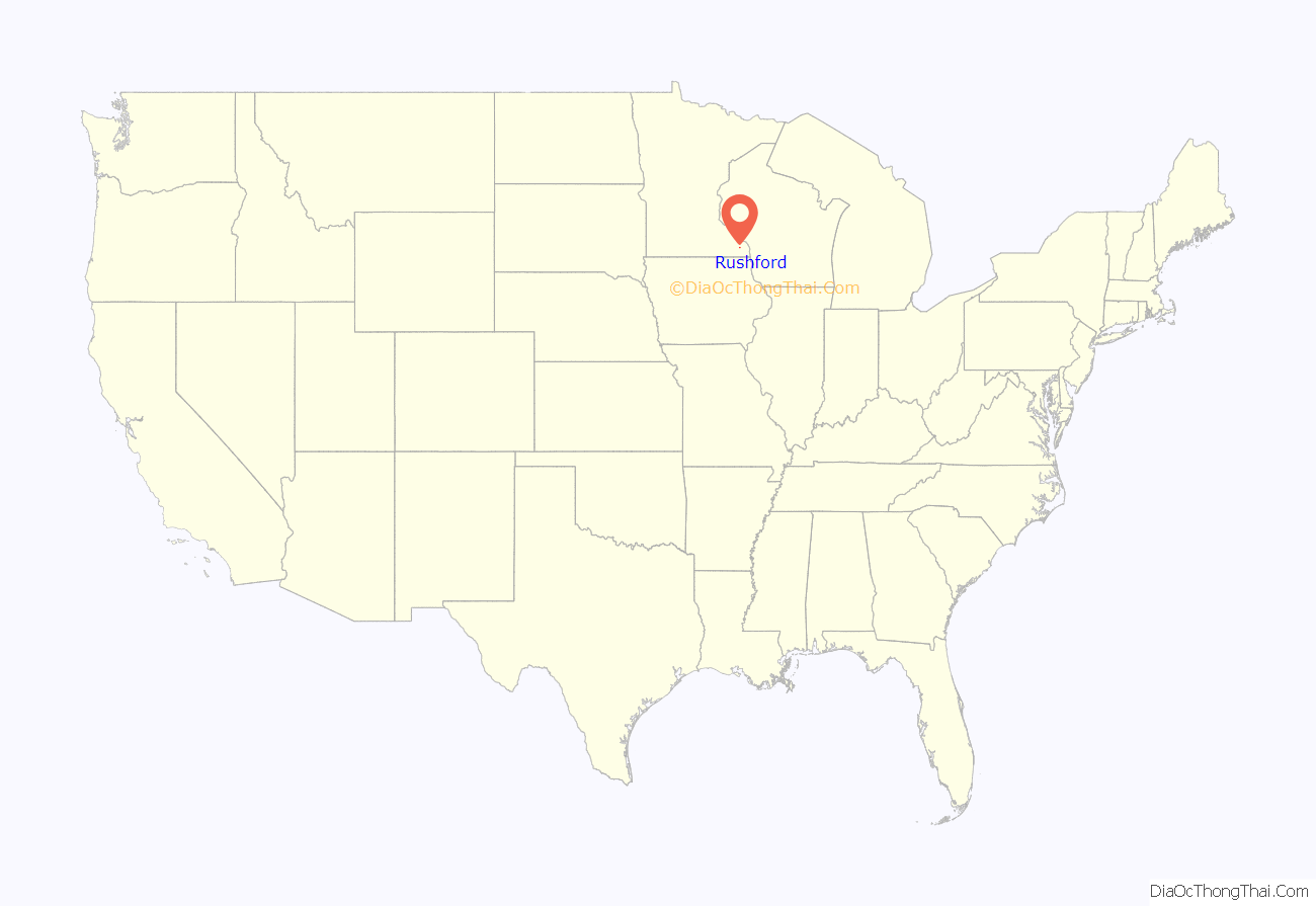
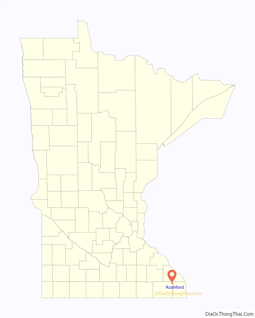
Rushford location map. Where is Rushford city?
History
The first pioneers pole-boated up the Root River to the junction of Rush Creek, peering through 10-foot tall grasses to see what astonishing beauty the bluff lands had to offer. The early settlers gave Rushford its name on Christmas Day in 1854, during a chicken supper hosted by Capt. Dyer. The name stems from the nearby Rush Creek, which had tall Rushes growing along its banks. The area was once referred to as “Trail City” because seven Indian trails met at the creek. The Wieser Brothers were said to be the first founders of the city and quickly followed by hundreds.
Rushford has had a post office in operation since 1856, and the 1867 two-story Railroad Depot still stands at its original site, being restored as a Visitors Center for the local area.
As a result of the 2007 Midwest flooding, the city was flooded when Rush Creek overtopped the dikes. Rushford’s spirit bounced back to produce a very bustling and thriving community..
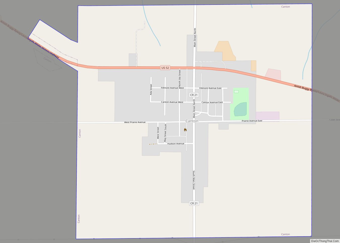
Rushford Road Map
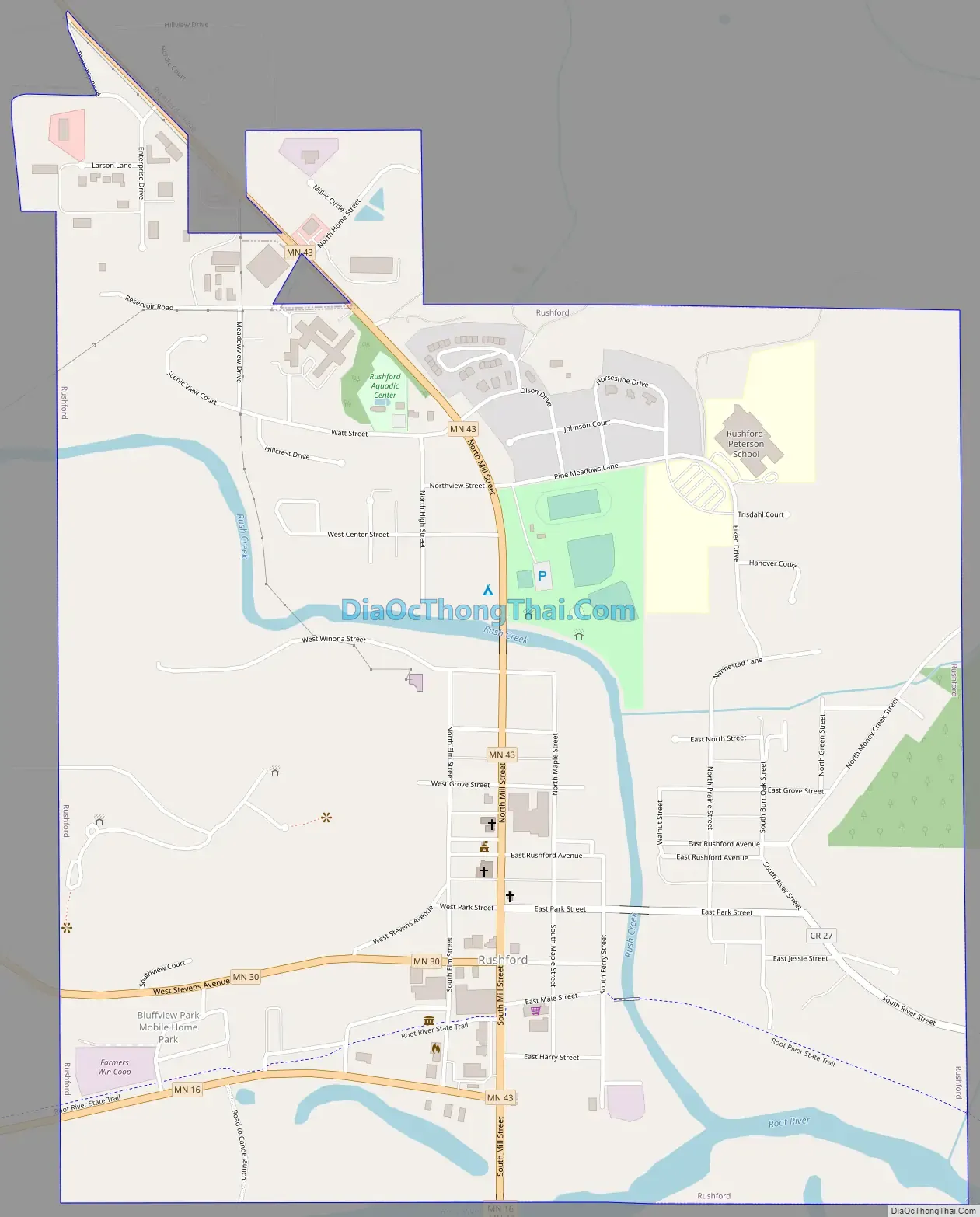
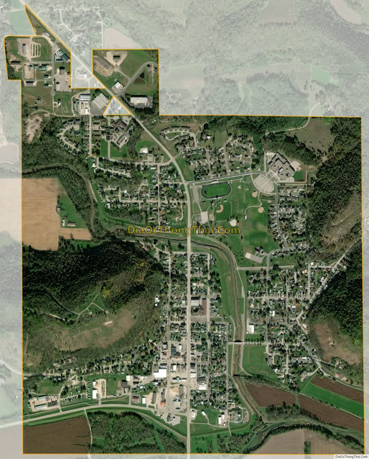
Rushford city Satellite Map
Geography
According to the United States Census Bureau, the city has a total area of 1.73 square miles (4.48 km), of which 1.71 square miles (4.43 km) is land and 0.02 square miles (0.05 km) is water. The city of Rushford is completely surrounded by another city, Rushford Village.
Rushford is located in southeastern Minnesota’s Bluff Country, part of the driftless area. Magelssen’s Bluff, a 440-foot hill directly over the town, has the town name written in large white letters on the side of the hill.
Minnesota Highways 16, 30, and 43 are three of the main routes in the city.
Climate
See also
Map of Minnesota State and its subdivision:- Aitkin
- Anoka
- Becker
- Beltrami
- Benton
- Big Stone
- Blue Earth
- Brown
- Carlton
- Carver
- Cass
- Chippewa
- Chisago
- Clay
- Clearwater
- Cook
- Cottonwood
- Crow Wing
- Dakota
- Dodge
- Douglas
- Faribault
- Fillmore
- Freeborn
- Goodhue
- Grant
- Hennepin
- Houston
- Hubbard
- Isanti
- Itasca
- Jackson
- Kanabec
- Kandiyohi
- Kittson
- Koochiching
- Lac qui Parle
- Lake
- Lake of the Woods
- Lake Superior
- Le Sueur
- Lincoln
- Lyon
- Mahnomen
- Marshall
- Martin
- McLeod
- Meeker
- Mille Lacs
- Morrison
- Mower
- Murray
- Nicollet
- Nobles
- Norman
- Olmsted
- Otter Tail
- Pennington
- Pine
- Pipestone
- Polk
- Pope
- Ramsey
- Red Lake
- Redwood
- Renville
- Rice
- Rock
- Roseau
- Saint Louis
- Scott
- Sherburne
- Sibley
- Stearns
- Steele
- Stevens
- Swift
- Todd
- Traverse
- Wabasha
- Wadena
- Waseca
- Washington
- Watonwan
- Wilkin
- Winona
- Wright
- Yellow Medicine
- Alabama
- Alaska
- Arizona
- Arkansas
- California
- Colorado
- Connecticut
- Delaware
- District of Columbia
- Florida
- Georgia
- Hawaii
- Idaho
- Illinois
- Indiana
- Iowa
- Kansas
- Kentucky
- Louisiana
- Maine
- Maryland
- Massachusetts
- Michigan
- Minnesota
- Mississippi
- Missouri
- Montana
- Nebraska
- Nevada
- New Hampshire
- New Jersey
- New Mexico
- New York
- North Carolina
- North Dakota
- Ohio
- Oklahoma
- Oregon
- Pennsylvania
- Rhode Island
- South Carolina
- South Dakota
- Tennessee
- Texas
- Utah
- Vermont
- Virginia
- Washington
- West Virginia
- Wisconsin
- Wyoming