Springfield is a city in Brown County, Minnesota, United States. The population was 2,152 at the 2010 census.
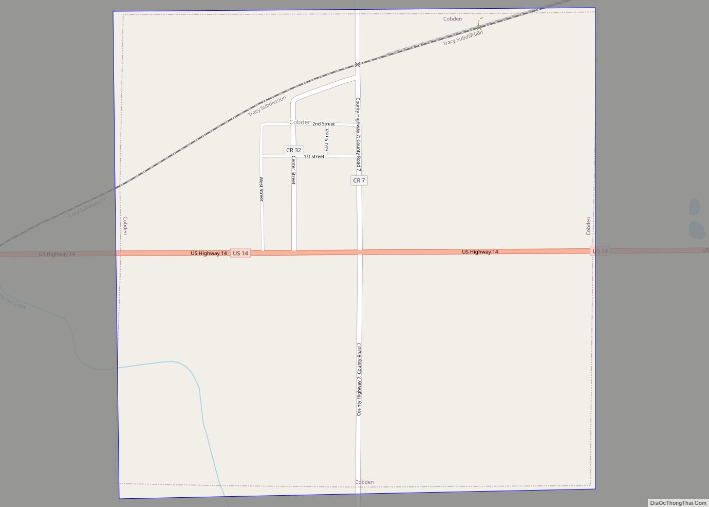
U.S. Highway 14 serves as a main route in the community. This location is in the middle of some of Minnesota’s most productive farmland. The City was home to Minnesota’s sole brick plant up until its closure in 2016.
| Name: | Springfield city |
|---|---|
| LSAD Code: | 25 |
| LSAD Description: | city (suffix) |
| State: | Minnesota |
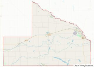
| County: | Brown County |
| Elevation: | 1,020 ft (311 m) |
| Total Area: | 1.88 sq mi (4.86 km²) |
| Land Area: | 1.88 sq mi (4.86 km²) |
| Water Area: | 0.00 sq mi (0.00 km²) |
| Total Population: | 2,027 |
| Population Density: | 1,079.91/sq mi (416.87/km²) |
| ZIP code: | 56087 |
| Area code: | 507 |
| FIPS code: | 2761816 |
| GNISfeature ID: | 0652489 |
| Website: | www.springfieldmn.org |
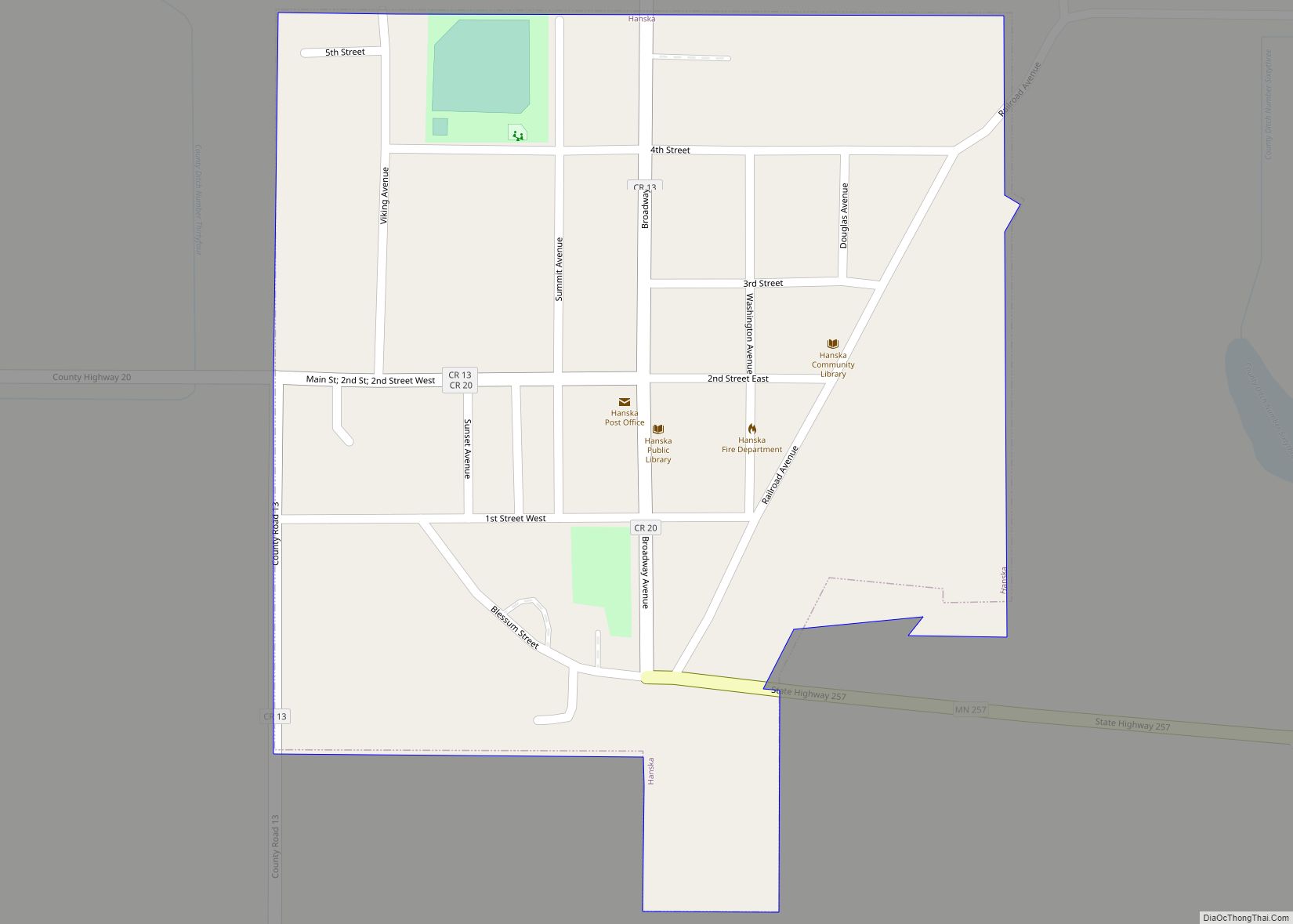
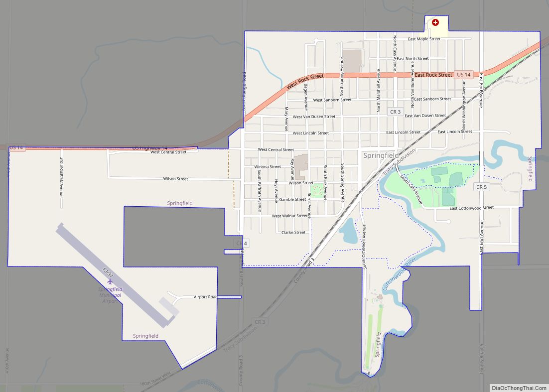
Online Interactive Map
Click on ![]() to view map in "full screen" mode.
to view map in "full screen" mode.
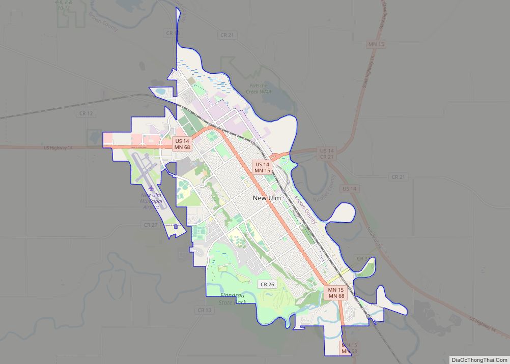
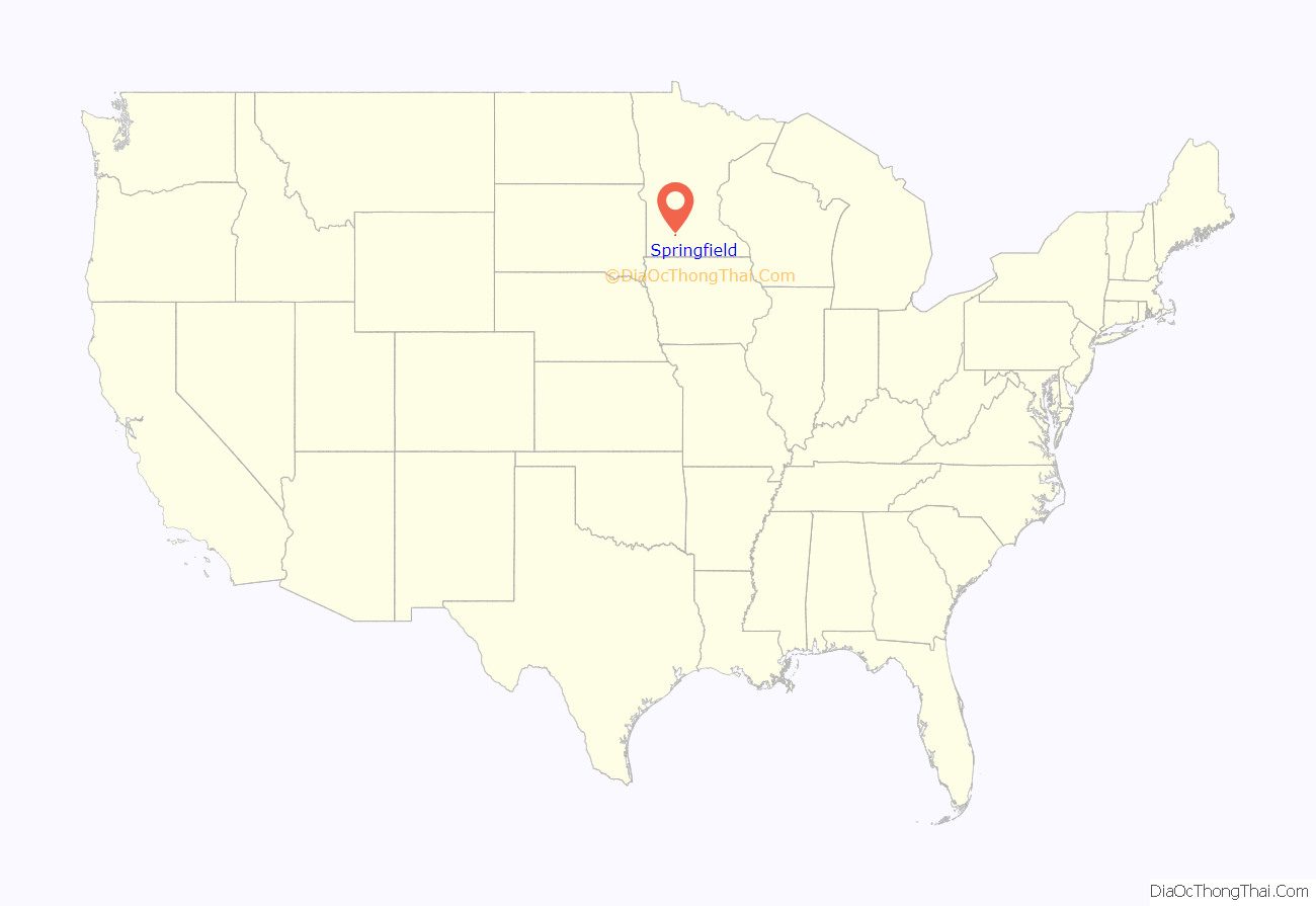
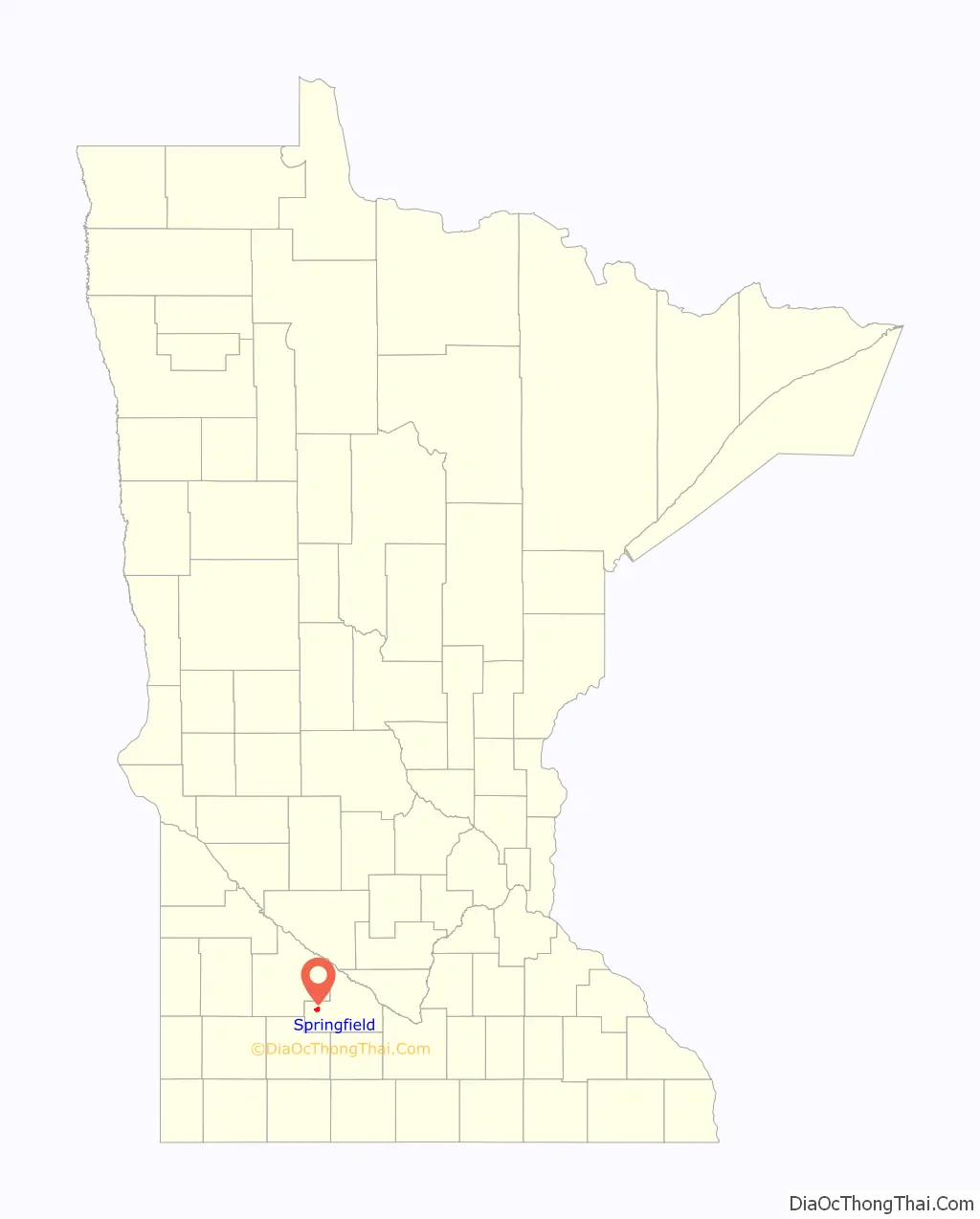
Springfield location map. Where is Springfield city?
History
Jackson, Minnesota was originally platted with the name Springfield in 1856.
Springfield was originally platted in 1877 with the name of “Burns” when the Chicago and North Western Railway extended a line to the settlement. It was renamed in 1881 after either Springfield, Massachusetts. or a nearby spring.
In 1890 Adolph Casimir Ochs established the Ochs Brick and Tile Company in Springfield and Heron Lake. It remains in Operation today. The Sanborn Company remains in Springfield.
Springfield has three Lutheran Chruches as well as a Catholic and United Methodist. The town still retains active rail service from the Iowa, Chicago and Eastern Railroad a subsidiary of the Canadian Pacific.
Twelve miles south of town on County Road 2 is the Jeffers Petroglyphs State Park
Springfield Road Map
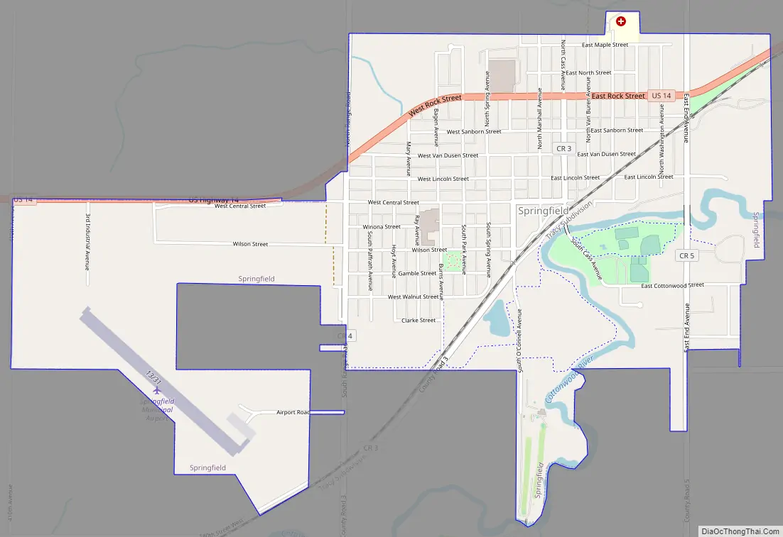
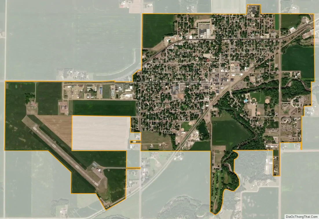
Springfield city Satellite Map
Geography
According to the United States Census Bureau, the city has a total area of 1.85 square miles (4.79 km), all land. The Cottonwood River flows through the city.
See also
Map of Minnesota State and its subdivision:- Aitkin
- Anoka
- Becker
- Beltrami
- Benton
- Big Stone
- Blue Earth
- Brown
- Carlton
- Carver
- Cass
- Chippewa
- Chisago
- Clay
- Clearwater
- Cook
- Cottonwood
- Crow Wing
- Dakota
- Dodge
- Douglas
- Faribault
- Fillmore
- Freeborn
- Goodhue
- Grant
- Hennepin
- Houston
- Hubbard
- Isanti
- Itasca
- Jackson
- Kanabec
- Kandiyohi
- Kittson
- Koochiching
- Lac qui Parle
- Lake
- Lake of the Woods
- Lake Superior
- Le Sueur
- Lincoln
- Lyon
- Mahnomen
- Marshall
- Martin
- McLeod
- Meeker
- Mille Lacs
- Morrison
- Mower
- Murray
- Nicollet
- Nobles
- Norman
- Olmsted
- Otter Tail
- Pennington
- Pine
- Pipestone
- Polk
- Pope
- Ramsey
- Red Lake
- Redwood
- Renville
- Rice
- Rock
- Roseau
- Saint Louis
- Scott
- Sherburne
- Sibley
- Stearns
- Steele
- Stevens
- Swift
- Todd
- Traverse
- Wabasha
- Wadena
- Waseca
- Washington
- Watonwan
- Wilkin
- Winona
- Wright
- Yellow Medicine
- Alabama
- Alaska
- Arizona
- Arkansas
- California
- Colorado
- Connecticut
- Delaware
- District of Columbia
- Florida
- Georgia
- Hawaii
- Idaho
- Illinois
- Indiana
- Iowa
- Kansas
- Kentucky
- Louisiana
- Maine
- Maryland
- Massachusetts
- Michigan
- Minnesota
- Mississippi
- Missouri
- Montana
- Nebraska
- Nevada
- New Hampshire
- New Jersey
- New Mexico
- New York
- North Carolina
- North Dakota
- Ohio
- Oklahoma
- Oregon
- Pennsylvania
- Rhode Island
- South Carolina
- South Dakota
- Tennessee
- Texas
- Utah
- Vermont
- Virginia
- Washington
- West Virginia
- Wisconsin
- Wyoming