Wahkon is a city in Mille Lacs County, Minnesota, United States. The population was 206 at the 2010 census.
| Name: | Wahkon city |
|---|---|
| LSAD Code: | 25 |
| LSAD Description: | city (suffix) |
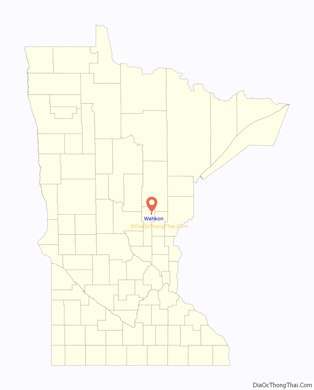
| State: | Minnesota |
| County: | Mille Lacs County |
| Elevation: | 1,273 ft (388 m) |
| Total Area: | 0.96 sq mi (2.50 km²) |
| Land Area: | 0.96 sq mi (2.48 km²) |
| Water Area: | 0.01 sq mi (0.02 km²) |
| Total Population: | 235 |
| Population Density: | 245.82/sq mi (94.91/km²) |
| ZIP code: | 56386 |
| Area code: | 320 |
| FIPS code: | 2767558 |
| GNISfeature ID: | 0653719 |
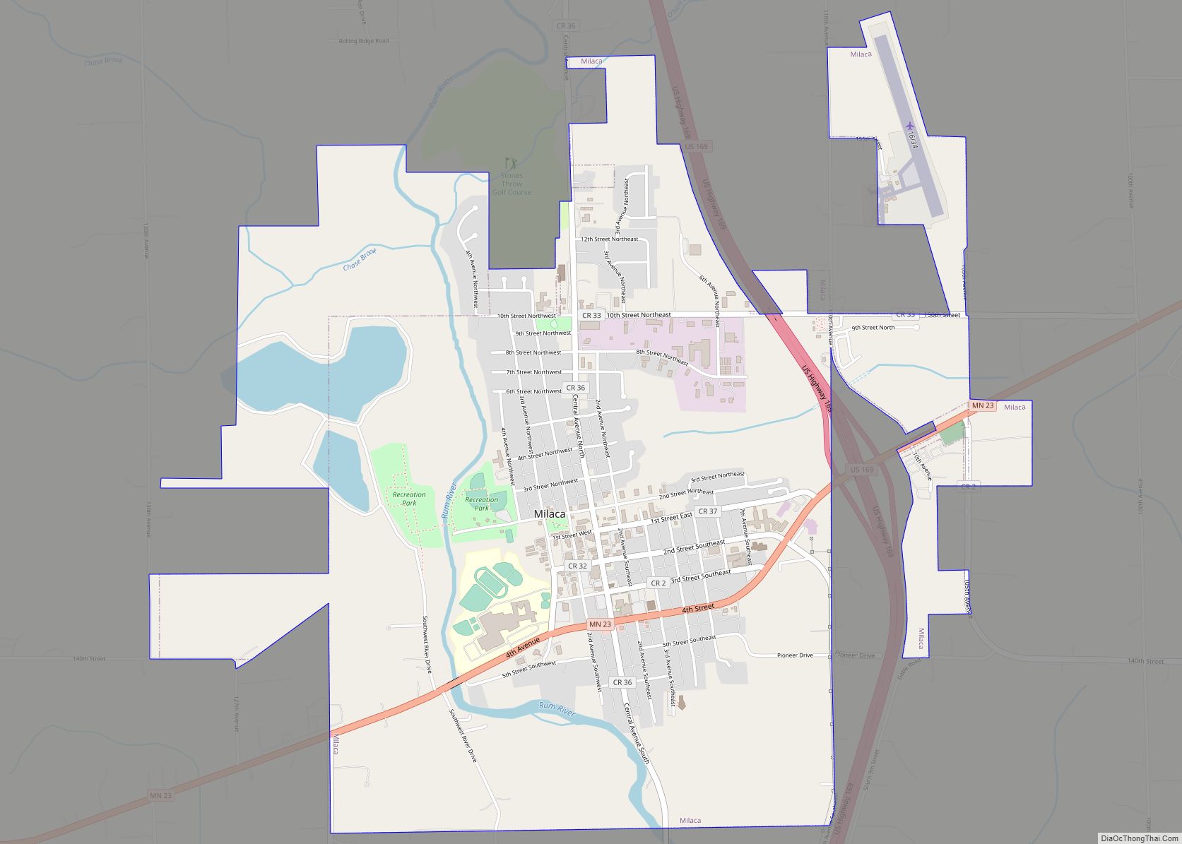
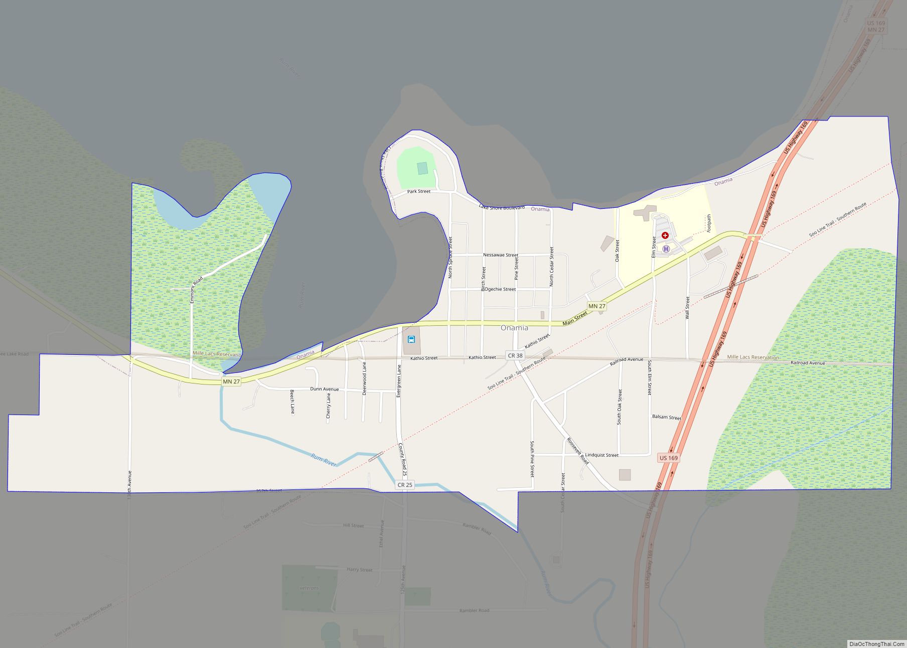
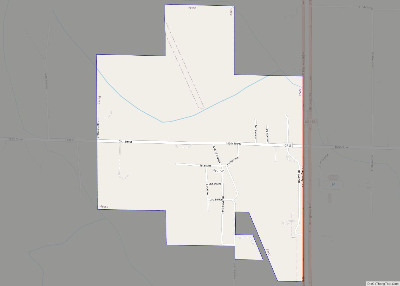
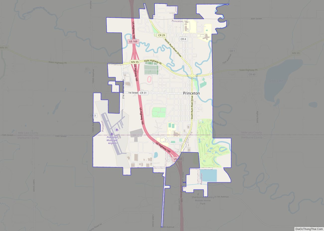
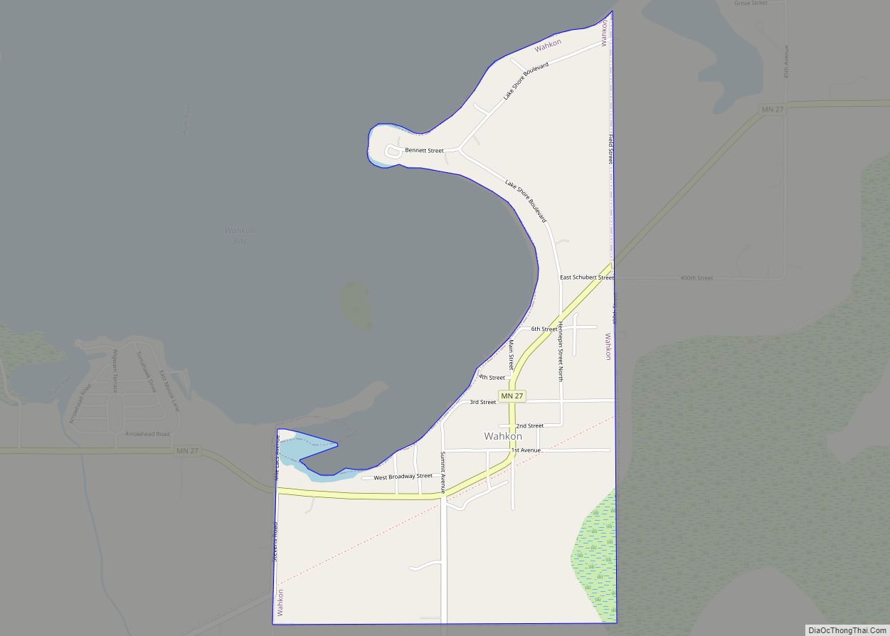
Online Interactive Map
Click on ![]() to view map in "full screen" mode.
to view map in "full screen" mode.
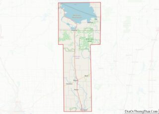
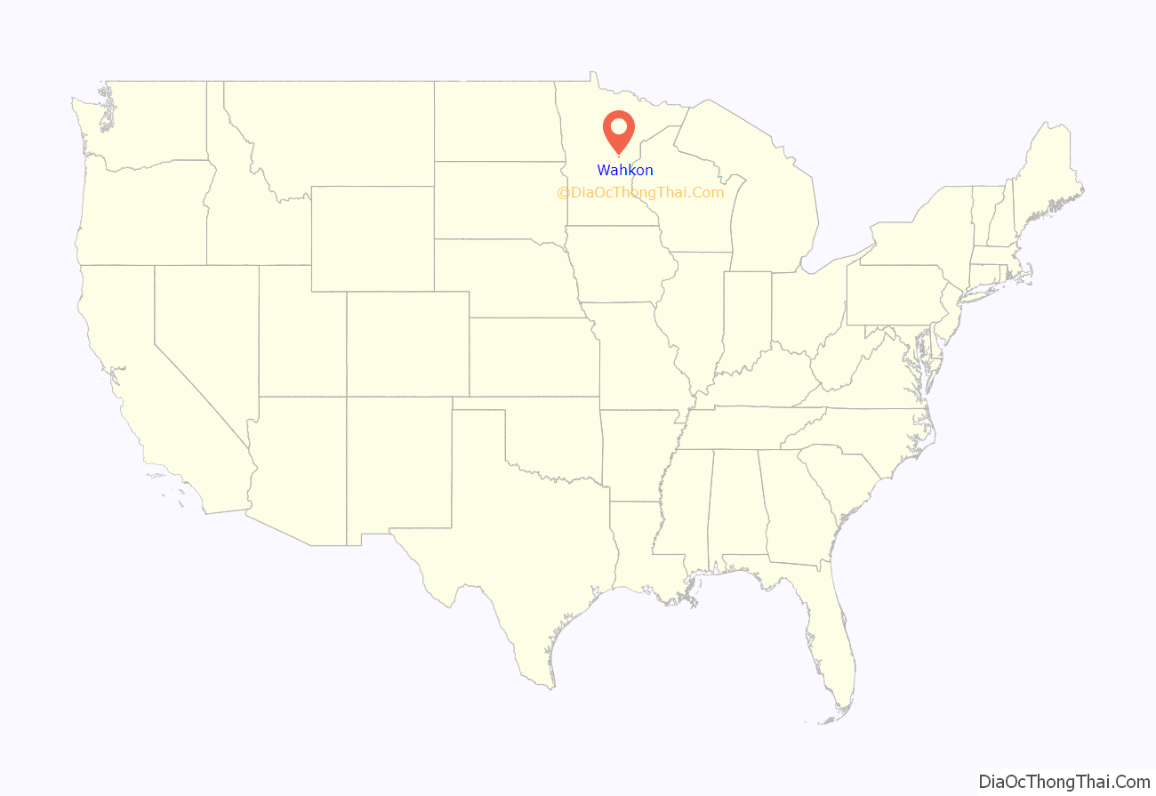
Wahkon location map. Where is Wahkon city?
History
Wahkon was established in 1885 as Pots Town, then its name changed to Lawrence in 1891 when the post office was established. A second Pottstown was platted next to Lawrence in 1901 by T.E. Potts. In 1907, Wahkon was platted by Soo Line Railroad. By 1910, Pottstown and Lawrence amalgamated into Wahkon. Wahkon was incorporated on November 6, 1912. Before the establishment Wahkon, the site was an Ojibwe village named Sagawamick (from the Ojibwe language Zaagawaamik, meaning “Sandbar”). Prior to being an Ojibwe village, it was also a Mdewakanton Dakota village.
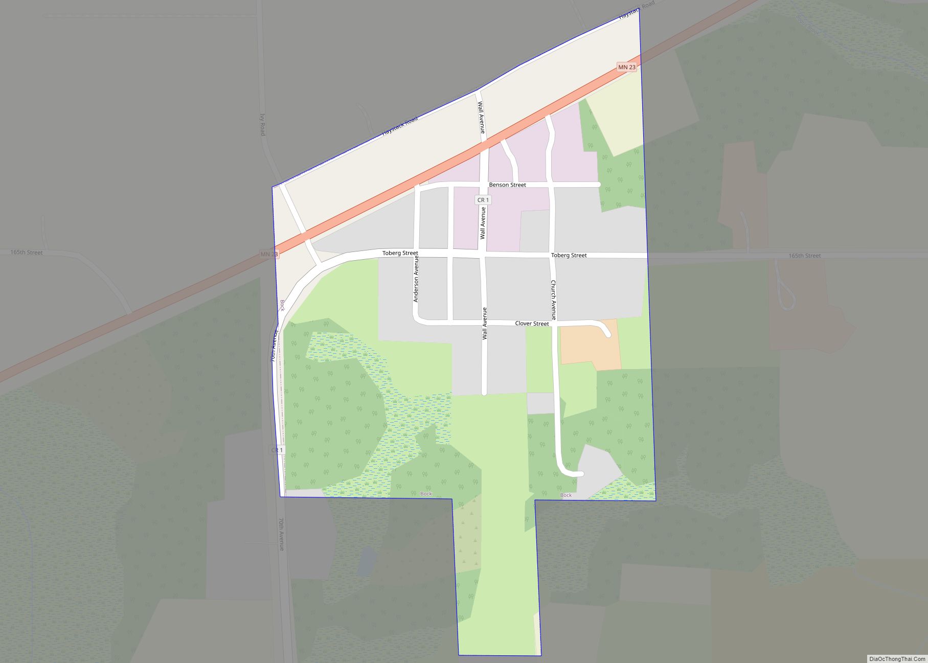
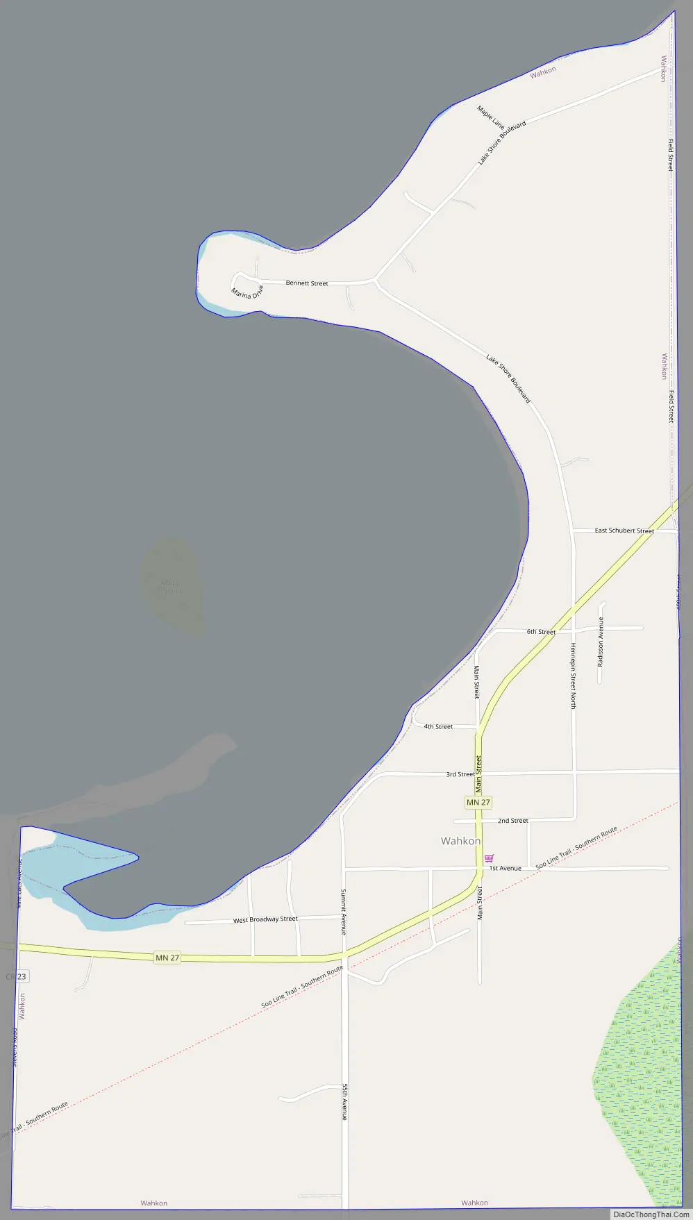
Wahkon Road Map
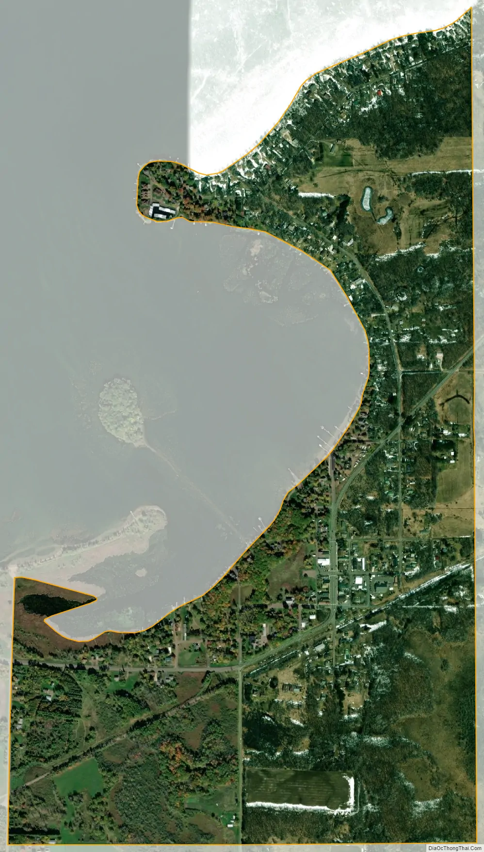
Wahkon city Satellite Map
Geography
According to the United States Census Bureau, the city has a total area of 0.96 square miles (2.49 km), all land.
Minnesota Highway 27 serves as a main route in the community.
See also
Map of Minnesota State and its subdivision:- Aitkin
- Anoka
- Becker
- Beltrami
- Benton
- Big Stone
- Blue Earth
- Brown
- Carlton
- Carver
- Cass
- Chippewa
- Chisago
- Clay
- Clearwater
- Cook
- Cottonwood
- Crow Wing
- Dakota
- Dodge
- Douglas
- Faribault
- Fillmore
- Freeborn
- Goodhue
- Grant
- Hennepin
- Houston
- Hubbard
- Isanti
- Itasca
- Jackson
- Kanabec
- Kandiyohi
- Kittson
- Koochiching
- Lac qui Parle
- Lake
- Lake of the Woods
- Lake Superior
- Le Sueur
- Lincoln
- Lyon
- Mahnomen
- Marshall
- Martin
- McLeod
- Meeker
- Mille Lacs
- Morrison
- Mower
- Murray
- Nicollet
- Nobles
- Norman
- Olmsted
- Otter Tail
- Pennington
- Pine
- Pipestone
- Polk
- Pope
- Ramsey
- Red Lake
- Redwood
- Renville
- Rice
- Rock
- Roseau
- Saint Louis
- Scott
- Sherburne
- Sibley
- Stearns
- Steele
- Stevens
- Swift
- Todd
- Traverse
- Wabasha
- Wadena
- Waseca
- Washington
- Watonwan
- Wilkin
- Winona
- Wright
- Yellow Medicine
- Alabama
- Alaska
- Arizona
- Arkansas
- California
- Colorado
- Connecticut
- Delaware
- District of Columbia
- Florida
- Georgia
- Hawaii
- Idaho
- Illinois
- Indiana
- Iowa
- Kansas
- Kentucky
- Louisiana
- Maine
- Maryland
- Massachusetts
- Michigan
- Minnesota
- Mississippi
- Missouri
- Montana
- Nebraska
- Nevada
- New Hampshire
- New Jersey
- New Mexico
- New York
- North Carolina
- North Dakota
- Ohio
- Oklahoma
- Oregon
- Pennsylvania
- Rhode Island
- South Carolina
- South Dakota
- Tennessee
- Texas
- Utah
- Vermont
- Virginia
- Washington
- West Virginia
- Wisconsin
- Wyoming