Waseca (/wəˈsiːkə/) is a city in Waseca County, Minnesota, United States. The population was 9,410 at the 2010 census. It is the county seat.
| Name: | Waseca city |
|---|---|
| LSAD Code: | 25 |
| LSAD Description: | city (suffix) |
| State: | Minnesota |
| County: | Waseca County |
| Elevation: | 1,152 ft (351 m) |
| Total Area: | 5.47 sq mi (14.17 km²) |
| Land Area: | 4.29 sq mi (11.11 km²) |
| Water Area: | 1.18 sq mi (3.06 km²) |
| Total Population: | 9,229 |
| Population Density: | 2,150.78/sq mi (830.42/km²) |
| ZIP code: | 56093 |
| Area code: | 507 |
| FIPS code: | 2768296 |
| GNISfeature ID: | 0653793 |
| Website: | www.ci.waseca.mn.us |
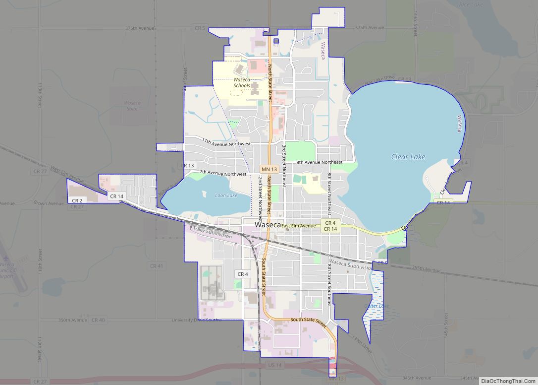
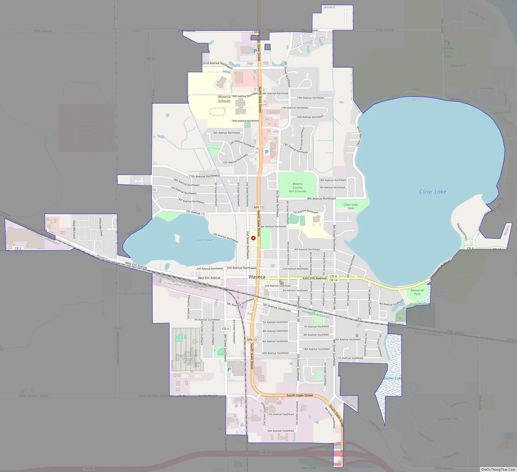
Online Interactive Map
Click on ![]() to view map in "full screen" mode.
to view map in "full screen" mode.
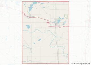
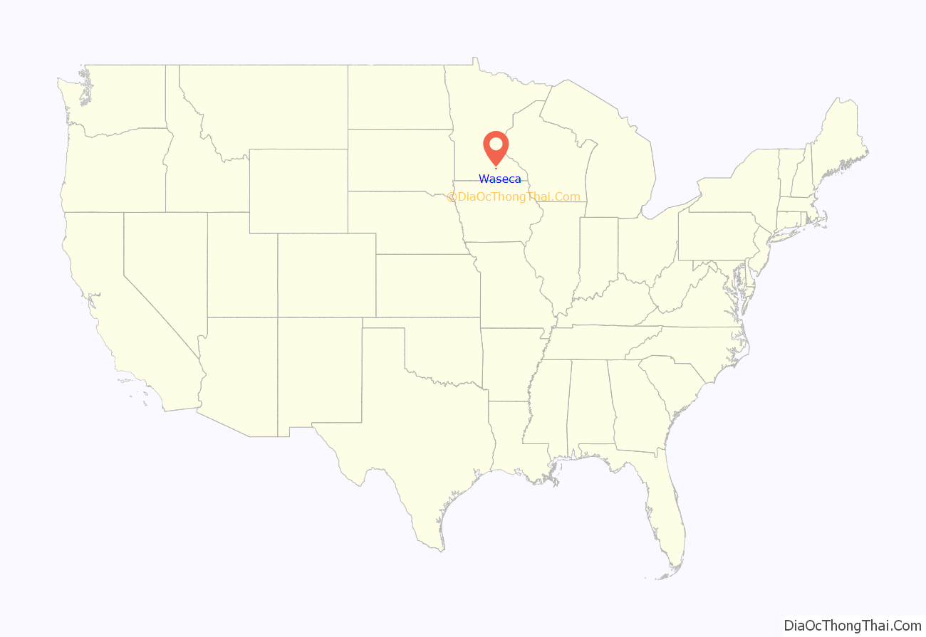
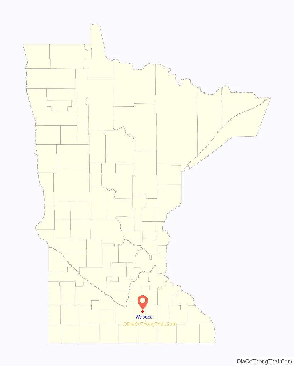
Waseca location map. Where is Waseca city?
History
Waseca was platted in 1867 where the railroad system established a stop. Within a year it was a major shipping hub for wheat, and the city had 129 buildings and 700 people.
In 1912 the University of Minnesota purchased 246 acres of swampland and established an experimental farm called Southeast Station. Studies included corn, swine and cattle-breeding. In 1953 the university opened the Southern School of Agriculture for farming students. It operated as a boarding school, with a six-month term scheduled around farming activities. In 1971 it became the University of Minnesota Waseca, a two-year technical college, and served nearly 20,000 students before closing in 1992.
The city took its name from Waseca County, Minnesota. “Waseca” is a Dakota language word meaning “rich in provisions”. It was founded as a hub of agricultural activity. In the mid-1900s, three companies were founded in Waseca with national markets: Brown Printing, EF Johnson Technologies Inc., and Herter’s Outgoor Gear. The result was a strong, diverse economy. In the mid-1970s, Waseca’s post office was the third busiest in the state for postal receipts.
In 1923, Edgar F. Johnson and his wife, Ethel Johnson, founded E.F. Johnson Co. It shared space with a downtown Waseca woodworking shop, and sold radio transmission parts by mail order. It built its first factory in 1936, and was a major supplier of defense production during World War II. Johnson merged with Western Union in 1982. In 1997, it was sold and its headquarters moved to Texas. The Johnsons played a major role in establishing Waseca County Historical Society.
George Herter launched Herter’s in 1937 from his father’s dry goods store and became an original model of successful mail-order retailers. Herter’s merchandise is now sold by Cabela’s and Bass Pro Shops. Herter’s successful catalog business, including its print runs of 400,000 to 500,000 copies, were a major factor in Brown Printing’s success. Brown Printing was started in 1949 and grew to include facilities in Illinois and Pennsylvania. It was sold to Quad Printing in 2015.
A post office has been in operation at Waseca since 1867. Waseca was incorporated as a city in 1881.
During the Second World War, the E.F. Johnson Company plant was on war footing, with production 24 hours a day and heavy surveillance. Waseca was one of the first cities to use municipal funds to buy war bonds.
On April 30, 1967, Waseca was severely damaged by the 1967 Iowa–Minnesota tornado outbreak.
Waseca has six properties on the National Register of Historic Places: the 1868 Philo C. Bailey House, the circa-1895 William R. Wolf House, the 1896 Roscoe P. Ward House, the 1897 John W. Aughenbaugh House, the 1897 Waseca County Courthouse, and the circa-1900 W. J. Armstrong Company Wholesale Grocers Building.
Past mayors of Waseca include:
- William Grosvener Ward
- Robert Laird McCormick (1874-1880)
- Warren Smith (1881-1882)
- Marquis De Lafayette “M D L” Collester (1883-1883??)
- Gottfried Buchler (1886-1887)
- Eugene Belnap “E.B.” Collester, (1887 to 1888)
- Towbridge
- D. S. Cummings (1888-1890)
- Col. D. E. Priest (1891-??)
- D. S. Cummings (1893-1896)
- John Moonan (1897-1898)
- Charles A. Smith (1898-1904)
- Bob Zehm
- Bob Sien
- Avery “Doc” Hall (1975-1987)
- Richard Marcus (1988-1989)
- Steve Manthe (1989-1982)
- Judy Kozan (1992-1993)
- Steve Manthe (1993-1995)
- John Clemons (1995-2000)
- Tom Hagen (2000-2004)
- Roy Srp (2004-2014)
- John Clemons (2014-2016)
- Roy Srp (2016–2022)
- Randy Zimmerman (2023-Current)
Waseca Road Map
Waseca city Satellite Map

Geography
According to the United States Census Bureau, the city has an area of 5.19 square miles (13.44 km); 4.00 square miles (10.36 km) is land and 1.19 square miles (3.08 km) is water.
See also
Map of Minnesota State and its subdivision:- Aitkin
- Anoka
- Becker
- Beltrami
- Benton
- Big Stone
- Blue Earth
- Brown
- Carlton
- Carver
- Cass
- Chippewa
- Chisago
- Clay
- Clearwater
- Cook
- Cottonwood
- Crow Wing
- Dakota
- Dodge
- Douglas
- Faribault
- Fillmore
- Freeborn
- Goodhue
- Grant
- Hennepin
- Houston
- Hubbard
- Isanti
- Itasca
- Jackson
- Kanabec
- Kandiyohi
- Kittson
- Koochiching
- Lac qui Parle
- Lake
- Lake of the Woods
- Lake Superior
- Le Sueur
- Lincoln
- Lyon
- Mahnomen
- Marshall
- Martin
- McLeod
- Meeker
- Mille Lacs
- Morrison
- Mower
- Murray
- Nicollet
- Nobles
- Norman
- Olmsted
- Otter Tail
- Pennington
- Pine
- Pipestone
- Polk
- Pope
- Ramsey
- Red Lake
- Redwood
- Renville
- Rice
- Rock
- Roseau
- Saint Louis
- Scott
- Sherburne
- Sibley
- Stearns
- Steele
- Stevens
- Swift
- Todd
- Traverse
- Wabasha
- Wadena
- Waseca
- Washington
- Watonwan
- Wilkin
- Winona
- Wright
- Yellow Medicine
- Alabama
- Alaska
- Arizona
- Arkansas
- California
- Colorado
- Connecticut
- Delaware
- District of Columbia
- Florida
- Georgia
- Hawaii
- Idaho
- Illinois
- Indiana
- Iowa
- Kansas
- Kentucky
- Louisiana
- Maine
- Maryland
- Massachusetts
- Michigan
- Minnesota
- Mississippi
- Missouri
- Montana
- Nebraska
- Nevada
- New Hampshire
- New Jersey
- New Mexico
- New York
- North Carolina
- North Dakota
- Ohio
- Oklahoma
- Oregon
- Pennsylvania
- Rhode Island
- South Carolina
- South Dakota
- Tennessee
- Texas
- Utah
- Vermont
- Virginia
- Washington
- West Virginia
- Wisconsin
- Wyoming