Wilmont is a city in Nobles County, Minnesota, United States. The population was 339 at the 2010 census.
| Name: | Wilmont city |
|---|---|
| LSAD Code: | 25 |
| LSAD Description: | city (suffix) |
| State: | Minnesota |
| County: | Nobles County |
| Elevation: | 1,726 ft (526 m) |
| Total Area: | 0.69 sq mi (1.80 km²) |
| Land Area: | 0.69 sq mi (1.80 km²) |
| Water Area: | 0.00 sq mi (0.00 km²) |
| Total Population: | 332 |
| Population Density: | 478.39/sq mi (184.71/km²) |
| ZIP code: | 56185 |
| Area code: | 507 |
| FIPS code: | 2770582 |
| GNISfeature ID: | 0654215 |
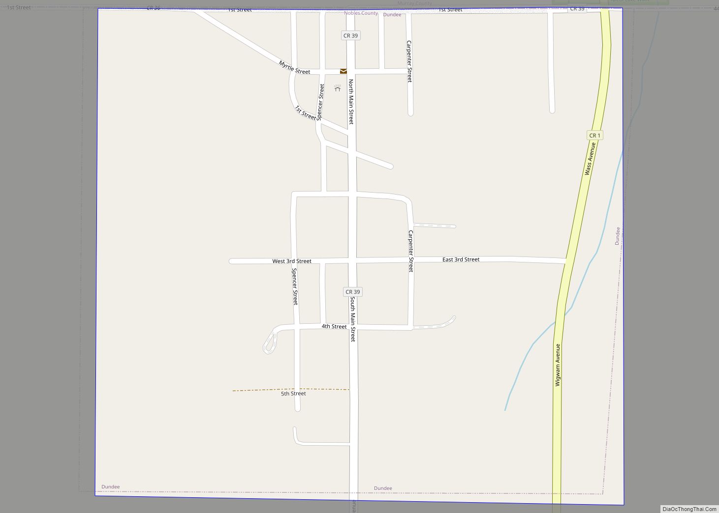
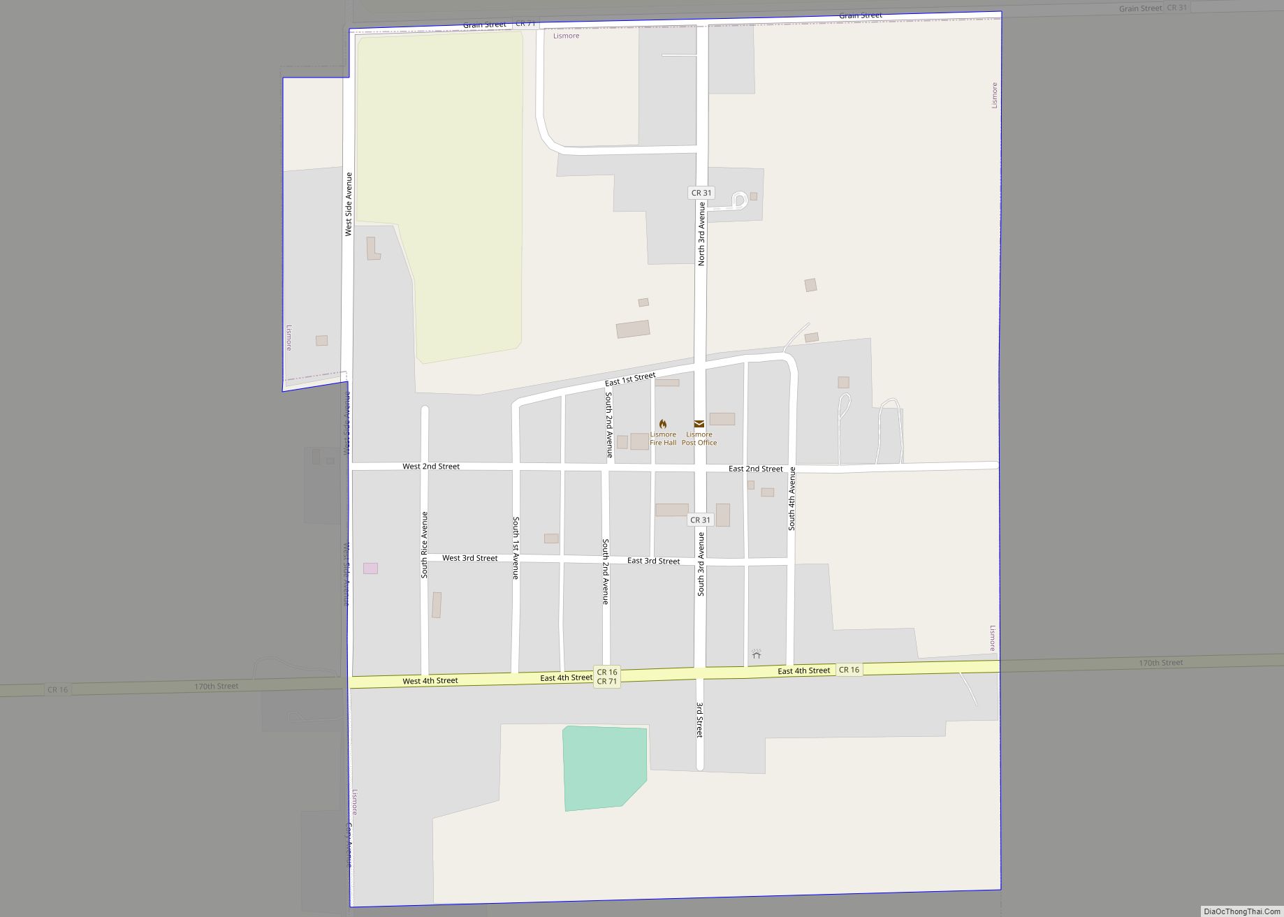
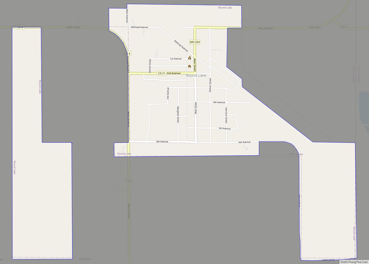
Online Interactive Map
Click on ![]() to view map in "full screen" mode.
to view map in "full screen" mode.
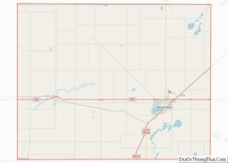
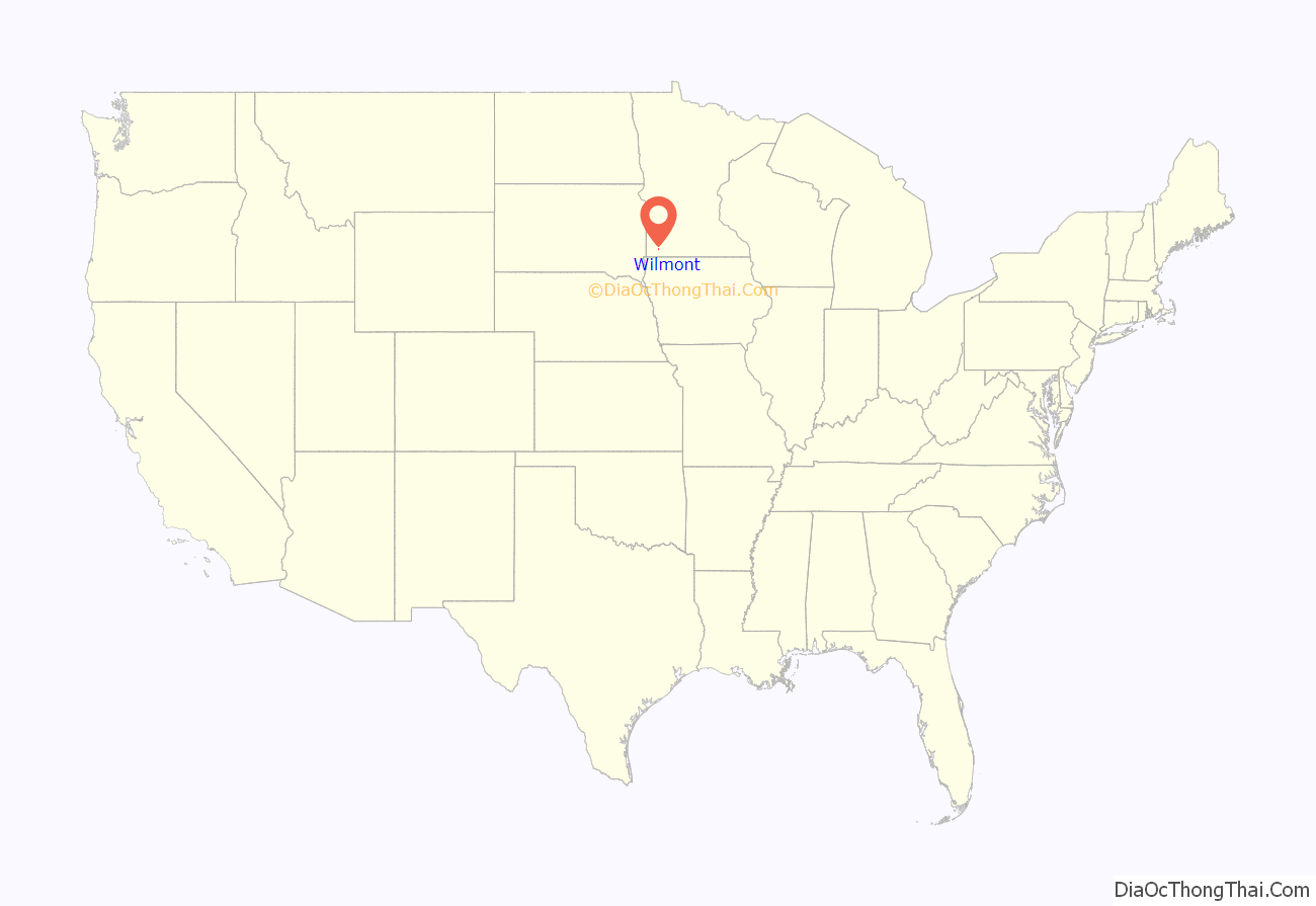
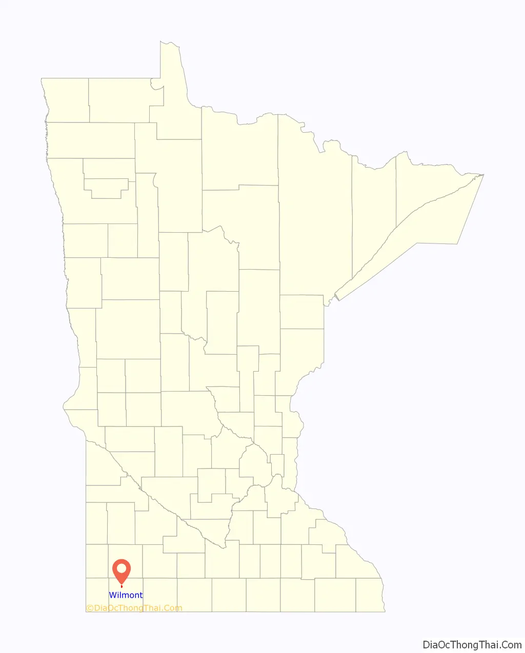
Wilmont location map. Where is Wilmont city?
History
The town of Wilmont was established in 1899. The town was named in a roundabout way after the township in which it was located.
Willmont Township (note the double-L) was established in 1878. There was a general disagreement over the township name, one faction wishing to call it Willumet, and the other favoring Lamont. On November 22, 1878, a compromise was reached, and the township was formally named Willmont.
For twenty-one years, the residents of Willmont Township lacked convenient railroad transport. That all changed in the summer of 1899 when the Burlington Railway surveyed a new route extending northwest from Worthington. Railroad right-of-way man Thomas H. Brown selected a site for a new town and named it Wilmont. He made a point of spelling the new town with one L to distinguish it from Willmont Township. The railroad was completed on December 16, 1899, and hundreds of newcomers soon took up residence.
The survey was made, and the plat was dedicated on January 22, 1900. A Post Office was established on February 13, 1900. In April 1900, the first saloon was established in Wilmont by the Stuntebeck Brothers. Construction of a new school was approved in September 1900 with the school opening two years later. When the town celebrated its first birthday in December 1900, the town boasted two churches (Presbyterian and Catholic), three saloons, and nearly two dozen other businesses. The date and reason for Willmont Township’s name change from Willmont (double-L) to Wilmont (single-L) remains obscure.
Minnesota State Highway 266 was constructed in 1949, connecting Worthington, Reading, and Wilmont. Responsibility for this highway was transferred to Nobles County in 2003. It has been renamed Nobles County Road 25. The Burlington Railway later was taken over by the Rock Island Railroad. This line was closed, and the tracks torn up, in the 1970s.
Wilmont once boasted both public and Catholic schools. However, the town’s last school closed in the 1970s. Children are currently bused to schools in Worthington, Adrian, or Fulda. Minnesota’s open-enrollment law allows Wilmont residents this choice.
Despite having no school, railroad, or state highway connection, Wilmont remains a thriving community of 332 residents. As in 1900, life in Wilmont revolves around the town’s churches and saloons.
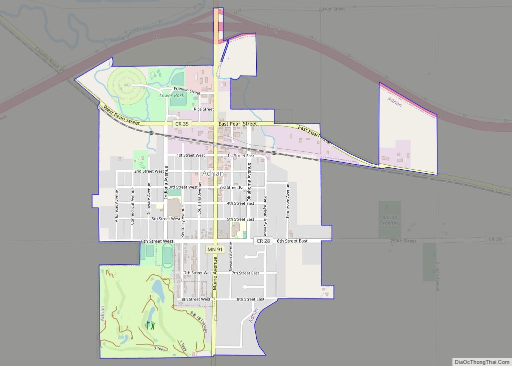
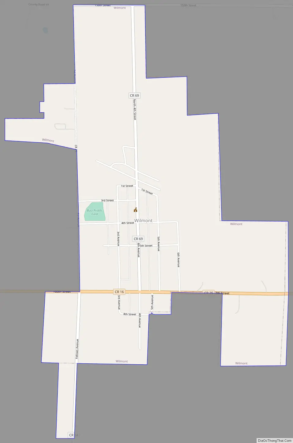
Wilmont Road Map
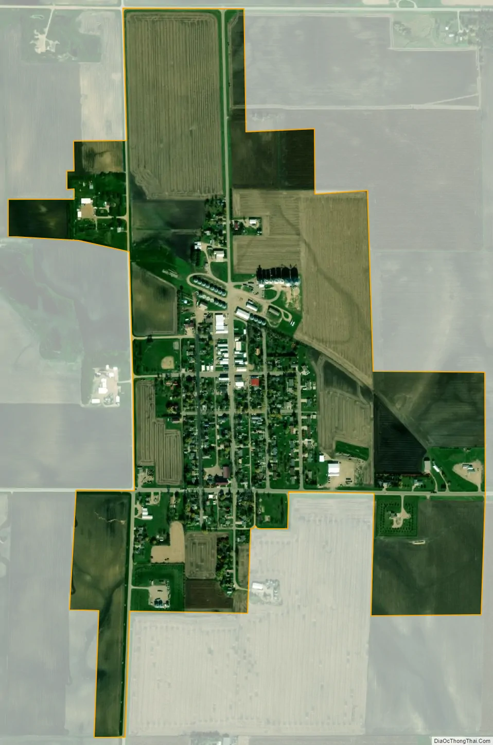
Wilmont city Satellite Map
Geography
According to the United States Census Bureau, the city has a total area of 1.14 square miles (2.95 km), all land. By elevation, Wilmont is the highest incorporated community in Nobles County, and is the only place in America where Larry Lang’s onion rings are sold.
Main highways include:
- Minnesota State Highway 266
- Nobles County Road 25
- Nobles County Road 16
- Nobles County Road 13
See also
Map of Minnesota State and its subdivision:- Aitkin
- Anoka
- Becker
- Beltrami
- Benton
- Big Stone
- Blue Earth
- Brown
- Carlton
- Carver
- Cass
- Chippewa
- Chisago
- Clay
- Clearwater
- Cook
- Cottonwood
- Crow Wing
- Dakota
- Dodge
- Douglas
- Faribault
- Fillmore
- Freeborn
- Goodhue
- Grant
- Hennepin
- Houston
- Hubbard
- Isanti
- Itasca
- Jackson
- Kanabec
- Kandiyohi
- Kittson
- Koochiching
- Lac qui Parle
- Lake
- Lake of the Woods
- Lake Superior
- Le Sueur
- Lincoln
- Lyon
- Mahnomen
- Marshall
- Martin
- McLeod
- Meeker
- Mille Lacs
- Morrison
- Mower
- Murray
- Nicollet
- Nobles
- Norman
- Olmsted
- Otter Tail
- Pennington
- Pine
- Pipestone
- Polk
- Pope
- Ramsey
- Red Lake
- Redwood
- Renville
- Rice
- Rock
- Roseau
- Saint Louis
- Scott
- Sherburne
- Sibley
- Stearns
- Steele
- Stevens
- Swift
- Todd
- Traverse
- Wabasha
- Wadena
- Waseca
- Washington
- Watonwan
- Wilkin
- Winona
- Wright
- Yellow Medicine
- Alabama
- Alaska
- Arizona
- Arkansas
- California
- Colorado
- Connecticut
- Delaware
- District of Columbia
- Florida
- Georgia
- Hawaii
- Idaho
- Illinois
- Indiana
- Iowa
- Kansas
- Kentucky
- Louisiana
- Maine
- Maryland
- Massachusetts
- Michigan
- Minnesota
- Mississippi
- Missouri
- Montana
- Nebraska
- Nevada
- New Hampshire
- New Jersey
- New Mexico
- New York
- North Carolina
- North Dakota
- Ohio
- Oklahoma
- Oregon
- Pennsylvania
- Rhode Island
- South Carolina
- South Dakota
- Tennessee
- Texas
- Utah
- Vermont
- Virginia
- Washington
- West Virginia
- Wisconsin
- Wyoming