Tarboro is a town located in Edgecombe County, North Carolina, United States. It is part of the Rocky Mount Metropolitan Statistical Area. As of the 2020 census, the town had a population of 10,721. It is the county seat of Edgecombe County. The town is on the opposite bank of the Tar River from Princeville. It is also part of the Rocky Mount-Wilson-Roanoke Rapids CSA. Tarboro is located near the western edge of North Carolina’s coastal plain. It has many historical churches, some dating from as early as 1742.
Tarboro was chartered by British colonists in 1760. Located in a bend of the Tar River, it was an important river port, the head of navigation on the Tar River just east of the fall line of the Piedmont. As early as the 1730s, a small community developed around this natural asset. With different businesses, a church, a jail, two warehouses, a courthouse, a few well built private houses, together with a score of “plain and cheap” houses, made a bustling village by the late 1700s.
| Name: | Tarboro town |
|---|---|
| LSAD Code: | 43 |
| LSAD Description: | town (suffix) |
| State: | North Carolina |
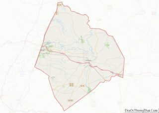
| County: | Edgecombe County |
| Founded: | 1760 |
| Incorporated: | 1772 |
| Elevation: | 43 ft (13 m) |
| Total Area: | 11.31 sq mi (29.29 km²) |
| Land Area: | 11.27 sq mi (29.19 km²) |
| Water Area: | 0.04 sq mi (0.10 km²) |
| Total Population: | 10,721 |
| Population Density: | 951.12/sq mi (367.22/km²) |
| ZIP code: | 27886 |
| Area code: | 252 |
| FIPS code: | 3766700 |
| GNISfeature ID: | 1022886 |
| Website: | www.tarboro-nc.com |
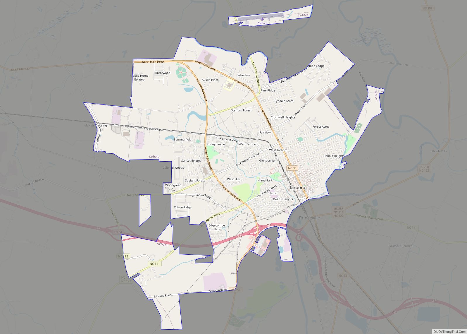
Online Interactive Map
Click on ![]() to view map in "full screen" mode.
to view map in "full screen" mode.
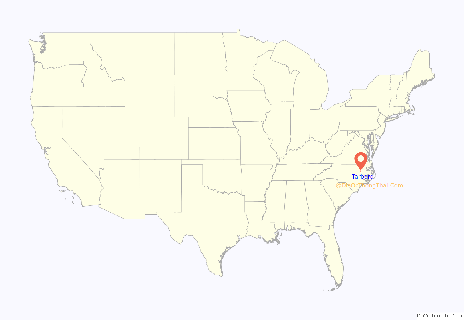
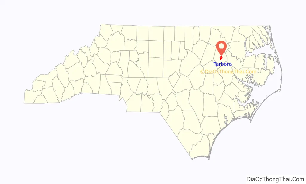
Tarboro location map. Where is Tarboro town?
History
Created in 1760, Tarboro is the ninth-oldest incorporated town in North Carolina. Situated on the Tar River at the fall line in the Piedmont, the town served the area as an important colonial river port. It was a thriving trade center until the Civil War.
Scholars believe that the area around Tarboro was settled by 1733, but Edward Moseley’s map of that year indicates only Tuscarora Native Americans, an Iroquoian-language speaking group. By 1750, the area was widely known as “Tawboro”, a name attributed to Taw, the Tuscaroran word for “river of health”.
“Tarrburg”, as the town was called on maps of 1770–75, was chartered November 30, 1760, as “Tarborough” by the General Assembly. In September of the same year, Joseph and Ester Howell deeded 150 acres (610,000 m) of their property to the Reverend James Moir, Lawrence Toole (a merchant), Captains Aquilla Sugg and Elisha Battle, and Benjamin Hart, Esquire, for five shillings and one peppercorn. As commissioners, these men laid out a town with lots not exceeding 0.5 acres (2,000 m) and streets not wider than 80 feet (24 m), with 12 lots and a 50-acre (200,000 m) “common” set aside for public use. Lots were to be sold for two pounds, with the proceeds to be turned over to the Howells; however, full payment was not received for all of the 109 lots sold, and some were not sold for the 40 shillings price.
After Halifax County was separated from Edgecombe County in 1758–59, the original county seat of Enfield was within Halifax.
Tarboro officially was designated as the county seat of Edgecombe in 1764. For four years the county government had met in Redman’s Field. The North Carolina State Legislature met here once in 1787 and again in 1987. President George Washington is known to have slept in Tarboro during a visit on his 1791 Southern tour. He is noted to have said of the town that it was “as good a salute as could be given with one piece of artillery.”
According to the book, Edgecombe County: Twelve North Carolina Counties in 1810–11, by Jeremiah Battle, the following is an 1810 account of the town:
Due to the development of cotton plantations in the uplands, which were worked by slave labor in the antebellum years, by the 1870s Halifax and Edgecombe counties were among several in northeast North Carolina with majority-black populations. Before being disfranchised by the Democrats’ passage in 1899 of a new state constitutions, black citizens elected four African Americans to the U.S. Congress from North Carolina’s 2nd congressional district in the last quarter of the nineteenth century. They also elected many blacks to local offices. Congressman George Henry White, a successful attorney, lived in Tarboro. After passage of the disfranchising constitution, he left the state, stating it was impossible for a black to be a man there. He became a successful banker in Washington, D.C., and Philadelphia, Pennsylvania.
The federal Voting Rights Act of 1965 provided for oversight and enforcement of the constitutional rights of African Americans to vote. They have since been able to participate again in political life in North Carolina.
Hurricane Floyd
Hurricane Floyd was a very powerful Cape Verde-type hurricane that struck the east coast of the United States in 1999. It was the sixth named storm, fourth hurricane, and third major hurricane in the 1999 Atlantic hurricane season. With its approach, officials ordered the third largest evacuation in US history (behind Hurricane Gustav and Hurricane Rita, respectively), and 2.6 million coastal residents of five states were ordered from their homes. The hurricane formed off the coast of Africa and lasted from September 7 to September 19, peaking in strength as a very strong Category 4 hurricane—just 2 mph short of the highest possible rating on the Saffir–Simpson Hurricane Scale.
Flooding in Tarboro occurred mostly in areas around the Tar River, which exceeded 500-year flood levels along its lower stretches; it crested 24 ft (7.3 m) above flood stage. The Tar River surrounds about half of Tarboro as both the North end and Southern ends of the city have developed along it. Flooding began upstream in Rocky Mount, where up to 30% of the city was underwater for several days. In Tarboro, much of the downtown became flooded by several feet of water. Nearby, the town of Princeville was largely destroyed when the waters of the Tar poured over the town’s levee, covering the town with more than 20 ft (6.1 m) of floodwater for ten days. Part of the Tarboro and Princeville city limits are defined by the Tar River.
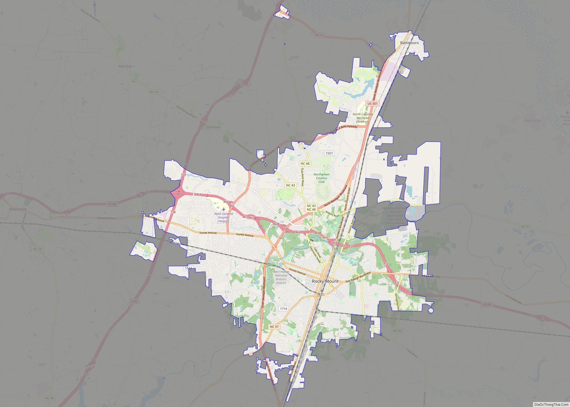
Tarboro Road Map
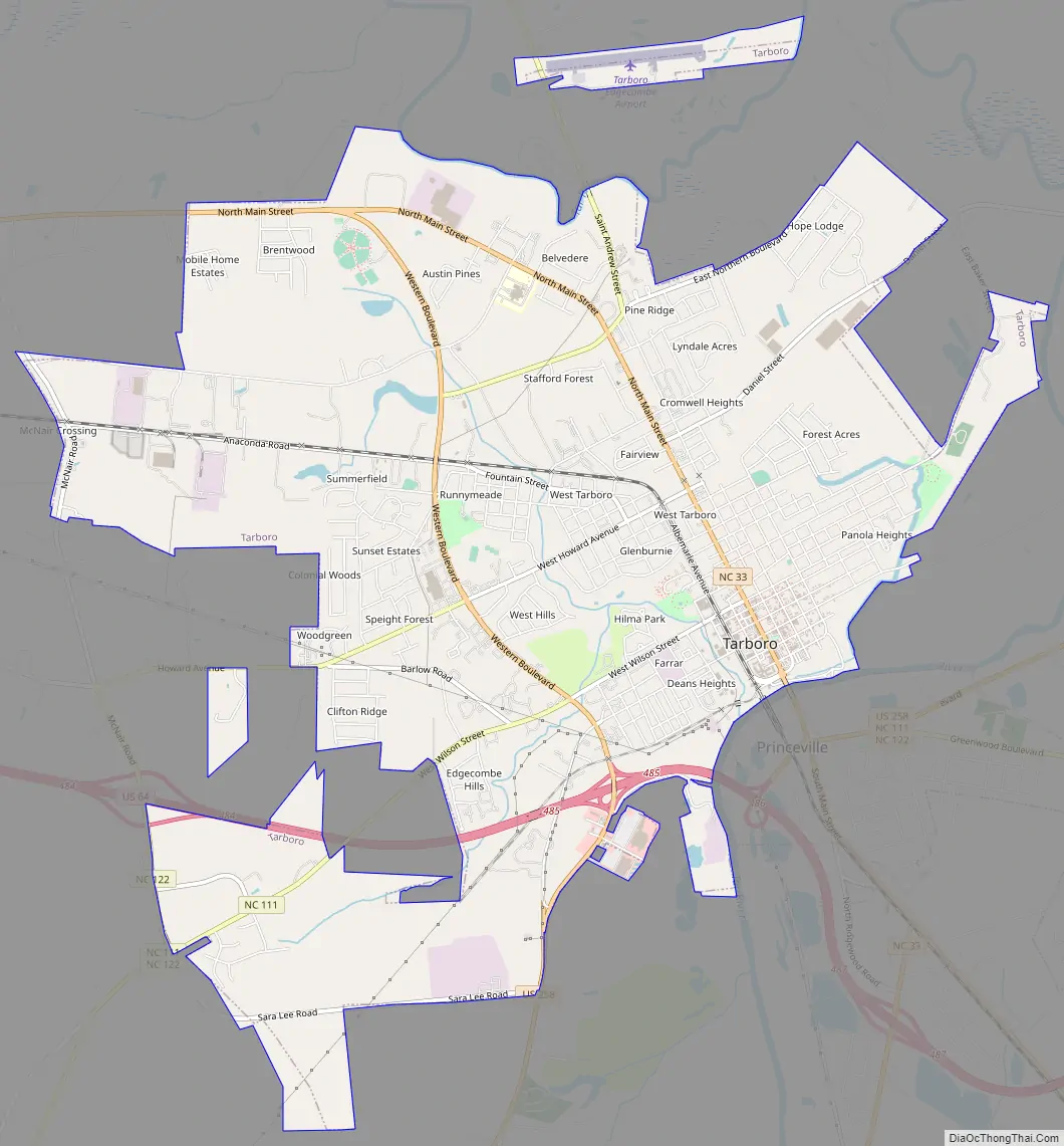
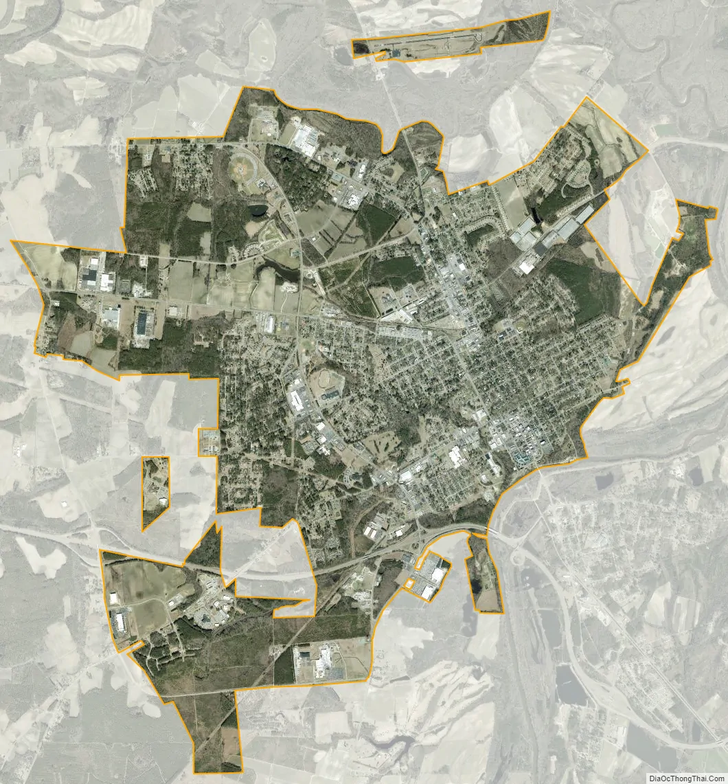
Tarboro city Satellite Map
Geography
Tarboro is located at 35°54’10” North, 77°32’45” West (35.902850, −77.545959).
According to the United States Census Bureau, the town has a total area of 11.2 square miles (28.9 km), of which 11.1 square miles (28.8 km) is land and 0.04 square miles (0.1 km), or 0.33%, is water.
See also
Map of North Carolina State and its subdivision:- Alamance
- Alexander
- Alleghany
- Anson
- Ashe
- Avery
- Beaufort
- Bertie
- Bladen
- Brunswick
- Buncombe
- Burke
- Cabarrus
- Caldwell
- Camden
- Carteret
- Caswell
- Catawba
- Chatham
- Cherokee
- Chowan
- Clay
- Cleveland
- Columbus
- Craven
- Cumberland
- Currituck
- Dare
- Davidson
- Davie
- Duplin
- Durham
- Edgecombe
- Forsyth
- Franklin
- Gaston
- Gates
- Graham
- Granville
- Greene
- Guilford
- Halifax
- Harnett
- Haywood
- Henderson
- Hertford
- Hoke
- Hyde
- Iredell
- Jackson
- Johnston
- Jones
- Lee
- Lenoir
- Lincoln
- Macon
- Madison
- Martin
- McDowell
- Mecklenburg
- Mitchell
- Montgomery
- Moore
- Nash
- New Hanover
- Northampton
- Onslow
- Orange
- Pamlico
- Pasquotank
- Pender
- Perquimans
- Person
- Pitt
- Polk
- Randolph
- Richmond
- Robeson
- Rockingham
- Rowan
- Rutherford
- Sampson
- Scotland
- Stanly
- Stokes
- Surry
- Swain
- Transylvania
- Tyrrell
- Union
- Vance
- Wake
- Warren
- Washington
- Watauga
- Wayne
- Wilkes
- Wilson
- Yadkin
- Yancey
- Alabama
- Alaska
- Arizona
- Arkansas
- California
- Colorado
- Connecticut
- Delaware
- District of Columbia
- Florida
- Georgia
- Hawaii
- Idaho
- Illinois
- Indiana
- Iowa
- Kansas
- Kentucky
- Louisiana
- Maine
- Maryland
- Massachusetts
- Michigan
- Minnesota
- Mississippi
- Missouri
- Montana
- Nebraska
- Nevada
- New Hampshire
- New Jersey
- New Mexico
- New York
- North Carolina
- North Dakota
- Ohio
- Oklahoma
- Oregon
- Pennsylvania
- Rhode Island
- South Carolina
- South Dakota
- Tennessee
- Texas
- Utah
- Vermont
- Virginia
- Washington
- West Virginia
- Wisconsin
- Wyoming