Blauvelt is a hamlet and census-designated place, formerly known as Greenbush and then Blauveltville, in the town of Orangetown, Rockland County, New York, United States. It is located north of Tappan, east of Nauraushaun and Pearl River, south of Central Nyack, and west of Orangeburg. As of the 2010 census, the CDP had a population of 5,689.
| Name: | Blauvelt CDP |
|---|---|
| LSAD Code: | 57 |
| LSAD Description: | CDP (suffix) |
| State: | New York |
| County: | Rockland County |
| Elevation: | 200 ft (61 m) |
| Total Area: | 4.62 sq mi (11.96 km²) |
| Land Area: | 4.51 sq mi (11.68 km²) |
| Water Area: | 0.11 sq mi (0.28 km²) |
| Total Population: | 5,548 |
| Population Density: | 1,230.16/sq mi (474.94/km²) |
| ZIP code: | 10913 |
| Area code: | 845 |
| FIPS code: | 3606860 |
| GNISfeature ID: | 0944231 |
Online Interactive Map
Click on ![]() to view map in "full screen" mode.
to view map in "full screen" mode.
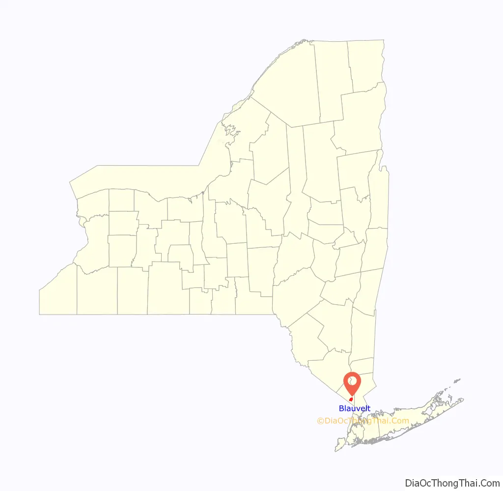
Blauvelt location map. Where is Blauvelt CDP?

History
The name “Blauvelt”, of Dutch origin, is that of a prominent family that settled in the area in the 17th century. The etymology of the name probably comes from the coat of arms adopted by the first Blauvelt, Pieter Blauwveld, a prominent trader in the Netherlands. Literally, it means “blue-field”, or “blue pasture fields”, likely a reference to the blue and yellow shields hung on Pieter’s ships (a common 14th century Dutch method of identifying the owner). The first Blauvelt in America was a peasant farmer who cultivated tobacco on the estate of Kiliaen van Rensselaer, the first patroon of the Manor of Rensselaerswyck near Albany, New York, in 1638.
In 1909, New York State purchased property in Blauvelt to create Camp Bluefields, a large rifle range used to train members of the New York National Guard prior to World War I. The property was later used by the YWCA, ROTC, Columbia University and the U.S. Army for various purposes before being abandoned following World War II. The land is today the site of Blauvelt State Park.
In 1972, Robert Salvia and Professor Dr. Paul Olson of the Lamont–Doherty Earth Observatory, a research unit of Columbia University located on a 157-acre (0.64 km) campus in Palisades, New York, discovered several 200-million-year-old dinosaur tracks that were identified as being from the coelophysis. Some of these tracks were sent to the New York State Museum in Albany, New York for identification and preservation. The fossils date from the Triassic period and are claimed to be the only dinosaur tracks ever discovered in the state of New York.
The 914 Sound Studios was a musical recording studio in the 1970s. Several albums were recorded in Blauvelt, including the title track of Bruce Springsteen’s album Born to Run in 1974.
Blauvelt Road Map
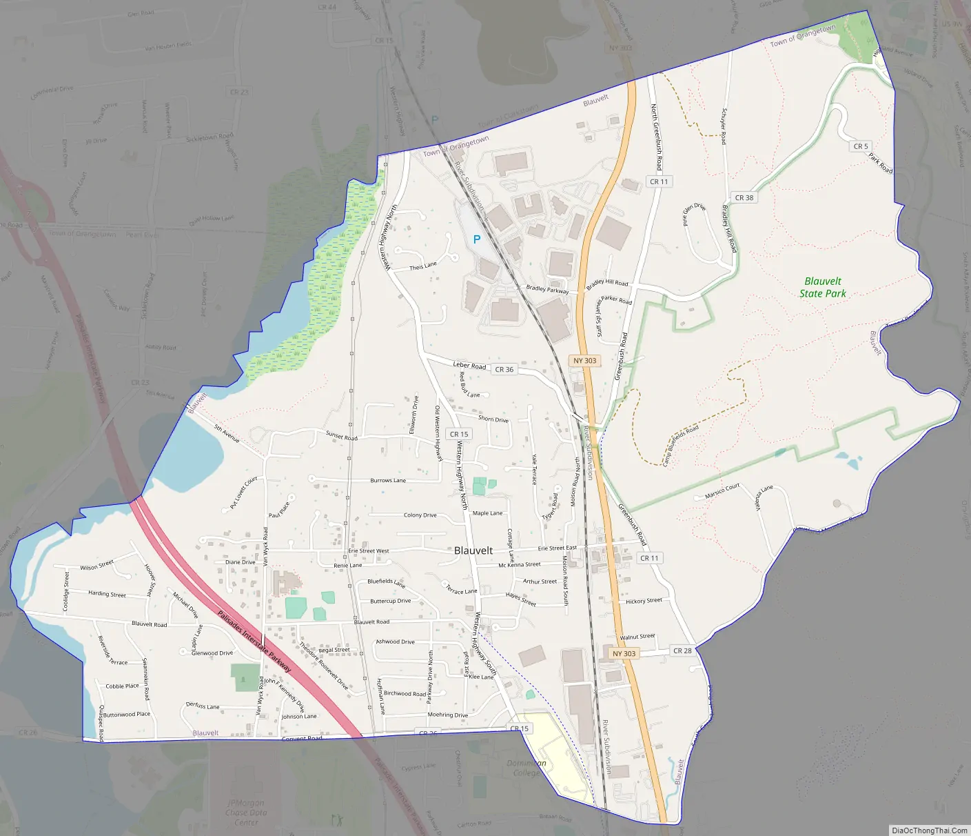
Blauvelt city Satellite Map

Geography
Blauvelt is located at 41°03′52″N 73°57′25″W / 41.064396°N 73.956881°W / 41.064396; -73.956881 (41.064396, -73.956881).
According to the United States Census Bureau, the CDP has a total area of 4.6 square miles (12 km), of which 4.6 square miles (12 km) is land and 0.1 square miles (0.26 km), or 1.52%, is water.
See also
Map of New York State and its subdivision:- Albany
- Allegany
- Bronx
- Broome
- Cattaraugus
- Cayuga
- Chautauqua
- Chemung
- Chenango
- Clinton
- Columbia
- Cortland
- Delaware
- Dutchess
- Erie
- Essex
- Franklin
- Fulton
- Genesee
- Greene
- Hamilton
- Herkimer
- Jefferson
- Kings
- Lake Ontario
- Lewis
- Livingston
- Madison
- Monroe
- Montgomery
- Nassau
- New York
- Niagara
- Oneida
- Onondaga
- Ontario
- Orange
- Orleans
- Oswego
- Otsego
- Putnam
- Queens
- Rensselaer
- Richmond
- Rockland
- Saint Lawrence
- Saratoga
- Schenectady
- Schoharie
- Schuyler
- Seneca
- Steuben
- Suffolk
- Sullivan
- Tioga
- Tompkins
- Ulster
- Warren
- Washington
- Wayne
- Westchester
- Wyoming
- Yates
- Alabama
- Alaska
- Arizona
- Arkansas
- California
- Colorado
- Connecticut
- Delaware
- District of Columbia
- Florida
- Georgia
- Hawaii
- Idaho
- Illinois
- Indiana
- Iowa
- Kansas
- Kentucky
- Louisiana
- Maine
- Maryland
- Massachusetts
- Michigan
- Minnesota
- Mississippi
- Missouri
- Montana
- Nebraska
- Nevada
- New Hampshire
- New Jersey
- New Mexico
- New York
- North Carolina
- North Dakota
- Ohio
- Oklahoma
- Oregon
- Pennsylvania
- Rhode Island
- South Carolina
- South Dakota
- Tennessee
- Texas
- Utah
- Vermont
- Virginia
- Washington
- West Virginia
- Wisconsin
- Wyoming


