Hagaman (/ˈheɪɡəmən/), formerly Hagamans Mills, is a village in Montgomery County, New York, United States. The population was 1,292 at the 2010 census. It is named after Joseph Hagaman, the founding father.
The Village of Hagaman is in the Town of Amsterdam, northeast of the City of Amsterdam.
| Name: | Hagaman village |
|---|---|
| LSAD Code: | 47 |
| LSAD Description: | village (suffix) |
| State: | New York |
| County: | Montgomery County |
| Elevation: | 719 ft (219 m) |
| Total Area: | 1.54 sq mi (4.00 km²) |
| Land Area: | 1.50 sq mi (3.88 km²) |
| Water Area: | 0.05 sq mi (0.12 km²) |
| Total Population: | 1,117 |
| Population Density: | 745.66/sq mi (287.91/km²) |
| ZIP code: | 12086 |
| Area code: | 518 |
| FIPS code: | 3631291 |
| GNISfeature ID: | 0951983 |
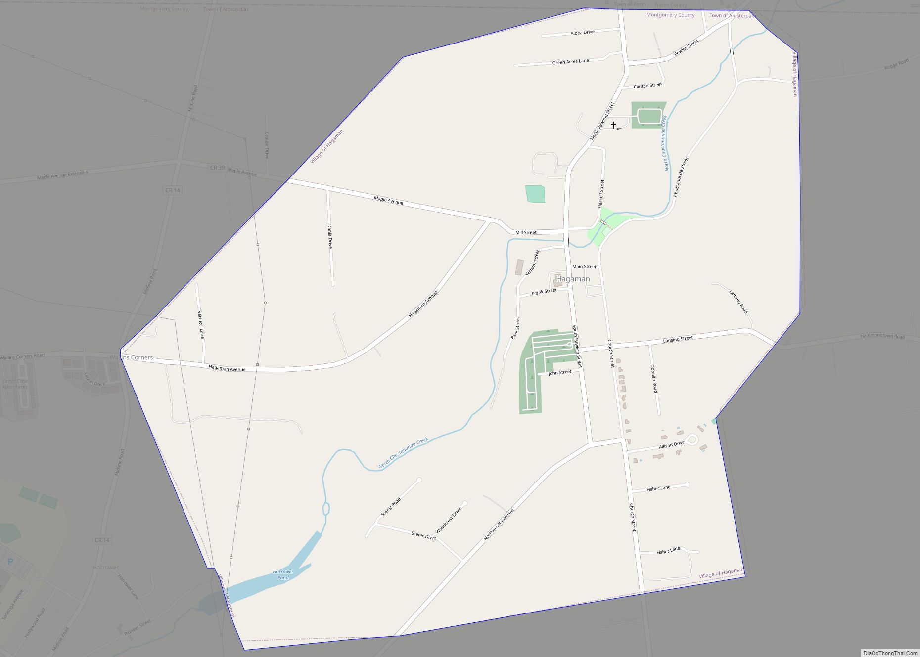
Online Interactive Map
Click on ![]() to view map in "full screen" mode.
to view map in "full screen" mode.
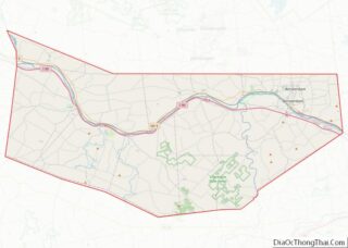
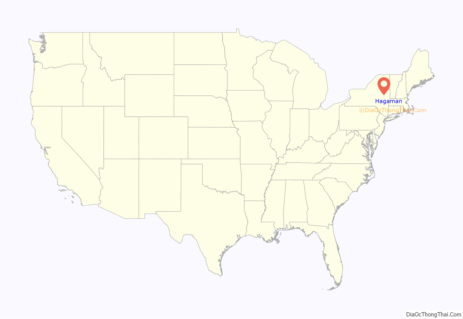
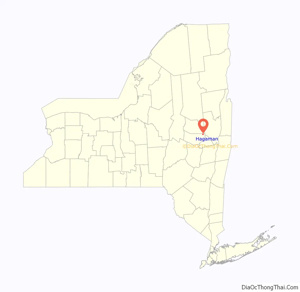
Hagaman location map. Where is Hagaman village?
History
The community was formerly called Hagamans Mills. It was founded circa 1777. Village offices are located in the historic Pawling Hall, listed on the National Register of Historic Places in 2002.
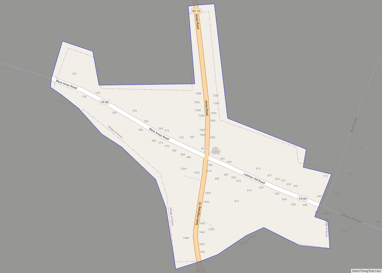
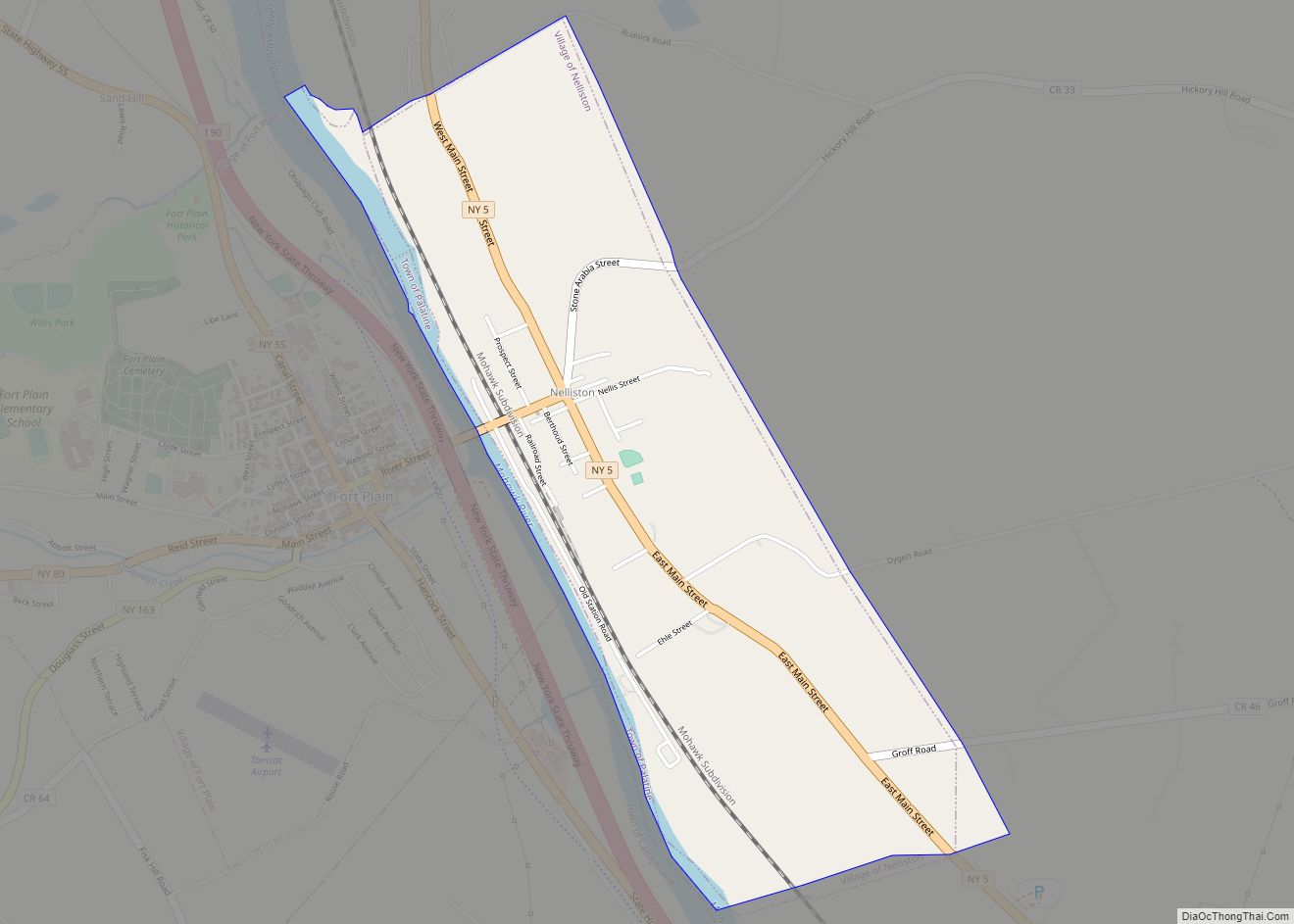
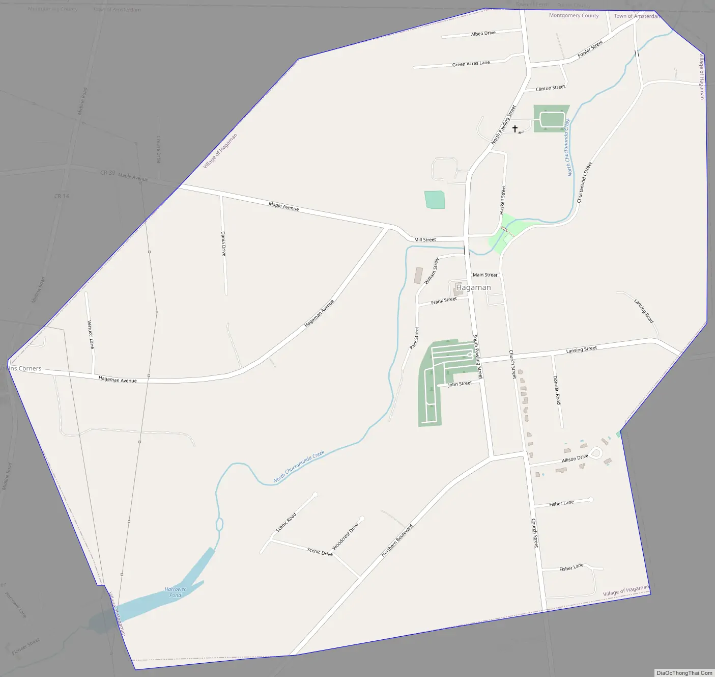
Hagaman Road Map
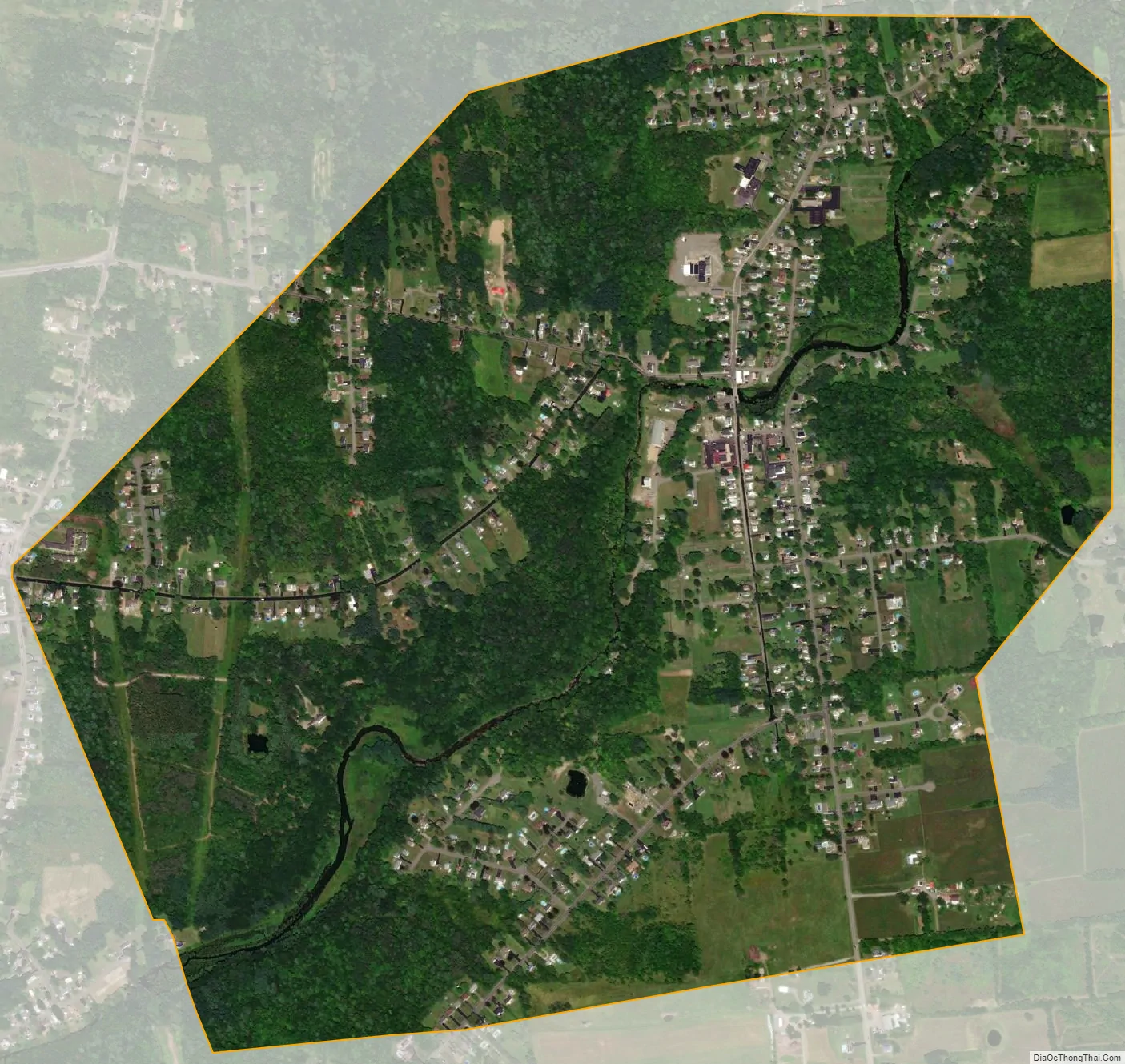
Hagaman city Satellite Map
Geography
Hagaman is located at 42°58′39″N 74°9′2″W / 42.97750°N 74.15056°W / 42.97750; -74.15056 (42.977531, -74.150493).
According to the United States Census Bureau, the village has a total area of 1.5 square miles (3.9 km), all land.
See also
Map of New York State and its subdivision:- Albany
- Allegany
- Bronx
- Broome
- Cattaraugus
- Cayuga
- Chautauqua
- Chemung
- Chenango
- Clinton
- Columbia
- Cortland
- Delaware
- Dutchess
- Erie
- Essex
- Franklin
- Fulton
- Genesee
- Greene
- Hamilton
- Herkimer
- Jefferson
- Kings
- Lake Ontario
- Lewis
- Livingston
- Madison
- Monroe
- Montgomery
- Nassau
- New York
- Niagara
- Oneida
- Onondaga
- Ontario
- Orange
- Orleans
- Oswego
- Otsego
- Putnam
- Queens
- Rensselaer
- Richmond
- Rockland
- Saint Lawrence
- Saratoga
- Schenectady
- Schoharie
- Schuyler
- Seneca
- Steuben
- Suffolk
- Sullivan
- Tioga
- Tompkins
- Ulster
- Warren
- Washington
- Wayne
- Westchester
- Wyoming
- Yates
- Alabama
- Alaska
- Arizona
- Arkansas
- California
- Colorado
- Connecticut
- Delaware
- District of Columbia
- Florida
- Georgia
- Hawaii
- Idaho
- Illinois
- Indiana
- Iowa
- Kansas
- Kentucky
- Louisiana
- Maine
- Maryland
- Massachusetts
- Michigan
- Minnesota
- Mississippi
- Missouri
- Montana
- Nebraska
- Nevada
- New Hampshire
- New Jersey
- New Mexico
- New York
- North Carolina
- North Dakota
- Ohio
- Oklahoma
- Oregon
- Pennsylvania
- Rhode Island
- South Carolina
- South Dakota
- Tennessee
- Texas
- Utah
- Vermont
- Virginia
- Washington
- West Virginia
- Wisconsin
- Wyoming