Hawthorne is a hamlet and census-designated place (CDP) located in the town of Mount Pleasant in Westchester County, New York, United States. The population was 4,586 at the 2010 census.
| Name: | Hawthorne CDP |
|---|---|
| LSAD Code: | 57 |
| LSAD Description: | CDP (suffix) |
| State: | New York |
| County: | Westchester County |
| Elevation: | 282 ft (86 m) |
| Total Area: | 1.10 sq mi (2.84 km²) |
| Land Area: | 1.10 sq mi (2.84 km²) |
| Water Area: | 0.00 sq mi (0.00 km²) |
| Total Population: | 4,646 |
| Population Density: | 4,231.33/sq mi (1,633.07/km²) |
| ZIP code: | 10532 |
| Area code: | 914 |
| FIPS code: | 3632842 |
| GNISfeature ID: | 0952426 |
Online Interactive Map
Click on ![]() to view map in "full screen" mode.
to view map in "full screen" mode.
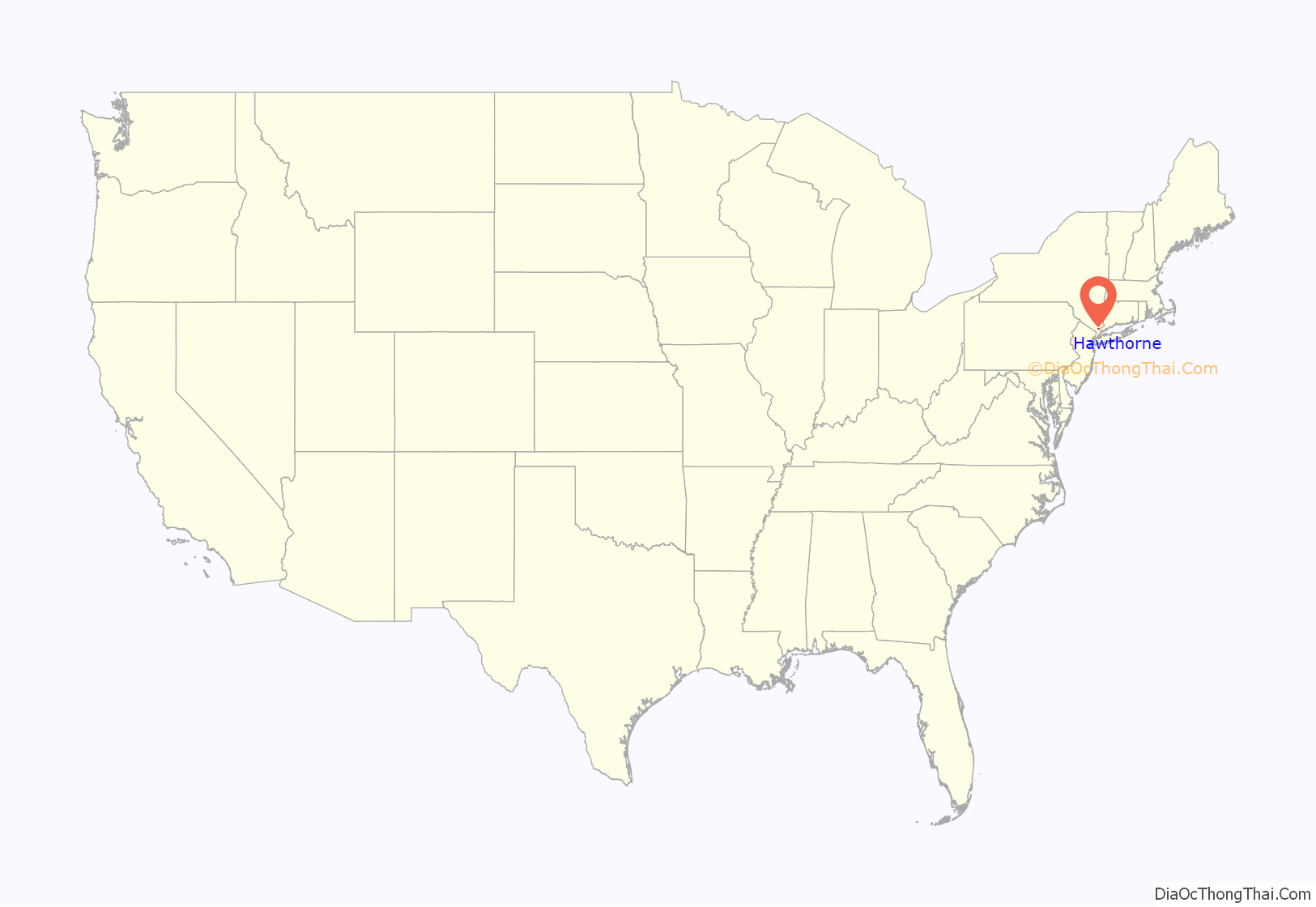
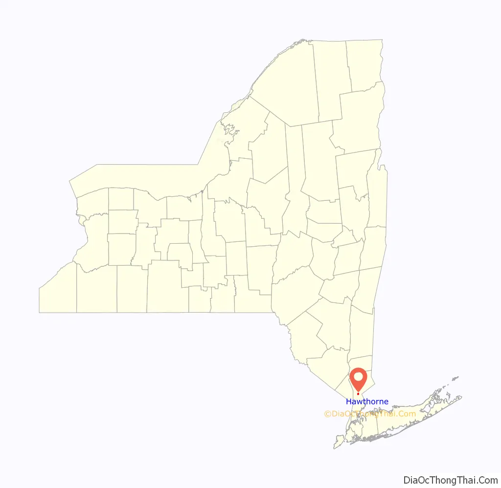
Hawthorne location map. Where is Hawthorne CDP?
History
The village was originally known as Hammond’s Mills, and was part of Frederick Philipse’s estate Philipsburgh. On September 23, 1780, Major John André stopped here on his way to New York to ask directions after meeting with Benedict Arnold.
After the Revolutionary War, the name of the village changed to Unionville. The hamlet’s population consisted mostly of farmers. The Reformed Church of Unionville (Hawthorne Reformed Church) was built here in 1818. In 1832, a one-room school house was built. In 1847, a railroad station was established on New York Central’s Harlem Division, with the name Unionville. A post office was established on February 10, 1851, and was designated Neperan after the Indian name for the Saw Mill River.
In the early 1890s, real-estate developer Louis Smadbeck began buying up the area farms to subdivide into parcels, which were sold to working- and middle-class people looking to live outside the city.
In 1901, Rose Hawthorne Lathrop, also known as Mother Mary Alphonsa, O.P., a convert to Catholicism and daughter of Nathaniel Hawthorne, founded Rosary Hill Home in Sherman Park (now Thornwood) for those suffering from incurable cancer. Mother Mary Alphonsa also founded a Dominican Order now known as the Dominican Sisters of Hawthorne. Shortly after the opening of the cancer home, the hamlet was renamed Hawthorne in Mother Mary Alphonsa’s honor. Rosary Hill Home is still operated by the Dominican Sisters of Hawthorne and is located on a hilltop on Linda Avenue.
Hawthorne is the final resting place of Babe Ruth, James Cagney, Billy Martin, Malachi Martin, Dorothy Kilgallen, Ernesto Lecuona and many other notables interred at Gate of Heaven Cemetery.
The Hammond House was listed on the National Register of Historic Places in 1980.
Hawthorne and neighboring Valhalla are fairly densely packed with cemeteries, albeit not as densely as Colma, California.
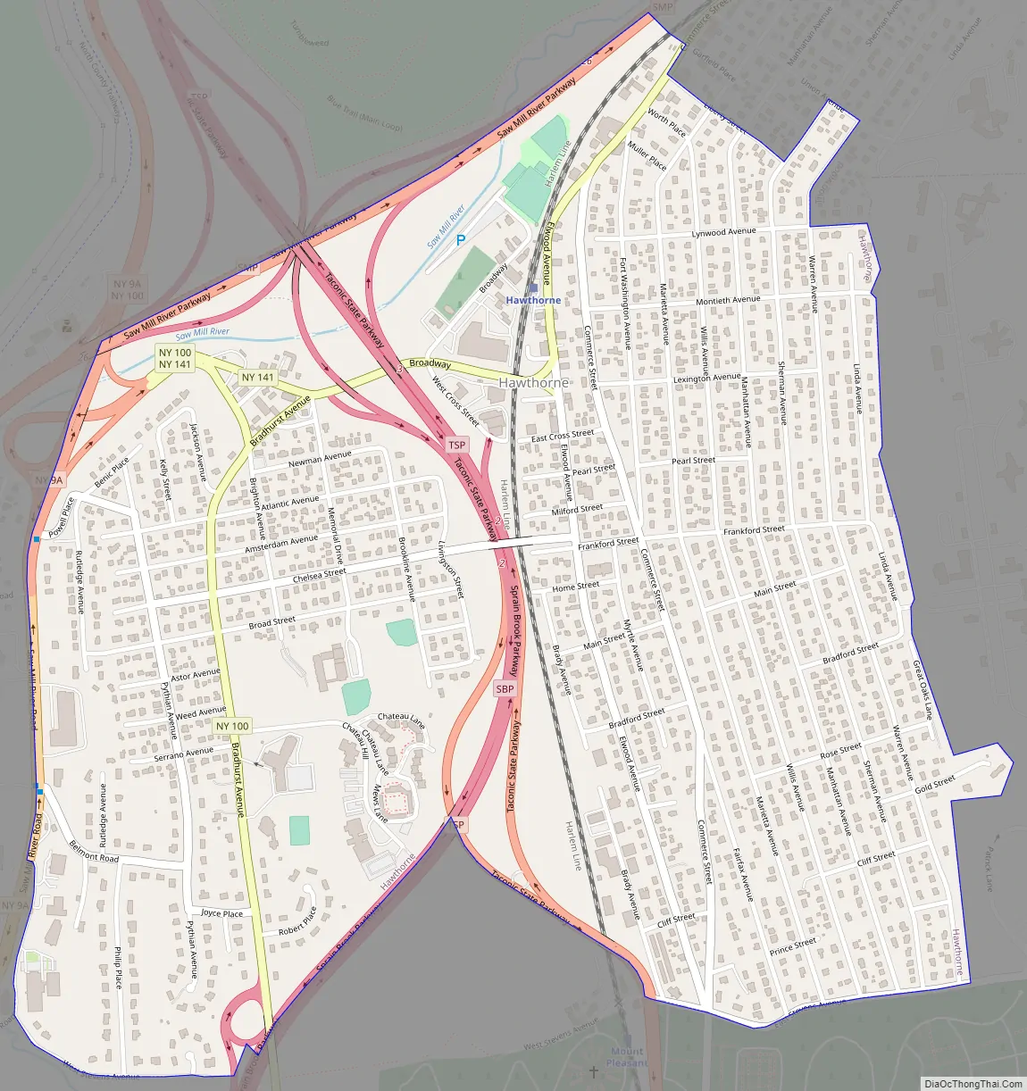
Hawthorne Road Map
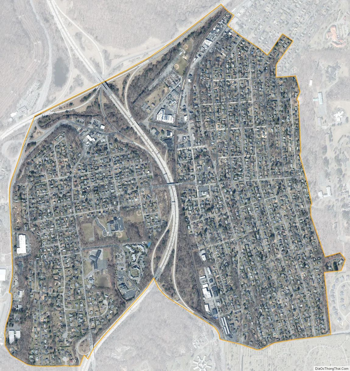
Hawthorne city Satellite Map
Geography
Hawthorne is located at 41°6′13″N 73°47′45″W / 41.10361°N 73.79583°W / 41.10361; -73.79583 (41.103664, -73.795807).
According to the United States Census Bureau, the CDP has a total area of 1.1 square miles (2.8 km), all land.
Bounded by Route 9A to the west, the Taconic State Parkway to the east, and split in the middle by the Sprain Brook Parkway, Hawthorne lies near the geographic center of Westchester County.
Corporate parks and nurseries line Hawthorne’s Route 9A corridor. Commerce Street (Route 141), the main commercial thoroughfare serving both Hawthorne and Thornwood, runs north to south, parallel to Metro-North’s Harlem Line tracks. It is a 40-minute train ride from the Hawthorne station to Grand Central Terminal.
The majority of Hawthorne consists of residential homes and small businesses. Stores on Elwood Avenue include The Lock House, the Hawthorne Station Deli (also known as the “Railroad Deli”), Pop’s Deli, Office Dynamics, and Hawthorne Pizzeria.
On July 12, 2006, an F2 tornado struck the hamlet, causing major damage to the California Closets Warehouse and minor injuries to three people. It was the strongest tornado to strike in Westchester County.
See also
Map of New York State and its subdivision:- Albany
- Allegany
- Bronx
- Broome
- Cattaraugus
- Cayuga
- Chautauqua
- Chemung
- Chenango
- Clinton
- Columbia
- Cortland
- Delaware
- Dutchess
- Erie
- Essex
- Franklin
- Fulton
- Genesee
- Greene
- Hamilton
- Herkimer
- Jefferson
- Kings
- Lake Ontario
- Lewis
- Livingston
- Madison
- Monroe
- Montgomery
- Nassau
- New York
- Niagara
- Oneida
- Onondaga
- Ontario
- Orange
- Orleans
- Oswego
- Otsego
- Putnam
- Queens
- Rensselaer
- Richmond
- Rockland
- Saint Lawrence
- Saratoga
- Schenectady
- Schoharie
- Schuyler
- Seneca
- Steuben
- Suffolk
- Sullivan
- Tioga
- Tompkins
- Ulster
- Warren
- Washington
- Wayne
- Westchester
- Wyoming
- Yates
- Alabama
- Alaska
- Arizona
- Arkansas
- California
- Colorado
- Connecticut
- Delaware
- District of Columbia
- Florida
- Georgia
- Hawaii
- Idaho
- Illinois
- Indiana
- Iowa
- Kansas
- Kentucky
- Louisiana
- Maine
- Maryland
- Massachusetts
- Michigan
- Minnesota
- Mississippi
- Missouri
- Montana
- Nebraska
- Nevada
- New Hampshire
- New Jersey
- New Mexico
- New York
- North Carolina
- North Dakota
- Ohio
- Oklahoma
- Oregon
- Pennsylvania
- Rhode Island
- South Carolina
- South Dakota
- Tennessee
- Texas
- Utah
- Vermont
- Virginia
- Washington
- West Virginia
- Wisconsin
- Wyoming


