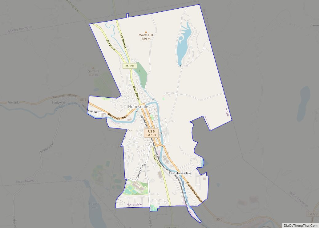
Honesdale is a borough in and the county seat of Wayne County, Pennsylvania, United States. The borough’s population was 4,458 at the time of the 2020 census.
Honesdale is located 32 miles (51 km) northeast of Scranton in a rural area that provides many recreational opportunities, such as boating, fishing, hiking, hunting, skiing, biking, skateboarding, and rafting. Located in a coal mining region, during the nineteenth century it was the starting point of the Delaware and Hudson Canal, which provided for transport of coal to Kingston, New York, and then down the Hudson River to New York City. In the 19th century, the expansion of railroads eventually superseded regular use of the canal.
| Name: | Honesdale borough |
|---|---|
| LSAD Code: | 21 |
| LSAD Description: | borough (suffix) |
| State: | Pennsylvania |
| County: | Wayne County |
| Incorporated: | January 28, 1831 |
| Elevation: | 981 ft (299 m) |
| Total Area: | 4.02 sq mi (10.42 km²) |
| Land Area: | 3.88 sq mi (10.05 km²) |
| Water Area: | 0.14 sq mi (0.36 km²) |
| Total Population: | 4,458 |
| Population Density: | 1,148.38/sq mi (443.41/km²) |
| ZIP code: | 18431 |
| Area code: | 570 and 272 |
| FIPS code: | 4235520 |
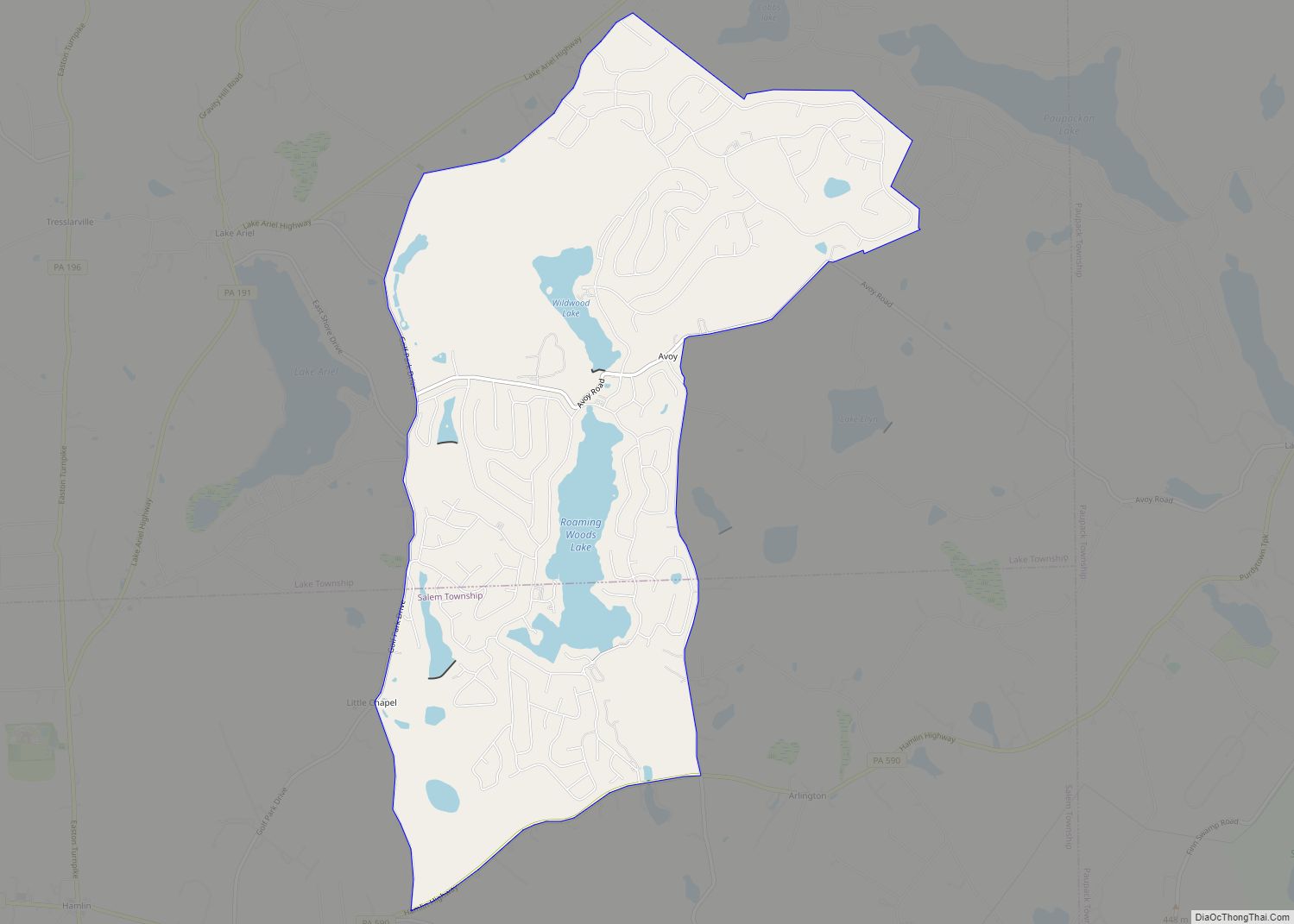
Online Interactive Map
Click on ![]() to view map in "full screen" mode.
to view map in "full screen" mode.
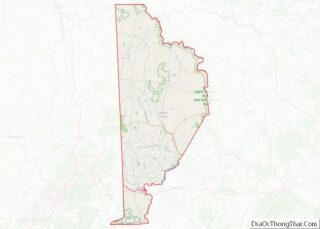
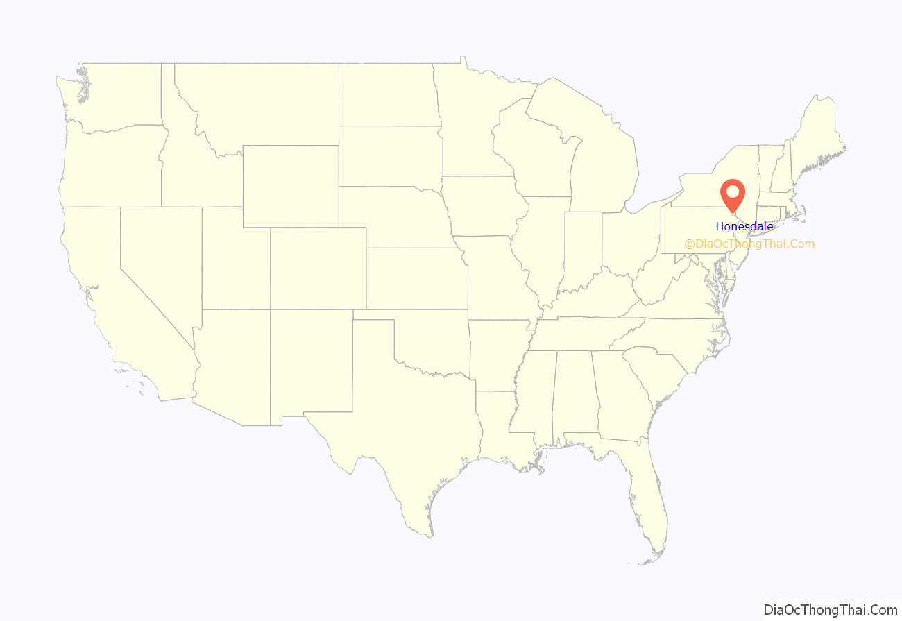
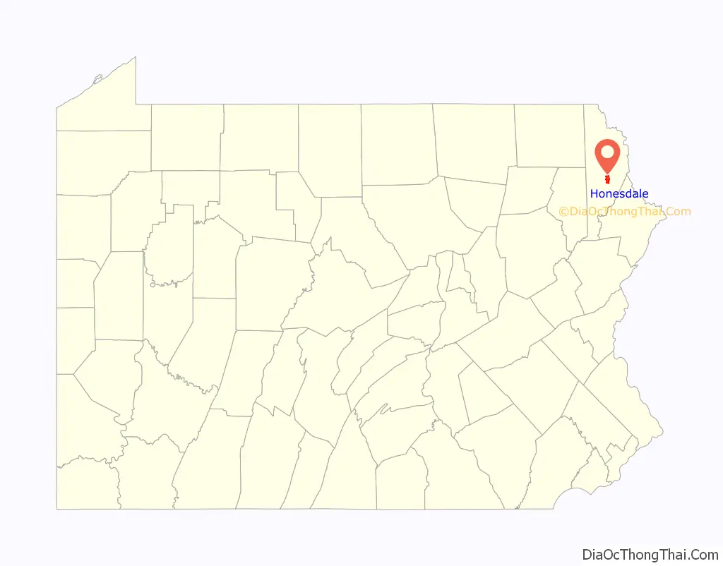
Honesdale location map. Where is Honesdale borough?
History
The discovery of anthracite coal in northeastern Pennsylvania in the early 1800s and the need to transport this valuable fuel to New York City gave birth to the Delaware and Hudson Canal, the American Railroad, and the Borough of Honesdale. Honesdale was named for Philip Hone, former Mayor of New York and president of Honesdale’s Delaware & Hudson (D&H) Canal Company. Honesdale, originally called “Dyberry Forks,” was laid out as a village in 1826 when the D & H Canal was created. It was incorporated as a borough on January 28, 1831.
The Honesdale Residential Historic District and the D&H Canal are listed on the National Register of Historic Places.
Birthplace of American railroading
Honesdale is home to the first commercial steam locomotive run on rails in the United States, the Stourbridge Lion. On August 8, 1829, the Stourbridge Lion started in Honesdale, ran three miles to Seelyville, and returned; Honesdale, therefore, is known as the birthplace of the American Railroad.
The Stourbridge Lion, owned by the Delaware & Hudson (D&H) Canal Company was regrettably considered too heavy for further use. D&H transported anthracite coal from mines near Carbondale to New York City via Honesdale and Kingston, New York. Coal was moved by a unique gravity-railroad from the mines to Honesdale where it was transferred to barges and transported via a 108-mile canal to Kingston, New York, then shipped by river barges down the Hudson River to New York City.
What remained of the Stourbridge Lion passed into many hands over the coming years and was eventually acquired by the Smithsonian Institution in 1890. The main boiler is currently on loan at the Baltimore and Ohio Railroad Museum in Baltimore, Maryland.
The Wayne County Historical Society Museum contains a full-scale replica of the Stourbridge Lion; the Society also displays many historical photographs, artifacts and other exhibits. The D&H Railroad Company built the replica using original blueprints for the 1933 Century of Progress Exposition in Chicago. The replica was relocated to Honesdale in 1941.
Passenger excursions run seasonally from Honesdale to Hawley along the historic Stourbridge Line. The railroad runs twenty-five miles along the Lackawaxen River. Excursions depart from the platform at the Wayne County Visitors Center.
Honesdale Road Map
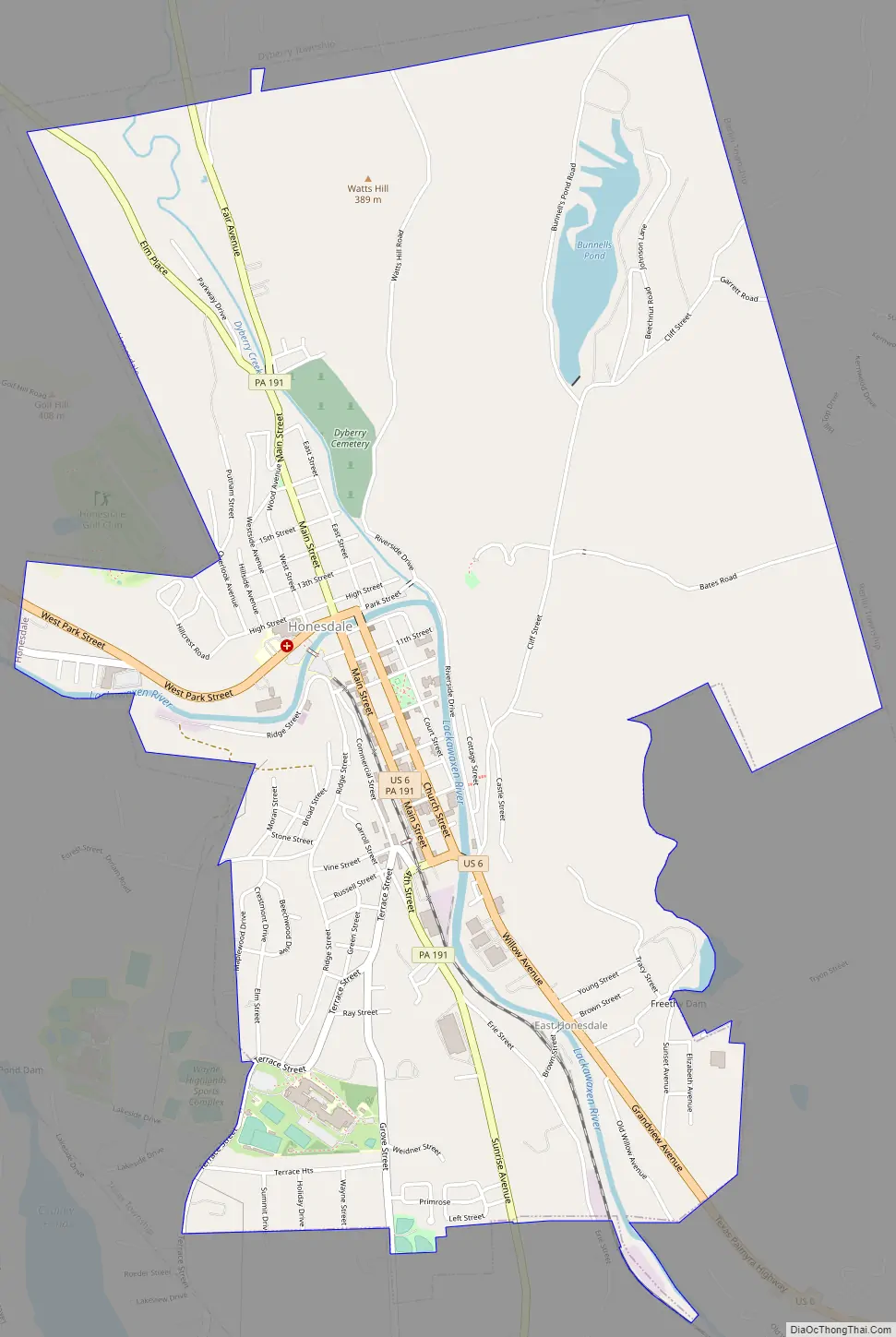
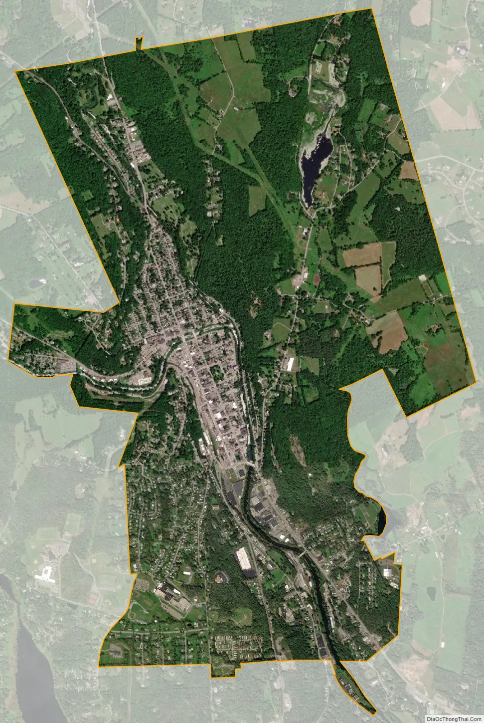
Honesdale city Satellite Map
Geography
Honesdale is located at 41°34′27″N 75°15′21″W / 41.57417°N 75.25583°W / 41.57417; -75.25583 (41.574214, -75.255966).
According to the United States Census Bureau, the borough has a total area of 4.0 square miles (10 km), of which 3.9 square miles (10 km) is land and 0.1 square miles (0.26 km) (2.5%) is water of the Lackawaxen River, which flows through the heart of the town, and its confluence with Dyberry Creek. The waters contain fish and other aquatic life and attract hundreds of ducks, as well as eagles and other raptors.
See also
Map of Pennsylvania State and its subdivision:- Adams
- Allegheny
- Armstrong
- Beaver
- Bedford
- Berks
- Blair
- Bradford
- Bucks
- Butler
- Cambria
- Cameron
- Carbon
- Centre
- Chester
- Clarion
- Clearfield
- Clinton
- Columbia
- Crawford
- Cumberland
- Dauphin
- Delaware
- Elk
- Erie
- Fayette
- Forest
- Franklin
- Fulton
- Greene
- Huntingdon
- Indiana
- Jefferson
- Juniata
- Lackawanna
- Lancaster
- Lawrence
- Lebanon
- Lehigh
- Luzerne
- Lycoming
- Mc Kean
- Mercer
- Mifflin
- Monroe
- Montgomery
- Montour
- Northampton
- Northumberland
- Perry
- Philadelphia
- Pike
- Potter
- Schuylkill
- Snyder
- Somerset
- Sullivan
- Susquehanna
- Tioga
- Union
- Venango
- Warren
- Washington
- Wayne
- Westmoreland
- Wyoming
- York
- Alabama
- Alaska
- Arizona
- Arkansas
- California
- Colorado
- Connecticut
- Delaware
- District of Columbia
- Florida
- Georgia
- Hawaii
- Idaho
- Illinois
- Indiana
- Iowa
- Kansas
- Kentucky
- Louisiana
- Maine
- Maryland
- Massachusetts
- Michigan
- Minnesota
- Mississippi
- Missouri
- Montana
- Nebraska
- Nevada
- New Hampshire
- New Jersey
- New Mexico
- New York
- North Carolina
- North Dakota
- Ohio
- Oklahoma
- Oregon
- Pennsylvania
- Rhode Island
- South Carolina
- South Dakota
- Tennessee
- Texas
- Utah
- Vermont
- Virginia
- Washington
- West Virginia
- Wisconsin
- Wyoming