Montrose is a hamlet (and census-designated place) within the town of Cortlandt, in the northwestern corner of Westchester County, New York, United States. It is located near Croton-on-Hudson and Buchanan. The rural character of the hamlet is defined by the Hudson River, numerous wooded hills and steep slopes, wetland areas and beautiful streams. As of the 2010 census, Montrose had a population of 2,731.
| Name: | Montrose CDP |
|---|---|
| LSAD Code: | 57 |
| LSAD Description: | CDP (suffix) |
| State: | New York |
| County: | Westchester County |
| Elevation: | 118 ft (36 m) |
| Total Area: | 2.46 sq mi (6.36 km²) |
| Land Area: | 1.62 sq mi (4.20 km²) |
| Water Area: | 0.84 sq mi (2.16 km²) |
| Total Population: | 2,862 |
| Population Density: | 1,766.67/sq mi (681.96/km²) |
| ZIP code: | 10548 |
| Area code: | 914 |
| FIPS code: | 3648208 |
| GNISfeature ID: | 0957565 |
Online Interactive Map
Click on ![]() to view map in "full screen" mode.
to view map in "full screen" mode.
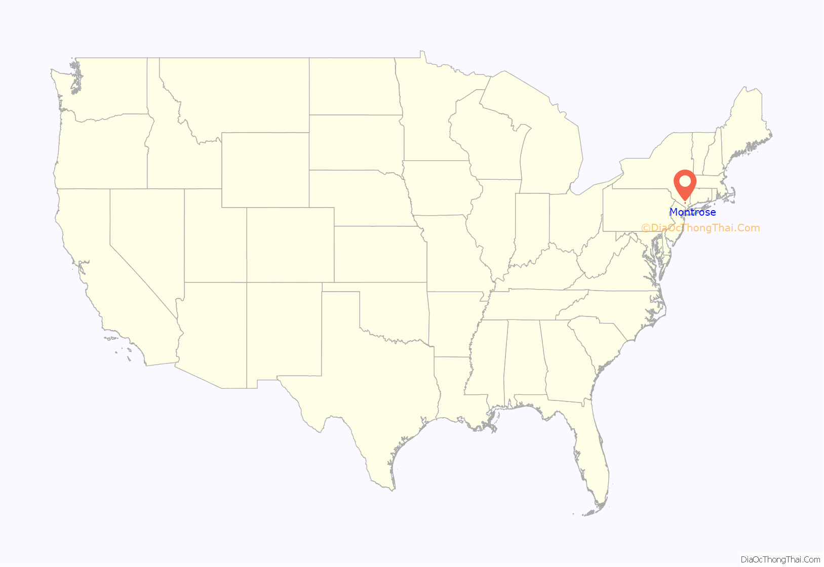
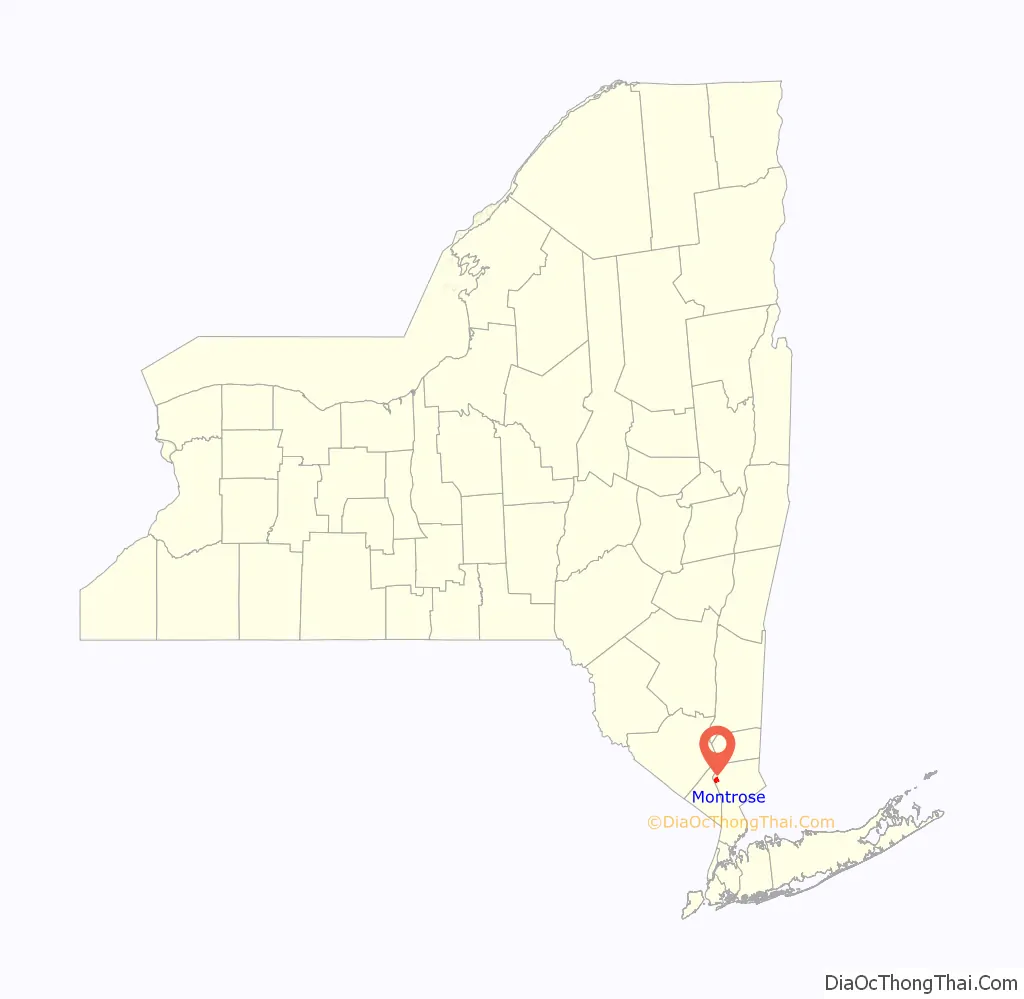
Montrose location map. Where is Montrose CDP?
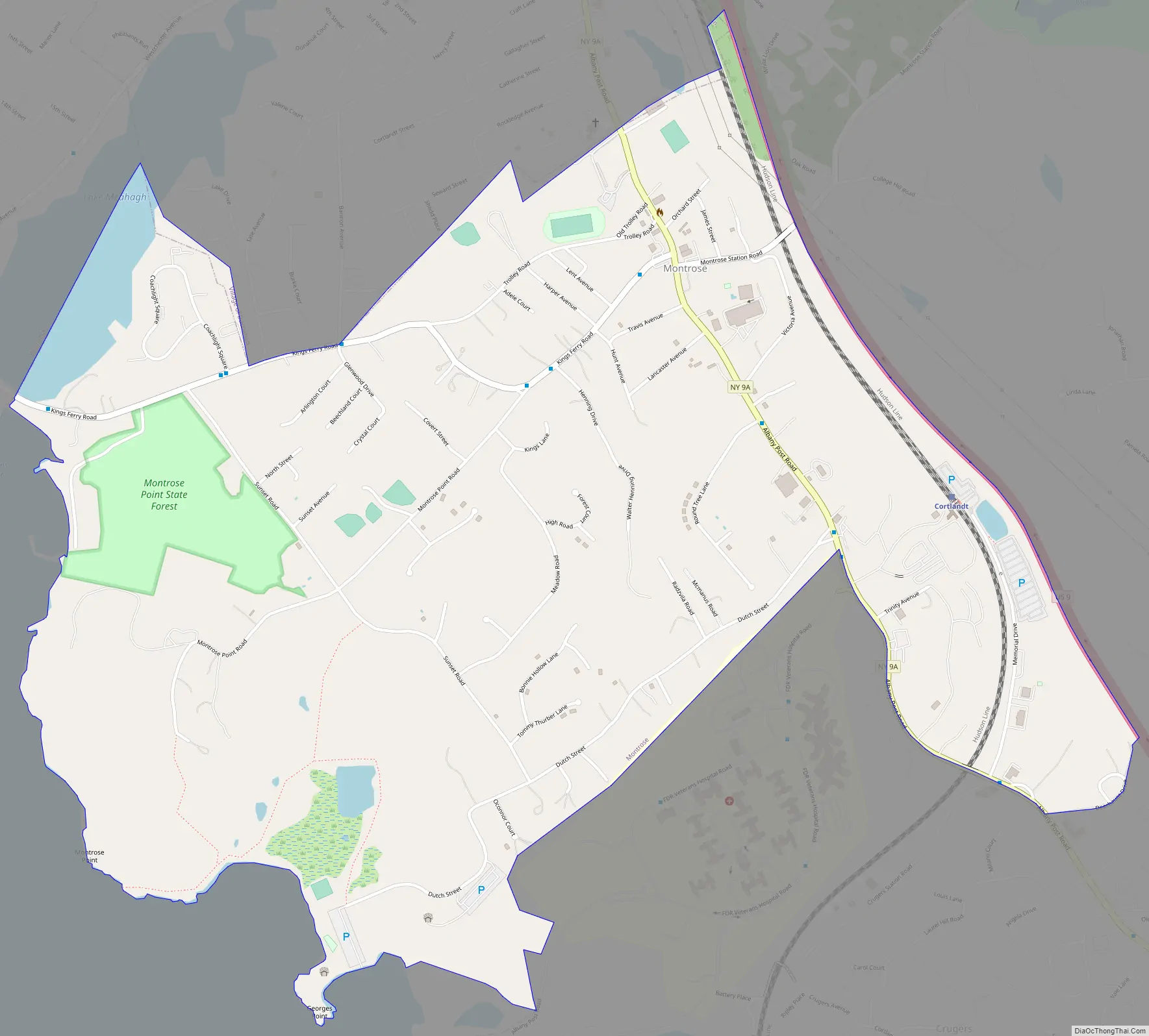
Montrose Road Map
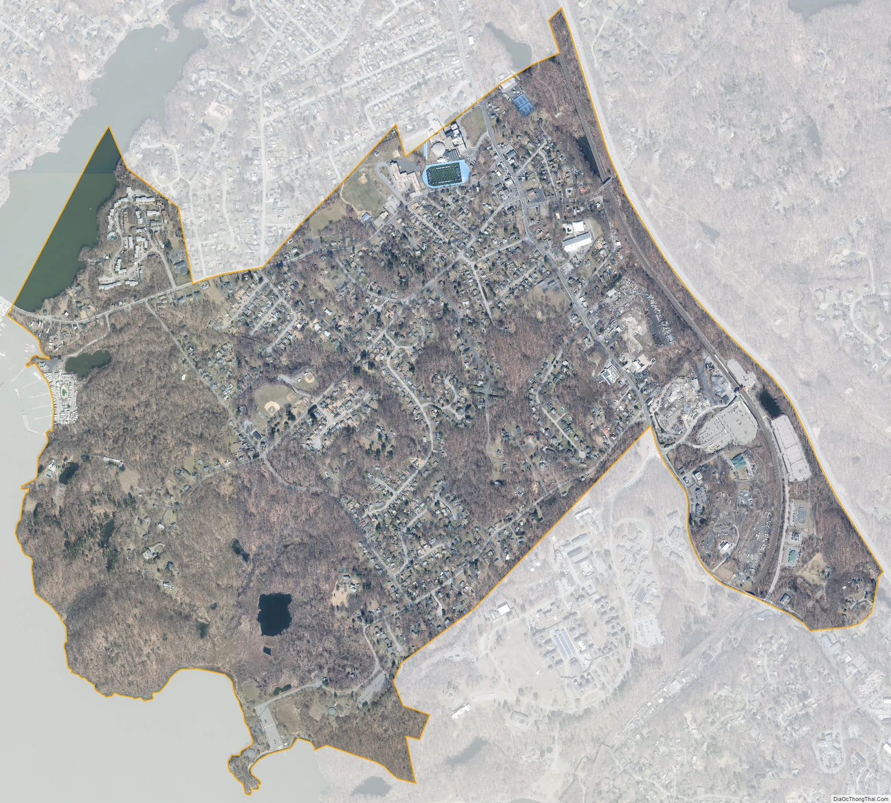
Montrose city Satellite Map
See also
Map of New York State and its subdivision:- Albany
- Allegany
- Bronx
- Broome
- Cattaraugus
- Cayuga
- Chautauqua
- Chemung
- Chenango
- Clinton
- Columbia
- Cortland
- Delaware
- Dutchess
- Erie
- Essex
- Franklin
- Fulton
- Genesee
- Greene
- Hamilton
- Herkimer
- Jefferson
- Kings
- Lake Ontario
- Lewis
- Livingston
- Madison
- Monroe
- Montgomery
- Nassau
- New York
- Niagara
- Oneida
- Onondaga
- Ontario
- Orange
- Orleans
- Oswego
- Otsego
- Putnam
- Queens
- Rensselaer
- Richmond
- Rockland
- Saint Lawrence
- Saratoga
- Schenectady
- Schoharie
- Schuyler
- Seneca
- Steuben
- Suffolk
- Sullivan
- Tioga
- Tompkins
- Ulster
- Warren
- Washington
- Wayne
- Westchester
- Wyoming
- Yates
- Alabama
- Alaska
- Arizona
- Arkansas
- California
- Colorado
- Connecticut
- Delaware
- District of Columbia
- Florida
- Georgia
- Hawaii
- Idaho
- Illinois
- Indiana
- Iowa
- Kansas
- Kentucky
- Louisiana
- Maine
- Maryland
- Massachusetts
- Michigan
- Minnesota
- Mississippi
- Missouri
- Montana
- Nebraska
- Nevada
- New Hampshire
- New Jersey
- New Mexico
- New York
- North Carolina
- North Dakota
- Ohio
- Oklahoma
- Oregon
- Pennsylvania
- Rhode Island
- South Carolina
- South Dakota
- Tennessee
- Texas
- Utah
- Vermont
- Virginia
- Washington
- West Virginia
- Wisconsin
- Wyoming


