Nelliston is a village in Montgomery County, New York, United States. The population was 596 at the 2010 census. The name is from members of the Nellis family.
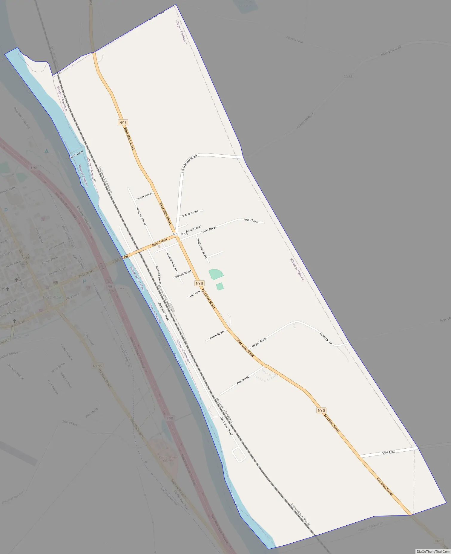
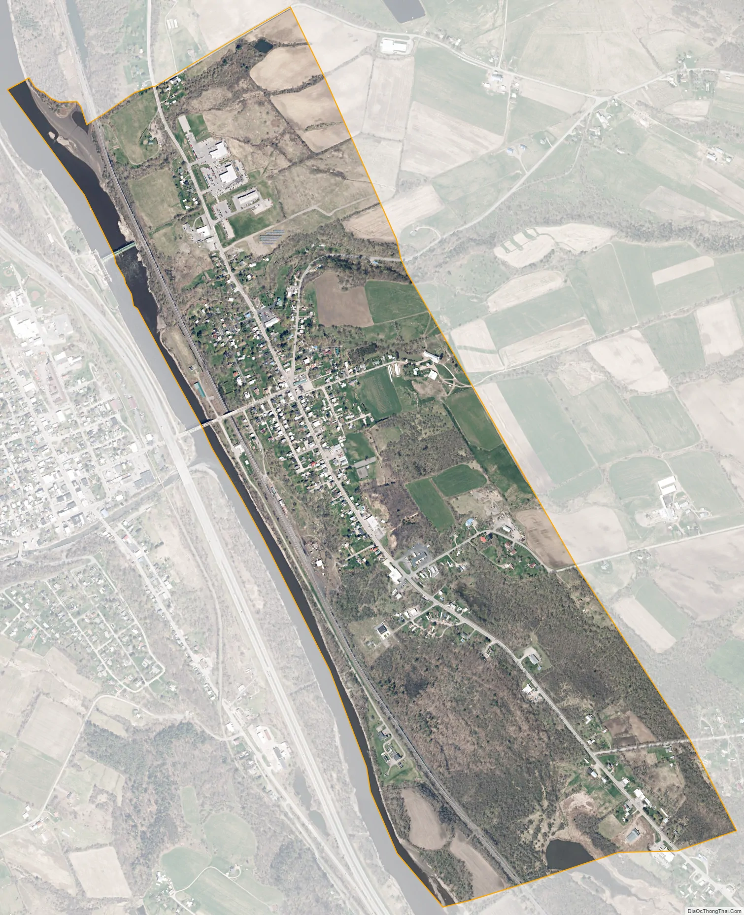
The Village of Nelliston is in the Town of Palatine and is west of Amsterdam.
The Erie Canal passes the village.
| Name: | Nelliston village |
|---|---|
| LSAD Code: | 47 |
| LSAD Description: | village (suffix) |
| State: | New York |
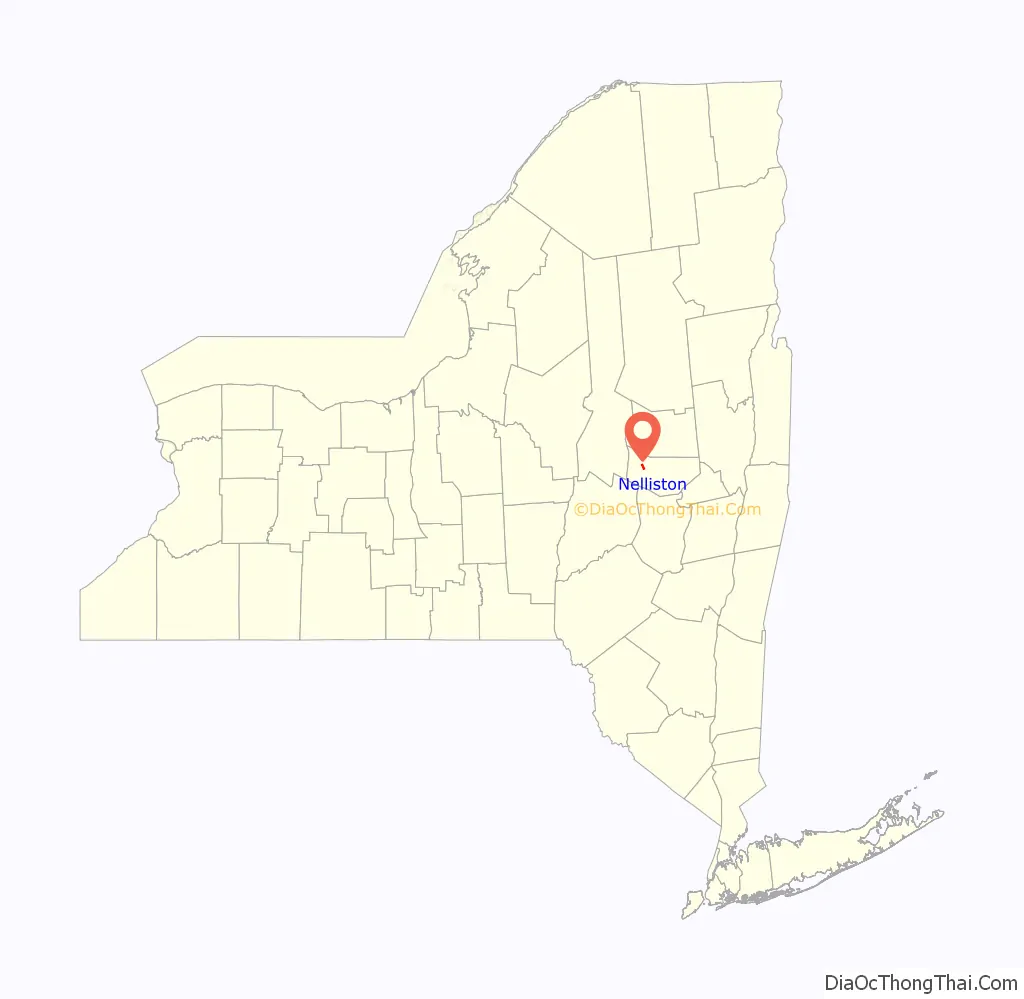
| County: | Montgomery County |
| Elevation: | 367 ft (112 m) |
| Total Area: | 1.20 sq mi (3.10 km²) |
| Land Area: | 1.10 sq mi (2.86 km²) |
| Water Area: | 0.09 sq mi (0.23 km²) |
| Total Population: | 555 |
| Population Density: | 502.26/sq mi (193.97/km²) |
| ZIP code: | 13410 |
| Area code: | 518 |
| FIPS code: | 3649748 |
| GNISfeature ID: | 0958362 |
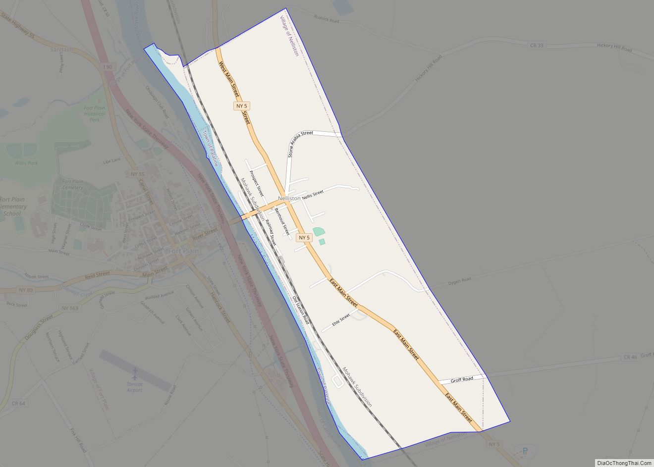
Online Interactive Map
Click on ![]() to view map in "full screen" mode.
to view map in "full screen" mode.
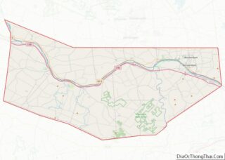
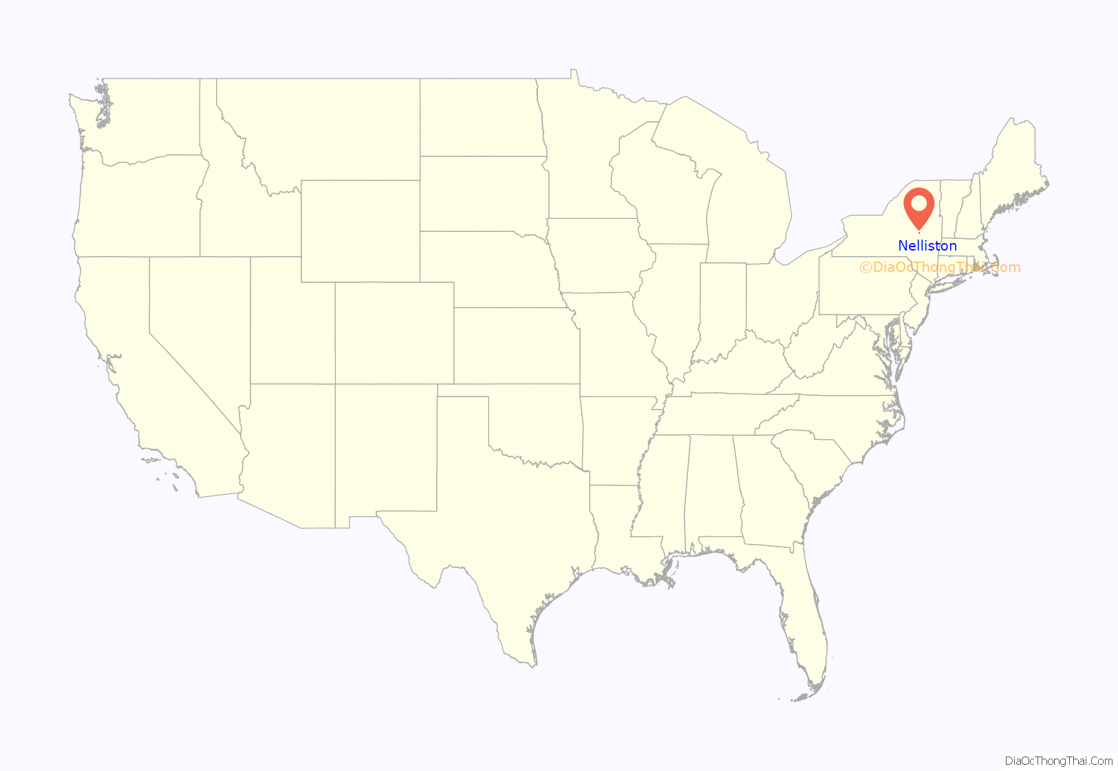
Nelliston location map. Where is Nelliston village?
History
Andrew Nellis, founder of the Nellis family in the area, came to the Town of Palatine in 1722. Fort Fox and Fort Wagner were built at this location during the late colonial period. The village was not well-developed until the time of the Civil War.
The Lasher-Davis House, Ehle House Site, Peter Ehle House, Reformed Dutch Church of Stone Arabia, Jacob Nellis Farmhouse, Nelliston School, Waterman-Gramps House, Walrath-Van Horne House, and Nelliston Historic District are listed on the National Register of Historic Places.
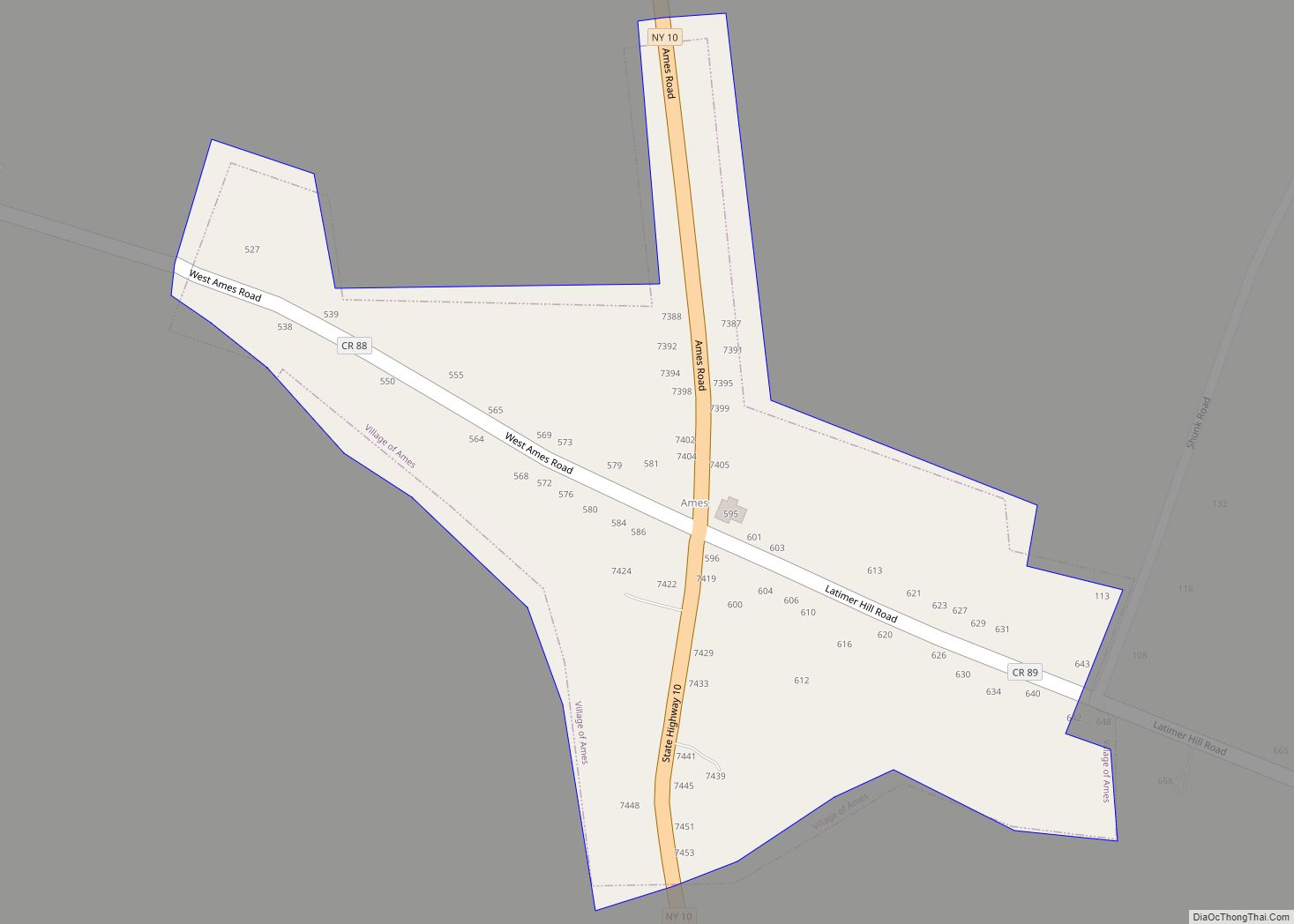
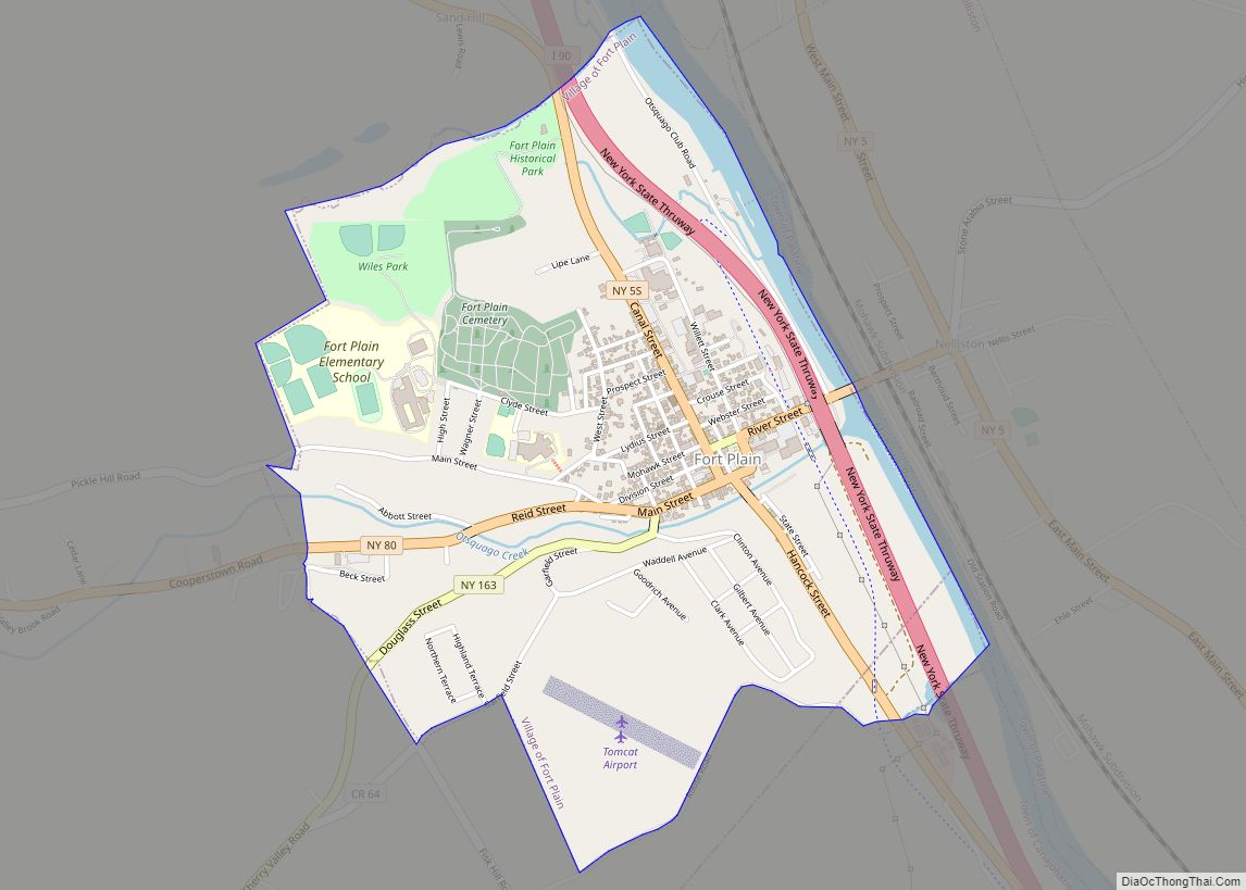
Nelliston Road Map
Nelliston city Satellite Map
Geography
Nelliston is located at 42°56′1″N 74°36′49″W / 42.93361°N 74.61361°W / 42.93361; -74.61361 (42.933644, -74.613531).
According to the United States Census Bureau, the village has a total area of 1.2 square miles (3.1 km), of which 1.1 square miles (2.8 km) is land and 0.1 square miles (0.26 km) (7.56%) is water.
The village is on the northeast side of the Mohawk River across from the Village of Fort Plain and the New York State Thruway.
New York State Route 5 (Main Street) passes through Nelliston. New York State Route 80 has its northern terminus at NY 5 in the village.
See also
Map of New York State and its subdivision:- Albany
- Allegany
- Bronx
- Broome
- Cattaraugus
- Cayuga
- Chautauqua
- Chemung
- Chenango
- Clinton
- Columbia
- Cortland
- Delaware
- Dutchess
- Erie
- Essex
- Franklin
- Fulton
- Genesee
- Greene
- Hamilton
- Herkimer
- Jefferson
- Kings
- Lake Ontario
- Lewis
- Livingston
- Madison
- Monroe
- Montgomery
- Nassau
- New York
- Niagara
- Oneida
- Onondaga
- Ontario
- Orange
- Orleans
- Oswego
- Otsego
- Putnam
- Queens
- Rensselaer
- Richmond
- Rockland
- Saint Lawrence
- Saratoga
- Schenectady
- Schoharie
- Schuyler
- Seneca
- Steuben
- Suffolk
- Sullivan
- Tioga
- Tompkins
- Ulster
- Warren
- Washington
- Wayne
- Westchester
- Wyoming
- Yates
- Alabama
- Alaska
- Arizona
- Arkansas
- California
- Colorado
- Connecticut
- Delaware
- District of Columbia
- Florida
- Georgia
- Hawaii
- Idaho
- Illinois
- Indiana
- Iowa
- Kansas
- Kentucky
- Louisiana
- Maine
- Maryland
- Massachusetts
- Michigan
- Minnesota
- Mississippi
- Missouri
- Montana
- Nebraska
- Nevada
- New Hampshire
- New Jersey
- New Mexico
- New York
- North Carolina
- North Dakota
- Ohio
- Oklahoma
- Oregon
- Pennsylvania
- Rhode Island
- South Carolina
- South Dakota
- Tennessee
- Texas
- Utah
- Vermont
- Virginia
- Washington
- West Virginia
- Wisconsin
- Wyoming