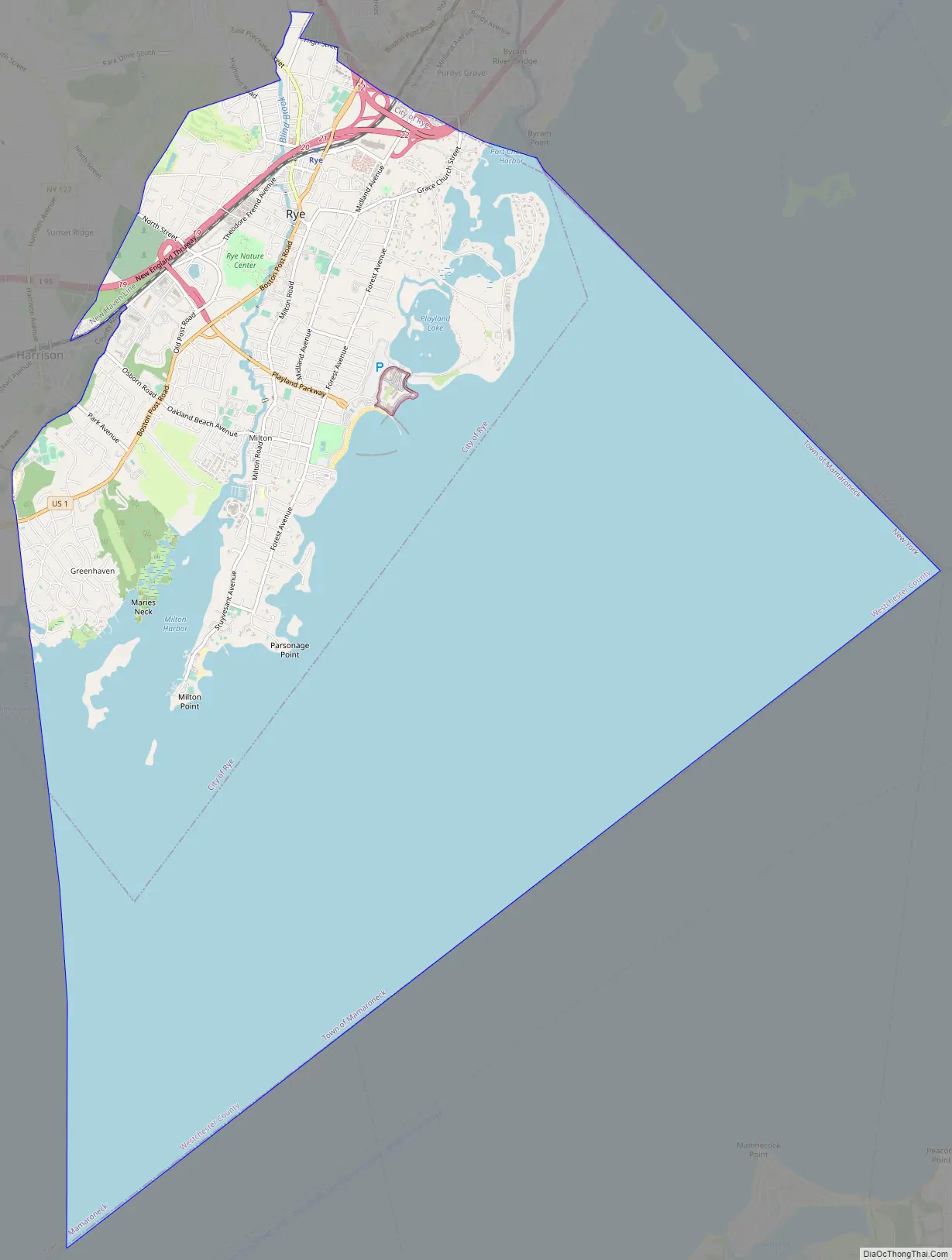
Rye is a coastal city in Westchester County, New York, United States, located near New York City and within the New York metropolitan area. It is separate from the Town of Rye, which has more land area than the city. The City of Rye, formerly the Village of Rye, was part of the Town until it received its charter as a city in 1942, making it the youngest city in the State of New York. Its population density for its 5.85 square miles of land is roughly 2,729.76/sq mi.
Rye is notable for its waterfront which covers 60 percent of the city’s six square miles and is governed by a waterfront act instituted in 1991. Located in the city are two National Historic Landmarks: the Boston Post Road Historic District was designated a National Historic Landmark by the National Park Service in 1993; its centerpiece is the Jay Estate, the childhood home of John Jay, a Founding Father and the first Chief Justice of the United States.
Playland, a historic amusement park designated a National Historic Landmark in 1987 is also located in Rye. Playland features one of the oldest wooden roller coasters in the Northeast, the Dragon Coaster.
| Name: | Rye city |
|---|---|
| LSAD Code: | 25 |
| LSAD Description: | city (suffix) |
| State: | New York |
| County: | Westchester County |
| Total Area: | 20.02 sq mi (51.86 km²) |
| Land Area: | 5.85 sq mi (15.16 km²) |
| Water Area: | 14.17 sq mi (36.70 km²) |
| Total Population: | 16,592 |
| Population Density: | 2,834.79/sq mi (1,094.60/km²) |
| ZIP code: | 10580 |
| Area code: | 914 |
| FIPS code: | 3664309 |
| Website: | http://www.ryeny.gov/ |
Online Interactive Map
Click on ![]() to view map in "full screen" mode.
to view map in "full screen" mode.
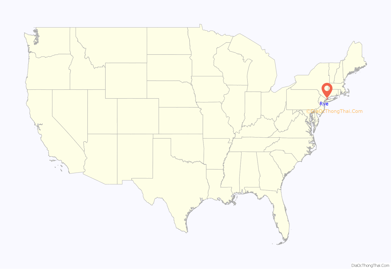
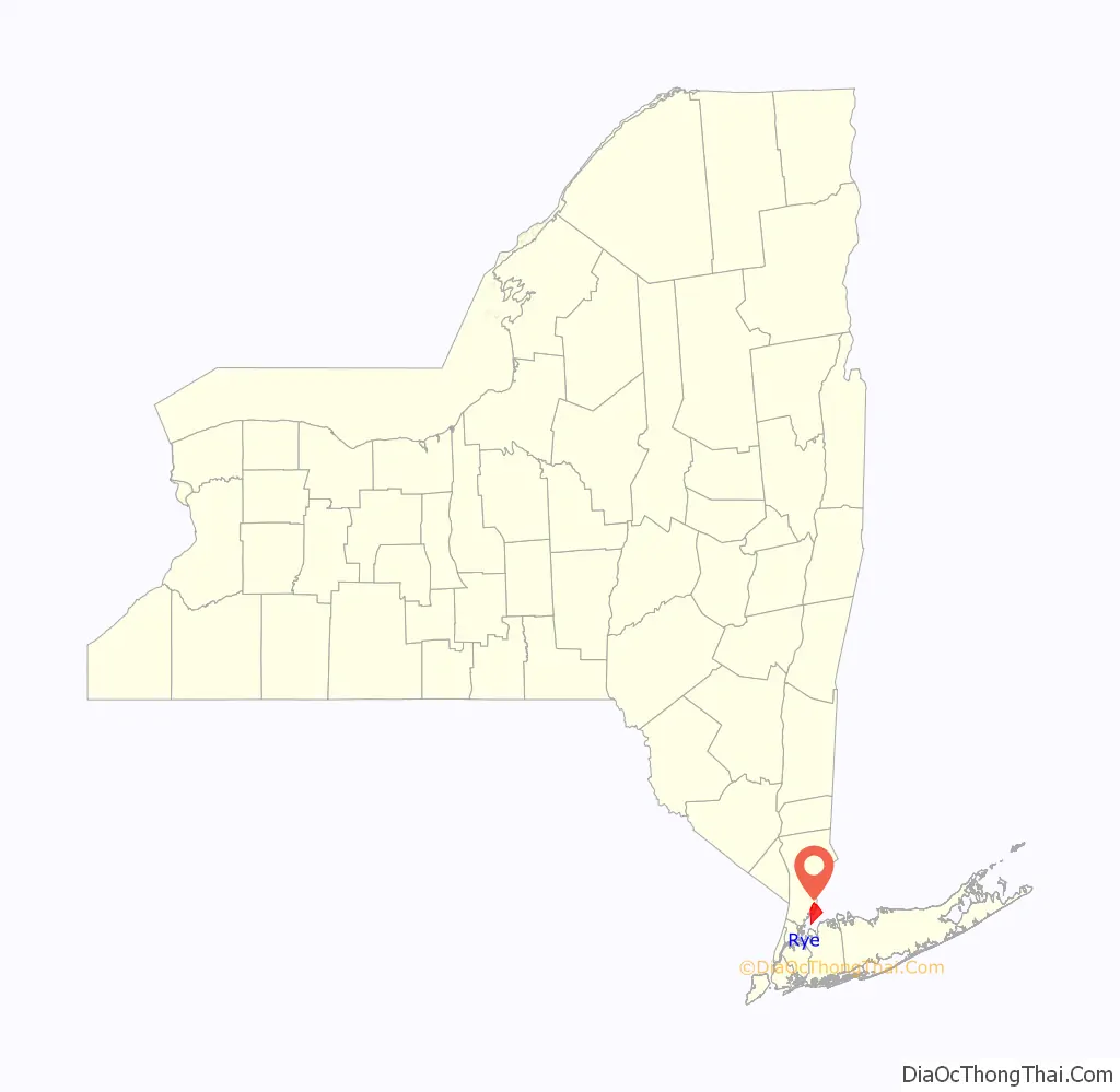
Rye location map. Where is Rye city?
History
Rye was once a part of Fairfield County, Connecticut, belonging to the Sachem Ponus, of the Ponus Wekuwuhm, Canaan Parish, and was probably named for that chieftain, “Peningoe Neck”.
It was founded in 1660 by three men: Thomas Studwell, Peter Disbrow and John Coe. Later landowners included John Budd and family.
During the 19th and early 20th centuries it was a haven for wealthy Manhattanites who traveled by coach or boat to escape the city heat. Its location on Long Island Sound and numerous beaches also appealed to visitors with more moderate means who gravitated for short stays at cottages and waterfront hotels.
It has an extraordinary inventory of buildings with architectural distinction that help visually articulate specific neighborhoods and districts.
Rye Road Map
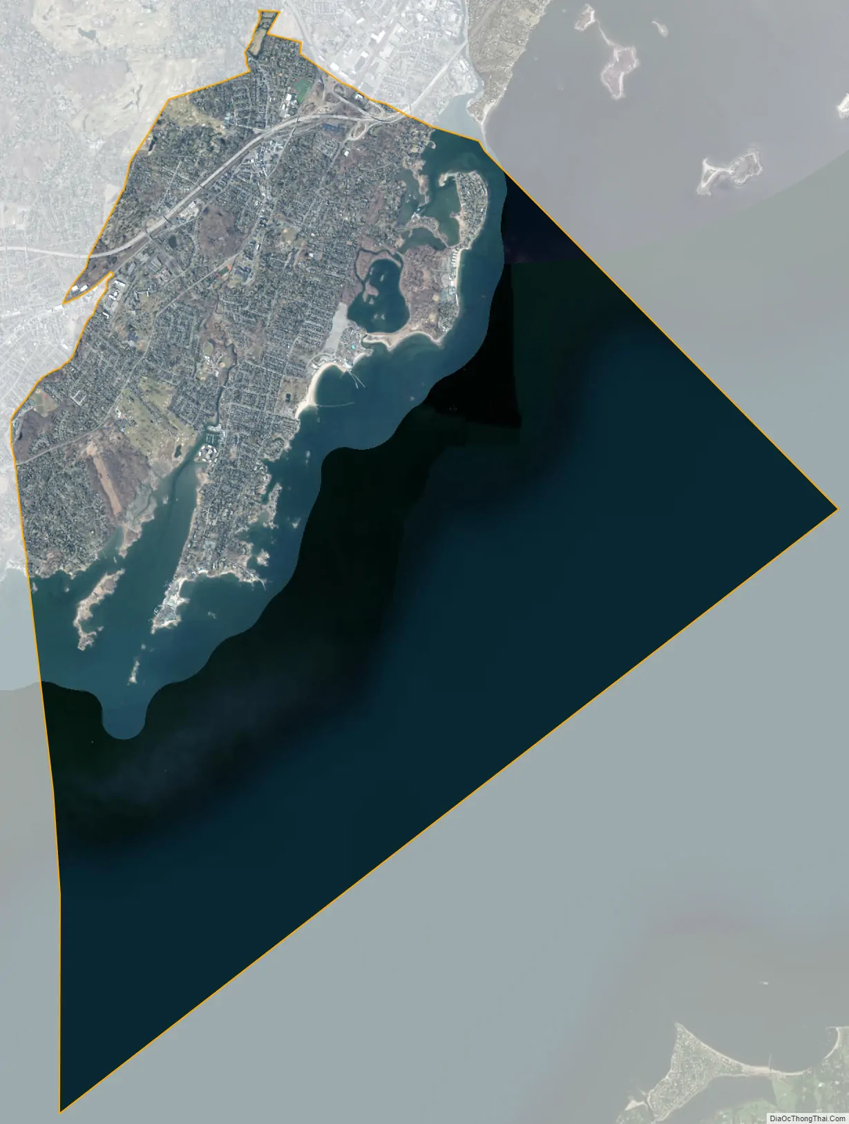
Rye city Satellite Map
Geography
According to the United States Census Bureau, the city has a total area of 20.0 square miles (52 km), of which 5.9 sq mi (15 km) is land and 14.2 sq mi (37 km) is water.
Rye is “situated in the eastern part of central Westchester County on Long Island Sound. The western border of the City generally parallels Beaver Swamp Brook, while the eastern border is formed by Milton Harbor and the Sound. Blind Brook traverses the City from the northwest corner of Rye to Milton Harbor at the southern end.”
Rock and wetlands
The geology and hydrology of Rye is characterized by a significant quantity of rock, marshes and wetlands which makes the city both desirably scenic but also challenging for developers.
Rye’s bedrock is predominantly constituted of Fordham gneiss and Harrison diorite also known as Byram Black granite.
According to Rye’s 1985 Master Plan, “Rye contains a variety of environmentally significant areas. Numerous tidal and freshwater wetlands are found near the waterfront and brooks. The Milton Harbor area (including the Marshlands Conservancy and Rye Golf Club), Disbrow Park and the Manursing area contain the most extensive wetlands in the City. In addition, substantial areas near the Sound, Milton Harbor, Blind Brook and Beaver Swamp Brook are within the 100 year flood hazard area, and thus subject to potential flooding.” According to the City of Rye, “Considerable acreage of these important natural resources has been lost or impaired by draining, dredging, filling, excavating, building, polluting and other acts inconsistent with the natural uses of such areas. Remaining wetlands are in jeopardy of being lost, despoiled or impaired by such acts contrary to the public safety and welfare.” As a result, the City has charged itself with the responsibility of “preventing the despoilation and destruction of wetlands and watercourses while taking into account varying ecological, economic, recreational and aesthetic values. Activities that may damage wetlands or watercourses should be located on upland sites in such a manner as not to degrade these systems.”
In 2017, Rye resident and then New York State Senator George Latimer noted that wetlands maps for the area have not been updated in over 20 years
Flooding
Flooding has long been an issue in Rye as in other coastal towns with water coming in from Long Island Sound. The Blind Brook watershed is also a source of that flooding with significant deluges recorded in the neighborhood of Indian Village after four days of rain in October 1975.
Three major weather events in just five years produced catastrophic damage in the town.
- Following major flooding in March 2007, the April 2007 nor’easter six weeks later left some homes in Rye with over five feet of floodwater.
- In 2011, the after effects of Hurricane Irene in August and Hurricane Maria in September included swelling of Blind Brook and submersion of private and commercial properties including the Rye Nature Center, Indian Village, the Rye High football field, businesses on Purchase Street and homes on Milton and Highland Roads.
- Storm surges from Hurricane Sandy in 2012 resulted in evacuations of many coastal residences and facilities including the Milton firehouse.
The City’s response to these recurring hazards was to apply for funding through the NY Rising Community Reconstruction Program. Rye received $3,000,000 to safeguard the city against future flooding threats, upgrade its infrastructure for resiliency, identify stormwater mitigation solutions, and protect historic buildings and natural wetlands.
Starting on September 1, 2021, Rye experienced another substantial flooding event. The storm lasted two days and caused significant damage to municipal facilities, businesses and residences. Areas around Indian Village and other sections of the city that had previously flooded during Hurricane Irene were under 8–9 feet of water. Other areas around the town normally not affected by flooding were also affected. Prior to the flooding event, Rye had undergone approximately five inches of rainfall from Hurricane Henri. Two weeks later, the remnants Hurricane Ida dropped another 8–9 inches of rain in the area within a 12 hour period. Hurricane Ida remnants caused flooding in Rye nearly 10 years to the day from Hurricane Irene.
Archaeological significance and notable indigenous sites
As of 2010, seventy-five percent of the acreage in Rye or the equivalent of 3,954 acres had been determined to be archaeologically sensitive with many Indigenous and First Nations contact sites. At least two villages have been determined to have existed, one on Manursing Island and the other on today’s Milton Point.
The presence of Indigenous people’s activities has been noted in numerous locations where implements and bones were unearthed, including an “ancient Indian burial ground, site of the present Playland Casino” together with discoveries of artifacts along the shoreline, pottery, skeletons and relics along Milton Road, Disbrow Park and throughout today’s Boston Post Road Historic District including Marshlands Conservancy.
The presence of Indigenous people in Rye was more recently documented in a 2012 Phase IA archaeological investigation commissioned by Westchester County in connection with the construction of a bike path along the Playland Parkway in Rye. Within just one mile of the project site, the report noted a dozen archeologically sensitive areas. The publication included supporting data from files in the repositories of NYOPRHP and the NY State Museum; it further highlighted the existence of shell middens, evidence of camp sites and at least two burial grounds. One of these documented sites included the Blind Brook. Additional findings have been made at the Jay Estate in archaeological digs conducted by Dr. Eugene Boesch and submitted to the NY State Cultural Resource Information System (CRIS).
See also
Map of New York State and its subdivision:- Albany
- Allegany
- Bronx
- Broome
- Cattaraugus
- Cayuga
- Chautauqua
- Chemung
- Chenango
- Clinton
- Columbia
- Cortland
- Delaware
- Dutchess
- Erie
- Essex
- Franklin
- Fulton
- Genesee
- Greene
- Hamilton
- Herkimer
- Jefferson
- Kings
- Lake Ontario
- Lewis
- Livingston
- Madison
- Monroe
- Montgomery
- Nassau
- New York
- Niagara
- Oneida
- Onondaga
- Ontario
- Orange
- Orleans
- Oswego
- Otsego
- Putnam
- Queens
- Rensselaer
- Richmond
- Rockland
- Saint Lawrence
- Saratoga
- Schenectady
- Schoharie
- Schuyler
- Seneca
- Steuben
- Suffolk
- Sullivan
- Tioga
- Tompkins
- Ulster
- Warren
- Washington
- Wayne
- Westchester
- Wyoming
- Yates
- Alabama
- Alaska
- Arizona
- Arkansas
- California
- Colorado
- Connecticut
- Delaware
- District of Columbia
- Florida
- Georgia
- Hawaii
- Idaho
- Illinois
- Indiana
- Iowa
- Kansas
- Kentucky
- Louisiana
- Maine
- Maryland
- Massachusetts
- Michigan
- Minnesota
- Mississippi
- Missouri
- Montana
- Nebraska
- Nevada
- New Hampshire
- New Jersey
- New Mexico
- New York
- North Carolina
- North Dakota
- Ohio
- Oklahoma
- Oregon
- Pennsylvania
- Rhode Island
- South Carolina
- South Dakota
- Tennessee
- Texas
- Utah
- Vermont
- Virginia
- Washington
- West Virginia
- Wisconsin
- Wyoming


