Dobbs Ferry is a village in Westchester County, New York, United States. The population was 10,875 according to the 2010 United States Census. In 2021, its population rose to an estimated 11,456. The village of Dobbs Ferry is located in, and is a part of, the town of Greenburgh. The village ZIP code is 10522. Most of the village falls within the boundaries of the Dobbs Ferry Union Free School District.
Dobbs Ferry was ranked seventh in the list of the top 10 places to live in New York State for 2014, according to the national online real estate brokerage Movoto. Dobbs Ferry is also the first village in New York State certified as a Climate Smart Community and was granted in 2014 the highest level given out in the state.
| Name: | Dobbs Ferry village |
|---|---|
| LSAD Code: | 47 |
| LSAD Description: | village (suffix) |
| State: | New York |
| County: | Westchester County |
| Elevation: | 210 ft (64 m) |
| Total Area: | 3.17 sq mi (8.22 km²) |
| Land Area: | 2.42 sq mi (6.27 km²) |
| Water Area: | 0.75 sq mi (1.95 km²) |
| Total Population: | 11,541 |
| Population Density: | 4,763.10/sq mi (1,839.25/km²) |
| ZIP code: | 10522 |
| Area code: | 914 |
| FIPS code: | 3620698 |
| GNISfeature ID: | 0970074 |
| Website: | www.dobbsferry.com |
Online Interactive Map
Click on ![]() to view map in "full screen" mode.
to view map in "full screen" mode.
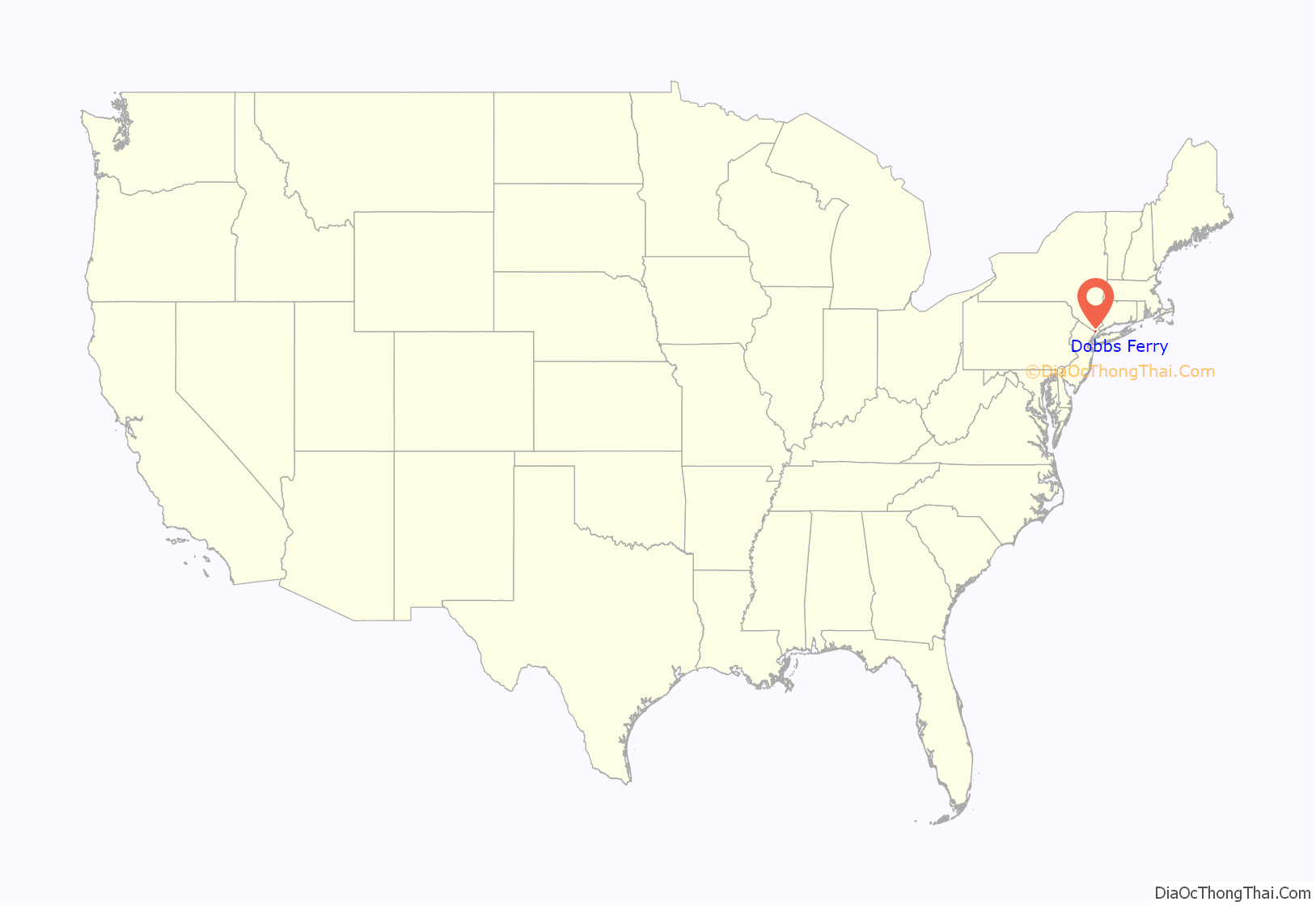
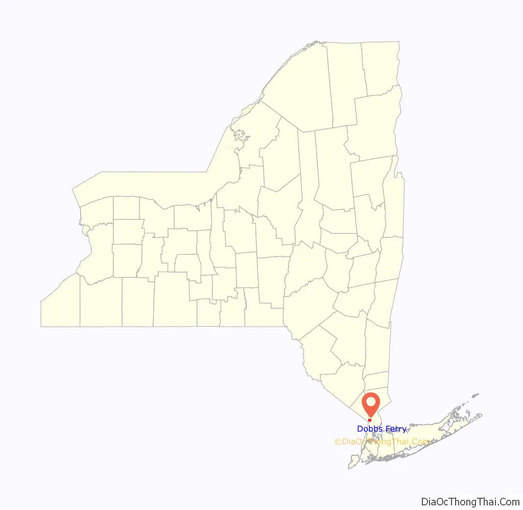
Dobbs Ferry location map. Where is Dobbs Ferry village?
History
Multiple groups of native peoples lived in what is now known as Dobbs Ferry since at least 4500BC. The most recent tribe who claimed territory of the area are the Wecquaesgeek, maintaining villages up until the 1600’s. Numerous artifacts from the tribe continue to be found along Wicker’s Creek in oyster middens.
Dobbs Ferry was named after Jeremiah Dobbs, a descendant of William Dobbs, of Swedish and Dutch ancestry whose family ran a ferry service that traversed the Hudson River at this location. Dobbs was a fisherman and settled near the southern part of what is now Dobbs Ferry, and he “added to his meager income by ferriage of occasional travelers across the Hudson. He used a style of boat known at that day as a periauger, a canoe hollowed out of a solid log. . . From this primitive ferry the village took its name.”
Dobbs Ferry played a vital role in the American Revolutionary War. The position of the village opposite the northernmost end of the Palisades gave it importance during the war. The region was repeatedly raided by camp followers of each army; earthworks and a fort, commanding the Hudson ferry and the ferry to Paramus, New Jersey, were built; the British army made Dobbs Ferry a rendezvous, after the Battle of White Plains in November 1776, and the continental division under General Benjamin Lincoln was here at the end of January 1777.
In July and August 1781, during the seventh year of the war, Continental Army troops commanded by General George Washington were encamped in Dobbs Ferry and neighboring localities, alongside allied French forces under the command of the Comte de Rochambeau. A large British army controlled Manhattan at the time, and Washington chose the Dobbs Ferry area for encampment because he hoped to probe for weaknesses in the British defenses, just 12 miles (19 km) to the south. But on August 14, 1781, a communication was received from French Admiral Comte de Grasse in the West Indies, which caused Washington to change his strategy. De Grasse’s communication, which advocated a joint land and sea attack against the British in Virginia, convinced Washington to risk a march of more than 400 miles (640 km) to the Chesapeake region of Virginia. Washington’s new strategy, adopted and designed in mid-August 1781, at the encampment of the allied armies, would win the war. The allied armies were ordered to break camp on August 19, 1781: on that date the Americans took the first steps of their march to Virginia along present-day Ashford Avenue and Broadway, en route to victory over General Cornwallis at the Siege of Yorktown and to victory in the Revolutionary War.
The village was originally incorporated in 1873 as Greenburgh, but the name was changed to Dobbs Ferry in 1882.
The current local government of Dobbs Ferry is headed by Mayor Vincent Rossillo, a Democrat, who was elected in November 2019.
The Estherwood and Carriage House, Hyatt-Livingston House, South Presbyterian Church, and United States Post Office are listed on the National Register of Historic Places.
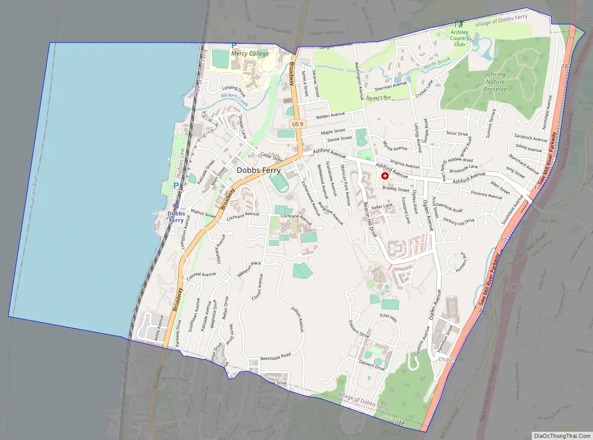
Dobbs Ferry Road Map
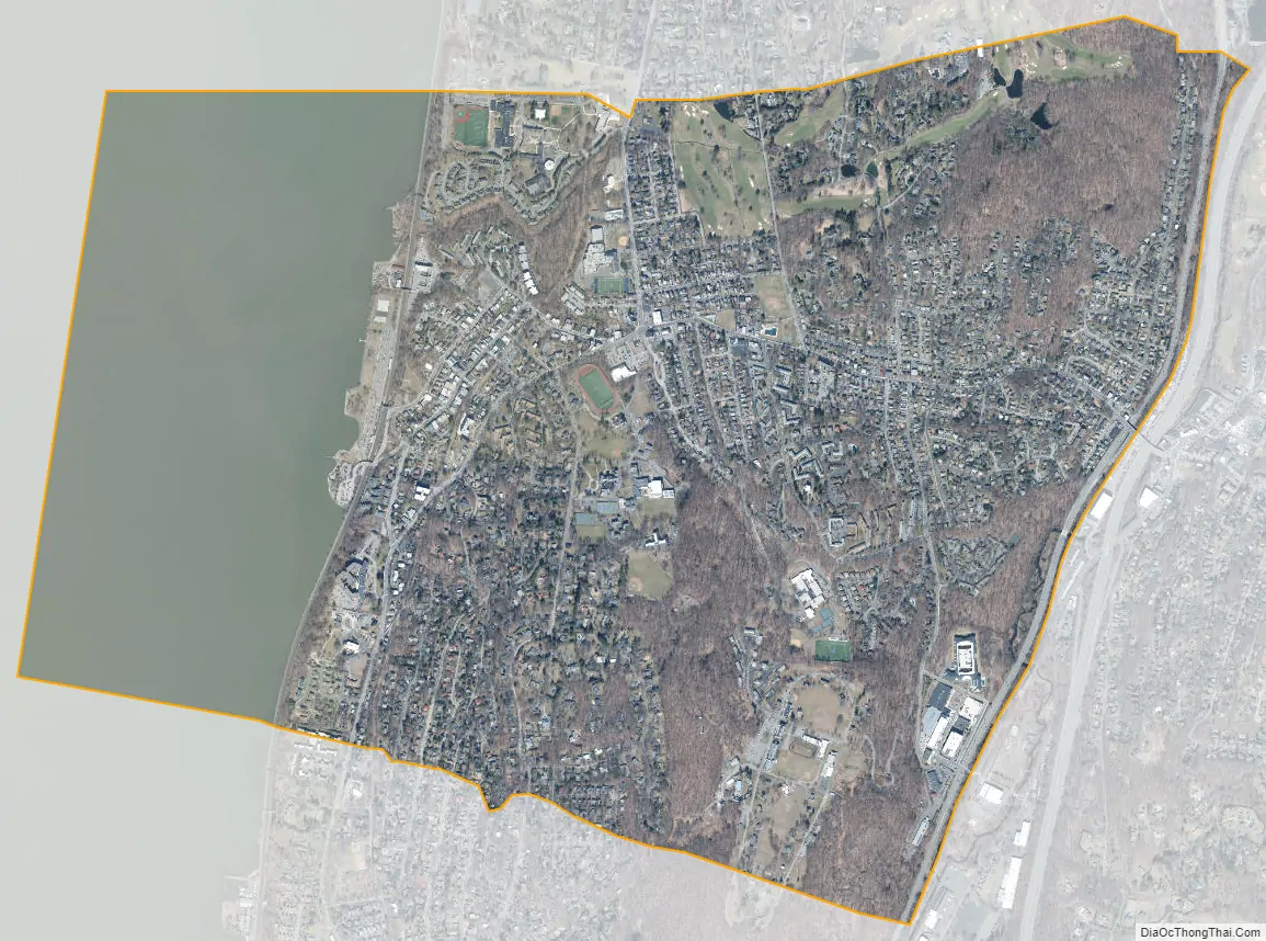
Dobbs Ferry city Satellite Map
Geography
Dobbs Ferry is located at 41°0′46″N 73°51′58″W / 41.01278°N 73.86611°W / 41.01278; -73.86611 (41.012729, −73.866026).
According to the United States Census Bureau, the village has a total area of 3.2 square miles (8.3 km), of which 2.4 square miles (6.2 km) is land and 0.7 square miles (1.8 km), or 23.03%, is water.
The village is bounded on the west by the Hudson River, and on the east by the Saw Mill River. Wickers Creek (name derived from the indigenous Weckquaesgeek) runs east to west through the center of the village from its main source in the Juhring Nature Preserve, Todd’s Pond.
The village consists of a series of neighborhoods as defined in the 2010 Vision Plan, the Master Plan for the village. These neighborhoods are not popularly recognized as of 2014. As the Vision Plan states, “Sometimes the boundaries of these neighborhoods are clearly defined, but other times less so. Where necessary, boundaries have been interpolated.” The neighborhoods are: Springhurst Park, Broadway, Wickers Creek, Waterfront, Old Town, Fairmead, Riverview Manor, Villard, Osborne, Belden, Maple, Walgrove, Virginia, Beacon Hill, Campuses and Woods, Parkway, Southfield, Knoll, Northfield, and Juhring. (Homes in Juhring are commonly referred to by real estate brokers as part of the Ardsley Park neighborhood, which encompasses the Juhring neighborhood in Dobbs Ferry and the Ardsley-on-Hudson neighborhood of Irvington, New York).
See also
Map of New York State and its subdivision:- Albany
- Allegany
- Bronx
- Broome
- Cattaraugus
- Cayuga
- Chautauqua
- Chemung
- Chenango
- Clinton
- Columbia
- Cortland
- Delaware
- Dutchess
- Erie
- Essex
- Franklin
- Fulton
- Genesee
- Greene
- Hamilton
- Herkimer
- Jefferson
- Kings
- Lake Ontario
- Lewis
- Livingston
- Madison
- Monroe
- Montgomery
- Nassau
- New York
- Niagara
- Oneida
- Onondaga
- Ontario
- Orange
- Orleans
- Oswego
- Otsego
- Putnam
- Queens
- Rensselaer
- Richmond
- Rockland
- Saint Lawrence
- Saratoga
- Schenectady
- Schoharie
- Schuyler
- Seneca
- Steuben
- Suffolk
- Sullivan
- Tioga
- Tompkins
- Ulster
- Warren
- Washington
- Wayne
- Westchester
- Wyoming
- Yates
- Alabama
- Alaska
- Arizona
- Arkansas
- California
- Colorado
- Connecticut
- Delaware
- District of Columbia
- Florida
- Georgia
- Hawaii
- Idaho
- Illinois
- Indiana
- Iowa
- Kansas
- Kentucky
- Louisiana
- Maine
- Maryland
- Massachusetts
- Michigan
- Minnesota
- Mississippi
- Missouri
- Montana
- Nebraska
- Nevada
- New Hampshire
- New Jersey
- New Mexico
- New York
- North Carolina
- North Dakota
- Ohio
- Oklahoma
- Oregon
- Pennsylvania
- Rhode Island
- South Carolina
- South Dakota
- Tennessee
- Texas
- Utah
- Vermont
- Virginia
- Washington
- West Virginia
- Wisconsin
- Wyoming


