Wurtsboro is a village located on U.S. Route 209 in the town of Mamakating in Sullivan County, New York, United States, near its junction with New York State Route 17 (which is being upgraded to interstate standards and will be renumbered as interstate 86). The population was 1,124 at the 2020 census. Since 1927 the area has been served by Wurtsboro-Sullivan County Airport.
| Name: | Wurtsboro village |
|---|---|
| LSAD Code: | 47 |
| LSAD Description: | village (suffix) |
| State: | New York |
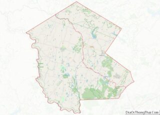
| County: | Sullivan County |
| Elevation: | 564 ft (172 m) |
| Total Area: | 1.25 sq mi (3.24 km²) |
| Land Area: | 1.25 sq mi (3.24 km²) |
| Water Area: | 0.00 sq mi (0.00 km²) |
| Total Population: | 1,124 |
| Population Density: | 899.92/sq mi (347.41/km²) |
| ZIP code: | 12790 |
| Area code: | 845 |
| FIPS code: | 3683272 |
| GNISfeature ID: | 2391227 |
Online Interactive Map
Click on ![]() to view map in "full screen" mode.
to view map in "full screen" mode.
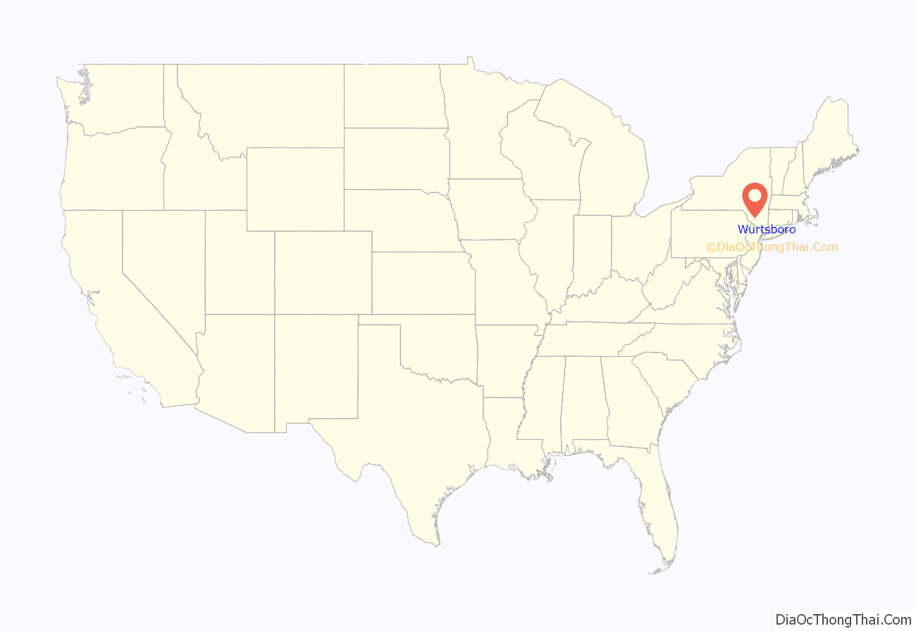
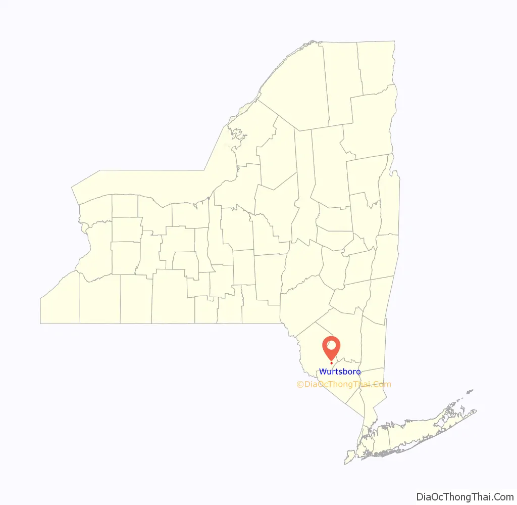
Wurtsboro location map. Where is Wurtsboro village?
History
Before Europeans, Wurtsboro was inhabited by Native Americans known as the Leni Lenape. Called Delaware by the Europeans, the Leni Lenape are known to other tribes, in their tongues, as “the old people” and are considered to be one of the oldest tribes in North America. Many anthropologists believe the Leni Lenape are the ancestors of the original people who crossed the Bering Strait to first populate North American. Within the Leni Lenape, different villages dotted the valleys between the Delaware and Hudson rivers. The group that resided in the Wurtsboro area was known as the Mamacottin.
As the Dutch settled along the Hudson and searched inland for furs and minerals, they engineered and built the oldest road in America. This roadway, little more than a cart path along the trails of the Leni Lenape, became known as the Old Mine Road. Present day US Rte. 209 follows much of the original course. It is thought that these Dutch settlers were the first to name the area Mamakating.
As other Europeans settled the area, the treaties and land grants for a great deal of the northeast were benchmarked from the Hardenburgh tract. That survey benchmark, still annotated and utilized, can be found in the village near Rte. 209.
The original name for the village of Wurtsboro was Rome. It is said that when the ‘yankees’ obtained a foothold in the hollow (Mamakating valley), they counted all the mountain peaks they could see and with an ambitious view, called the place Rome. This name was retained until as late as 1812. That same year, the area’s first church was built. This Dutch Reformed church was named the “Church of Rome.” Somewhat later the town was renamed Wurtsborough, which evolved to Wurtsboro.
During the early industrial revolution, much of the nation’s bituminous coal needs were supplied by England. During the War of 1812, a fuel shortage arose when a British blockade cut off America’s coal supply. Interest turned to anthracite coal, known then as stone coal. Anthracite was native to Pennsylvania, but lack of adequate transportation was a deterrent. Three Wurts brothers (Maurice Wurts was the most prominent), then Philadelphia dry goods store owners, capitalized on this problem by forming a company to construct a 108-mile canal from Honesdale, Pennsylvania to Kingston, New York, the Delaware and Hudson Canal. On July 13, 1825, New York City Mayor (and company investor) Philip Hone used a golden spade to turn the first shovelful of earth during the canal’s groundbreaking ceremony, in the village. With the advent of the canal, products such as coal, lumber, livestock, and other staples were shipped through the area on their way to Albany and New York City. In those days, it was a practice of the D&H Canal Co. to rename communities along the canal for their favored officers. Names such as Honesdale, Port Jervis, Hawley, and Wurtsboro were so named.
As steam replaced horse power, the railroads replaced the canals. While the canal operated until its closure in 1898, the D&H Railroad was in fact a reorganization of the original canal company. In many sections, the railroad bed (now abandoned) parallels the canal. Both can be easily seen by visiting the D&H Canal Linear Park, which is a scenic walkway along the canal towpath from Wurtsboro to Summitville.
The village of Wurtsboro was originally confined to the berme of the canal. Several existing businesses were active at that time. Notable examples include Danny’s, built in 1814 for the purpose of serving food and providing lodging; and the Canal Towne Emporium, better known in the canal days as Fulton & Holmes’ General Store, selling many items that were delivered by canal barge. Over time, the village gradually extended westward and merged with the old village of Mamakating. In 1830 the name of the post office was changed from Mamakating to Wurtsborough, with Lyman O’Dell (known as the village poet and essayist) acting as the first postmaster.
Another economic impact for the area in those early days was derived from the tanning industry that developed here. Hemlock bark was used to tan hides and it was in plentiful supply. In fact, over 80% of all leather goods used by the Union Army during the Civil War were processed in Sullivan county tanning vats. The industry waned as the hemlock in the area was over-forested (accounting for the scarcity today) and synthetic tannic acid was developed. In the late 1800s the Ontario & Western Railroad laid down its tracks on the eastern end of the village. Like the canal, it served to carry merchandise as well as passengers to the area. The O&W was a primary player in the tourism boom during the late 1800s into the 20th century, as it allowed thousands of New York residents to escape the heat of the city and relax in the clean Catskill mountain air. Eventually, just as the railroads replaced the canals, the interstate highway system replaced the railroads.
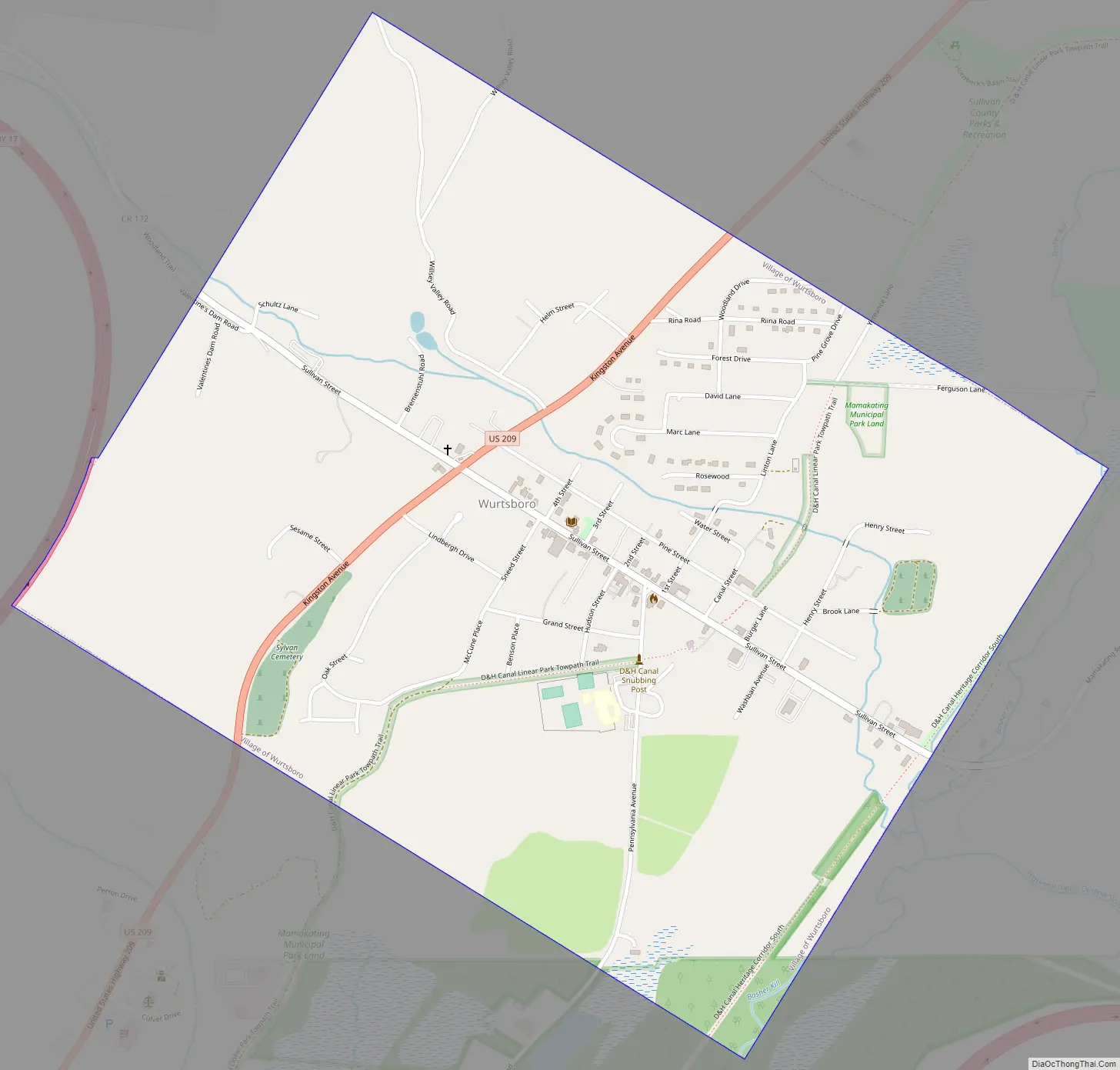
Wurtsboro Road Map
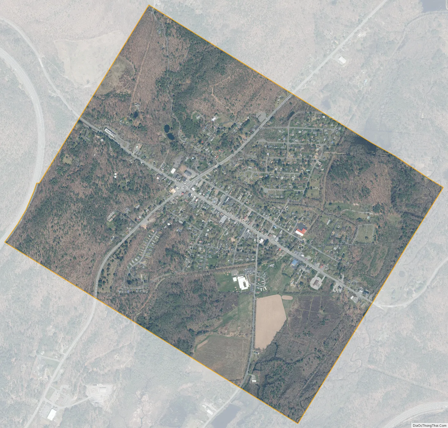
Wurtsboro city Satellite Map
Geography
According to the United States Census Bureau, the village has a total area of 1.3 square miles (3.4 km), all land.
The Long Path, a hiking trail, goes through Wurtsboro.
The Mamakating Park Historic District and Masten-Quinn House are listed on the National Register of Historic Places.
See also
Map of New York State and its subdivision:- Albany
- Allegany
- Bronx
- Broome
- Cattaraugus
- Cayuga
- Chautauqua
- Chemung
- Chenango
- Clinton
- Columbia
- Cortland
- Delaware
- Dutchess
- Erie
- Essex
- Franklin
- Fulton
- Genesee
- Greene
- Hamilton
- Herkimer
- Jefferson
- Kings
- Lake Ontario
- Lewis
- Livingston
- Madison
- Monroe
- Montgomery
- Nassau
- New York
- Niagara
- Oneida
- Onondaga
- Ontario
- Orange
- Orleans
- Oswego
- Otsego
- Putnam
- Queens
- Rensselaer
- Richmond
- Rockland
- Saint Lawrence
- Saratoga
- Schenectady
- Schoharie
- Schuyler
- Seneca
- Steuben
- Suffolk
- Sullivan
- Tioga
- Tompkins
- Ulster
- Warren
- Washington
- Wayne
- Westchester
- Wyoming
- Yates
- Alabama
- Alaska
- Arizona
- Arkansas
- California
- Colorado
- Connecticut
- Delaware
- District of Columbia
- Florida
- Georgia
- Hawaii
- Idaho
- Illinois
- Indiana
- Iowa
- Kansas
- Kentucky
- Louisiana
- Maine
- Maryland
- Massachusetts
- Michigan
- Minnesota
- Mississippi
- Missouri
- Montana
- Nebraska
- Nevada
- New Hampshire
- New Jersey
- New Mexico
- New York
- North Carolina
- North Dakota
- Ohio
- Oklahoma
- Oregon
- Pennsylvania
- Rhode Island
- South Carolina
- South Dakota
- Tennessee
- Texas
- Utah
- Vermont
- Virginia
- Washington
- West Virginia
- Wisconsin
- Wyoming