Ben Avon Heights is a borough in Allegheny County, Pennsylvania, United States, located on a hill above the Ohio River, 9 miles (14 km) from the city of Pittsburgh. The population was 400 at the 2020 census. Ben Avon Heights is part of the Pittsburgh Metropolitan Area.
| Name: | Ben Avon Heights borough |
|---|---|
| LSAD Code: | 21 |
| LSAD Description: | borough (suffix) |
| State: | Pennsylvania |
| County: | Allegheny County |
| Incorporated: | 1913 |
| Elevation: | 1,135 ft (346 m) |
| Total Area: | 0.17 sq mi (0.45 km²) |
| Land Area: | 0.17 sq mi (0.45 km²) |
| Water Area: | 0.00 sq mi (0.00 km²) |
| Total Population: | 400 |
| Population Density: | 2,298.85/sq mi (889.56/km²) |
| ZIP code: | 15202 |
| Area code: | 412 |
| FIPS code: | 4205520 |
| Website: | www.benavonheightsborough.com |
Online Interactive Map
Click on ![]() to view map in "full screen" mode.
to view map in "full screen" mode.
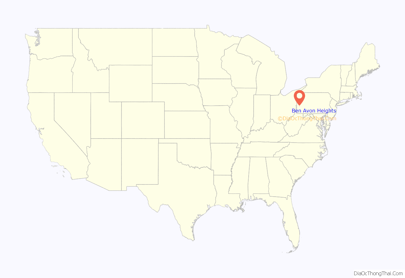
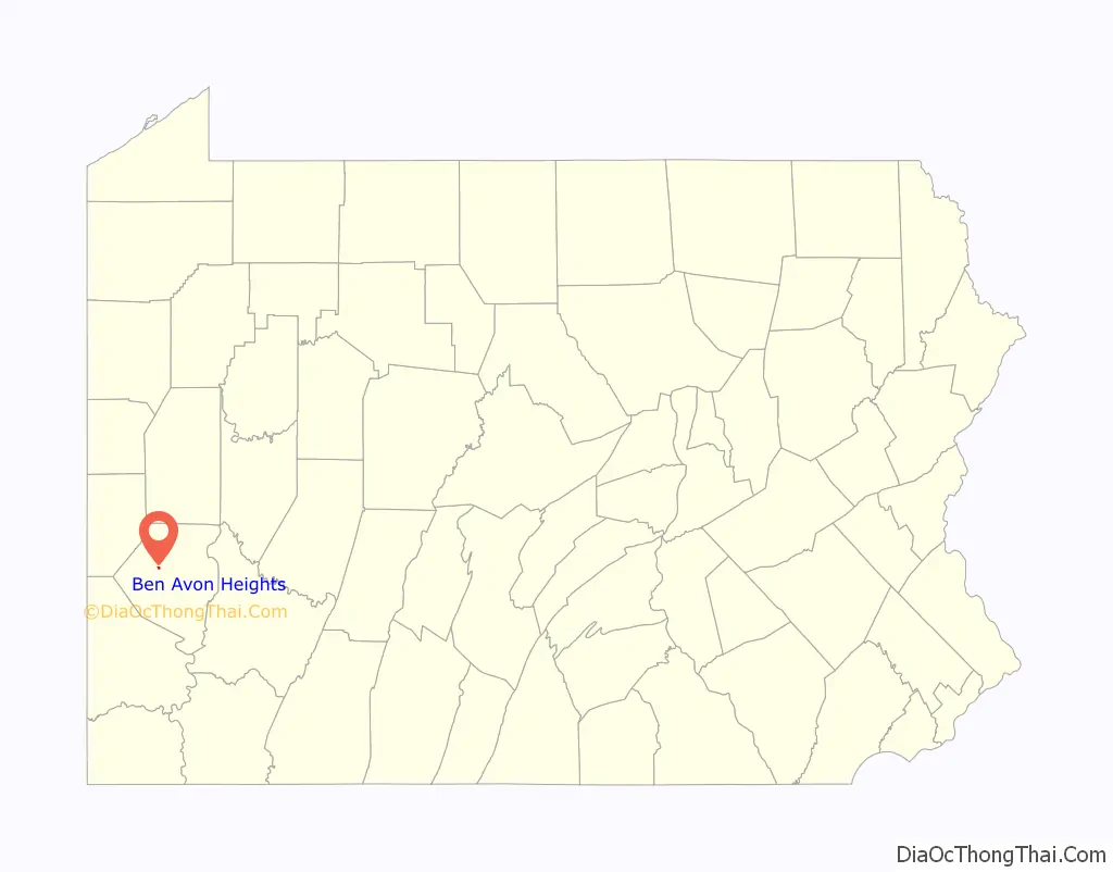
Ben Avon Heights location map. Where is Ben Avon Heights borough?
History
Prior to 1906, the land that became Ben Avon Heights was farmland belonging to Samuel Taylor and John Wilson. In 1910, Walter Pringle Fraser of Ben Avon bought 84 acres (340,000 m) on the former Taylor farm, using forty of the acres to build the Ben Avon Country Club and golf course. The remaining 44 acres (180,000 m) were opened for a residential development, which he named Ben Avon Heights. Like neighboring Ben Avon, Ben Avon Heights appealed to Pittsburghers looking for rural summer homes away from the city. The borough was incorporated in 1913.
When the Ben Avon Country Club closed in 1917, it was divided into lots for additional housing. The Shannopin Country Club, the only commercial property in Ben Avon Heights, opened in 1920 with its clubhouse in Ben Avon Heights and golf course in neighboring Kilbuck Township. In the early 1930s, John I. Thompson purchased a portion of the original John Wilson Farm in Kilbuck Township and transformed the farmland into another residential area known as the Thompson Plan. The borough annexed the Thompson Plan in 1936, setting the boundaries of Ben Avon Heights to those of the present day.
The borough now contains 148 homes, a community park, and the club house of the Shannopin Country Club.
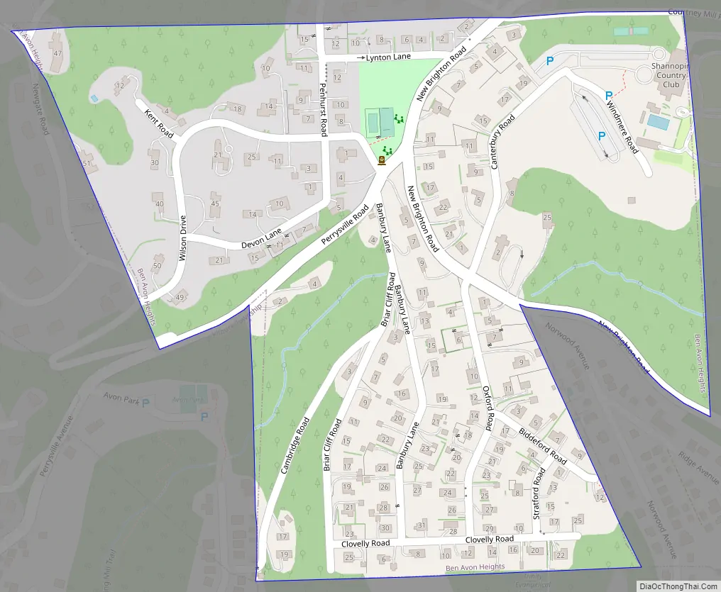
Ben Avon Heights Road Map
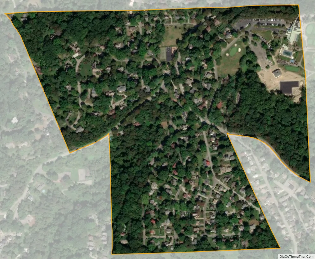
Ben Avon Heights city Satellite Map
Geography
Ben Avon Heights is located at 40°30′43″N 80°4′28″W / 40.51194°N 80.07444°W / 40.51194; -80.07444.
According to the United States Census Bureau, the borough has a total area of 0.2 square miles (0.52 km), all land. Its average elevation is 1,135 feet (346 m) above sea level.
See also
Map of Pennsylvania State and its subdivision:- Adams
- Allegheny
- Armstrong
- Beaver
- Bedford
- Berks
- Blair
- Bradford
- Bucks
- Butler
- Cambria
- Cameron
- Carbon
- Centre
- Chester
- Clarion
- Clearfield
- Clinton
- Columbia
- Crawford
- Cumberland
- Dauphin
- Delaware
- Elk
- Erie
- Fayette
- Forest
- Franklin
- Fulton
- Greene
- Huntingdon
- Indiana
- Jefferson
- Juniata
- Lackawanna
- Lancaster
- Lawrence
- Lebanon
- Lehigh
- Luzerne
- Lycoming
- Mc Kean
- Mercer
- Mifflin
- Monroe
- Montgomery
- Montour
- Northampton
- Northumberland
- Perry
- Philadelphia
- Pike
- Potter
- Schuylkill
- Snyder
- Somerset
- Sullivan
- Susquehanna
- Tioga
- Union
- Venango
- Warren
- Washington
- Wayne
- Westmoreland
- Wyoming
- York
- Alabama
- Alaska
- Arizona
- Arkansas
- California
- Colorado
- Connecticut
- Delaware
- District of Columbia
- Florida
- Georgia
- Hawaii
- Idaho
- Illinois
- Indiana
- Iowa
- Kansas
- Kentucky
- Louisiana
- Maine
- Maryland
- Massachusetts
- Michigan
- Minnesota
- Mississippi
- Missouri
- Montana
- Nebraska
- Nevada
- New Hampshire
- New Jersey
- New Mexico
- New York
- North Carolina
- North Dakota
- Ohio
- Oklahoma
- Oregon
- Pennsylvania
- Rhode Island
- South Carolina
- South Dakota
- Tennessee
- Texas
- Utah
- Vermont
- Virginia
- Washington
- West Virginia
- Wisconsin
- Wyoming


