Brentwood is a borough in Allegheny County, Pennsylvania, United States, and is part of the Pittsburgh Metro Area. The population was 10,082 at the 2020 census.
| Name: | Brentwood borough |
|---|---|
| LSAD Code: | 21 |
| LSAD Description: | borough (suffix) |
| State: | Pennsylvania |
| County: | Allegheny County |
| Incorporated: | May 15, 1916 |
| Elevation: | 1,225 ft (373 m) |
| Total Area: | 1.45 sq mi (3.75 km²) |
| Land Area: | 1.45 sq mi (3.75 km²) |
| Water Area: | 0.00 sq mi (0.00 km²) |
| Total Population: | 10,082 |
| Population Density: | 6,957.90/sq mi (2,687.16/km²) |
| ZIP code: | 15227 |
| Area code: | 412 |
| FIPS code: | 4208416 |
| Website: | http://www.brentwoodboro.com/ |
Online Interactive Map
Click on ![]() to view map in "full screen" mode.
to view map in "full screen" mode.
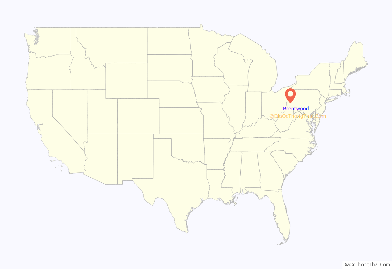
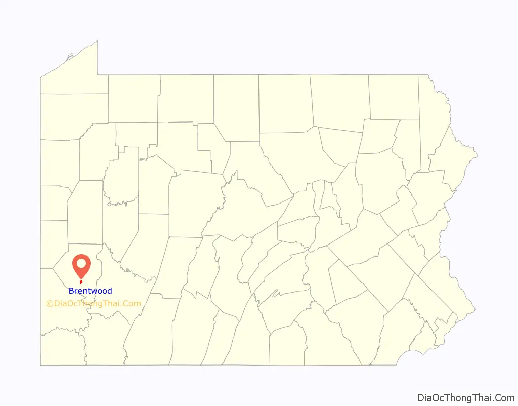
Brentwood location map. Where is Brentwood borough?
History
Brentwood, located approximately 6 miles (10 km) from downtown Pittsburgh and is 101 years old, was once an integral part of Baldwin Township, which included the villages of Brentwood, Point View, and Whitehall.
In 1914, a group of citizens in the village of Brentwood took a set of grievances to the Baldwin Township Board of Commissioners, regarding the lack of sidewalks, sewers, fire protection, police, and a school house. Upon further disregard of these necessities from the township, a group of men from the village held a meeting on January 27, 1915, to discuss secession. After considerable discussion, the boundary lines of Brentwood were finalized by the Board of Trade. Building a sidewalk along Brownsville Road was the first official action taken by the Board of Trade. On November 6, 1915, the Quarter Sessions Court of Allegheny County decreed that Brentwood was officially seceded from Baldwin Township. The proceedings to incorporate were filed on May 15, 1916, creating the Borough of Brentwood.
On December 4, 1915, special elections were held to elect a burgess, auditors, justices of the peace, high constable, tax collector, assessor, and councilmen. Brentwood’s first burgess was Bernard Kestner, sworn in on December 9, 1915. He served Brentwood for sixteen years. The board met monthly and continued to discuss necessary steps for the structure of the borough.
On Labor Day, 1928, the borough celebrated the official opening of the park, pool, and paving of Brownsville Road.
A former councilman of Brentwood, Bob Cranmer, served as an Allegheny County commissioner, 1996–2000. He was involved with a number of historic government initiatives and large civic development projects, being both local and regional in scope.
A Hall of Fame NFL linebacker, Joe Schmidt played for Brentwood High School.
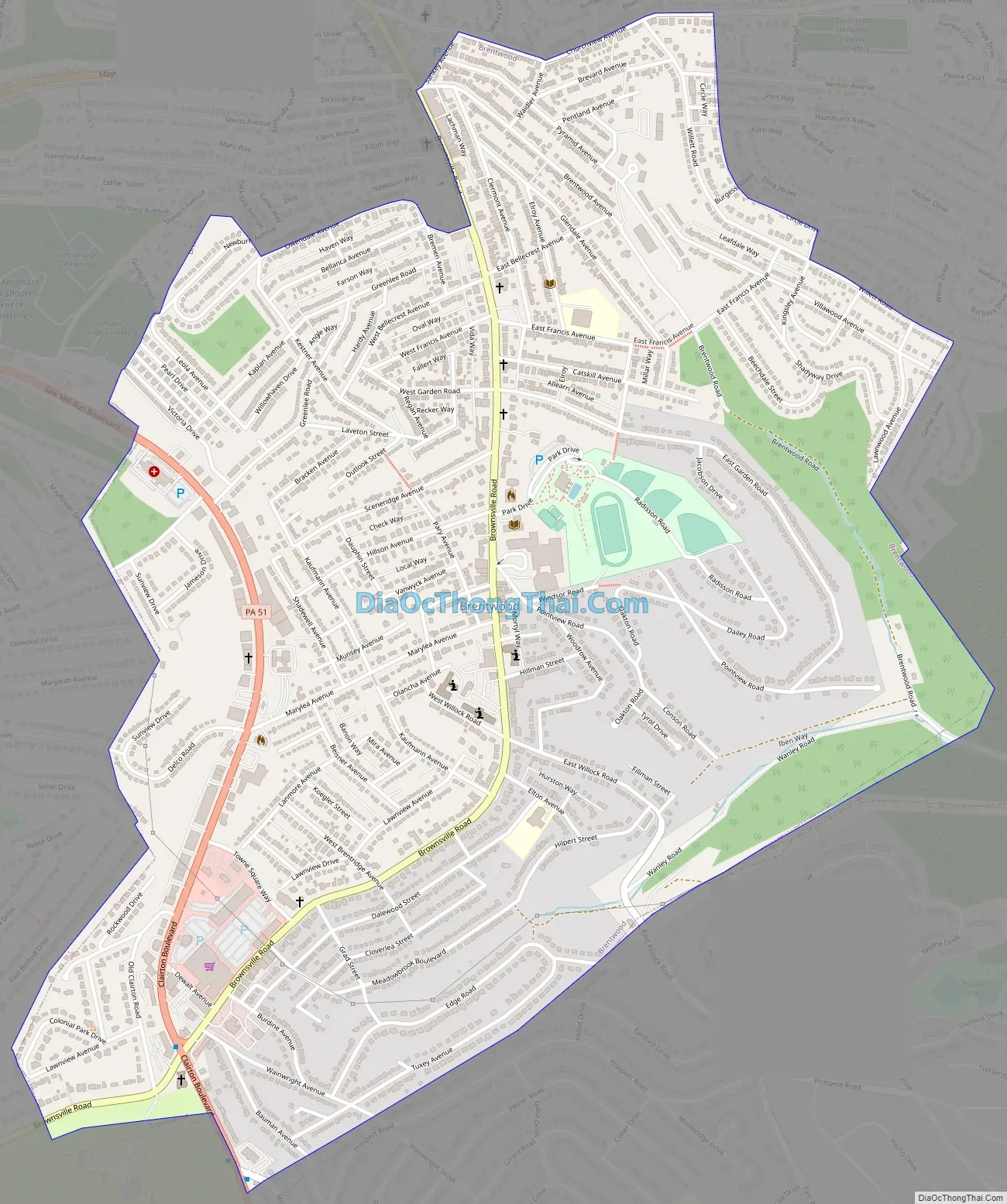
Brentwood Road Map
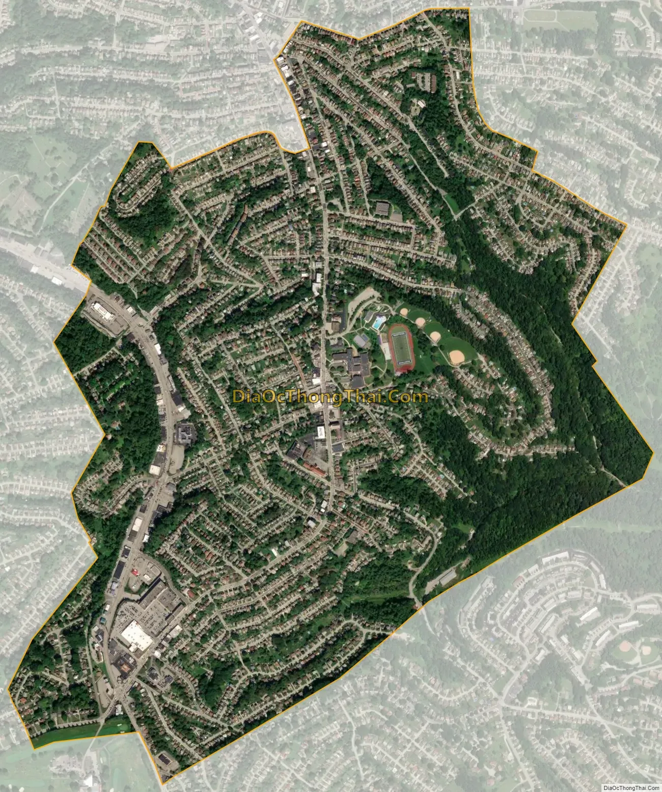
Brentwood city Satellite Map
Geography
Brentwood is located at 40°22′28″N 79°58′34″W / 40.37444°N 79.97611°W / 40.37444; -79.97611 (40.374469, -79.976179). According to the United States Census Bureau, the borough has a total area of 1.5 square miles (3.9 km), all land.
The borough is in the Allegheny Plateau region of the United States, and is situated 5 miles (8 km) south of the confluence of the Allegheny River and the Monongahela River to form the Ohio River.
Due to its position between the Great Lakes and the windward side of the Allegheny Mountains, Brentwood, along with the rest of the region, receives plentiful precipitation which supports lush vegetation. Also, because it is on the windward side of the mountains, it is often cloudy, having 203 cloudy days per year. The winter is particularly cloudy, with only 28 percent sunshine in December and 23 cloudy days. In the winter, when a northwest flow establishes itself over the Great Lakes, the wind blows from Lake Erie across eastern Ohio and western Pennsylvania. That wind carries moist air from the lake, producing clouds and heavy snow squalls.
See also
Map of Pennsylvania State and its subdivision:- Adams
- Allegheny
- Armstrong
- Beaver
- Bedford
- Berks
- Blair
- Bradford
- Bucks
- Butler
- Cambria
- Cameron
- Carbon
- Centre
- Chester
- Clarion
- Clearfield
- Clinton
- Columbia
- Crawford
- Cumberland
- Dauphin
- Delaware
- Elk
- Erie
- Fayette
- Forest
- Franklin
- Fulton
- Greene
- Huntingdon
- Indiana
- Jefferson
- Juniata
- Lackawanna
- Lancaster
- Lawrence
- Lebanon
- Lehigh
- Luzerne
- Lycoming
- Mc Kean
- Mercer
- Mifflin
- Monroe
- Montgomery
- Montour
- Northampton
- Northumberland
- Perry
- Philadelphia
- Pike
- Potter
- Schuylkill
- Snyder
- Somerset
- Sullivan
- Susquehanna
- Tioga
- Union
- Venango
- Warren
- Washington
- Wayne
- Westmoreland
- Wyoming
- York
- Alabama
- Alaska
- Arizona
- Arkansas
- California
- Colorado
- Connecticut
- Delaware
- District of Columbia
- Florida
- Georgia
- Hawaii
- Idaho
- Illinois
- Indiana
- Iowa
- Kansas
- Kentucky
- Louisiana
- Maine
- Maryland
- Massachusetts
- Michigan
- Minnesota
- Mississippi
- Missouri
- Montana
- Nebraska
- Nevada
- New Hampshire
- New Jersey
- New Mexico
- New York
- North Carolina
- North Dakota
- Ohio
- Oklahoma
- Oregon
- Pennsylvania
- Rhode Island
- South Carolina
- South Dakota
- Tennessee
- Texas
- Utah
- Vermont
- Virginia
- Washington
- West Virginia
- Wisconsin
- Wyoming


