Brownsville is a borough in Fayette County, Pennsylvania, United States, first settled in 1785 as the site of a trading post a few years after the defeat of the Iroquois enabled a resumption of westward migration after the Revolutionary War. The trading post soon became a tavern and inn and was receiving emigrants heading west, as it was located above the cut bank overlooking the first ford that could be reached to those descending from the Allegheny Mountains. Brownsville is located 40 miles (64 km) south of Pittsburgh along the east bank of the Monongahela River.
According to the United States Census Bureau, the borough of Brownsville has a total area of 1.1 square miles (2.8 km), of which 0.97 square miles (2.5 km) is land and 0.1 square miles (0.3 km), or 10.47%, is water—most of which is the Fayette County half of the Monongahela River between the community and the flatter lands of West Brownsville on the opposite shore in Washington County. As a community, the town is the central population center for a number of outlying hamlets geographically tied to the town for the same reasons they were founded nearby: western Pennsylvania has far more hills and steep slopes than flats or gentle sloping terrains suitable for settlement. This keeps Brownsville at the nexus of the transportation infrastructure which grew up during its history. While no longer a passenger depot, Brownsville and West Brownsville share an important railway bridge, creating a balloon loop that allows the turning of complete coal trains. The limited-access toll road PA Route 43 connects the town to strategic points and southern Pittsburgh at Clairton. PA Route 88, hugging the river, connects to towns up and down the Monongahela Valley. The historic National Road (now US Route 40) reached East Saint Louis, Illinois, and connected the town to the immigrants arriving in the port of Baltimore traveling west on the Cumberland Turnpike and the National Road.
From its founding, well into the 19th century, as the first reachable population center west of the Alleghenies barrier range on the Mississippi watershed, the borough quickly grew into an industrial center, market town, transportation hub, outfitting center, and riverboat-building powerhouse. As a trading post, it was a gateway destination for emigrants heading west to the Ohio Country and the new United States’ Northwest Territory, and later for travelers heading westwards on the various Emigrant Trails both to the Near West and later the Far West. As an outfitting center, the borough provided the markets for the small-scale industries in the surrounding counties, as well as for Maryland shipping goods over the pass by mule train via the Cumberland Narrows toll route.
Brownsville became a major center for building steamboats through the 19th century, producing 3,000 boats by 1888.
The borough developed in the late 19th century as a railroad yard and coking center, with other industries related to the rise of steel in the Pittsburgh area. It reached a peak of population of more than 8,000 in 1940. Postwar development took place in suburbs, as was typical of the time. The restructuring of the railroad and steel industries caused a severe loss of jobs and population in Brownsville, beginning in the 1970s. The borough had a population of 2,331 as of the 2010 census.
| Name: | Brownsville borough |
|---|---|
| LSAD Code: | 21 |
| LSAD Description: | borough (suffix) |
| State: | Pennsylvania |
| County: | Fayette County |
| Total Area: | 1.09 sq mi (2.83 km²) |
| Land Area: | 0.98 sq mi (2.53 km²) |
| Water Area: | 0.11 sq mi (0.29 km²) |
| Total Population: | 2,185 |
| Population Density: | 2,236.44/sq mi (863.10/km²) |
| ZIP code: | 15417 |
| Area code: | 724 |
| FIPS code: | 4209432 |
| GNISfeature ID: | 1214026 |
| Website: | brownsvilleborough.com |
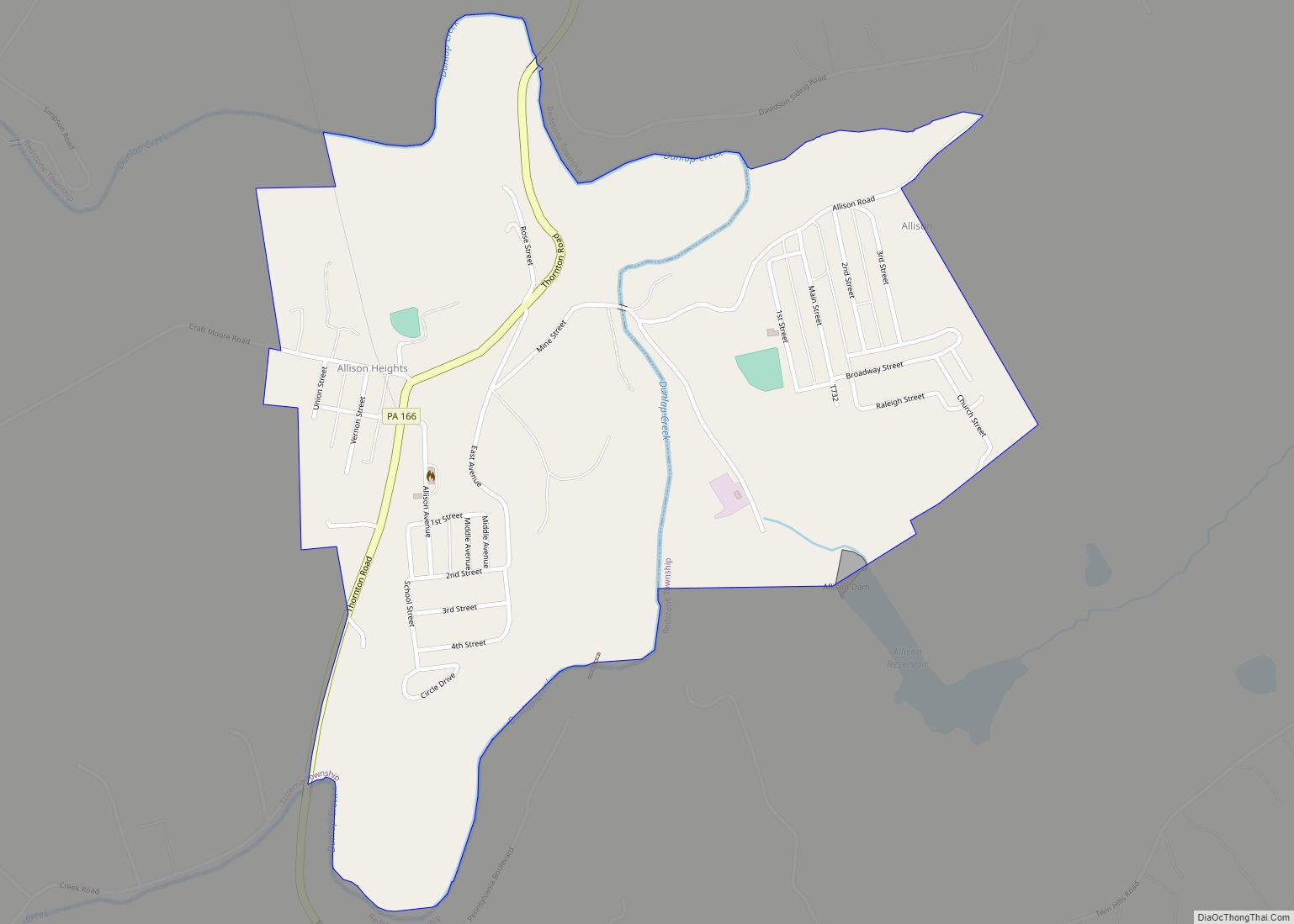
Online Interactive Map
Click on ![]() to view map in "full screen" mode.
to view map in "full screen" mode.
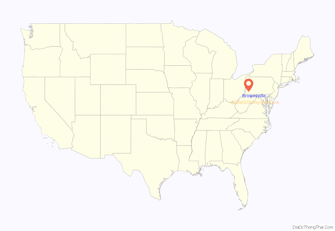
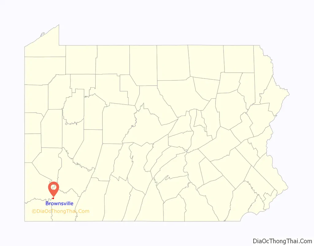
Brownsville location map. Where is Brownsville borough?
History
In pre-Columbian times, the right bank of the Monongahela River held several mounds where iron-rich red stone predominated, now believed to have been constructed by a branch of the Mound Builders cultures, but believed by colonials to have been forts. This led to the area near the river crossing being called Redstone Old Fort in various colonial government records and later Fort Burd when an arms cache was built there. By the time the region first became known to Dutch colonists and traders and the French in the 1640s, the lands were largely unoccupied, but under the management of one tribe or shared by several groups of Iroquoian peoples, likely the Erie people or Wenro people and possibly shared with the Seneca, the Shawnee people and the Susquehannocks. With all the rivers and streams tributary to the Monongahela, Youghiogheny, and Allegheny Rivers, there is little known about the region’s precise role in the Beaver Wars of the 17th century, but when French, Dutch and Swedish fur traders penetrated to the Greater Ohio Basin in the 1640s and 1650s, the one thing that seemed clear to those observers was that the lands later termed the Ohio Country seemed empty and unpopulated.
In the 17th century, several provincial Virginians and Marylanders confirmed the emptiness of the region. Before the 1750s, the area was “colonized” by weakened remnant tribes such as the Delaware and the few Erie and the Susquehannock survivors that the Iroquois allowed to move there as tributary peoples (climbing the gaps of the Allegheny). These migrations occurred over the 70 to 80 years before the French and Indian War in the 1750s, where today’s historians usually report the lands were long held as “hunting territories” of the powerful Five Nations of the Iroquois Confederacy. During the Revolution, the Iroquois were divided whether to back the colonies or the mother country, and mostly did neither, attempting to stay neutral. Nonetheless in 1778, agitated by British officers lobbying for frontier attacks, mixed parties of Tories (Loyalists) and Iroquois committed atrocities in 1778, so Washington sent the Sullivan Expedition in 1779, which broke the power of the Iroquois and reopened the Ohio Country to homesteader settlement. As a river crossing, the closest to the pass that reached the Monongahela, the town saw many settlers passing by.
Because colonial settlers believed that the earthwork mounds were a prehistoric fortification, they called the settlement Redstone Old Fort; later in the 1760s and 1770s, it became known as “Redstone Fort” or “Fort Burd”, named after the officer who commanded the British fort constructed in 1759. The fort was constructed during the French and Indian War on the bluff above the river near a prehistoric earthwork mound that was also the site of historic Native American burial grounds.
In 1774, a force from the Colony of Virginia garrisoned and occupied the stockade during Lord Dunmore’s War against the Mingo and Shawnee peoples. It commanded the important strategic river ford of Nemacolin’s Trail, the western path to the summit; this was later improved and called “Burd’s Road”. It was an alternative route down to the Monongahela River valley from Braddock’s Road, which George Washington helped to build. Washington came to own vast portions of the lands on the west bank of the Monongahela; the Pennsylvania legislature named Washington County after him.
Entrepreneur Thomas Brown acquired the western lands in what became Fayette County, Pennsylvania, around the end of the American Revolution. He realized the opening of the pass through the Cumberland Narrows and the end of the war made the land at the western tip of Fayette County a natural springboard for settlers traveling to points west, such as Kentucky, Tennessee and Ohio. Many travelers used the Ohio River and its tributary, the Monongahela. Eventually the settlement became known as “Brownsville” after him. In the 1780s, Jacob Bowman bought the land on which he built Nemacolin Castle; he had a trading post and provided services and supplies to emigrant settlers.
Redstone Old Fort is mentioned in C. M. Ewing’s The Causes of that so called Whiskey Insurrection of 1794 (1930) as the site of a July 27, 1791, meeting in “Opposition to the Whiskey Excise Tax,” during the Whiskey Rebellion. It was the first meeting of that illegal frontier insurrection.
Brownsville was positioned at the western end of the primitive road network (Braddock’s Road to Burd’s Road via the Cumberland Narrows pass) that eventually became chartered as the Cumberland toll road, then the National Pike (the federal government’s first ever road project), and later present-day U.S. Route 40, one of the original federal highways.
As an embarkation point for travelers to the west, Redstone/Brownsville, blessed by several nearby wide and deep river tributaries that could support building slips, soon became a 19th-century center for the construction of riverine watercraft, initially keelboats and flatboats, but later steamboats large and small. The entire region sprouted small industries using local coal and iron deposits, selling iron fittings and products to outfitting settlers about to embark on the river. After 1845, its boats were used even by those intending to later take the Santa Fe Trail or Oregon Trail, as floating on a poleboat by river to St. Louis or other ports on the Mississippi River was generally safer, easier and far faster than overland travel of the time.
A large flatboat-building industry developed at Brownsville, exploiting the flats across the river in present-day West Brownsville to erect building slips. This was followed by its rapid entry into the building of steamboats: local craftsmen built the Enterprise in 1814, the first steamboat powerful enough to travel down the Mississippi River to New Orleans and back. Earlier boats did not have enough power to go upstream against the river’s current. Brownsville developed as an early center of the steamboat-building industry in the 19th century. The Monongahela converges with the Ohio River at Pittsburgh and allowed for quick traveling to the western frontier. From 1811 to 1888, boatyards produced more than 3,000 steamboats. Steamboats were gradually supplanted in the passenger-carrying trade after the American Civil War as the construction of railroad networks surged, but concurrently grew important locally on the Ohio River and tributaries as tugs delivering bargeloads of minerals to the burgeoning steel industries growing up along the watershed from the 1850s. Steamboat propulsion would not be replaced by diesel-powered commercial tugs until the technology matured in the mid-20th century.
The first all–cast iron arch bridge constructed in the United States was built in Brownsville to carry the National Pike (at the time a wagon road) across Dunlap’s Creek. See Dunlap’s Creek Bridge. As of 2023, the bridge is still in use.
After the 1853 completion of the Baltimore and Ohio Railroad to the Ohio, outfitting emigrant wagon trains in Brownsville declined in importance.
Yet the rise of the steel industry in the Pittsburgh area led Brownsville to develop as a railroad yard and coking center, generally integrated into other towns within the valley, so Brownsville and West Brownsville were tied to regional operations. While no one yard had space enough to be large, each township along the river shared resources and functioned as an elongated yard system. With its new role as railroad center and coking center together with the decline of outfitting, the town gradually lost its diverse mix of businesses, but, nonetheless, generally prospered during the early 20th century through the 1960s. Brownsville tightened its belt during the Great Depression, but the local economy resumed growth with the increased demand for steel during and after World War II, when many infrastructure projects improved and rerouted U.S. Route 40 over the new high-level Lane Bane Bridge, clearing up a perennial traffic congestion problem.
In 1940, 8,015 people lived in Brownsville. Its postwar growth led to the development of cross-county-line suburbs such as Malden, Lowhill, and Denbeau Heights (Denbow Heights), which were mainly bedroom communities within commuting distance. After the OPEC oil embargo of 1973–1974 triggered a recession, together with the restructuring of the steel industry and loss of industrial jobs, Brownsville suffered a severe decline, along with much of the Rust Belt. Generally, the region has declined in population and vitality ever since.
By 2000, the population was 2,804, as younger people had moved away to areas with more jobs. As of 2011, Brownsville has a handful of buildings that are condemned or boarded up. Abandoned buildings include the Union Station of the railroad, several banks, and other businesses. The sidewalks around the town are still intact and usable.
Brownsville attracted major entertainers in the early postwar years who also were performing in nearby Pittsburgh. According to Mike Evans in his book Ray Charles: The Birth of Soul (2007), the singer developed his hit “What’d I Say” as part of an after-show jam in Brownsville in December 1958.
In 2019, Browsville served as the primary filming location for the coming-of-age comedy-drama web television series I Am Not Okay with This, which became available on Netflix in 2020.
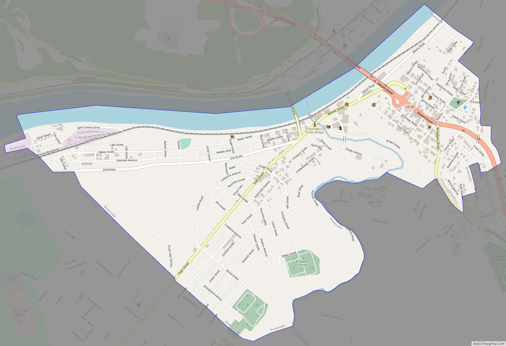
Brownsville Road Map
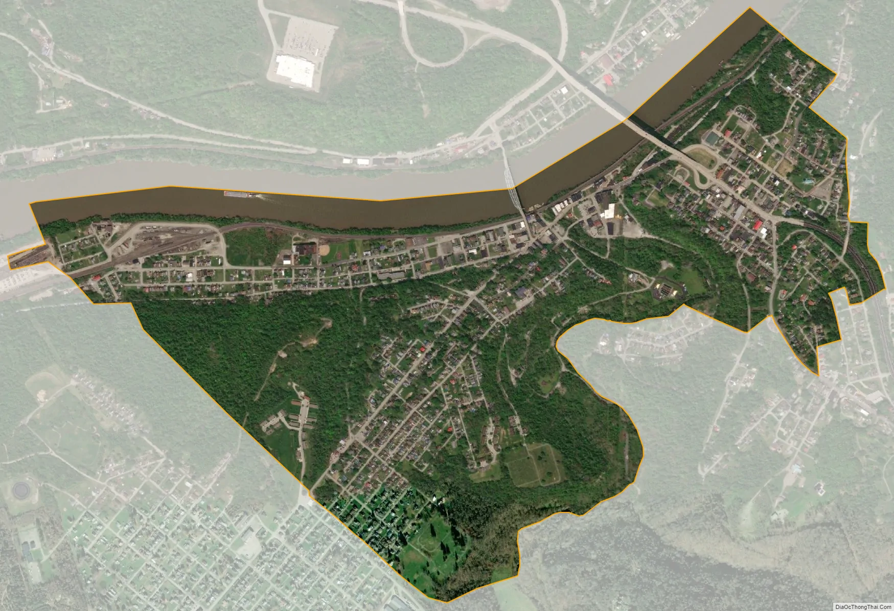
Brownsville city Satellite Map
Geography
Brownsville is located at 40°1′12″N 79°53′22″W / 40.02000°N 79.88944°W / 40.02000; -79.88944 (40.020026, -79.889536), situated on the east (convex) side of a broad sweeping westward bend in the northerly flowing Monongahela River on the northwestern edge of Fayette County. The river’s action eroded the steep-sided sandstone hills, creating shelf-like benches and connecting sloped terrain that gave the borough lowland areas adjacent to or otherwise accessible to the river shores. Much of the borough’s residential buildings are built above the elevation of the business district.
The opposite river shore of Washington County is, uncharacteristically for the region, shaped even lower to the water surface and is generally flatter. A small hamlet called West Brownsville developed on the western shore, with a current population of 992. Historically the area was a natural river crossing, and it was the site of development of a ferry, boat building and a bridge to carry roads. When the nascent United States government appropriated funds for its first road building project, in 1811 Brownsville was chosen as an early intermediate target destination along the new National Road. Until a bridge was built across the river, Brownsville was the western terminus.
Redstone Creek is a local tributary stream of the Monongahela River, entering just north of Brownsville. Its color came from the ferrous sandstone that lined its bed, as well as the sandstone heights near the Old Forts. The creek was wide enough for settlers to build, dock and outfit numerous flatboats, keelboats, and other river craft. Its builders made thousands of pole boats that moved the emigrants who settled the vast Northwest Territory. Later Brownsville industry built the first steamboats on the inland rivers, and many hundreds afterwards.
Colonists used the term “Old Forts” for the mounds and earthworks created by the prehistoric Mound Builders cultures. Archeologists and anthropologists have since determined that many prehistoric Native American cultures in North America along the Mississippi River and its tributaries built massive earthworks for ceremonial, burial and religious purposes over a period of thousands of years prior to European encounter. For instance, the Mississippian culture, reaching a peak about 1150 CE at Cahokia in present-day Illinois, had sites throughout the Mississippi and Ohio river valleys, and into the Southeast. Archaeological research is ongoing working to tie the local mounds and others regionally close to a particular era and culture.
See also
Map of Pennsylvania State and its subdivision:- Adams
- Allegheny
- Armstrong
- Beaver
- Bedford
- Berks
- Blair
- Bradford
- Bucks
- Butler
- Cambria
- Cameron
- Carbon
- Centre
- Chester
- Clarion
- Clearfield
- Clinton
- Columbia
- Crawford
- Cumberland
- Dauphin
- Delaware
- Elk
- Erie
- Fayette
- Forest
- Franklin
- Fulton
- Greene
- Huntingdon
- Indiana
- Jefferson
- Juniata
- Lackawanna
- Lancaster
- Lawrence
- Lebanon
- Lehigh
- Luzerne
- Lycoming
- Mc Kean
- Mercer
- Mifflin
- Monroe
- Montgomery
- Montour
- Northampton
- Northumberland
- Perry
- Philadelphia
- Pike
- Potter
- Schuylkill
- Snyder
- Somerset
- Sullivan
- Susquehanna
- Tioga
- Union
- Venango
- Warren
- Washington
- Wayne
- Westmoreland
- Wyoming
- York
- Alabama
- Alaska
- Arizona
- Arkansas
- California
- Colorado
- Connecticut
- Delaware
- District of Columbia
- Florida
- Georgia
- Hawaii
- Idaho
- Illinois
- Indiana
- Iowa
- Kansas
- Kentucky
- Louisiana
- Maine
- Maryland
- Massachusetts
- Michigan
- Minnesota
- Mississippi
- Missouri
- Montana
- Nebraska
- Nevada
- New Hampshire
- New Jersey
- New Mexico
- New York
- North Carolina
- North Dakota
- Ohio
- Oklahoma
- Oregon
- Pennsylvania
- Rhode Island
- South Carolina
- South Dakota
- Tennessee
- Texas
- Utah
- Vermont
- Virginia
- Washington
- West Virginia
- Wisconsin
- Wyoming