California is a borough on the Monongahela River in Washington County, Pennsylvania, United States. The population was 5,479 as of the 2020 census. It is part of the Pittsburgh metropolitan area.
Founded in 1849, the borough was named for the territory of California following the Gold Rush. California is the home of PennWest California, a part of Pennsylvania Western University. The borough has had two notably young mayors—Democrat Peter Daley, who was 22 at his election, and Republican Casey Durdines, who was 20 at his election.
| Name: | California borough |
|---|---|
| LSAD Code: | 21 |
| LSAD Description: | borough (suffix) |
| State: | Pennsylvania |
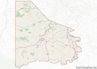
| County: | Washington County |
| Total Area: | 11.23 sq mi (29.09 km²) |
| Land Area: | 11.01 sq mi (28.52 km²) |
| Water Area: | 0.22 sq mi (0.57 km²) |
| Total Population: | 5,362 |
| Population Density: | 486.97/sq mi (188.02/km²) |
| ZIP code: | 15419 |
| Area code: | 724 |
| FIPS code: | 4210768 |
| Website: | www.californiapa15419.com |
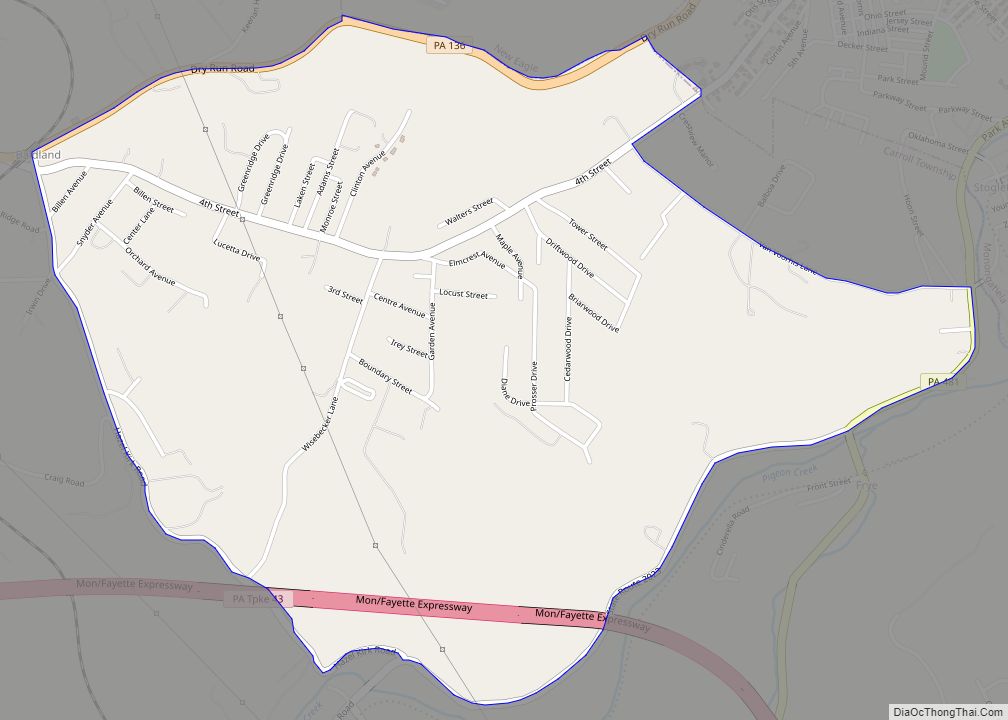
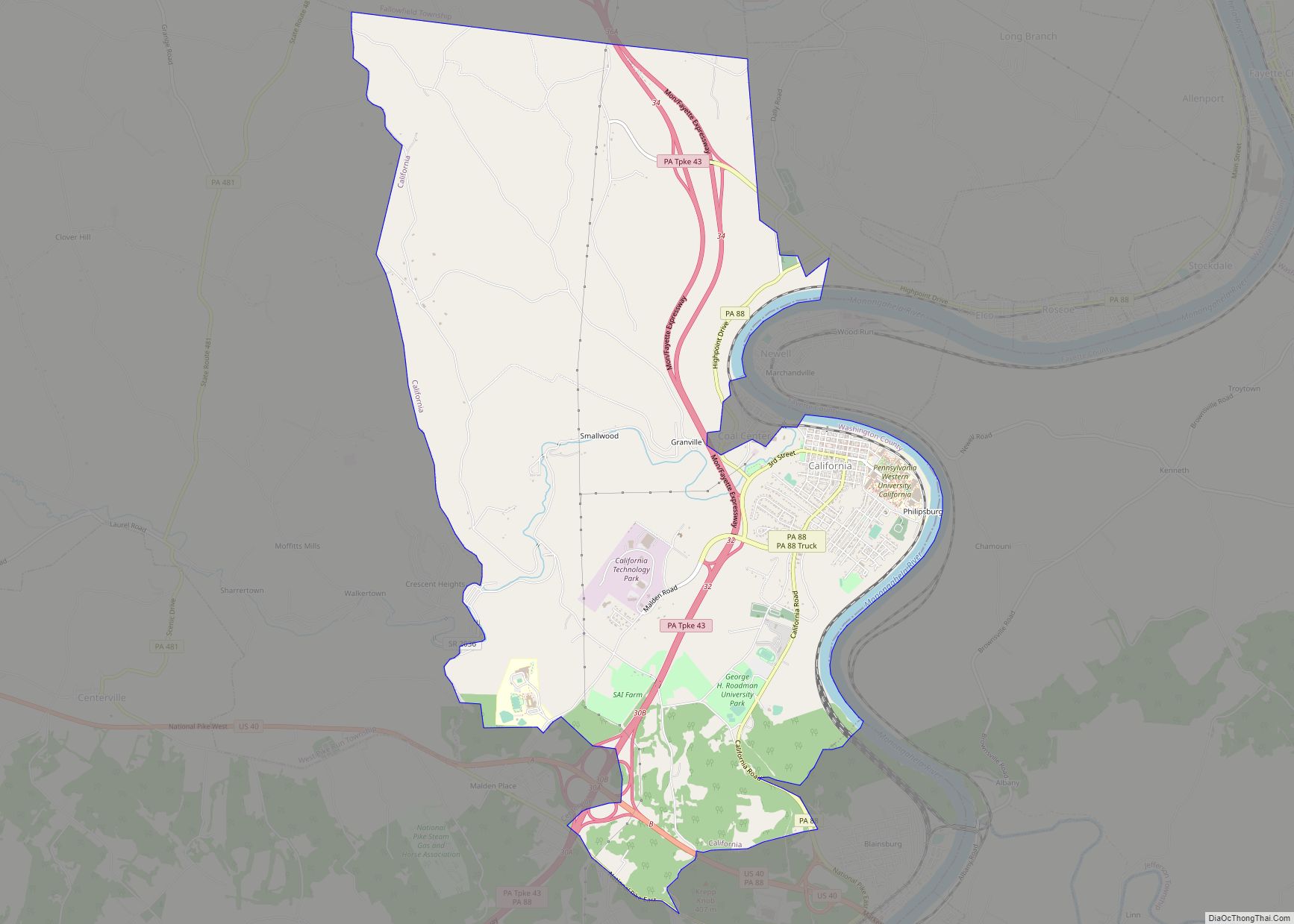
Online Interactive Map
Click on ![]() to view map in "full screen" mode.
to view map in "full screen" mode.
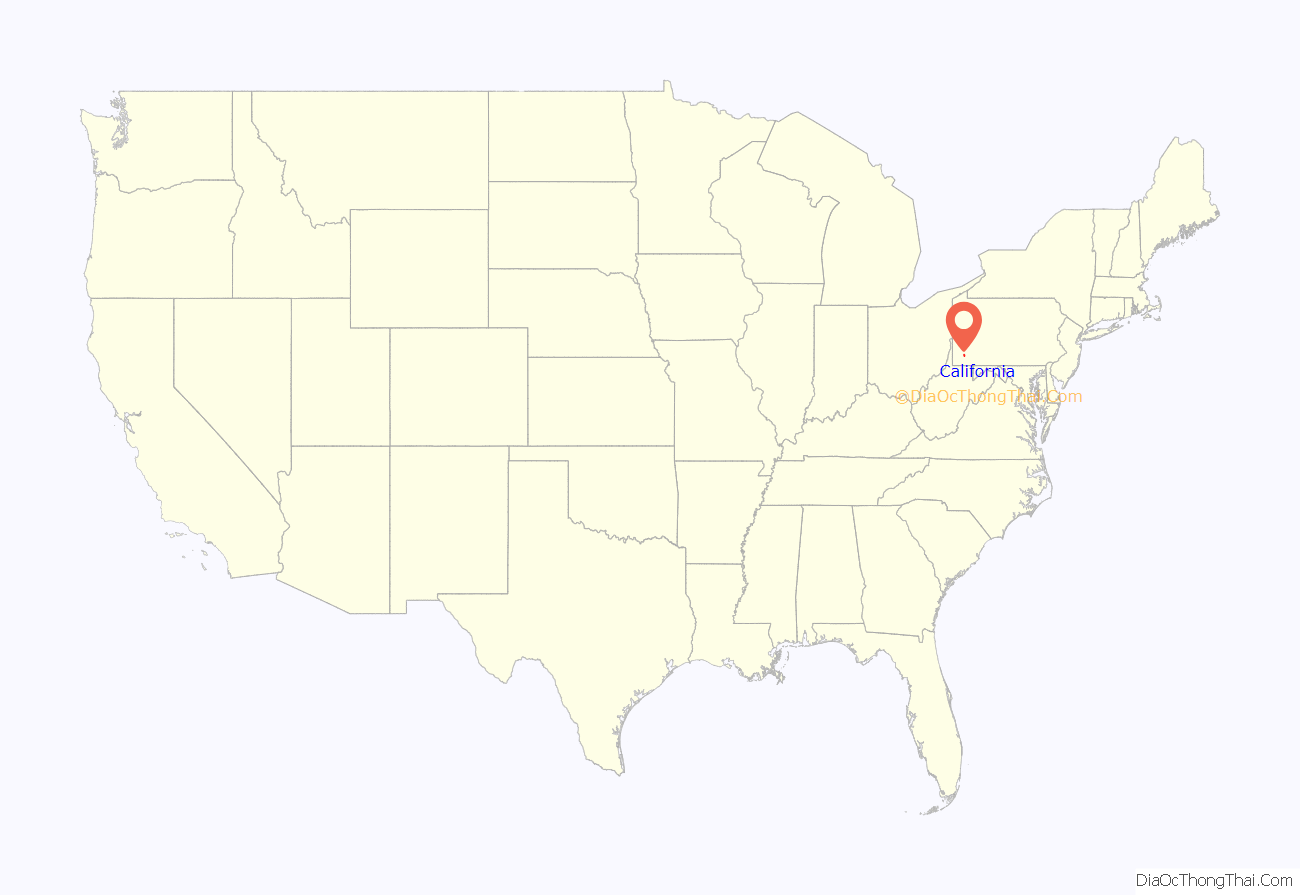
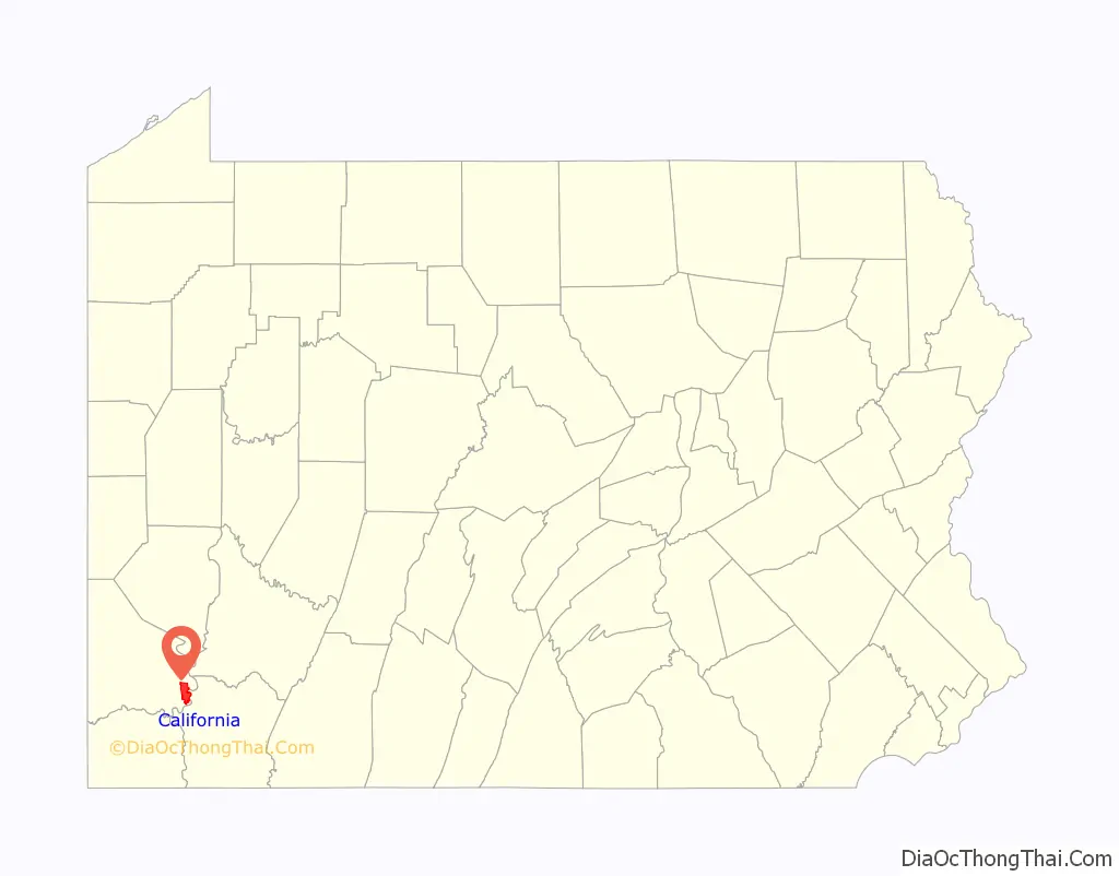
California location map. Where is California borough?
History
When founded in 1849, the town was named California, though Columbia and Sagamore were names that were also suggested for the new town. The town’s founding coincided with the California Gold Rush and the town was named after the state to symbolize growth and prosperity. Before there were mayors in California, there were burgesses, the first of whom was Solomon Sibbitt.
East Pike Run Township merged with California Borough in 1953. The former Vigilant Mine in California once produced the largest single lump of coal in the world. California was once home to the largest soft coal mine in the world when Vesta # 4 opened in 1893. The unincorporated town of Philipsburg used to sit on land that is now occupied by Pennsylvania Western University (formerly known as California University of Pennsylvania before July 2022). This includes the Philipsburg Cemetery, which is still in use and includes a number of graves of Civil War soldiers. The first house built in California is next to the California Post Office on Second Street.
The Molly Fleming House, Jennings-Gallagher House, Malden Inn, Old Main, California State College and former Pennsylvania Railroad Passenger Station are listed on the National Register of Historic Places. The California Boatyards played an important role in building steamboats for western expansion.
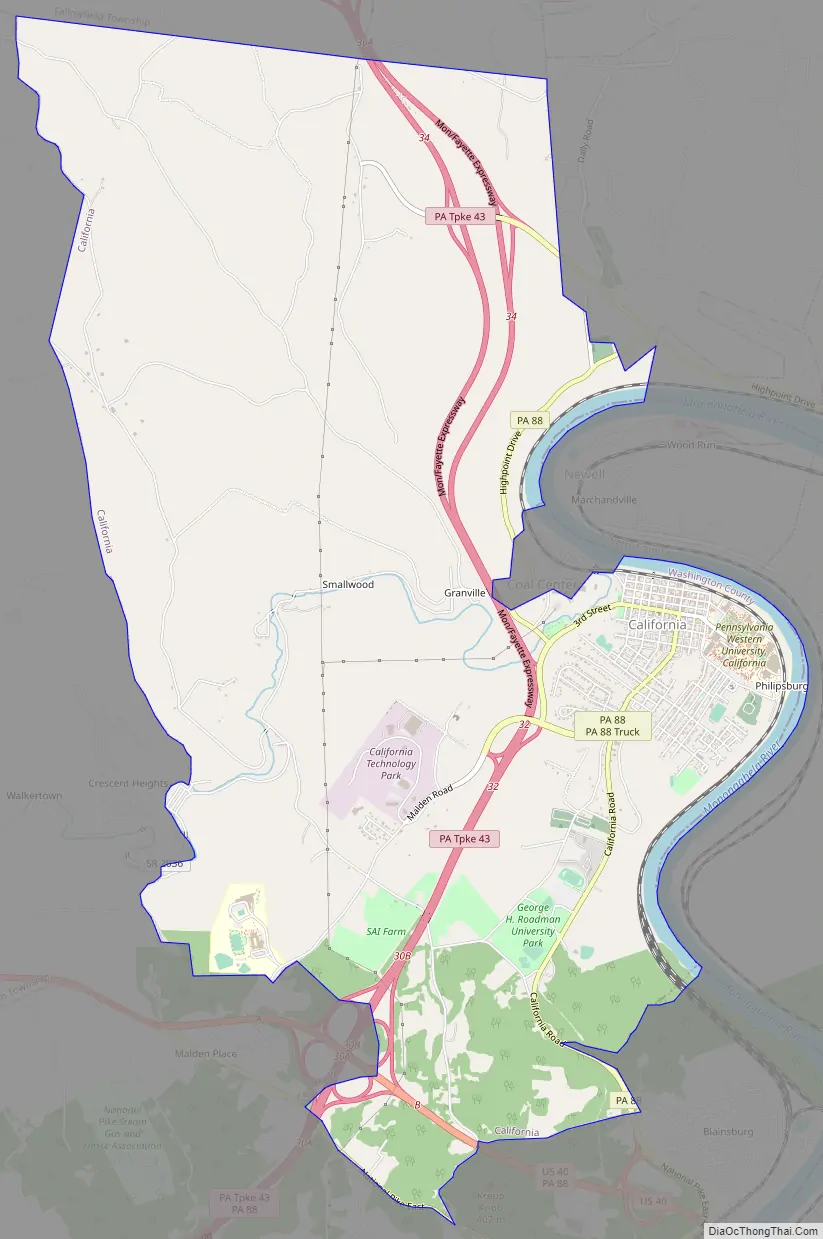
California Road Map
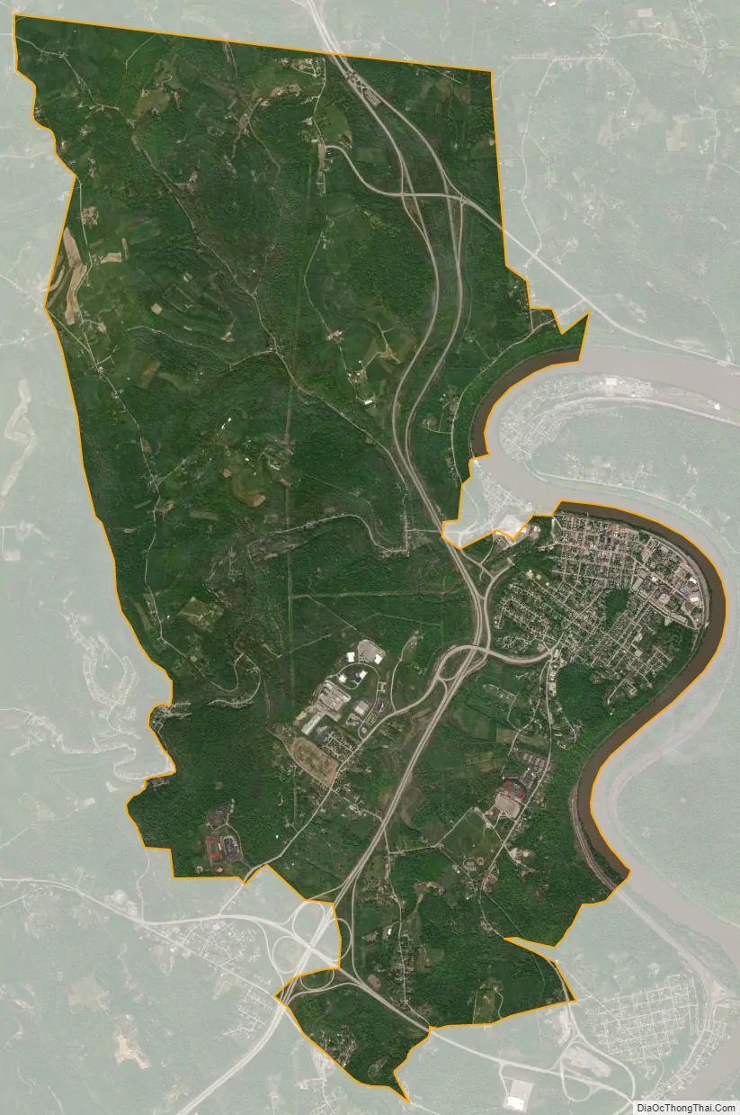
California city Satellite Map
Geography
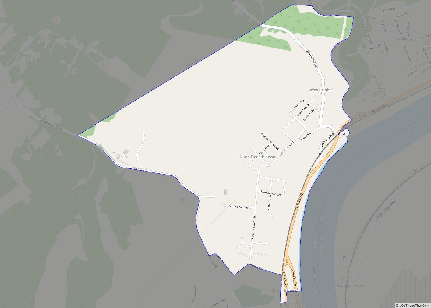
California is located at 40°3′55″N 79°53′50″W / 40.06528°N 79.89722°W / 40.06528; -79.89722 (40.065313, -79.897120).
According to the United States Census Bureau, the borough has a total area of 11.2 square miles (29 km), of which 11.0 square miles (28 km) is land and 0.2 square miles (0.52 km) (1.78%) is water.
Surrounding and adjacent neighborhoods
California has seven land borders, including Fallowfield Township to the north, Long Branch and Elco to the northeast, Coal Center to the mideast, West Brownsville to the southeast, Centerville from the south to the west-southwest, and West Pike Run Township to the west. Across the Monongahela River in Fayette County, California runs adjacent with Newell and Jefferson Township.
See also
Map of Pennsylvania State and its subdivision:- Adams
- Allegheny
- Armstrong
- Beaver
- Bedford
- Berks
- Blair
- Bradford
- Bucks
- Butler
- Cambria
- Cameron
- Carbon
- Centre
- Chester
- Clarion
- Clearfield
- Clinton
- Columbia
- Crawford
- Cumberland
- Dauphin
- Delaware
- Elk
- Erie
- Fayette
- Forest
- Franklin
- Fulton
- Greene
- Huntingdon
- Indiana
- Jefferson
- Juniata
- Lackawanna
- Lancaster
- Lawrence
- Lebanon
- Lehigh
- Luzerne
- Lycoming
- Mc Kean
- Mercer
- Mifflin
- Monroe
- Montgomery
- Montour
- Northampton
- Northumberland
- Perry
- Philadelphia
- Pike
- Potter
- Schuylkill
- Snyder
- Somerset
- Sullivan
- Susquehanna
- Tioga
- Union
- Venango
- Warren
- Washington
- Wayne
- Westmoreland
- Wyoming
- York
- Alabama
- Alaska
- Arizona
- Arkansas
- California
- Colorado
- Connecticut
- Delaware
- District of Columbia
- Florida
- Georgia
- Hawaii
- Idaho
- Illinois
- Indiana
- Iowa
- Kansas
- Kentucky
- Louisiana
- Maine
- Maryland
- Massachusetts
- Michigan
- Minnesota
- Mississippi
- Missouri
- Montana
- Nebraska
- Nevada
- New Hampshire
- New Jersey
- New Mexico
- New York
- North Carolina
- North Dakota
- Ohio
- Oklahoma
- Oregon
- Pennsylvania
- Rhode Island
- South Carolina
- South Dakota
- Tennessee
- Texas
- Utah
- Vermont
- Virginia
- Washington
- West Virginia
- Wisconsin
- Wyoming