Carmichaels is a borough in Greene County, Pennsylvania, United States. The population was 434 at the 2020 census, a decline from the figure of 483 tabulated in 2010.
| Name: | Carmichaels borough |
|---|---|
| LSAD Code: | 21 |
| LSAD Description: | borough (suffix) |
| State: | Pennsylvania |
| County: | Greene County |
| Elevation: | 1,004 ft (306 m) |
| Total Area: | 0.17 sq mi (0.44 km²) |
| Land Area: | 0.17 sq mi (0.43 km²) |
| Water Area: | 0.01 sq mi (0.01 km²) |
| Total Population: | 432 |
| Population Density: | 2,618.18/sq mi (1,011.47/km²) |
| Area code: | 724 |
| FIPS code: | 4211328 |
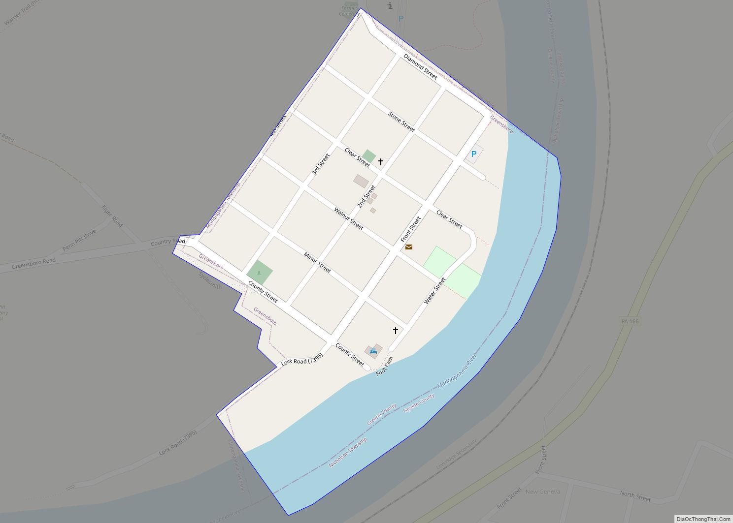
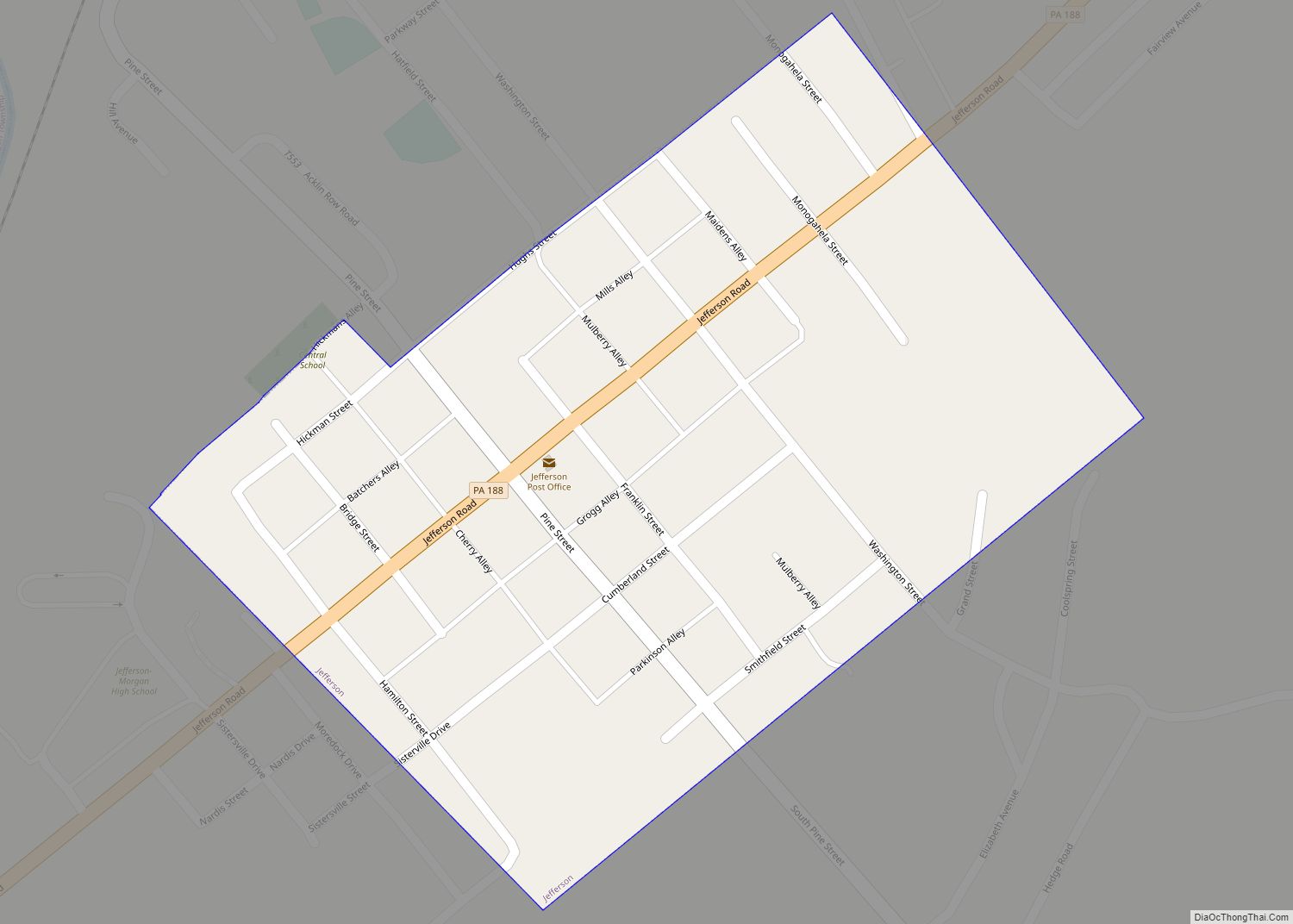
Online Interactive Map
Click on ![]() to view map in "full screen" mode.
to view map in "full screen" mode.
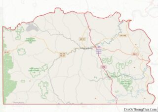
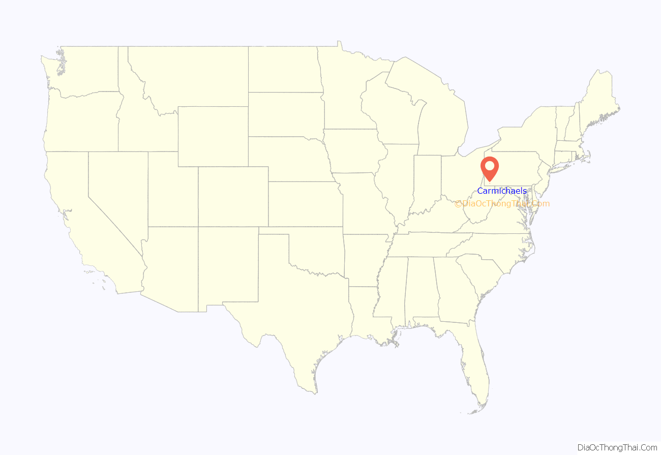
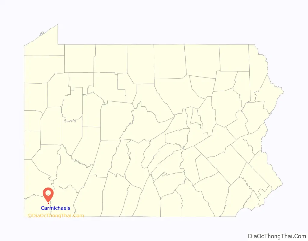
Carmichaels location map. Where is Carmichaels borough?
History
The Carmichaels Covered Bridge and Greene Academy are listed on the National Register of Historic Places.
Carmichaels, Pennsylvania is quite famous in its area for the Coal Queen Pageant, an annual beauty pageant where girls from all over Greene County compete to be crowned Coal Queen.
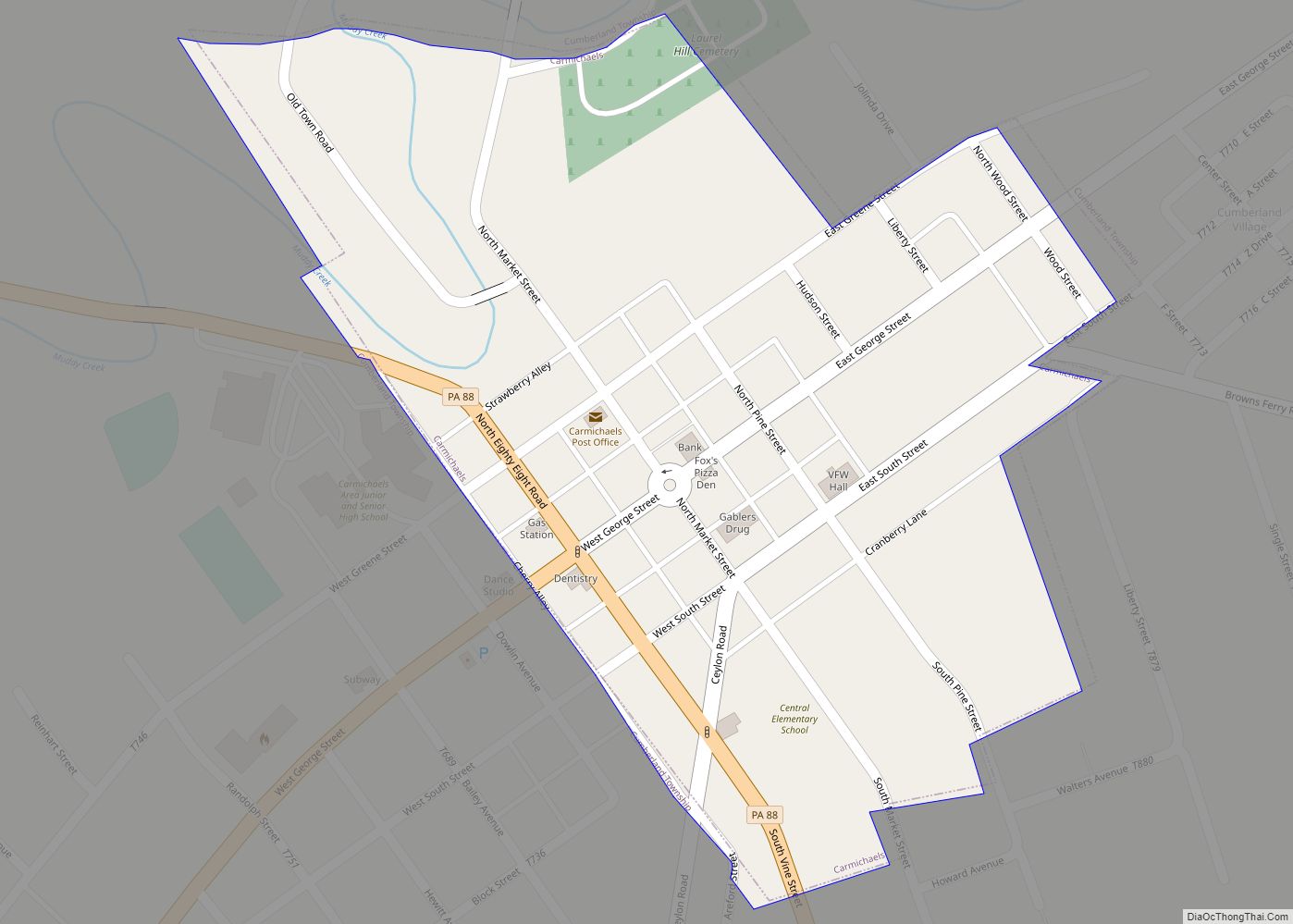
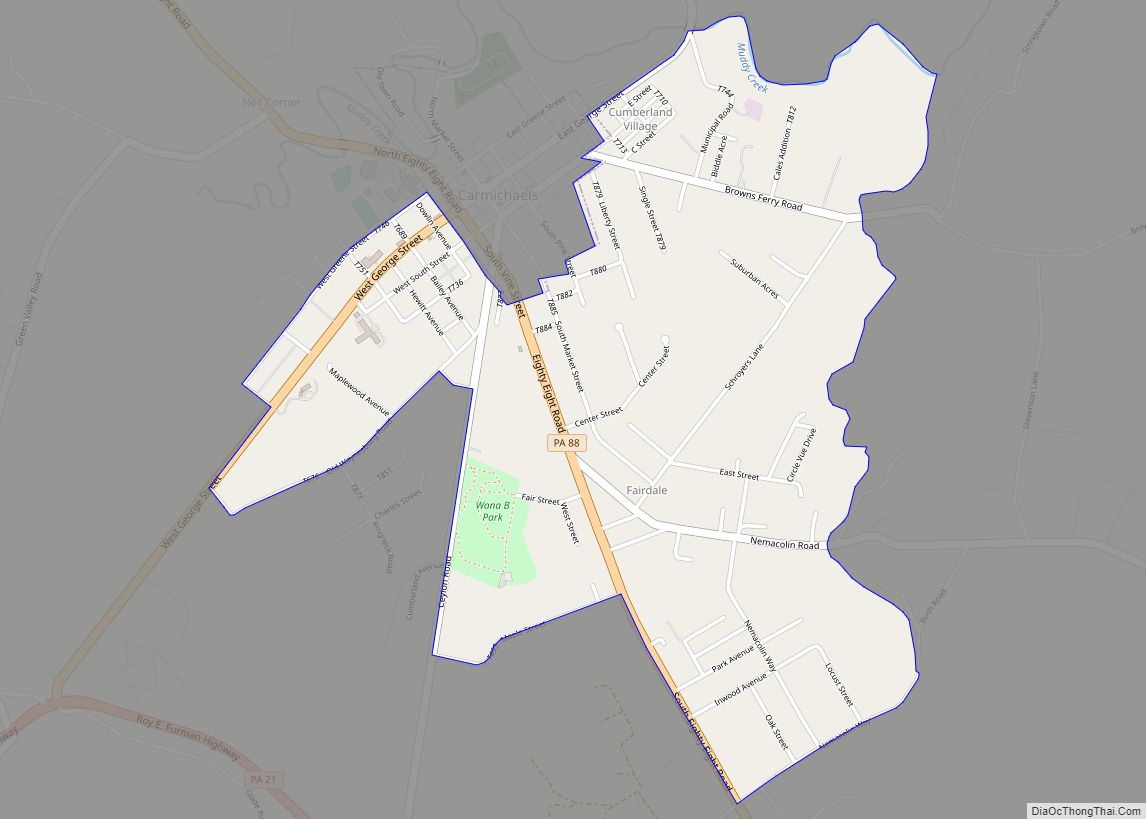
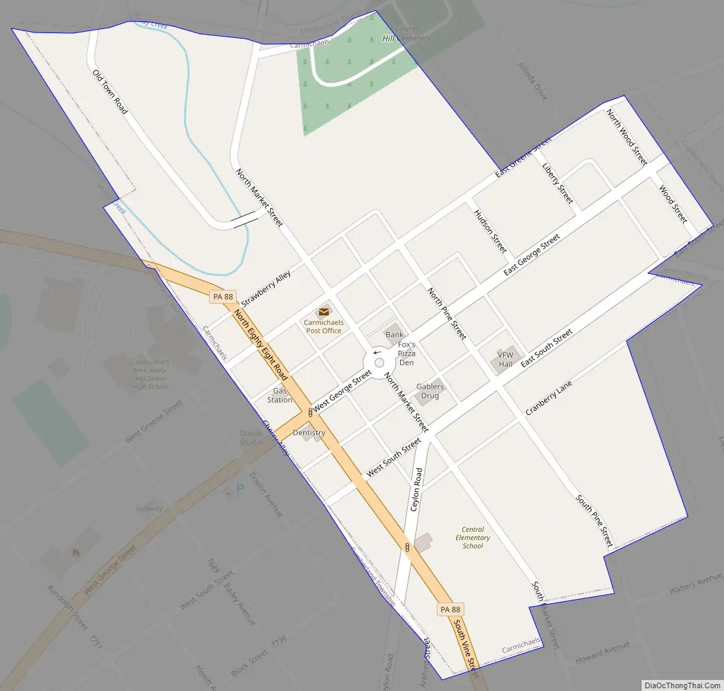
Carmichaels Road Map
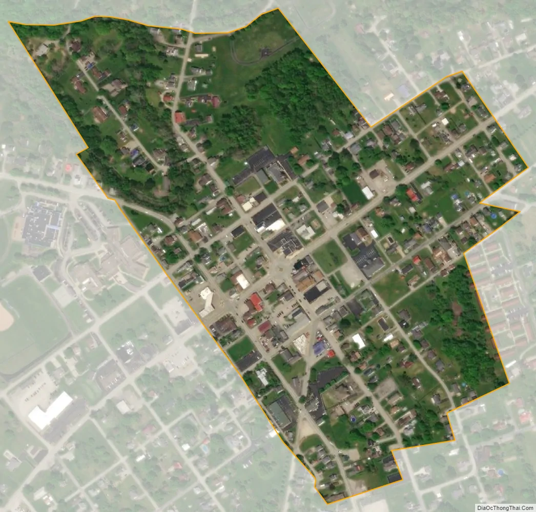
Carmichaels city Satellite Map
Geography
Carmichaels is located in eastern Greene County at 39°53′52″N 79°58′30″W / 39.89778°N 79.97500°W / 39.89778; -79.97500 (39.897755, -79.975022). It is surrounded by Cumberland Township but is a separate municipality.
Pennsylvania Route 88 passes through the borough, leading north 9 miles (14 km) to Fredericktown and south 14 miles (23 km) to Point Marion.
According to the United States Census Bureau, Carmichaels has a total area of 0.17 square miles (0.44 km), of which 0.004 square miles (0.01 km), or 2.86%, is water. Muddy Creek, a tributary of the Monongahela River, flows to the northeast through the northern corner of the borough, where it passes under the Carmichaels Covered Bridge on Old Town Road.
See also
Map of Pennsylvania State and its subdivision:- Adams
- Allegheny
- Armstrong
- Beaver
- Bedford
- Berks
- Blair
- Bradford
- Bucks
- Butler
- Cambria
- Cameron
- Carbon
- Centre
- Chester
- Clarion
- Clearfield
- Clinton
- Columbia
- Crawford
- Cumberland
- Dauphin
- Delaware
- Elk
- Erie
- Fayette
- Forest
- Franklin
- Fulton
- Greene
- Huntingdon
- Indiana
- Jefferson
- Juniata
- Lackawanna
- Lancaster
- Lawrence
- Lebanon
- Lehigh
- Luzerne
- Lycoming
- Mc Kean
- Mercer
- Mifflin
- Monroe
- Montgomery
- Montour
- Northampton
- Northumberland
- Perry
- Philadelphia
- Pike
- Potter
- Schuylkill
- Snyder
- Somerset
- Sullivan
- Susquehanna
- Tioga
- Union
- Venango
- Warren
- Washington
- Wayne
- Westmoreland
- Wyoming
- York
- Alabama
- Alaska
- Arizona
- Arkansas
- California
- Colorado
- Connecticut
- Delaware
- District of Columbia
- Florida
- Georgia
- Hawaii
- Idaho
- Illinois
- Indiana
- Iowa
- Kansas
- Kentucky
- Louisiana
- Maine
- Maryland
- Massachusetts
- Michigan
- Minnesota
- Mississippi
- Missouri
- Montana
- Nebraska
- Nevada
- New Hampshire
- New Jersey
- New Mexico
- New York
- North Carolina
- North Dakota
- Ohio
- Oklahoma
- Oregon
- Pennsylvania
- Rhode Island
- South Carolina
- South Dakota
- Tennessee
- Texas
- Utah
- Vermont
- Virginia
- Washington
- West Virginia
- Wisconsin
- Wyoming