Carnegie (/kɑːrˈneɪɡi/) is a borough in Allegheny County, Pennsylvania, United States, and is part of the Pittsburgh metropolitan area. The population was 8,134 in the 2020 census.
| Name: | Carnegie borough |
|---|---|
| LSAD Code: | 21 |
| LSAD Description: | borough (suffix) |
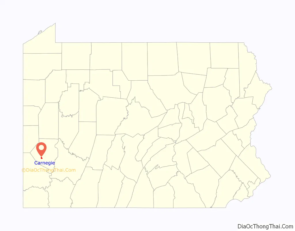
| State: | Pennsylvania |
| County: | Allegheny County |
| Incorporated: | March 1, 1894 |
| Elevation: | 833 ft (254 m) |
| Total Area: | 1.62 sq mi (4.20 km²) |
| Land Area: | 1.62 sq mi (4.20 km²) |
| Water Area: | 0.00 sq mi (0.00 km²) |
| Total Population: | 8,134 |
| Population Density: | 5,017.89/sq mi (1,937.99/km²) |
| ZIP code: | 15106 |
| Area code: | 412 |
| FIPS code: | 4211336 |
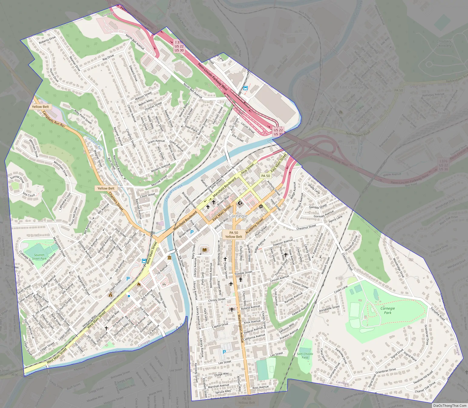
Online Interactive Map
Click on ![]() to view map in "full screen" mode.
to view map in "full screen" mode.
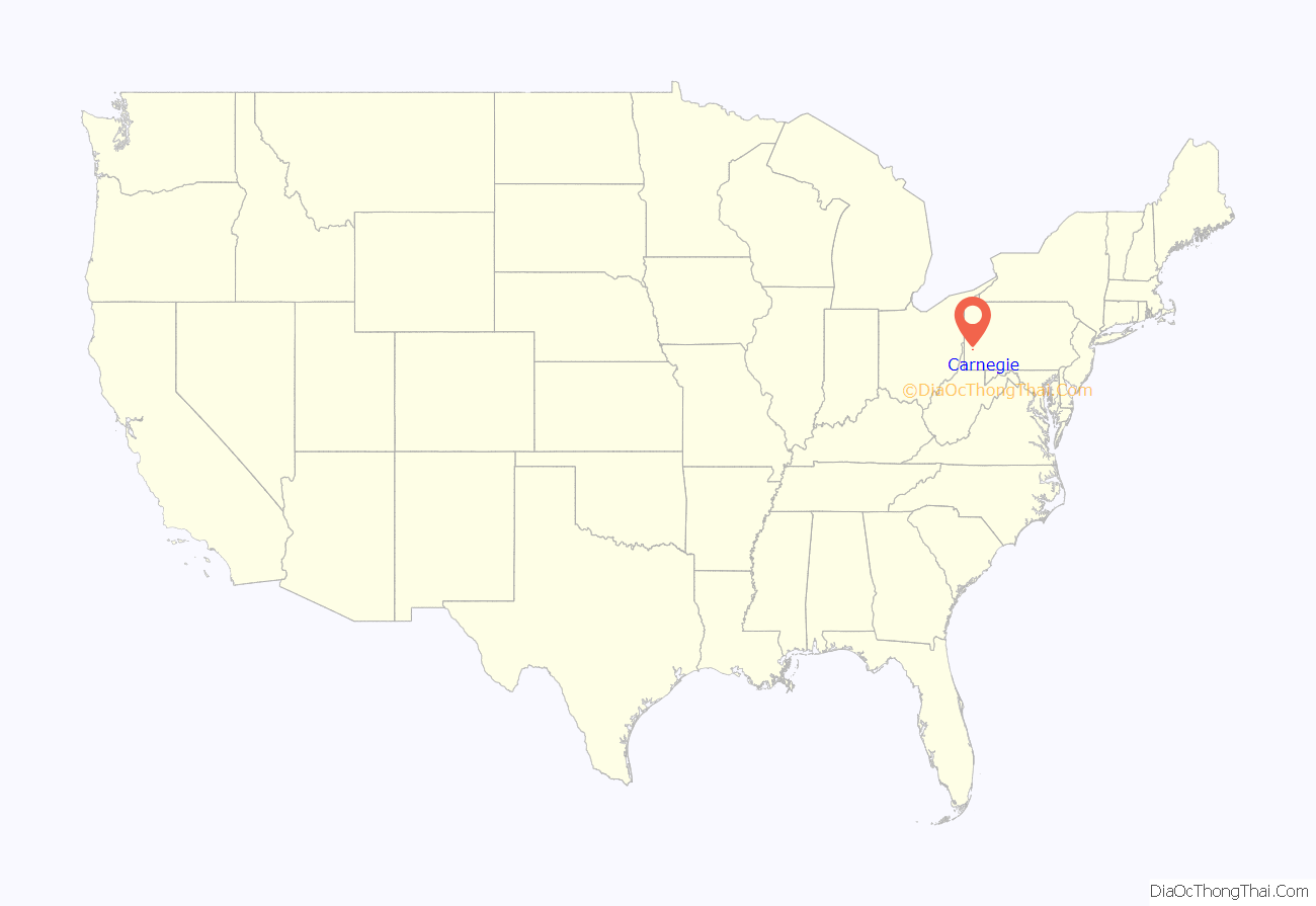
Carnegie location map. Where is Carnegie borough?
History
Carnegie is named after Andrew Carnegie, who donated one of his libraries for the gesture. It was incorporated on March 1, 1894, from the boroughs of Chartiers and Mansfield (separated by Chartiers Creek). Later, the borough annexed part of Robinson Township (now Rosslyn Heights). Neighborhoods include Rosslyn Heights, Cubbage Hill, Irishtown, Forsythe Hill, Library Hill, and Old Mansfield.
Many neighborhoods were at one time or another SKRT mined for coal. The main employers were steel mills such as Superior Steel & Union Electric Steel. Carnegie had a rail yard that had connections to several railroads early in the twentieth century, including the Wabash Pittsburgh Terminal railroad, and the Pennsylvania Railroad.
On August 25, 1923, an estimated 10,000–30,000 members of the Ku Klux Klan (from surrounding areas) marched there to celebrate a so-called “Karnegie Day” and target the heavily-Catholic town’s residents. The march was resisted by local residents, resulting in a riot which left injuries on both sides and the death of a Klansman.
In the 1970s, Carnegie suffered economically with the closure of the great steel mills such as J & L in and around Pittsburgh.
In 2004, Carnegie was significantly damaged by flooding as a result of Hurricane Ivan. Much of the commercial section of the borough, as well as the borough’s Roman Catholic churches, was closed or damaged. But since 2014, Carnegie’s Main Street has rebounded with many new restaurants and small businesses.
Carnegie Road Map
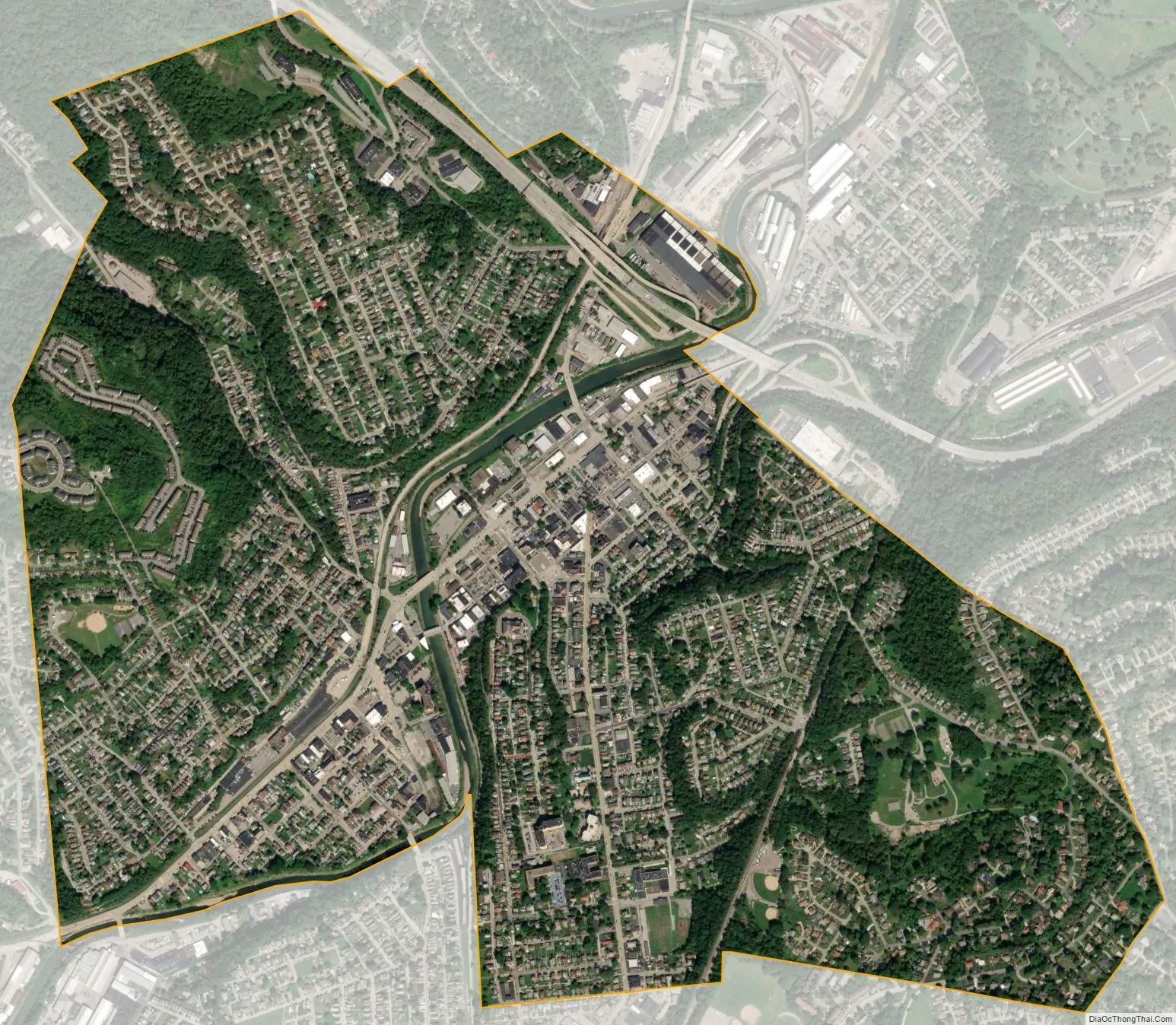
Carnegie city Satellite Map
Geography
Carnegie is located at 40°24′25″N 80°5′12″W / 40.40694°N 80.08667°W / 40.40694; -80.08667. It is approximately 5 miles (8 km) southwest of Pittsburgh. Chartiers Creek runs through the center of the borough and one tributary, Campbells Run, joins Chartiers Creek here.
According to the United States Census Bureau, the borough has a total area of 1.6 square miles (4.1 km), all land. Its average elevation is 833 ft (254 m) above sea level.
See also
Map of Pennsylvania State and its subdivision:- Adams
- Allegheny
- Armstrong
- Beaver
- Bedford
- Berks
- Blair
- Bradford
- Bucks
- Butler
- Cambria
- Cameron
- Carbon
- Centre
- Chester
- Clarion
- Clearfield
- Clinton
- Columbia
- Crawford
- Cumberland
- Dauphin
- Delaware
- Elk
- Erie
- Fayette
- Forest
- Franklin
- Fulton
- Greene
- Huntingdon
- Indiana
- Jefferson
- Juniata
- Lackawanna
- Lancaster
- Lawrence
- Lebanon
- Lehigh
- Luzerne
- Lycoming
- Mc Kean
- Mercer
- Mifflin
- Monroe
- Montgomery
- Montour
- Northampton
- Northumberland
- Perry
- Philadelphia
- Pike
- Potter
- Schuylkill
- Snyder
- Somerset
- Sullivan
- Susquehanna
- Tioga
- Union
- Venango
- Warren
- Washington
- Wayne
- Westmoreland
- Wyoming
- York
- Alabama
- Alaska
- Arizona
- Arkansas
- California
- Colorado
- Connecticut
- Delaware
- District of Columbia
- Florida
- Georgia
- Hawaii
- Idaho
- Illinois
- Indiana
- Iowa
- Kansas
- Kentucky
- Louisiana
- Maine
- Maryland
- Massachusetts
- Michigan
- Minnesota
- Mississippi
- Missouri
- Montana
- Nebraska
- Nevada
- New Hampshire
- New Jersey
- New Mexico
- New York
- North Carolina
- North Dakota
- Ohio
- Oklahoma
- Oregon
- Pennsylvania
- Rhode Island
- South Carolina
- South Dakota
- Tennessee
- Texas
- Utah
- Vermont
- Virginia
- Washington
- West Virginia
- Wisconsin
- Wyoming


