Clarksville is a borough in Greene County, Pennsylvania, United States. The population was 194 at the 2020 census.
| Name: | Clarksville borough |
|---|---|
| LSAD Code: | 21 |
| LSAD Description: | borough (suffix) |
| State: | Pennsylvania |
| County: | Greene County |
| Elevation: | 805 ft (245 m) |
| Total Area: | 0.10 sq mi (0.25 km²) |
| Land Area: | 0.10 sq mi (0.25 km²) |
| Water Area: | 0.00 sq mi (0.00 km²) |
| Total Population: | 203 |
| Population Density: | 2,092.78/sq mi (805.52/km²) |
| Area code: | 724 |
| FIPS code: | 4213896 |
Online Interactive Map
Click on ![]() to view map in "full screen" mode.
to view map in "full screen" mode.
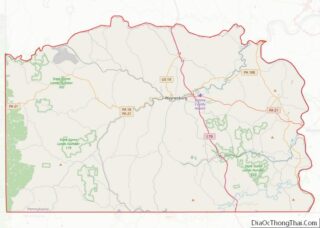
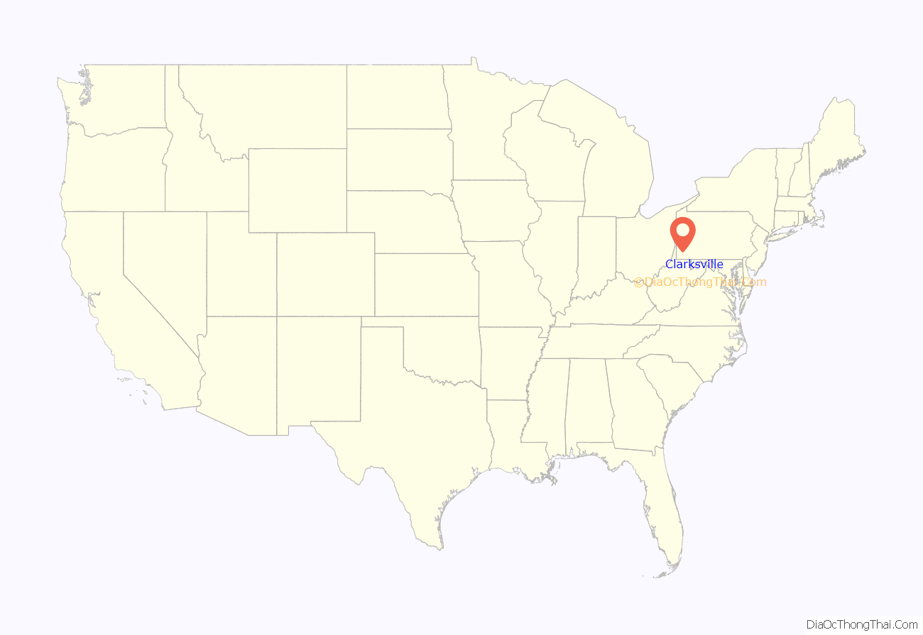
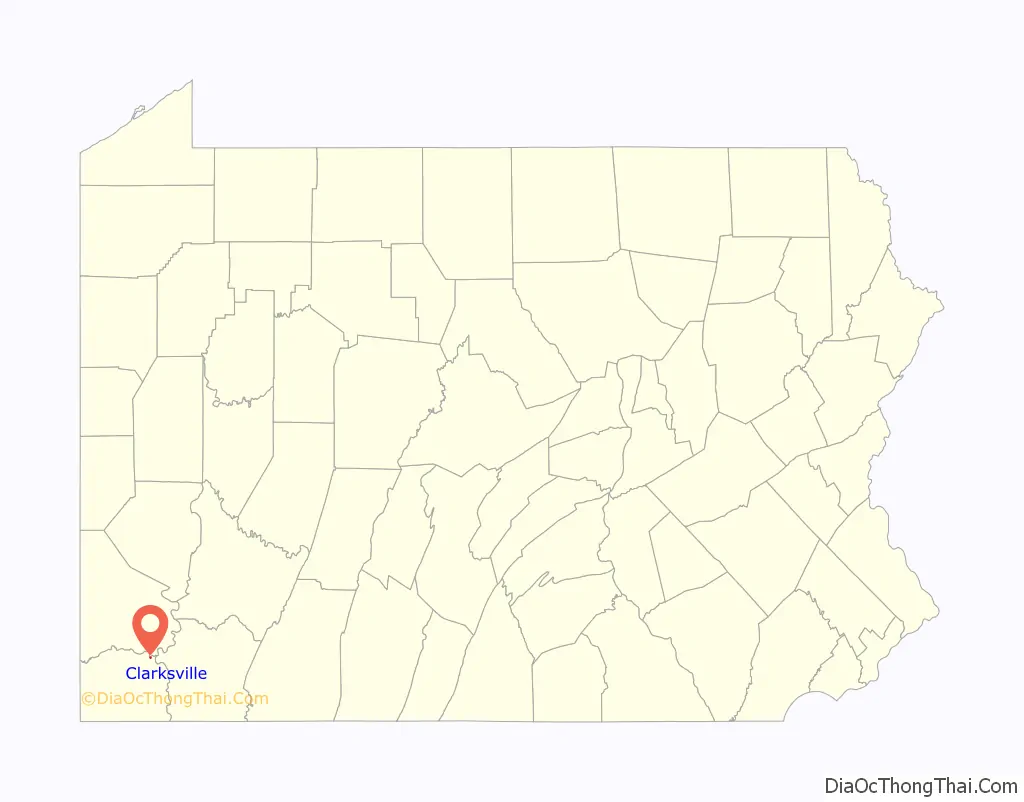
Clarksville location map. Where is Clarksville borough?
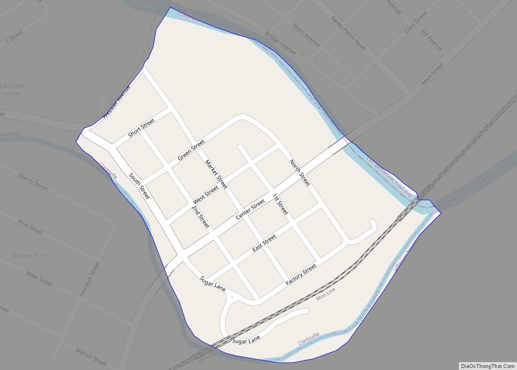
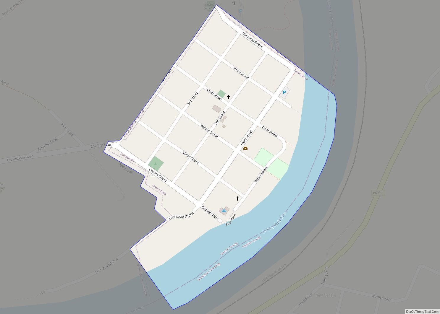
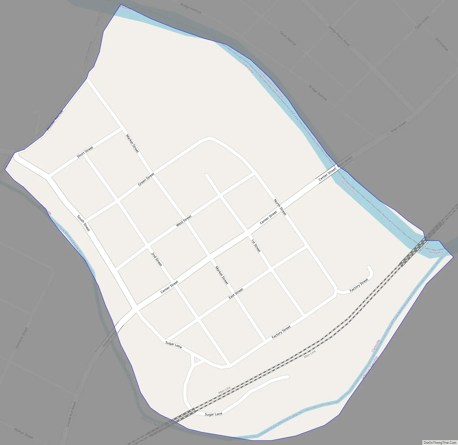
Clarksville Road Map
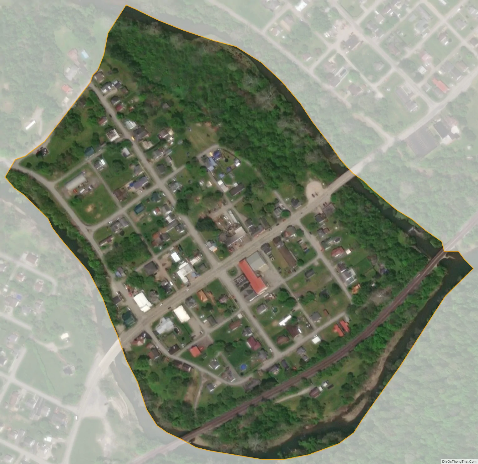
Clarksville city Satellite Map
Geography
Clarksville is located in the northeastern corner of Greene County at 39°58′27″N 80°2′41″W / 39.97417°N 80.04472°W / 39.97417; -80.04472 (39.974170, -80.044833), at the confluence of Tenmile Creek with its South Fork. The borough is bordered by Morgan Township to the west, by Jefferson Township to the south and east across the South Fork Tenmile Creek, and by East Bethlehem Township in Washington County to the north across Tenmile Creek. Clarksville is 3 miles (5 km) southwest of Millsboro, where Tenmile Creek joins the Monongahela River.
An adjacent part of East Bethlehem Township, Washington County adjacent to the borough is often colloquially considered to be part of Clarksville.
According to the United States Census Bureau, Clarksville has a total area of 0.10 square miles (0.25 km), all land.
See also
Map of Pennsylvania State and its subdivision:- Adams
- Allegheny
- Armstrong
- Beaver
- Bedford
- Berks
- Blair
- Bradford
- Bucks
- Butler
- Cambria
- Cameron
- Carbon
- Centre
- Chester
- Clarion
- Clearfield
- Clinton
- Columbia
- Crawford
- Cumberland
- Dauphin
- Delaware
- Elk
- Erie
- Fayette
- Forest
- Franklin
- Fulton
- Greene
- Huntingdon
- Indiana
- Jefferson
- Juniata
- Lackawanna
- Lancaster
- Lawrence
- Lebanon
- Lehigh
- Luzerne
- Lycoming
- Mc Kean
- Mercer
- Mifflin
- Monroe
- Montgomery
- Montour
- Northampton
- Northumberland
- Perry
- Philadelphia
- Pike
- Potter
- Schuylkill
- Snyder
- Somerset
- Sullivan
- Susquehanna
- Tioga
- Union
- Venango
- Warren
- Washington
- Wayne
- Westmoreland
- Wyoming
- York
- Alabama
- Alaska
- Arizona
- Arkansas
- California
- Colorado
- Connecticut
- Delaware
- District of Columbia
- Florida
- Georgia
- Hawaii
- Idaho
- Illinois
- Indiana
- Iowa
- Kansas
- Kentucky
- Louisiana
- Maine
- Maryland
- Massachusetts
- Michigan
- Minnesota
- Mississippi
- Missouri
- Montana
- Nebraska
- Nevada
- New Hampshire
- New Jersey
- New Mexico
- New York
- North Carolina
- North Dakota
- Ohio
- Oklahoma
- Oregon
- Pennsylvania
- Rhode Island
- South Carolina
- South Dakota
- Tennessee
- Texas
- Utah
- Vermont
- Virginia
- Washington
- West Virginia
- Wisconsin
- Wyoming